Tropical
Highlights - December 2000
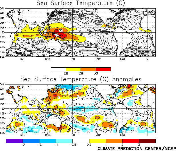
Cold episode conditions strengthened during
December 2000, as sea surface temperatures (SSTs) dropped to more than 1.0¯C below normal
across the central equatorial Pacific between 180¯–160¯W (Fig.
T18). This cooling resulted in the mean SST over the central equatorial Pacific
dropping below 28¯C, which is the value generally considered to be the approximate
threshold for deep tropical convection. The strengthening cold episode is reflected by
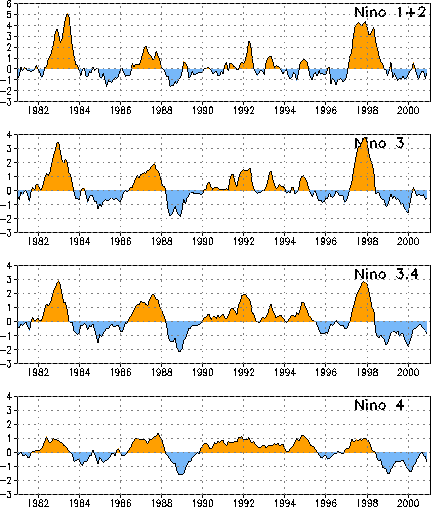
drops in the Niþo 4 and Niþo 3.4 region anomaly indices to -0.7 and -0.9, respectively (Fig. T5, Table T2). These values are
approximately one-half of the index amplitudes observed last winter during strong La Niþa
conditions.
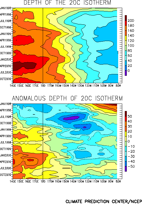
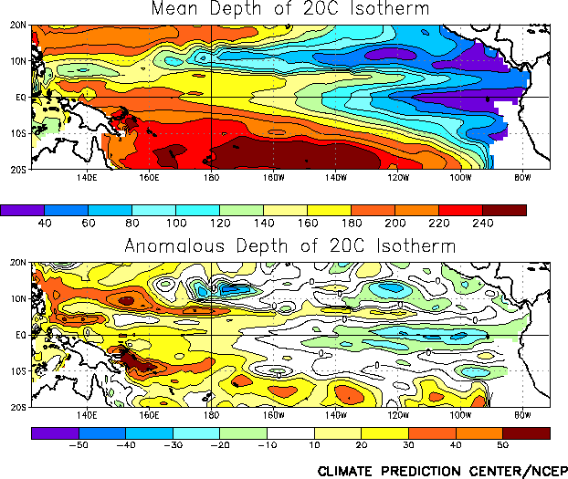
Consistent with this pattern of SST anomalies, the equatorial oceanic thermocline
remained shallower than normal across the eastern Pacific and deeper than normal in the
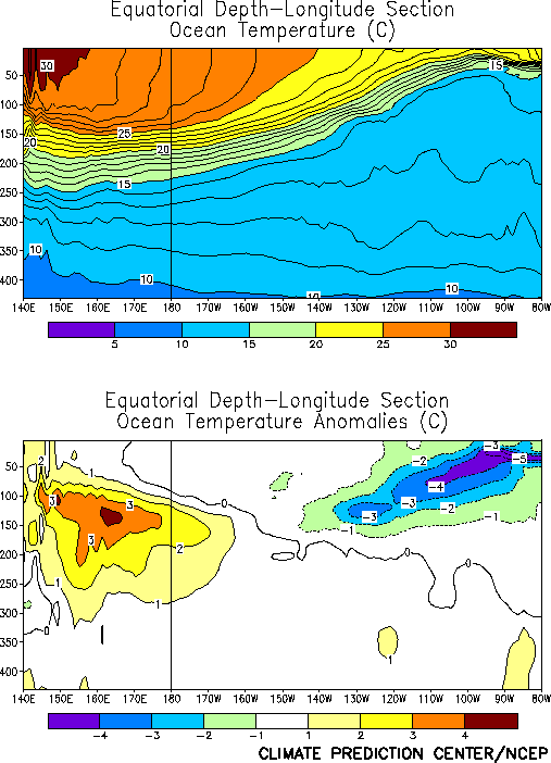
western Pacific (Fig. T15). Also, subsurface oceanic
temperatures increased to more than 3¯C above normal in the western Pacific and decreased
to more than 4¯C below normal in the eastern Pacific (Fig. T17).
Over the past few months, the return to La Niþa conditions has been accompanied by an
increase in both the slope of the oceanic thermocline (Fig. T16)
and the magnitude of the east-west temperature gradient across the equatorial Pacific.
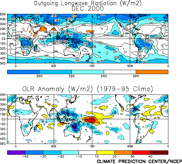
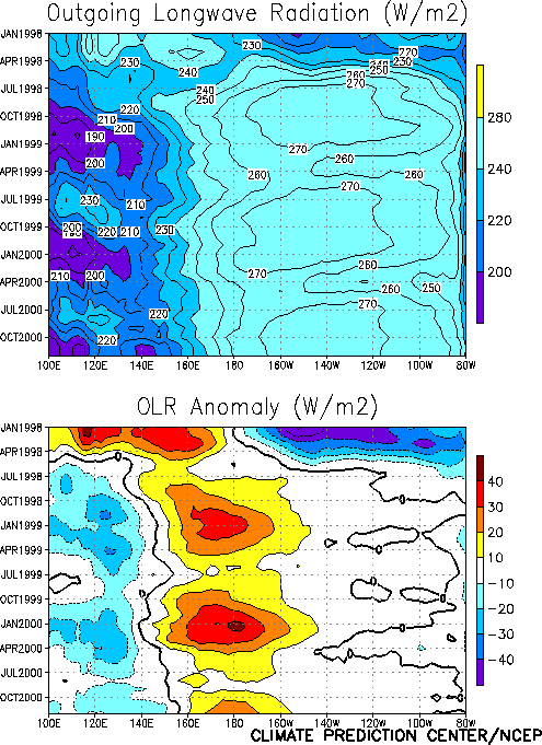
Tropical convection during December was below normal over the central Pacific [as
inferred from positive anomalies of outgoing longwave radiation (OLR)] and above normal
over the western Pacific, Indonesia, and northern Australia (Fig.
T25). This pattern of anomalous convection is consistent with La Niþa conditions
and has largely persisted since mid-1998 (Fig. T8).
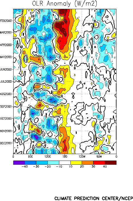
Intraseasonal activity (Madden-Julian Oscillation-MJO) has also continued to impact
tropical convection, with increased convection observed during December across the Indian
Ocean, Indonesia and the western Pacific (Fig. T11).
During the past few months, the period of this MJO activity has shortened from
approximately 45 days to near 35 days.
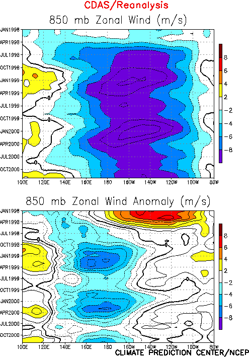
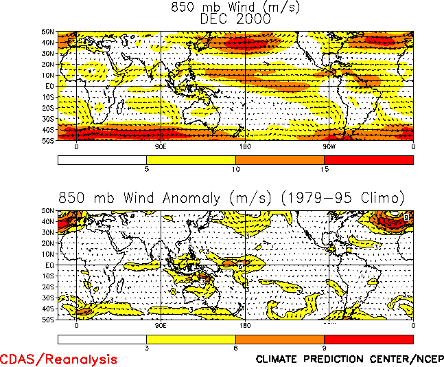
The anomalous tropical convection during December was associated with low-level (850
hPa) easterly wind anomalies over the western equatorial Pacific and westerly wind
anomalies over the eastern Indian Ocean (Figs. T7, T20, and Table T1). Easterly
wind anomalies have been observed over the western and central equatorial Pacific since
the onset of cold episode conditions in mid-1998 (Fig. T7).
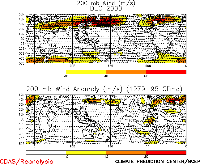
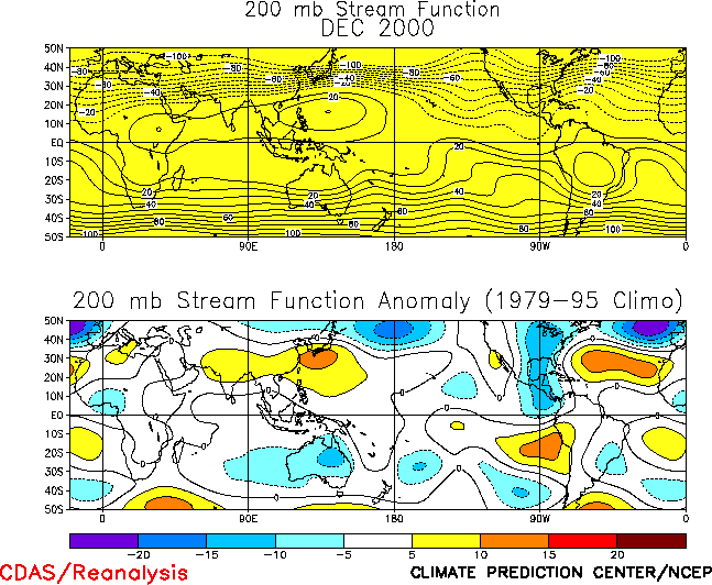
At upper levels, westerly wind anomalies persisted over the central equatorial Pacific,
consistent with cyclonic circulation anomalies flanking the region of suppressed
convection (Fig. T21, T22).
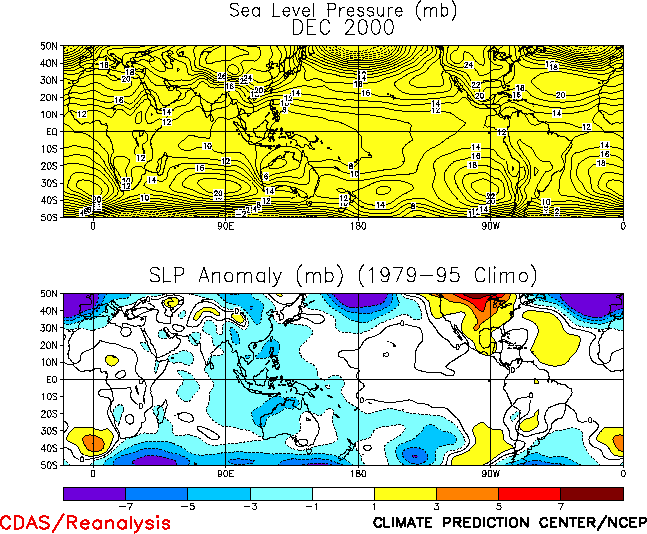
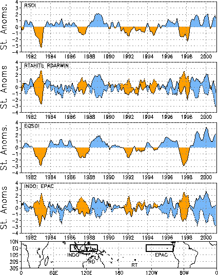
The sea level pressure (SLP) pattern during December featured large negative anomalies
over Indonesia and the western Pacific and weak positive anomalies over the eastern
tropical Pacific (Fig. T19). This pattern was associated
with positive values of both the Southern Oscillation Index (SOI) (0.7) and the equatorial
SOI (2.2) during the month (Table T1, Fig.
T2).
Editor’s Note: Due to a data loss at NESDIS, Figs. T26,
T27, T28, and A2.1 contain data from
December 1 - 22 only. |
