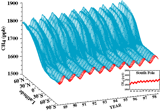
FIG. 71. Three dimensional representation of the
latitudinal distribution of atmospheric methane (CH4) in the marine boundary layer based
on measurements from the NOAA/CMDL cooperative air sampling network. Measurements from
South Pole are shown in red. (Analysis provided by CMDL.)
