
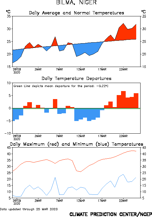
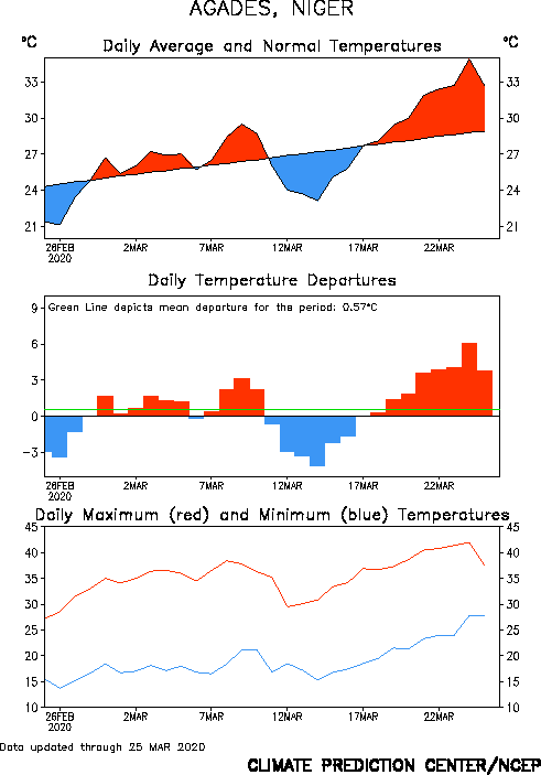
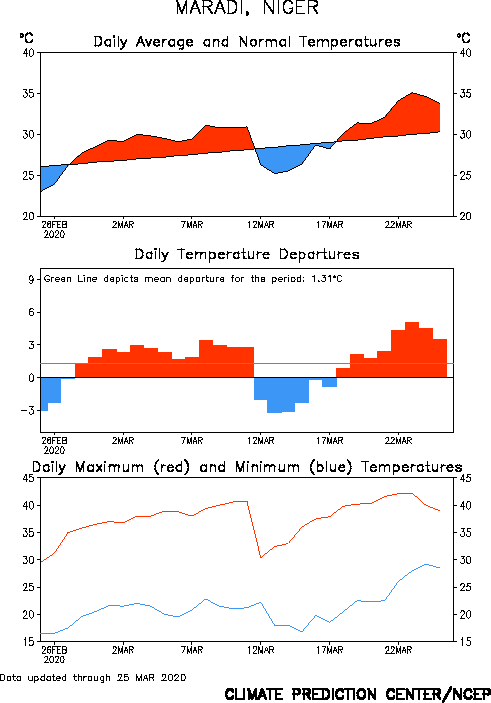
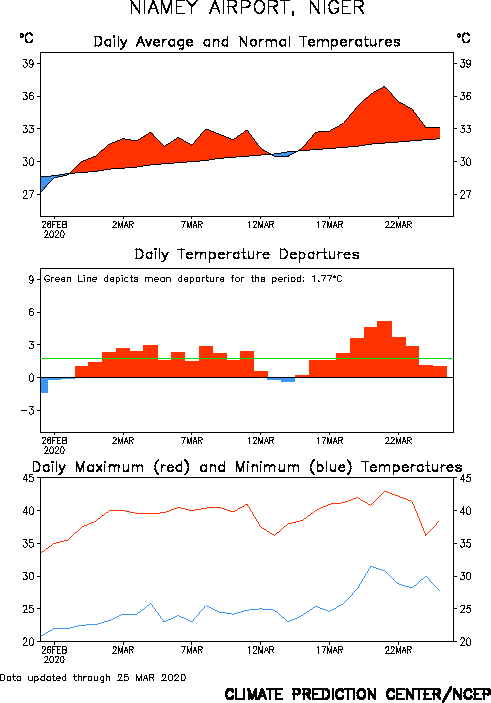
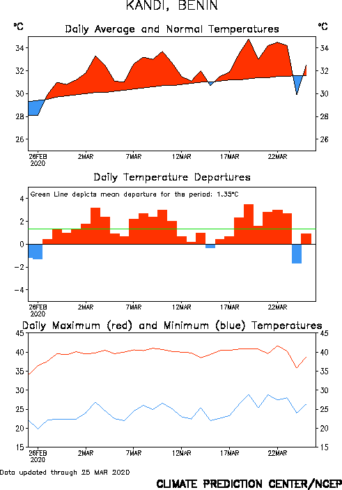
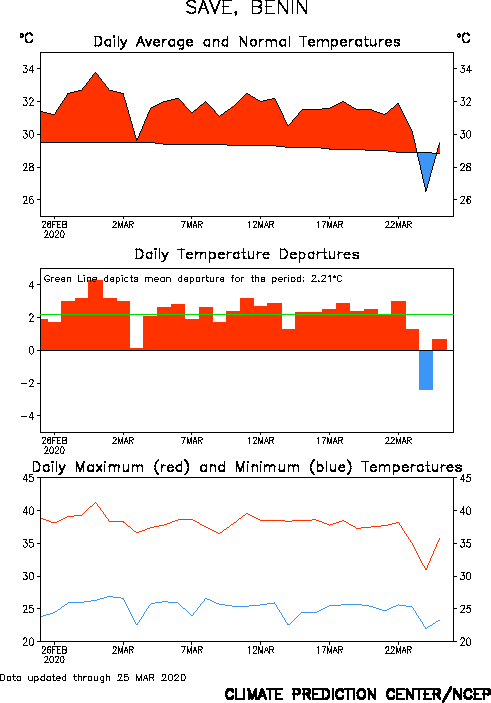
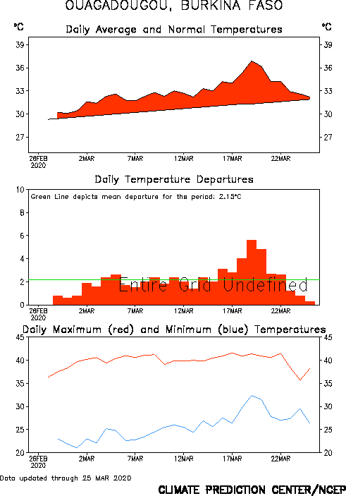
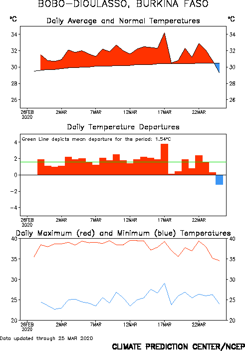
Click on the following station location on map or select name from list below to display time series of daily temperature for various locations throughout western Africa (Sahel). Regions shaded red show above-average temperatures; regions shaded blue show below-average temperatures. Blank areas indicate missing data.

|
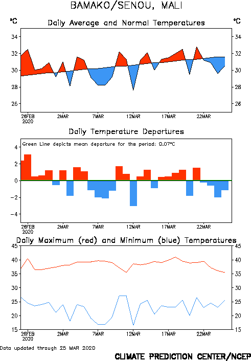
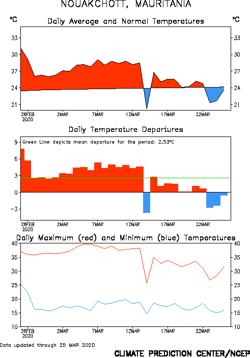
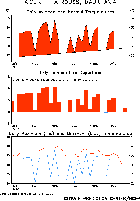
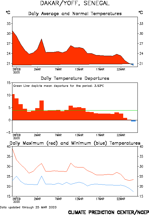
1. Bilma,Niger 2. Agades, Niger 3. Niguigmi, Niger 4. Maradi, Niger 5. Niamey, Niger 6. Gao, Mali 7. Bamako, Mali 8. Nouakchott, Mauritania 9. Aioun El Altrouss, Mauritania 10. Dakar, Senegal |
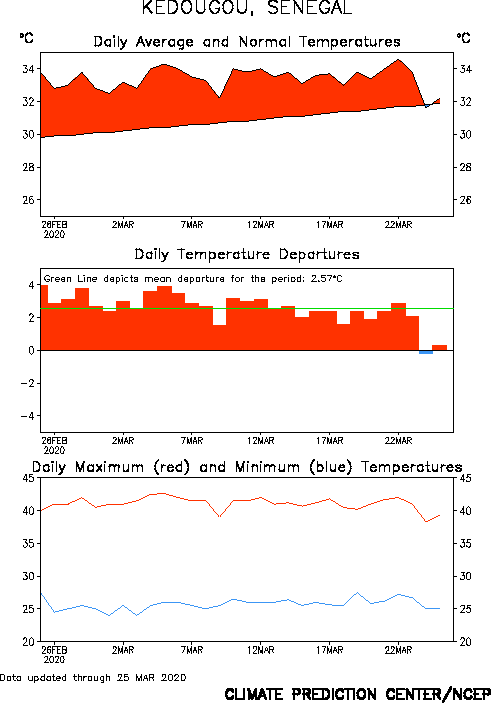
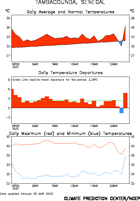
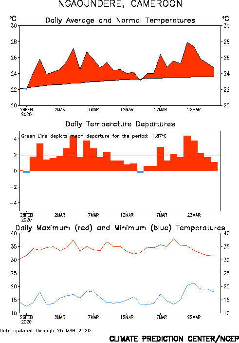
11. Kedougou, Senegal 12. Tambacounda, Senegal 13. Maroua-Salak, Cameroon 14. Ngaoundere, Cameroon 15. Kandi, Benin 16. Save, Benin 17. Mango, Togo 18. Ouagadougou, Burkina Faso 19. Bobo-Dioulasso, Burkina Faso 20. Korhogo, Cote D'Ivoire |