Pacific warm episode (El Niño)
conditions continued to weaken during March 2003 as sea surface temperature
(SST) anomalies again decreased across the equatorial Pacific (Table T2).
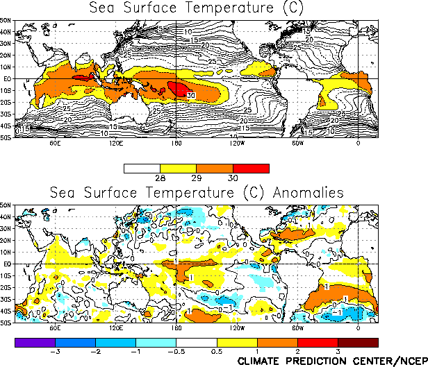
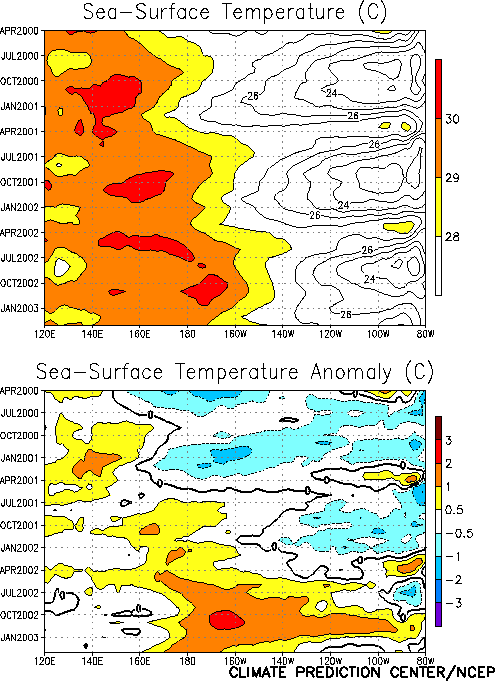
SSTs remained more than 1.0°C above
normal in the central Pacific between 170°E
and 140°W, but were slightly cooler
than normal east of 120°W (Fig.
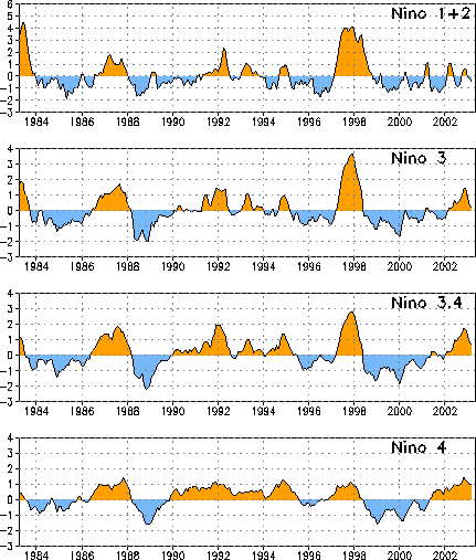
T18). The anomalies in all four Niño
region indices decreased for the third consecutive month (Table
T2, Fig.
T5). SST anomalies across the central and eastern equatorial Pacific
have steadily decreased since reaching maximum values in late 2002 (Fig.
T9).
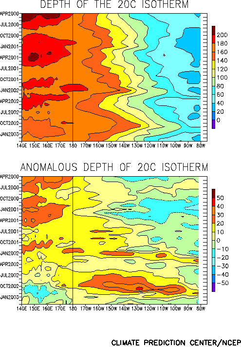
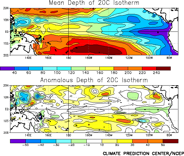
Consistent with weakening El Niño
conditions, the depth of the equatorial oceanic thermocline during March
remained near normal across the central Pacific and was slightly below
normal in the eastern Pacific (Figs. T15, T16). Ocean temperatures at
thermocline depth were 1-2°C above
normal in the central equatorial Pacific and 2-4°C
below normal in the eastern Pacific (Fig. T17).
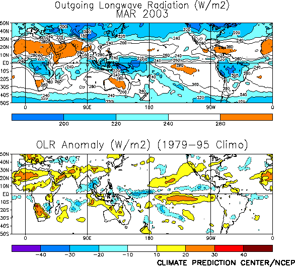
Tropical convection (precipitation and cloudiness) was above average
across the western and west-central equatorial Pacific and near average over
Indonesia during March (Fig. T25). Although above-average convection
has persisted over the central equatorial Pacific since August, there has
been a significant decrease in the departures from average since the
beginning of year, which is consistent with weakening warm episode
conditions (Fig. T9). The Outgoing Longwave Radiation index during
March (-0.5) was the smallest negative value since July 2002 (Table T1).
Elsewhere, precipitation deficits occurred over much of southern Africa and
northern Australia.
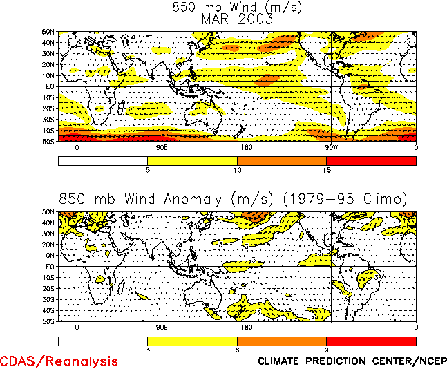
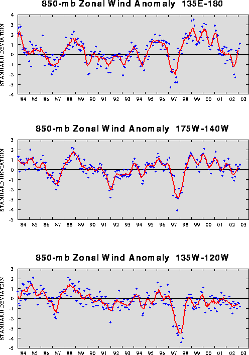
The low-level (850-hPa) equatorial easterly winds were stronger than
normal over the west-central Pacific and weaker than normal over the eastern
Pacific (Fig. T20). The enhanced easterlies were associated with the
largest value of the 850-hPa zonal wind index in the western Pacific region
since April 2001 (Fig. T4).
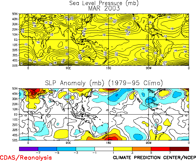
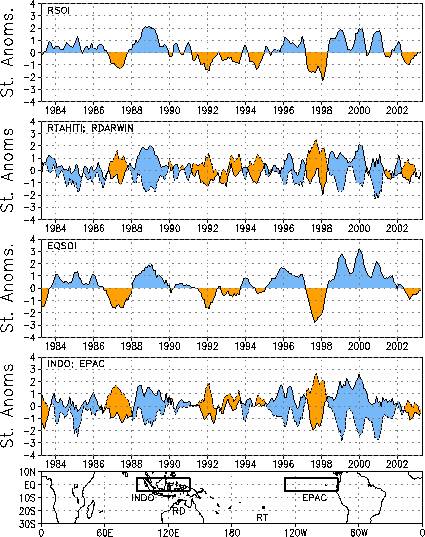
The tropical sea-level pressure (SLP) pattern during March featured
near-normal SLP throughout the entire global Tropics (Fig. T19). This
pattern was associated with a near-zero value of the equatorial SOI (-0.2) (Fig.
T2).


