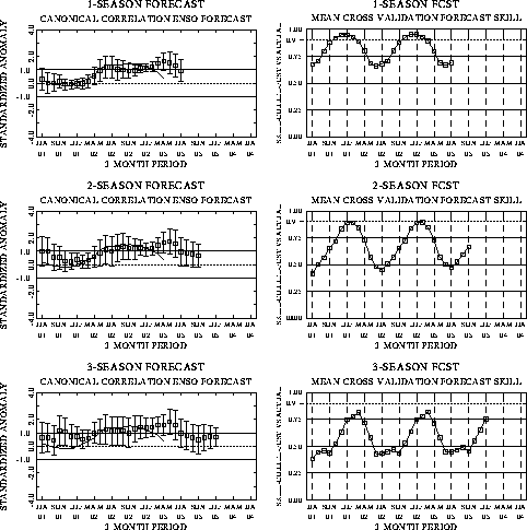
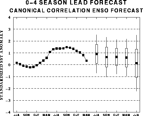
The canonical correlation analysis
(CCA) forecast of SST in the central Pacific (Barnett et al. 1988, Science, 241,
192-196; Barnston and Ropelewski 1992, J. Climate, 5, 1316-1345), is shown
in Figs. F1 and F2. This forecast
is produced routinely by the Prediction Branch of the Climate Prediction Center. The
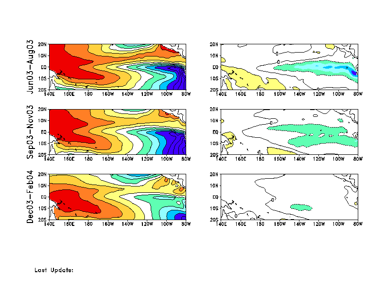
predictions from the National Centers for Environmental Prediction (NCEP) coupled
ocean/atmosphere model (Ji et al. 1998, Mon. Wea. Rev, 126, 1022-1034) are
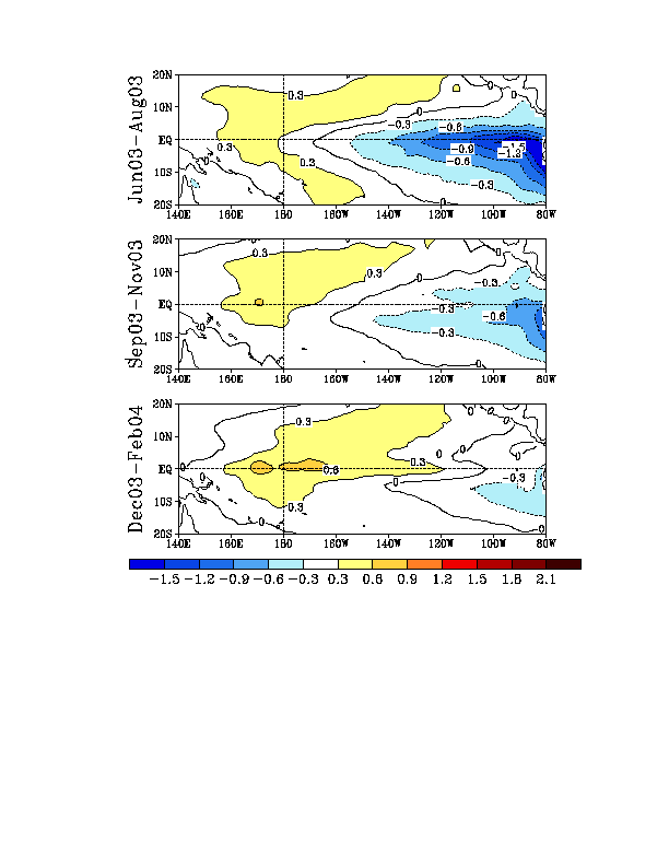
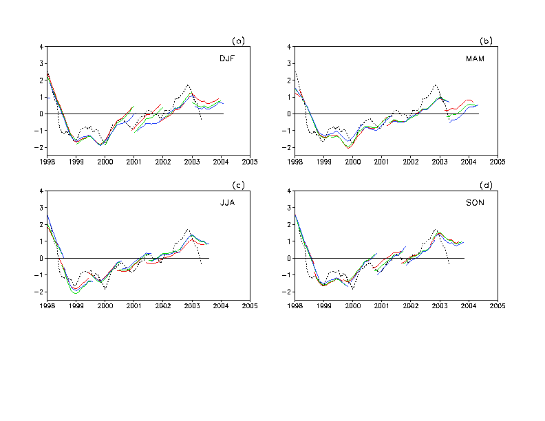
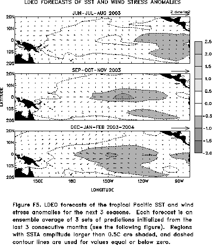
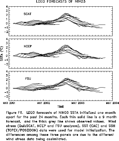
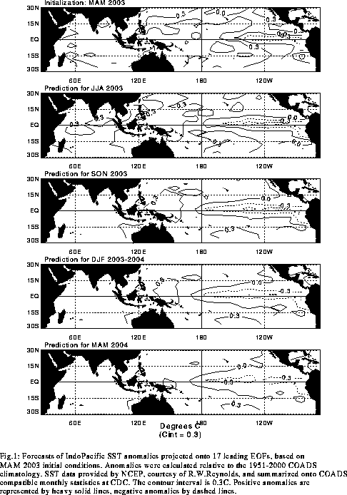
presented in Figs. F3 and F4a, F4b. Predictions from the Markov model (Xue, Y., A. Leetmaa,
and M. Ji, 2000: ENSO prediction with Markov model: The impact of sea level. J. Climate,
13, 849-871) are shown in Figs. F5 and F6.
Predictions from the latest version of the LDEO model (Chen, D., M. A. Cane, S.
E. Zebiak, Rafael Canizares and A. Kaplan, 2000, Geophys. Res. Let., 27,
2585-2587) are shown in Figs. F7 and F8.
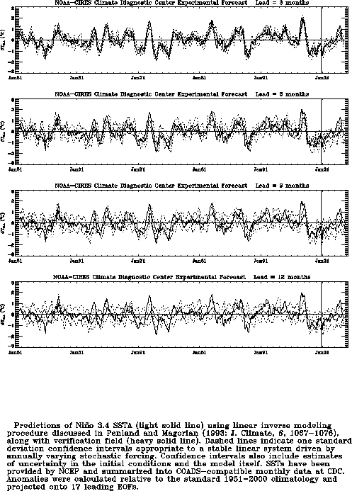
Predictions using linear inverse modeling (Penland and Magorian 1993, J. Climate, 6,
1067-1076) are shown in Figs. F9 and F10.
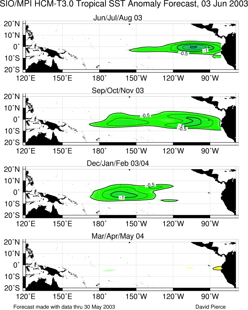
Predictions from the Scripps / Max Planck Institute (MPI) hybrid coupled model (Barnett et
al. 1993, J. Climate, 6, 1545-1566) are shown in Fig. F11. Predictions from the ENSO-CLIPER statistical model
(Knaff, J. A. and C. W. Landsea 1997, Wea. Forecasting, 12, 633-652) are
shown in Fig. F12. Niño
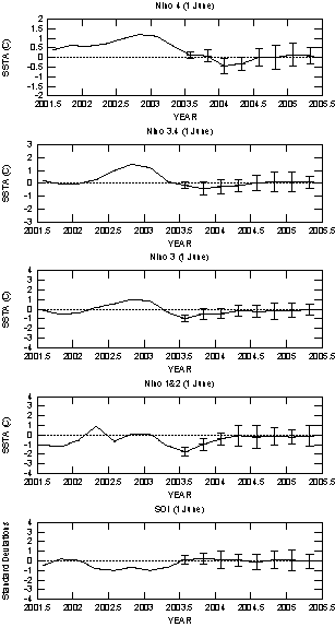
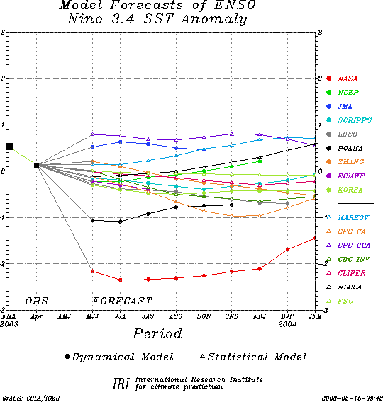
3.4 predictions are summarized in F13,
which is provided by the Forecasting
and Prediction Research Group of the IRI.
The CPC and the contributors to the Forecast Forum caution potential users of
this predictive information that they can expect only modest skill.
Outlook
Based on current conditions and recent observed
trends, it appears likely that cold episode (La NiZa)
conditions will develop in the tropical Pacific during the next few
months.
Discussion
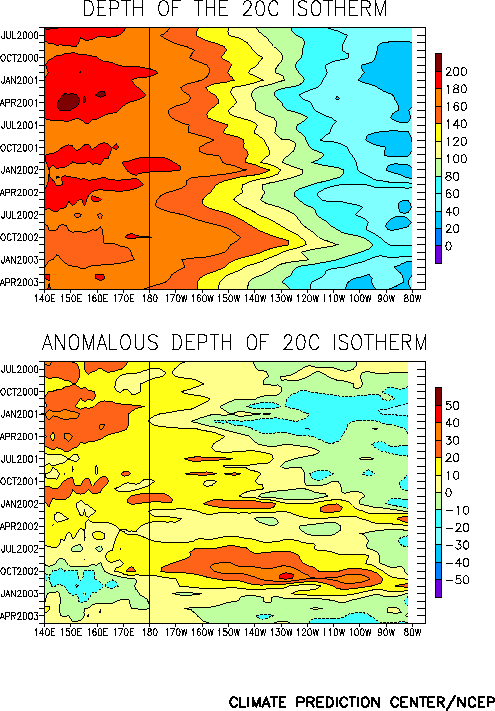
Oceanic and atmospheric conditions in the tropical Pacific during May
were consistent with a developing cold episode. Over the last several
months the depth of the oceanic thermocline has steadily decreased
throughout the central and eastern equatorial Pacific, consistent with
the appearance of colder than normal subsurface water in the upper ocean
of the equatorial Pacific (Fig. T15). In
May the oceanic temperature anomalies at thermocline depth were negative
across the central and eastern tropical Pacific (Fig.
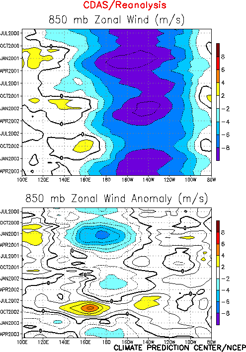
T17). In addition, there has been a gradual strengthening of the
low-level equatorial easterlies (Fig. T7).
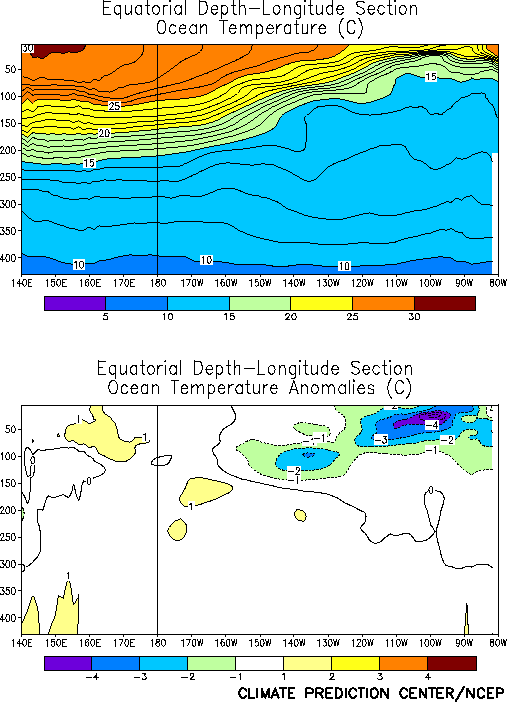
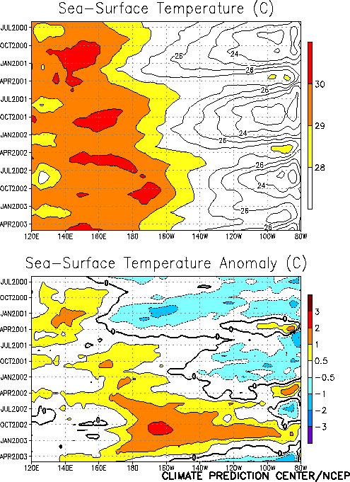
Consequently, equatorial oceanic upwelling strengthened and sea-surface
temperatures decreased (Fig. T9) as
colder-than-normal subsurface waters rose to the ocean surface. During
May SST’s continued to decrease across the east-central and eastern
equatorial Pacific (Table T2, Figs. T5
and T9). A crucial feature in any further
decrease in SST anomalies is the strength of the low-level easterlies,
which remained near average intensity along the equatorial Pacific
during May.
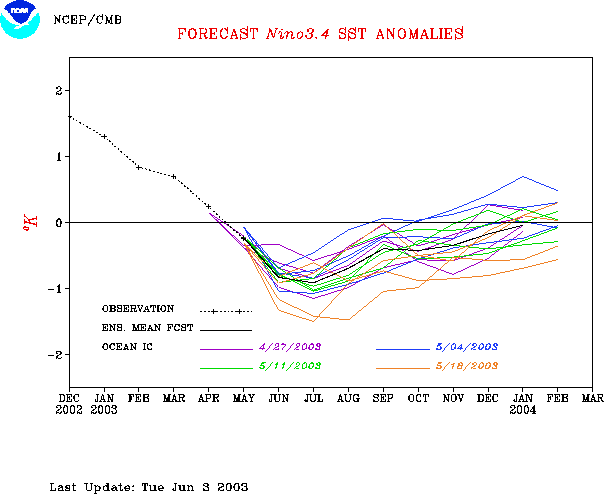
The latest statistical and coupled model forecasts indicate
considerable uncertainty for the next several months (Figs. F1,
F2, F3, F4,
F5, F6, F7,
F8, F9, F10,
F11, F12, F13).
Most forecasts indicate that either near neutral or La NiZa
conditions will occur during the last half of 2003. All such models have
relatively low skill during the transition phases of the ENSO cycle.
However, current conditions and recent trends favor the development of
cold episode (La NiZa)
conditions in the tropical Pacific during the next few months.


