1. Northern Hemisphere
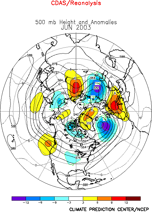
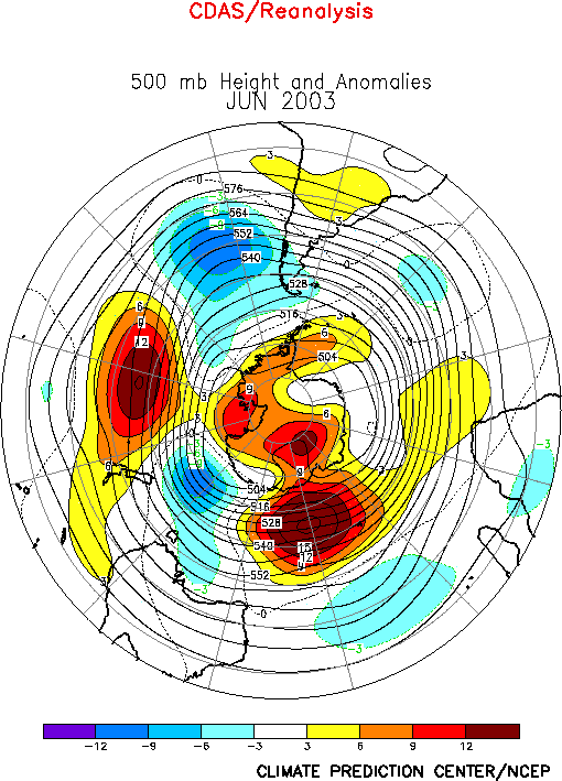
The 500-hPa circulation during June 2003 featured positive height
anomalies over the high latitudes of the North Pacific, Europe, and central
Russia, and negative height anomalies over the central United States, the
eastern North Atlantic, and western Russia (Fig.
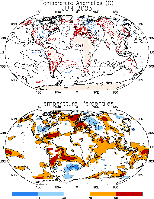
E10). The prominent temperature anomalies during the month included
warmer-than-average conditions over the western United States, Europe, and
central Russia, and cooler-than-average conditions across the eastern
two-thirds of the United States and western Russia (Fig.
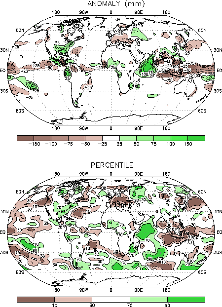
E1). Prominent precipitation anomalies during the month included
above-average totals in the southeastern and eastern United States, and
below-average totals in Europe (Fig. E3).
a. Pacific/North America
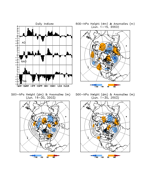
The mean upper-level circulation during June featured above-average
heights over the western and eastern North Pacific, and a broad trough over
the central United States. This anomaly pattern occurred primarily during
the first half of the month (Fig. A2.1).
During the second half of June the positions of the mean upper-level ridge
and trough over the U.S were reversed, with the trough axis aligned along
the west coast and the ridge axis located over the central part of the
country. For the month as a whole these circulation patterns contributed to
above-average surface temperatures in the western U.S. (+1°
to +2°C) and to below-average temperatures (-1°
to -2°C) over most of the country east of the
Rocky Mountains (Fig. E1).
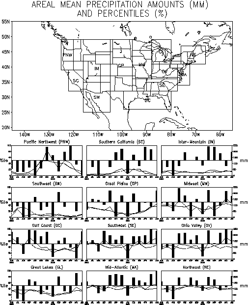
Well above-average rainfall occurred across the southeastern and eastern
United States during June, with totals exceeding the 90th
percentile in the Gulf Coast, Southeast, Mid-Atlantic, and Ohio Valley
regions (Figs. E3, E5).
The Southeast, Ohio Valley, and Mid-Atlantic regions have recorded
above-average precipitation in eight of the last nine months beginning
September 2002. The Inter-Mountain region also recorded above-average
precipitation during June. This area as a whole has received above-average
precipitation in four of the last five months, which follows nearly two
years of considerably below-average precipitation for the region. The only
region of significantly below-average precipitation during June occurred in
the Pacific Northwest, where totals were below the 10th
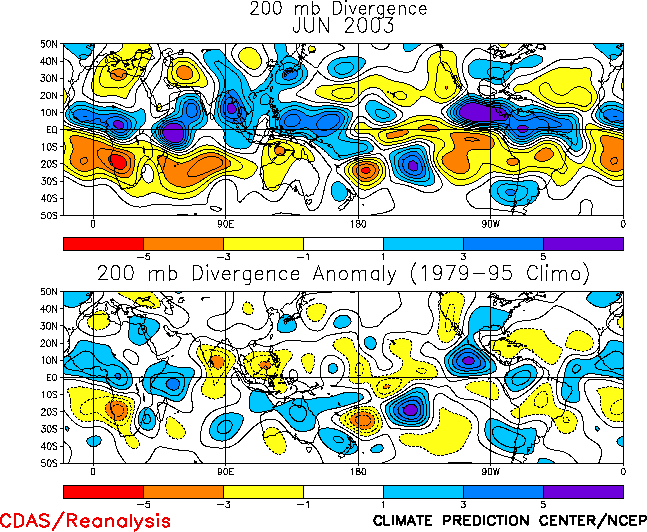
percentile of occurrences. This dryness was related to an area of mean
upper-level convergence (Fig. T23) located
immediately downstream of the anomalous ridge axis (Fig.
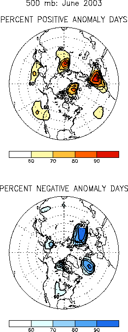
E12 right), and to an associated northward shift of the mean storm
track into Canada (Fig. E14).
b. Europe/Russia
The upper-level circulation during June featured a persistent anomalous
wave pattern of 500-hPa height anomalies extending from the eastern North
Atlantic to central Russia (Fig. E12). This
pattern was associated with deep troughs over the eastern Atlantic and
western Russia, and ridges over Europe and central Russia (Fig.
E10). This circulation contributed to warmer and drier-than-average
conditions over much of Europe, with monthly mean temperatures exceeding
the 90th percentile (Fig. E1) and
rainfall totals dropping below the 10th percentile over much of
the continent (Fig. E3). It also contributed
to cooler and wetter-than-average conditions across western Russia, with
mean temperatures below the 30th percentile and rainfall totals
in some areas exceeding the 90th percentile.
2. Southern Hemisphere
In the Southern Hemisphere the 500-hPa circulation during June featured
above-average heights over Antarctica, the central South Pacific, the high
latitudes of the Indian Ocean, and southern South America, and
below-average heights over the eastern South Pacific, the central Indian
Ocean, and in the area south of Australia (Fig. E16).
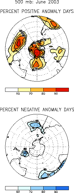
The circulation anomalies across the polar region, the South Pacific, and
South America were quite persistent and were evident on more than 80% of
the days during the month (Figs. E16, E18).
Most of extratropical South America experienced well above-average
temperatures during June, with monthly mean values exceeding the 90th
percentile in much of the region (Fig. E1).
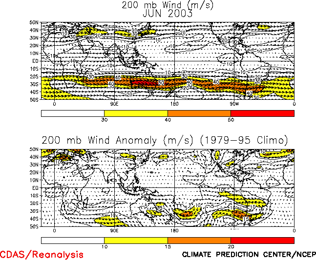
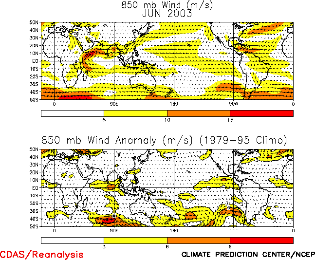
Eastern Australia experienced above-average temperatures and a continuation
of below-average rainfall during June. These conditions were related to the
combination of an anomalous anticyclonic circulation at upper-levels (Figs.
T21, T22) and
anomalous dry westerly winds at low levels (Fig.
T20).


