The
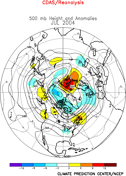
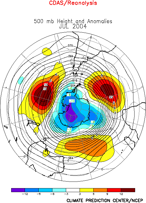
500-hPa circulation during July featured above-average heights over Alaska,
western Canada, and northwestern Russia, and below-average heights over the
north-central U.S., northwestern Europe, and eastern China (Fig. E9).
This circulation was associated with a continuation of above-average
surface temperatures and below-average precipitation in Alaska, and with
cooler than average conditions across eastern North America (Figs. E1,
E3). It was also associated with above-average precipitation in eastern
China.
a. North America
Over North America the circulation during July featured a
persistent upper-level ridge over the Rocky Mountains and eastern Alaska,
and an amplified trough over the Great Lakes (Fig.
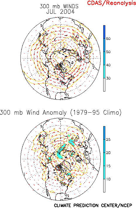
E9). For Alaska,
the associated mean jet stream and storm track were located south of the
state (Fig. E10), which led to a continuation of exceptionally warm
and dry conditions throughout the state. Farther east anomalous
northwesterly flow upstream of the amplified upper-level trough contributed
to a continuation of below-average surface temperatures across eastern
Canada and over most of the United States east of the Rocky Mountains. This
anomalous circulation is similar to that observed during April-June. The
persistence of these circulation features has led to four consecutive
months of extremely warm and dry conditions in Alaska, and to a prolonged
period of anomalously cold temperatures across central and eastern Canada
and large portions of the central and eastern U.S. (Fig. E1).
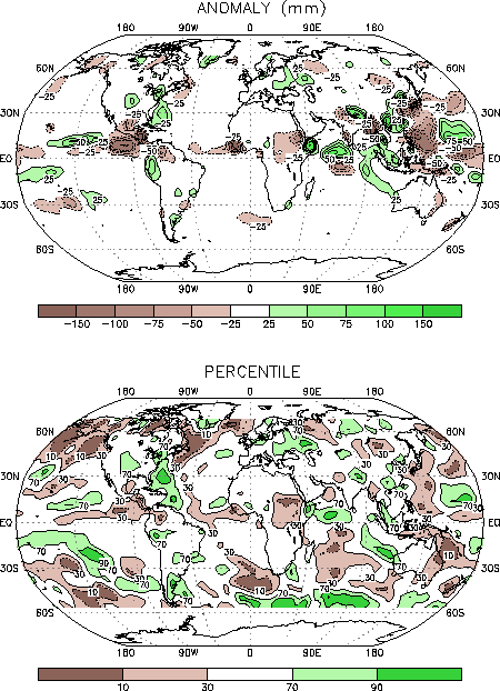
Also in the United States, significantly above-average
precipitation was observed over the central Plains States and in portions
of the Mid-Atlantic and Northeast regions during July, with totals in most
areas exceeding the 70th percentile of occurrences. This
enhanced rainfall is related to a series of cold frontal passages into the
central Plains States, and to increased storminess in the eastern U.S.
downstream of the upper-level trough axis.
b. Eastern China
Eastern China experienced above-average rainfall during
July, with totals in many areas exceeding the 70th percentile of
occurrences (Fig. E3). This enhanced rainfall was linked to a
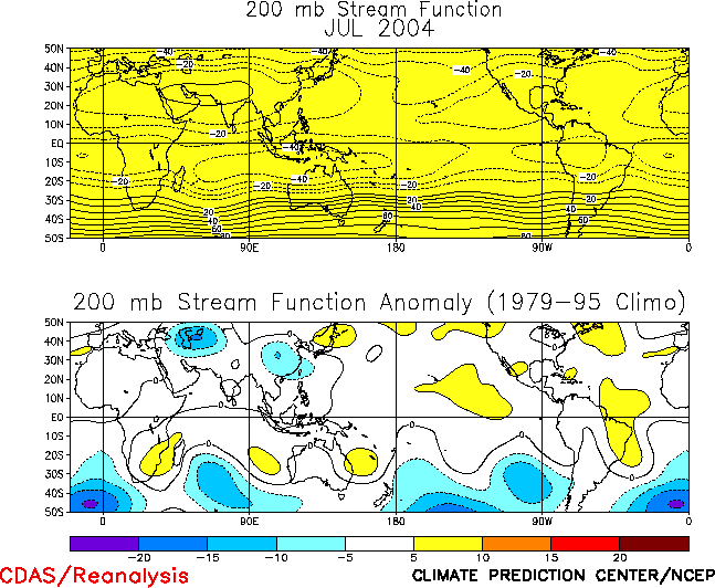
persistent upper-level trough east of the Tibetan Plateau, which occurred
in association with a below average strength of the Southeast Asian monsoon
ridge (Fig. T22). There has been considerable month-to-month
variability in the strength and eastward extent of the Asian monsoon ridge
during the last few months. For example, during June the ridge was stronger
than average and extended farther east than normal, which contributed to
well below-average precipitation across eastern China.
Eastern China has experienced generally below-average
precipitation since at least July 2003, with only two months (May and July
2004) recording above-average precipitation.
2. Southern Hemisphere
The 500-hPa circulation during July featured
above-average heights in the middle latitudes and below-average heights
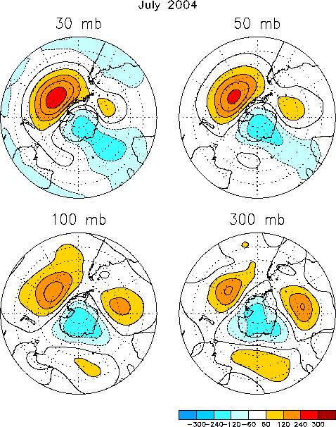
over Antarctica (Fig. E15). The associated circumpolar vortex was
enhanced throughout the lower stratosphere (Fig. S1).
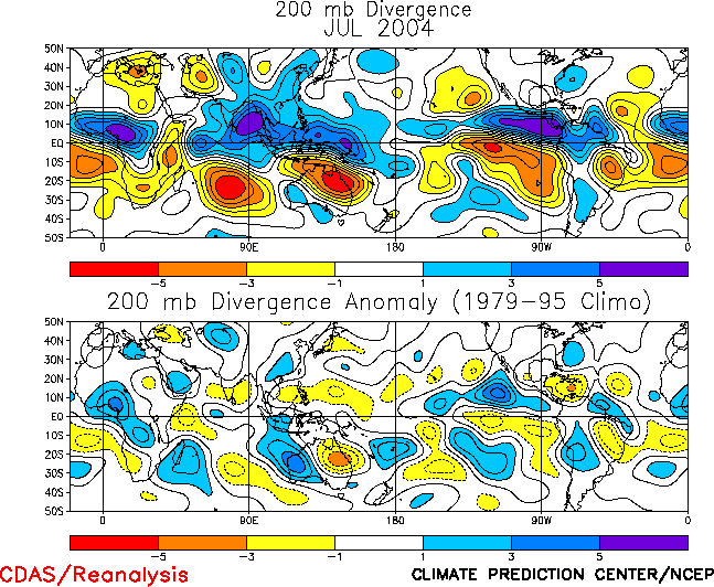
In Australia an east-west dipole of 200-hPa divergence
anomalies spanned the continent during July (Fig. T23). The area of
anomalous upper-level convergence and sinking motion was situated between
mean upper-level ridge and trough axes, and was associated with
below-average precipitation across the eastern one-third of the continent (Fig.
E3).


