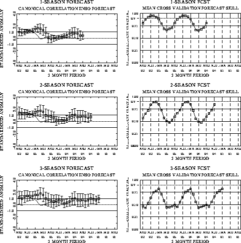
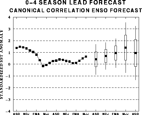
The canonical correlation analysis
(CCA) forecast of SST in the central Pacific (Barnett et al. 1988, Science, 241,
192-196; Barnston and Ropelewski 1992, J. Climate, 5, 1316-1345), is shown
in Figs. F1 and F2. This forecast
is produced routinely by the Prediction Branch of the Climate Prediction Center. The
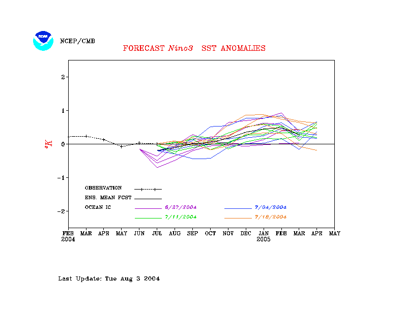
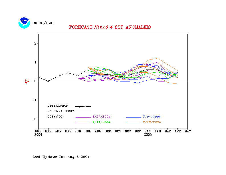
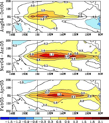
predictions from the National Centers for Environmental Prediction (NCEP) coupled
ocean/atmosphere model (Ji et al. 1998, Mon. Wea. Rev, 126, 1022-1034) are
presented in Figs. F3 and F4a, F4b. Predictions from the Markov model (Xue,
Y. et al. 2000: ENSO prediction with Markov model: The impact of sea level. J. Climate,
13, 849-871) are shown in Figs. F5 and F6.
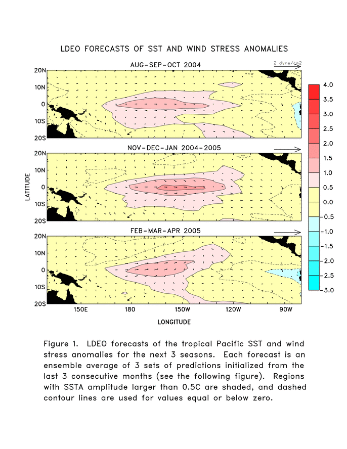
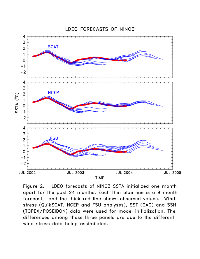
Predictions from the latest version of the LDEO model (Chen,
D. et al. 2000, Geophys. Res. Let., 27,
2585-2587) are shown in Figs. F7 and F8.
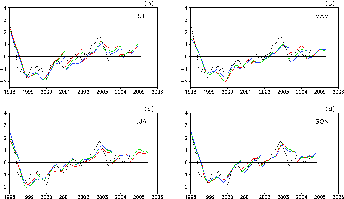
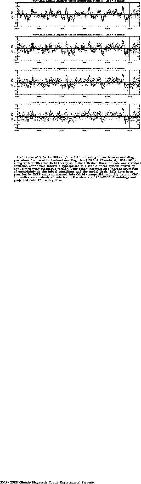
Predictions using linear inverse modeling (Penland and Magorian 1993, J. Climate, 6,
1067-1076) are shown in Figs. F9 and F10.
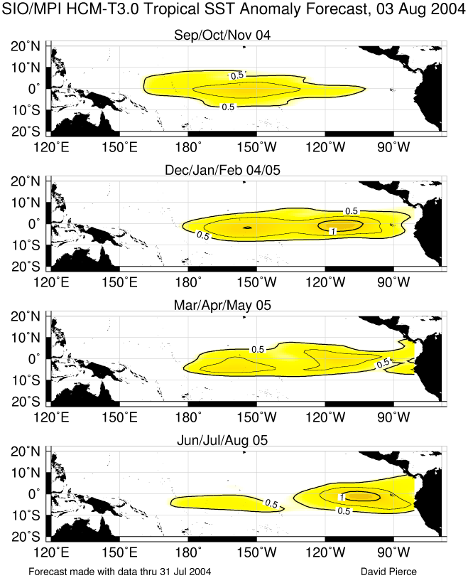
Predictions from the Scripps / Max Planck Institute (MPI) hybrid coupled model (Barnett et
al. 1993, J. Climate, 6, 1545-1566) are shown in Fig. F11. Predictions from the ENSO-CLIPER statistical model
(Knaff, J. A. and C. W. Landsea 1997, Wea. Forecasting, 12, 633-652) are
shown in Fig. F12. Niño
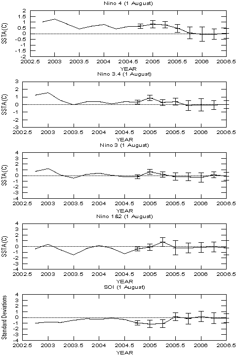
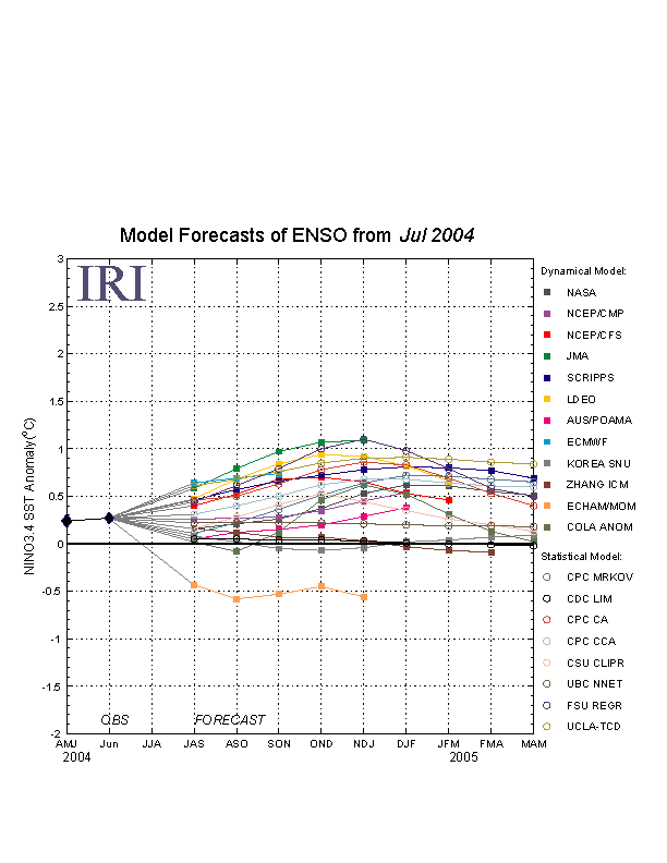
3.4 predictions are summarized in F13,
which is provided by the Forecasting
and Prediction Research Group of the IRI.
The CPC and the contributors to the Forecast Forum caution potential users of
this predictive information that they can expect only modest skill.
Outlook
Based on the observed oceanic and atmospheric
patterns and recent trends, it is likely that warm-episode (El Niño)
conditions will develop during the next 3 months.
Discussion
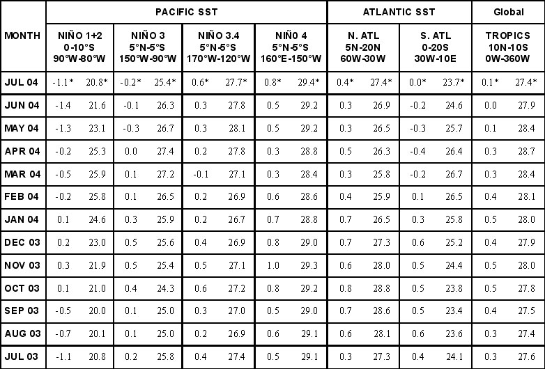
Sea surface temperature anomalies increased
substantially in the central equatorial Pacific (Niño 3.4 region)
during July 2004, while anomalies greater than +0.5°C persisted in the
Niño 4 region (Table T2).
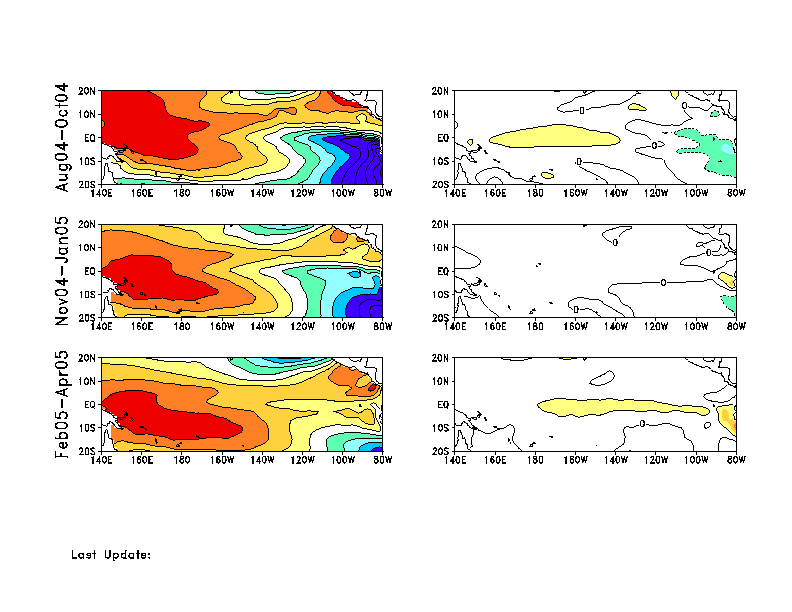
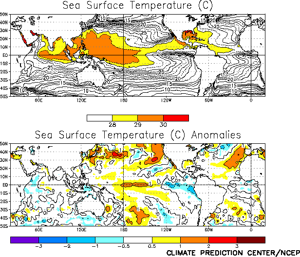
Positive SST anomalies greater than +1°C were found
between 180°W and 140°W, while negative SST anomalies less than
-0.5°C were found between 120°W and the South American coast (Fig.
T18). By the end of July, positive SST anomalies greater than
+1°C extended from 180°W eastward to 125°W. The recent increase and
eastward expansion of positive SST anomalies in the central equatorial
Pacific indicate the possible early stages of a warm episode. In spite
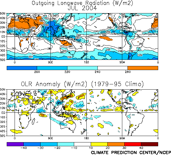
of the anomalous warmth in the central equatorial Pacific during July,
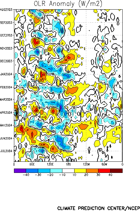
there appears to be little or no reflection of that warmth in the
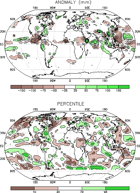
pattern of deep convection (precipitation) (Figs. T25,
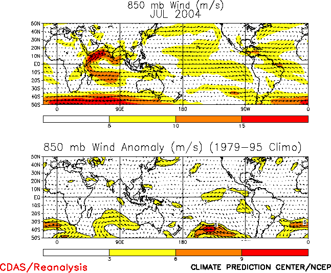
E3) or in the pattern of low-level winds (Fig.
T20) over the region.
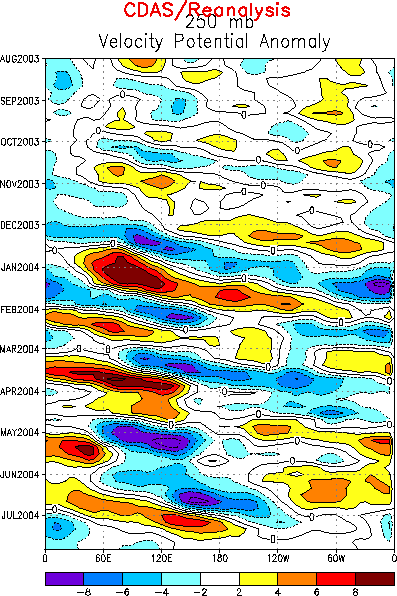
Considerable intraseasonal variability (MJO activity) in
recent months has resulted in week-to-week and month-to-month
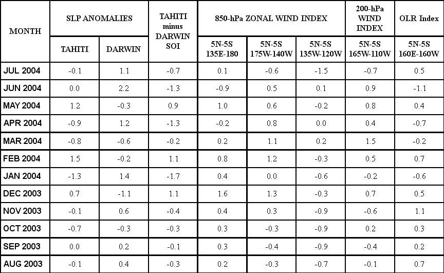
variability in many atmospheric and oceanic indices (Table
T1). During mid-June through early July the easterlies weakened
in many areas of the equatorial Pacific (Fig.
T13), as enhanced convection shifted eastward from the Indian
Ocean to the western tropical Pacific (Figs. T11,
T12). By mid-July the low-level winds and
equatorial convection returned to near average in many areas of the
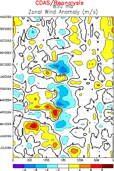
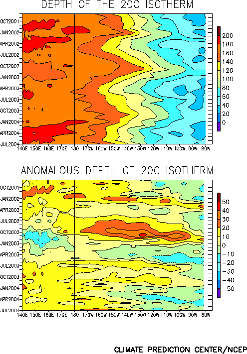
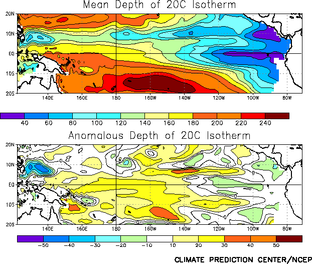
equatorial Pacific. However, a strong oceanic Kelvin wave, initiated by
the weaker-than-average easterly winds in June, has propagated eastward
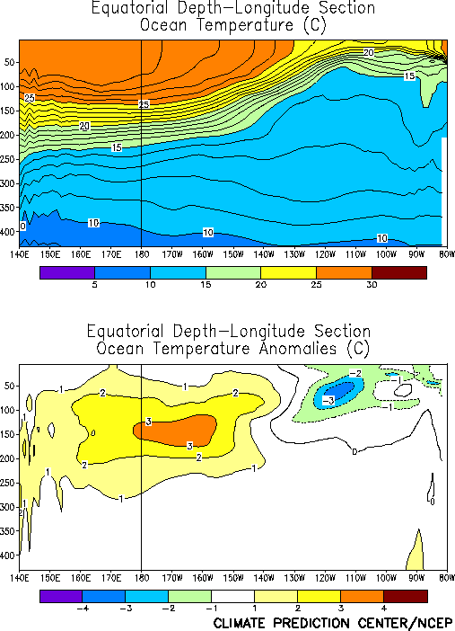
resulting in a substantial deepening of the oceanic thermocline (Figs.
T15 and T16) and
an increase in the subsurface temperature anomalies in the central and
east-central equatorial Pacific (Fig. T17).
This Kelvin wave is expected to reach the South American coast during
August.
Given the recent trends and observed oceanic and
atmospheric patterns discussed above, there is about a 50% chance that
the NOAA operational definition for El Niño [Oceanic Niño Index (ONI),
a three-month running mean of the Niño 3.4 index, greater than or equal
to +0.5°C] will be satisfied for the period June-August 2004. It seems
most likely that SST anomalies in the Niño 3.4 region will remain
positive, at or above +0.5°C, through the end of 2004. At this time it
is not clear what, if any, impacts this event will have on ocean
temperatures in the classical El Niño region (Niño 1+2) along the west
coast of South America.
Approximately half of the statistical and coupled model
forecasts indicate near neutral conditions in the tropical Pacific (Niño
3.4 SST anomalies between -0.5°C and +0.5°C) through the end of 2004 (Figs.
F1, F2, F3,
F4a, , F4b, F5,
F6, F7, F8,
F9, F10, F11,
F12, F13)
The remaining forecasts indicate El Niño conditions (Niño 3.4 SST
anomalies greater than or equal to +0.5°C) will develop within the next
3-6 months.
Weekly updates of SST, 850-hPa wind, OLR and features of the
equatorial subsurface thermal structure are available on the Climate
Prediction Center homepage at:
http://www.cpc.ncep.noaa.gov.


