Tropical Highlights - September 2002
Pacific warm episode (El Niño)
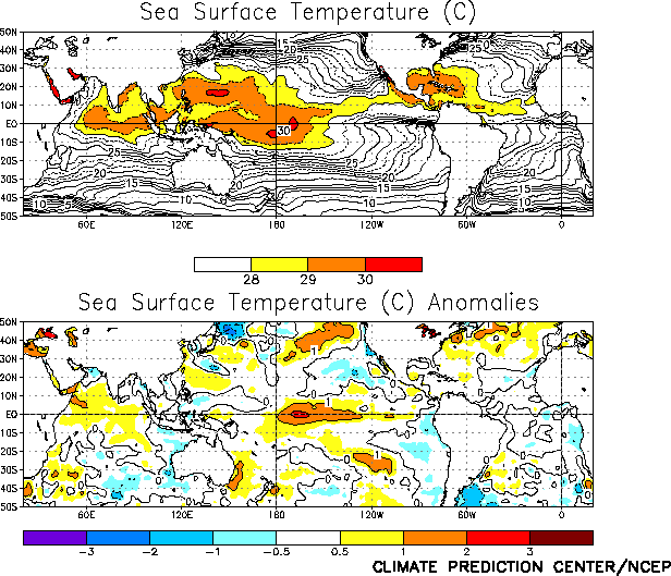
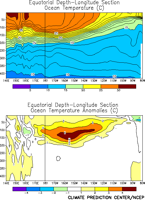
conditions continued during September 2002 as sea surface temperature
(SST) anomalies greater than +1°C persisted across the central equatorial Pacific between the date line
and 130°W, and anomalies greater than 2°C developed
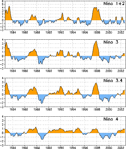
between 170°W-160°W (Fig. T18). The corresponding SST index for the Niño
3.4 region increased to 1.2 during the month, which is the largest value of that index since March 1998, the end
of the 1997-98 El Niño episode (Fig. T5, Table T2)..
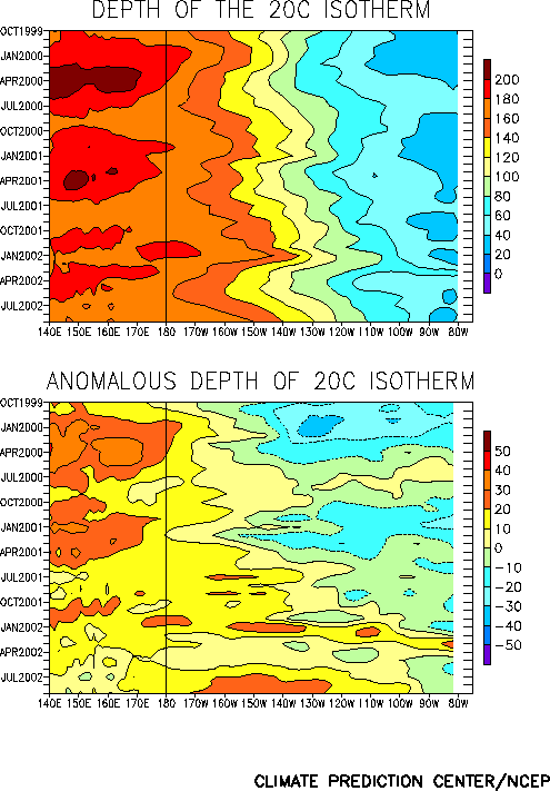
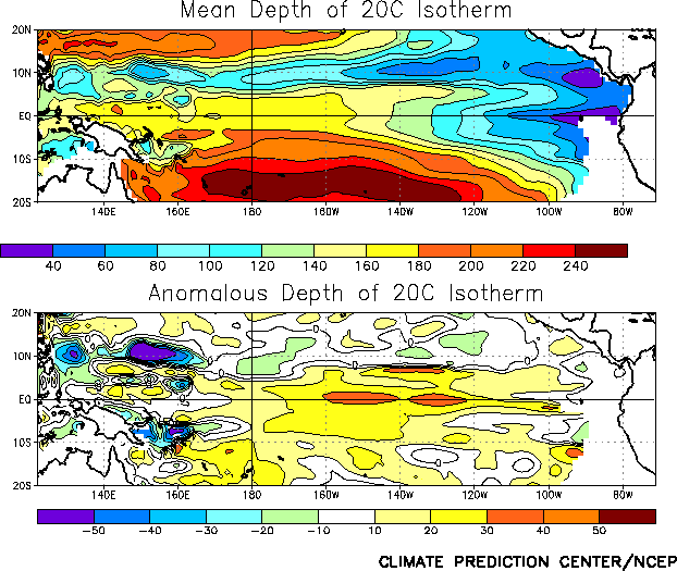
Consistent with this ongoing warmth the oceanic thermocline
remained deeper than normal across the central and eastern equatorial
Pacific (Figs. T15, T16). Sub-surface ocean temperatures in the
equatorial central and east-central Pacific also remained 4-5°C above normal at thermocline depth (Fig. T17).
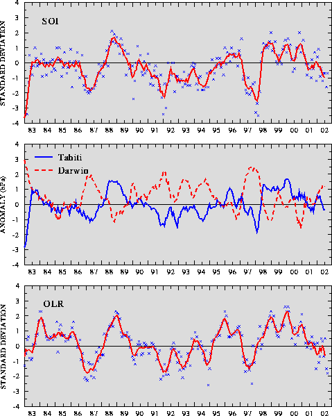
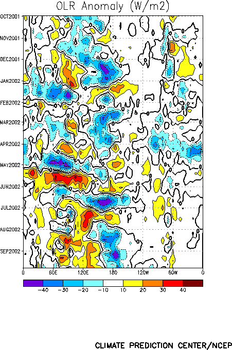
Convection was enhanced across the central equatorial Pacific
during September, resulting in the largest negative value of the OLR
index since October 1997 (Figs. T1, T11). During
the past two months convection has been enhanced in this region, and
suppressed over Indonesia and the western Pacific (Fig. T25).
These conditions are consistent with a strengthening of the El Niño
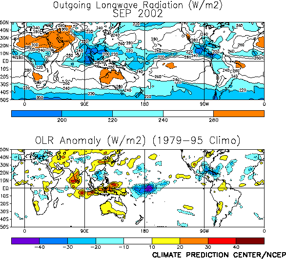
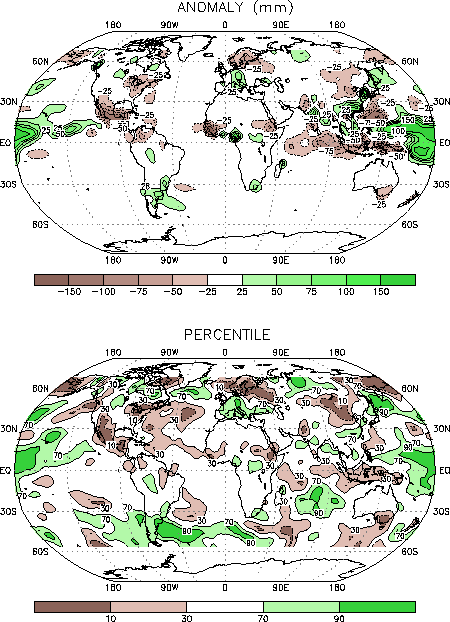
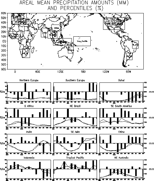
conditions during the period. Elsewhere, monsoon rainfall was below
normal during September over the Indian peninsula and the African
Sahel (Figs. E3, E4). Both regions experienced below normal
rainfall during their June - September wet season.
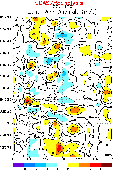
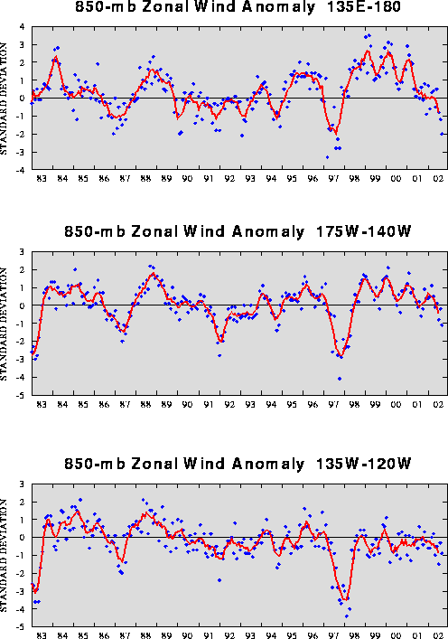
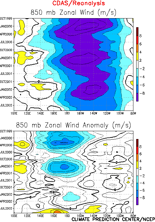
The low-level (850-hPa) easterly winds were weaker than normal
across the entire equatorial Pacific during September 2002 (Figs. T13,
T20). For both the western and central regions these
conditions produced the largest negative 850-hPa zonal wind index
values recorded since the 1997/98 warm episode. The low-level
easterlies have been weaker than normal across the equatorial Pacific
since July 2002 (Table T1, Figs. T4,
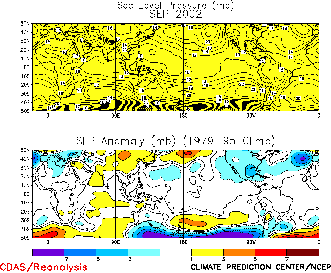
T7)The tropical sea-level pressure (SLP) pattern again reflected an
anomalous wave-1 pattern during September, characterized by
below-average pressure over most of the tropical Pacific and
above-average pressure elsewhere (Fig. T19). This pattern
resulted in negative values of both the Tahiti-Darwin Southern
Oscillation Index (SOI) (-0.7) and the equatorial SOI (-0.8) (Figs.
T1, T2, respectively). The SOI has been negative since March 2002
(Table T1), and the five-month running mean of the SOI reached
-1.0 during the May - September 2002 period.


