www.nws.noaa.gov
Site Map
News
Organization
Search
CPC Search
About Us
Our Mission
Who We Are
Contact Us
CPC Information
CPC Web Team
HOME
>
Monitoring and Data
>
Monitoring East Pacific Hurricane Potential
> Heights and Vorticity
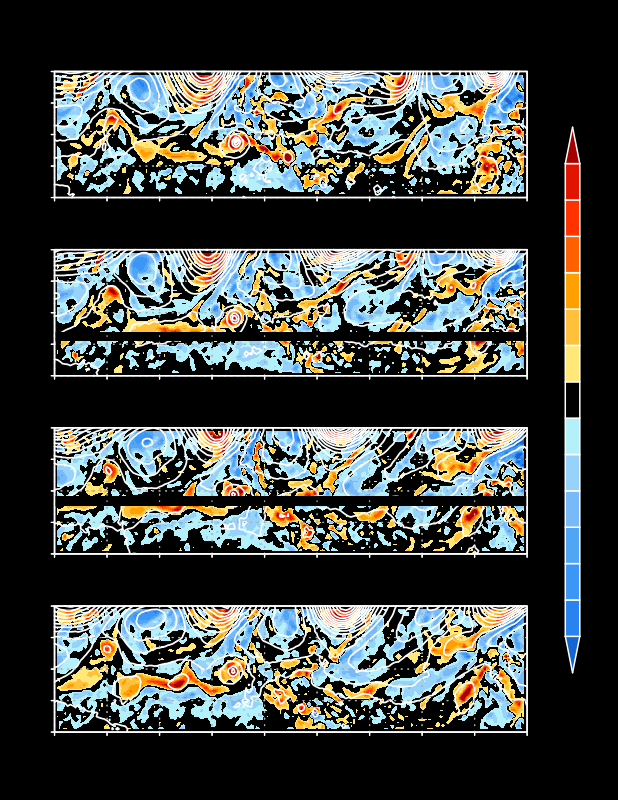
600-hPa heights and relative vorticity (shaded, 1 x 10⁻⁵ s-1) at specified time periods every 12 hours. Red colors indicate cyclonic relative vorticity and blue colors indicate anticyclonic relative vorticity.
NOAA/
National Weather Service
National Centers for Environmental Prediction
Climate Prediction Center
5200 Auth Road
Camp Springs, Maryland 20746
Climate Prediction Center Web Team
Page last modified: October 2, 2002
Disclaimer
Privacy Policy