|
| |
|
HOME > Monitoring and Data > Monitoring East Pacific Hurricane Potential > Vertical Wind Shear
|
| |
|
|
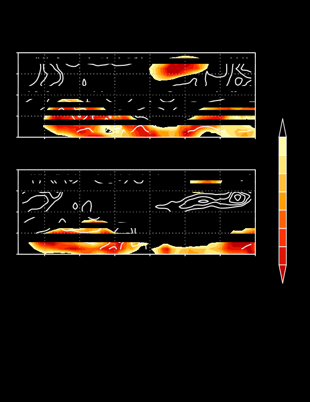
Weekly vertical wind shear (shaded, m/s) and 700-hPa cyclonic relative vorticity (contours, 1x10⁻⁵ s-1) for (top) two weeks ago, (middle) last week, and (bottom) numerical model forecast for the next seven days. Only vertical wind shear values less than 8 m/s are indicated, and highlight regions over the low latitudes of the East Pacific in which the vertical shear is favorable for tropical storm development. Model forecasts may have significant bias or error, which have not yet been determined, and may depart significantly from the observed fields.
|
|
|
|


