|
| |
|
HOME > Monitoring and Data > Monitoring East Pacific Hurricane Potential > Wind Shear and Circulation
|
| |
|
|
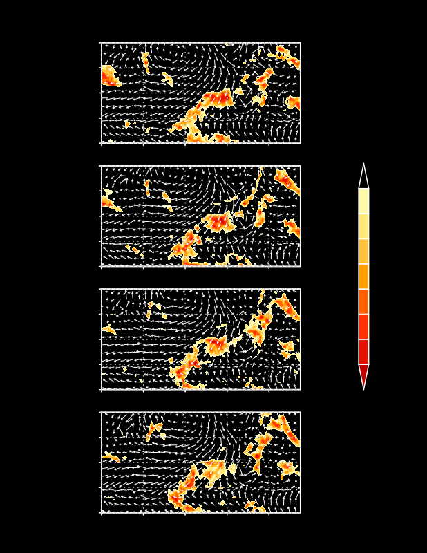
Magnitude of 200-850 hPa vertical wind shear and IR temperatures (shaded) at specified time periods every 6 hours. Only vertical wind shear values less than 8 m/s are contoured, and highlight regions over the low latitudes of the East Pacific in which the vertical shear is favorable for tropical storm development. Green shading indicates warmer cloud-top temperatures and possible stratiform precipitation and red shading indicates cold cloud-top temperatures and possible convective activity. IR temperatures are obtained from a merge of GOES 8, METEOSAT 7, and METEOSAT 5 satellites, and have latitudinally and seasonally dependent zenith angle corrections.
|
|
|
|


