|
| |
|
HOME > Monitoring and Data > Monitoring East Pacific Hurricane Potential > Streamlines, Winds, and Infrared Temperatures
|
| |
|
|
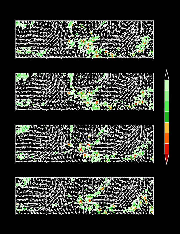
1000-hPa streamlines and satellite-derived infrared (IR) temperatures (shaded) at specified time periods every 6 hours. Green shading indicates warmer cloud-top temperatures and possible stratiform precipitation and red shading indicates cold cloud-top temperatures and possible convective activity. IR temperatures are obtained from a merge of GOES 8, METEOSAT 7, and METEOSAT 5 satellites, and have latitudinally and seasonally dependent zenith angle corrections.
|
|
|
|


