Warm episode (El Niño)
conditions continued to weaken during March 2003, as the equatorial
easterlies strengthened and SST anomalies decreased throughout the eastern
and central equatorial Pacific. Since December, SST anomalies have decreased
by more than 2°C
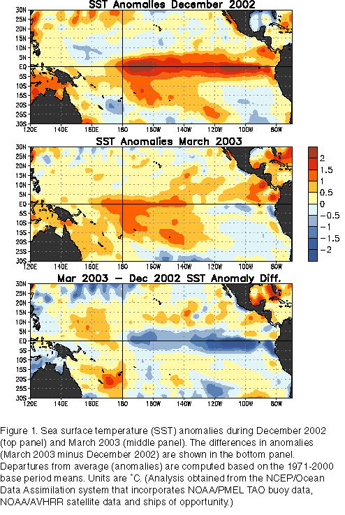
in the eastern equatorial Pacific between 130°W
and the South American coast (Fig. 1). This
decrease has resulted in near normal or slightly below normal SSTs in the
region east of 120°W
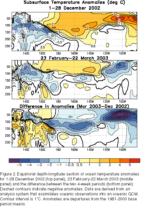
since February. During the same period there has also been a steady decrease
in the magnitude and extent of the positive subsurface temperature
anomalies, indicating a depletion of the excess warmth in the upper ocean of
the equatorial Pacific (Fig. 2). This evolution is
typical during the decay phases of warm episodes.
In spite of these trends, significant positive SST anomalies remained in
the central equatorial Pacific during March 2003, with anomalies greater
than +1°C
extending from 170°E
to 140°W (Fig.
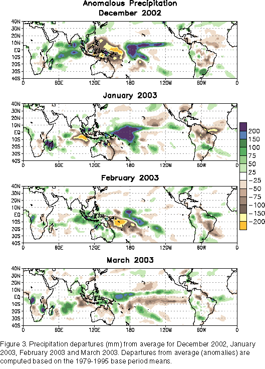
1, middle panel). Greater-than-average precipitation and cloudiness were
found over the western portion of this region, although the departures from
average and the spatial coverage have decreased substantially during the
last two months (Fig. 3). The Tahiti-Darwin SOI
remained negative (-1.0)
for the 13th consecutive month, while the equatorial SOI was near zero.
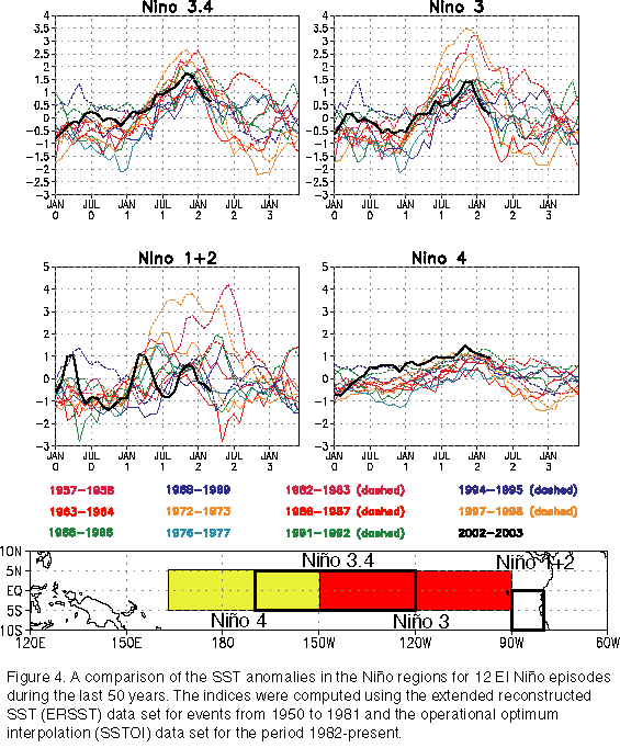
A comparison of the 2002-03 El Niño
episode with previous events in the last 50 years (Fig.
4) indicates that for the equatorial Pacific as a whole the 2002-2003
event was moderate
in intensity. The SST departures associated with the event were greatest in
the central equatorial Pacific (Niño
4 and Niño
3.4 regions) and least in the eastern equatorial Pacific (e.g., Niño
3 and especially Niño
1+2). This pattern of anomalous warming, combined with the rapid weakening
of the event, had a generally weaker than expected influence on the
atmospheric circulation and hence the precipitation and temperature patterns
over North and South America during January - March 2003.
Consistent with current conditions and recent observed trends, a majority
of the coupled model and statistical model forecasts indicate that
near-normal conditions will prevail through September 2003. However, there
is uncertainty in this forecast as some forecasts indicate the possibility
of continued weak El Niño
conditions while others indicate the development of La Niña
conditions during the second half of 2003.


