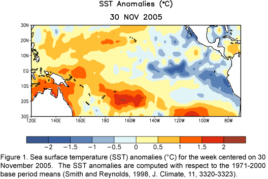
By the
end of November, equatorial SST anomalies greater than +0.5ºC were
restricted to the region between Indonesia and 170ºE, while negative
anomalies less than –0.5ºC were observed at most locations between 145ºW
and the South American coast (Fig. 1). The SST
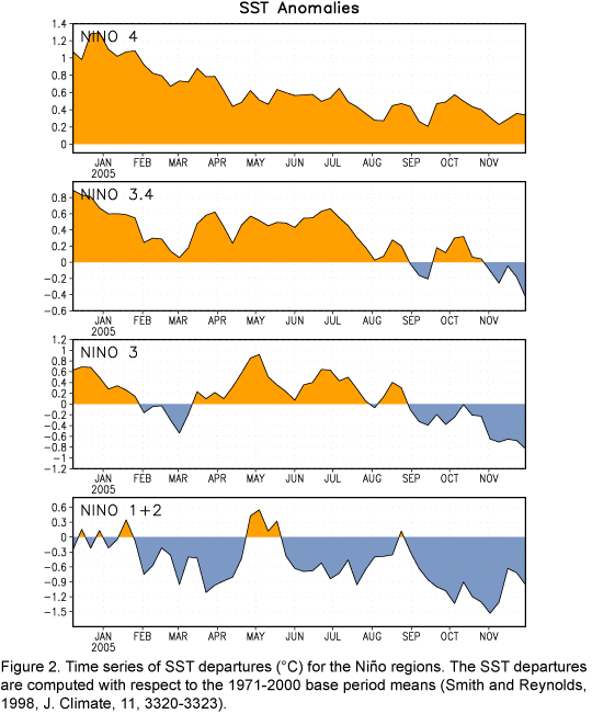
departures in the Niño 3, Niño 3.4, and Niño 1+2 regions were negative,
while weak positive departures were observed in the Niño 4 region (Fig.
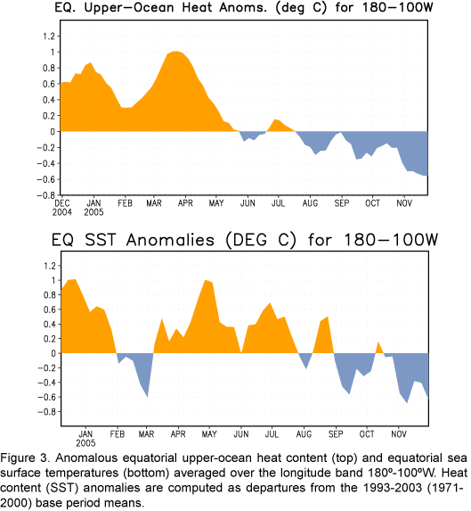
2). During the last several months surface and subsurface temperature
anomalies have decreased in the region between 180ºW and the South American
coast (Fig. 3). During the same period persistent stronger-than-average
low-level equatorial easterly winds were observed over the central Pacific,
while near-average patterns of convection and sea level pressure occurred
over most of the tropical Pacific. Collectively, the present oceanic and
atmospheric anomalies are consistent with a trend toward La Niña
conditions in the tropical Pacific.
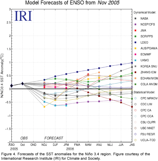
The spread of the most recent
statistical and coupled model forecasts (weak La Niña
to weak El Niño) indicates some uncertainty in the outlooks (Fig.
4).
However, current conditions (stronger-than-average easterly winds over the
central equatorial Pacific) and recent observed trends (decreasing SST
anomalies throughout the central and eastern equatorial Pacific) do not
support the development of El Niño. Rather, they support either a
continuation of ENSO-neutral conditions or the development of weak La Niña
conditions.
This discussion is a consolidated effort of NOAA and its funded institutions. Weekly updates for
SST, 850-hPa wind, OLR and features of the equatorial subsurface thermal structure are available on the Climate
Prediction Center web page at http://www.cpc.ncep.noaa.gov (Weekly Update). Forecasts for the evolution of El Niño/La Niña are updated monthly in the
Forecast Forum section of CPC's Climate
Diagnostics Bulletin. The next ENSO Diagnostics Discussion is scheduled for


