The patterns of anomalous ocean temperatures,
atmospheric circulation and precipitation are consistent in indicating La Niña
conditions in the tropical Pacific.
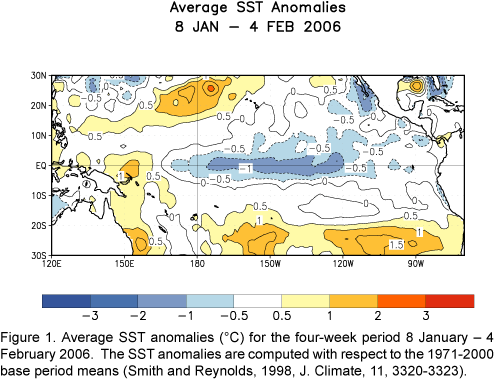
During January negative equatorial SST anomalies less than –0.5ºC were
observed at most locations between the date line and the South American
coast, while anomalies greater than +0.5ºC were restricted to the region
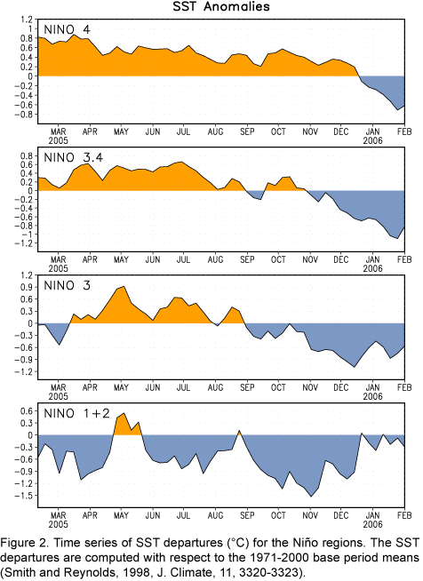
between Indonesia and 160ºE (Fig. 1). Negative SST
departures increased in magnitude in the Niño 4 and Niño 3.4 regions (Fig.
2), as the oceanic cold tongue strengthened in the central equatorial Pacific.
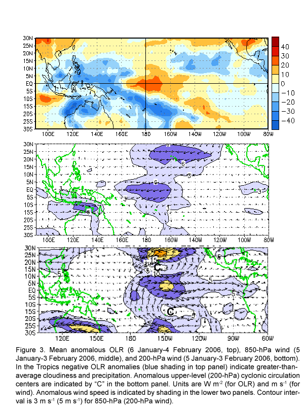
During January above-average precipitation (negative OLR anomalies, Fig.
3, top
panel) was observed over Indonesia, the Philippines and northern Australia, while
below-average precipitation (positive OLR anomalies) was observed
over the central equatorial Pacific. Stronger-than-average low-level
(850-hPa) easterly winds (Fig. 3, middle panel) persisted over the central
equatorial Pacific, and anomalous upper-level (200-hPa) cyclonic circulation
centers were observed in both hemispheres (Fig. 3, bottom panel). These
patterns are similar to those observed during previous La Niña episodes.
Over the
past several months most of the statistical and coupled model forecasts have
trended towards cooler conditions in the tropical Pacific through mid-2006.
The spread of the most recent statistical and coupled model forecasts (weak La Niña
to ENSO-neutral) indicates some uncertainty in the outlooks.
However, current conditions (stronger-than-average easterly winds over the
central equatorial Pacific) and recent cooling trends in observed oceanic
conditions support continuation of La Nina conditions in the tropical Pacific
during the next 3-6 months.
Based on current conditions in the tropical Pacific, the most recent SST
predictions, and on results from historical studies on the effects of cold
episodes, we expect wetter-than-normal (drier-than-normal) conditions to
prevail over Indonesia/Philippines (central equatorial Pacific) during the
remainder of the NH winter. That pattern of tropical precipitation favors a
northward shift in the position of the jet stream over the eastern North
Pacific during winter, which is usually accompanied by drier-than-normal
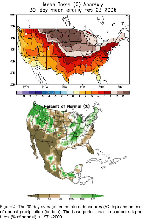
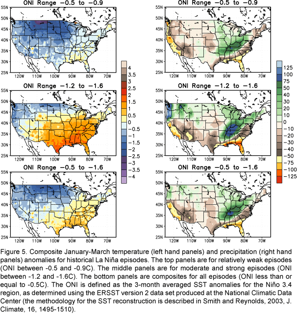
conditions over southern California and Arizona. The recent patterns of anomalous
temperature and precipitation for the United States (Fig.
4) are similar to
wintertime patterns observed during previous La Niña
episodes (Fig. 5), except for temperature over the northern Plains and in the
Pacific Northwest, which are normally colder than average.
This discussion is a consolidated effort of NOAA and its funded institutions. Weekly updates for
SST, 850-hPa wind, OLR and features of the equatorial subsurface thermal structure are available on the Climate
Prediction Center web page at http://www.cpc.ncep.noaa.gov (Weekly Update). Forecasts for the evolution of El Niño/La Niña are updated monthly in the
Forecast Forum section of CPC's Climate
Diagnostics Bulletin. The next ENSO Diagnostics Discussion is scheduled for


