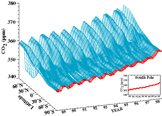
FIG. 70. Three dimensional representation of the
latitudinal distribution of atmospheric carbon dioxide (CO2)in the marine boundary layer
based on measurements from the NOAA/ CMDL cooperative air sampling network. Measurements
from South Pole are shown in red. (Analysis provided by CMDL.)
