Drought Monitor and outlook for Caribbean
CPC International Desk
| Drought Indices: | Realtime Monitor | Week1 Outlook | Week2 Outlook | Week3 Outlook | Week4 Outlook | Week5 Outlook |
|---|---|---|---|---|---|---|
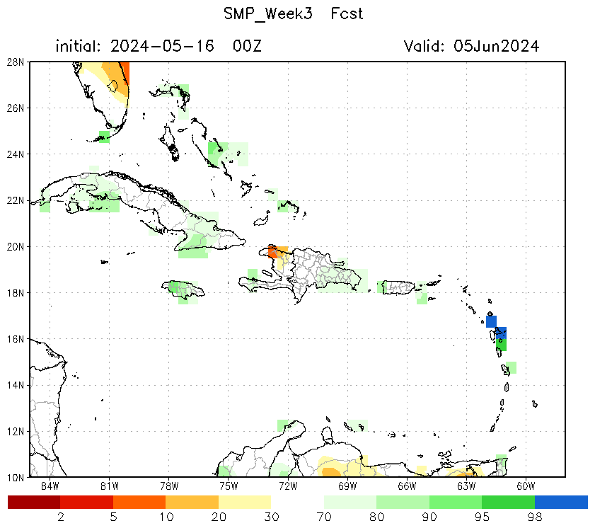
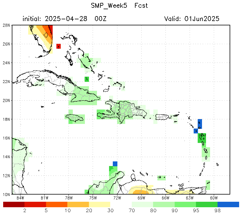
| Soil Moisture Percentile (SMP) | 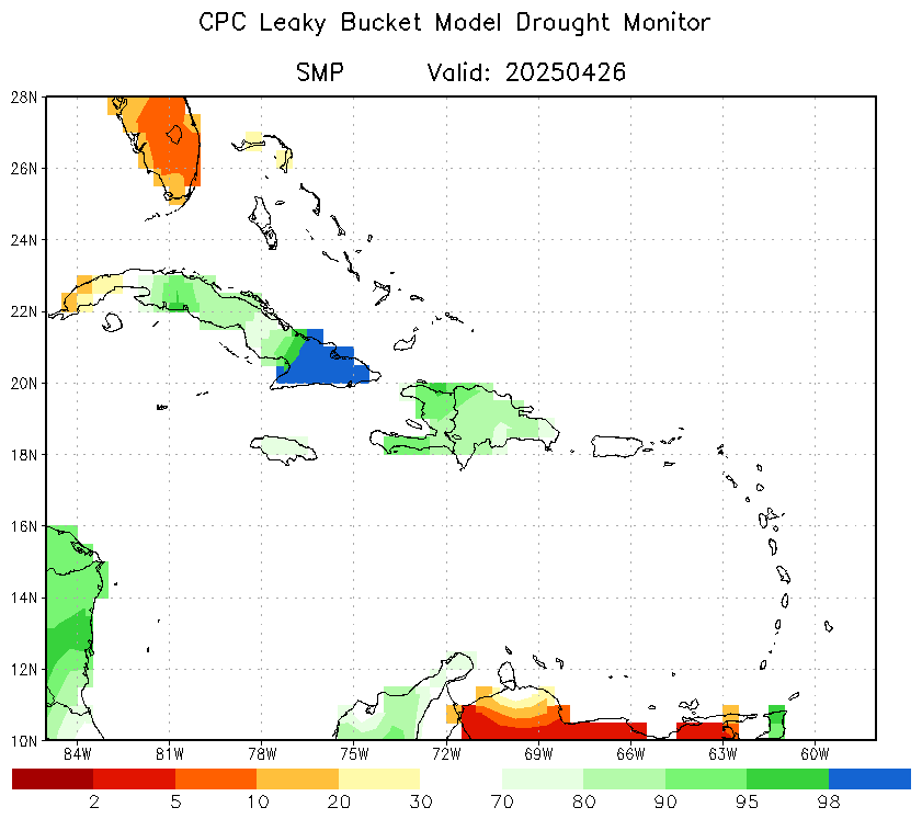 |
 |
 |
 |
 |
 |
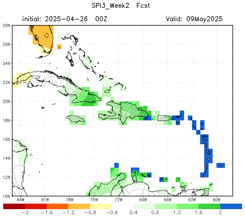
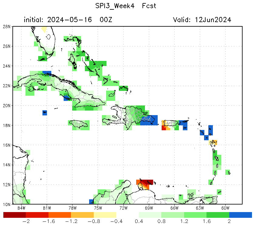
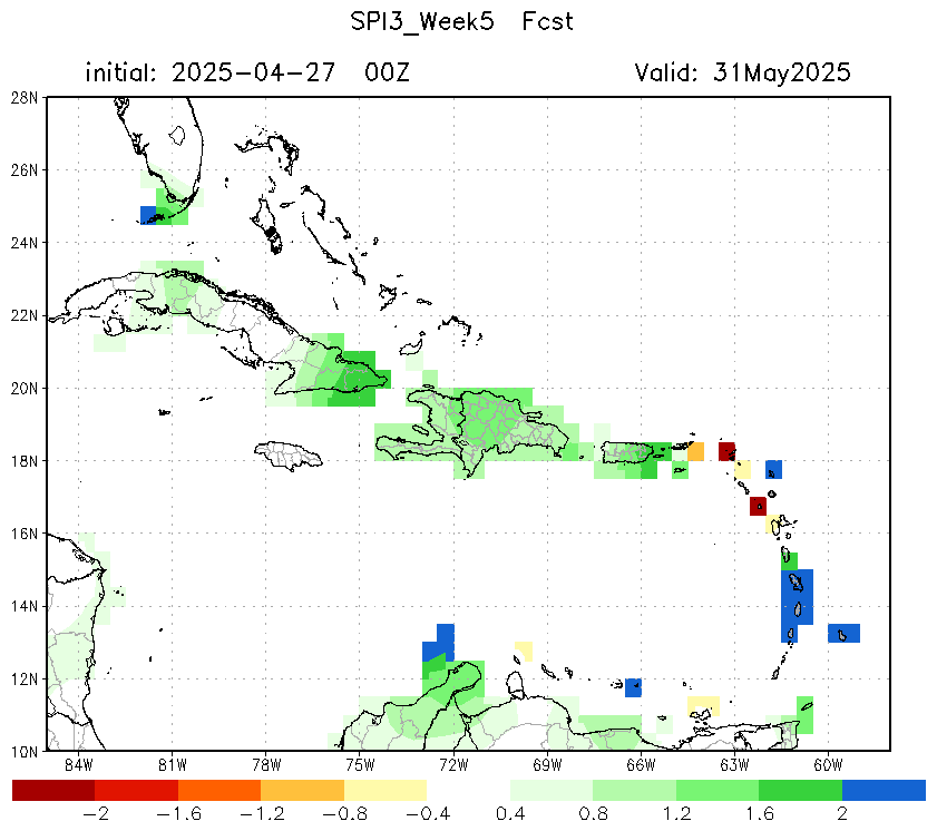
| Std. Prcp. Index (SPI3) | 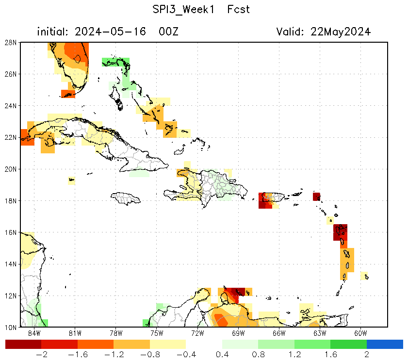 |
|
 |
 |
 |
 |
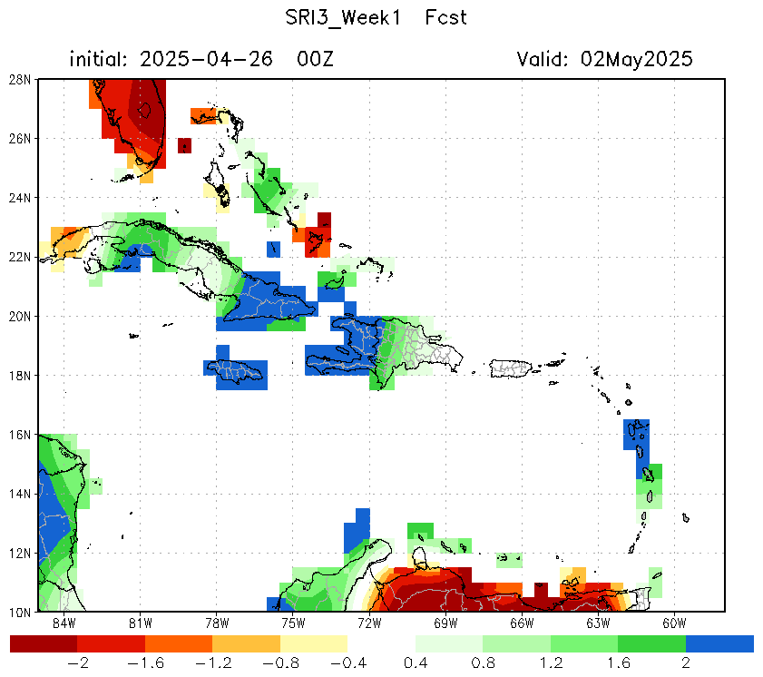
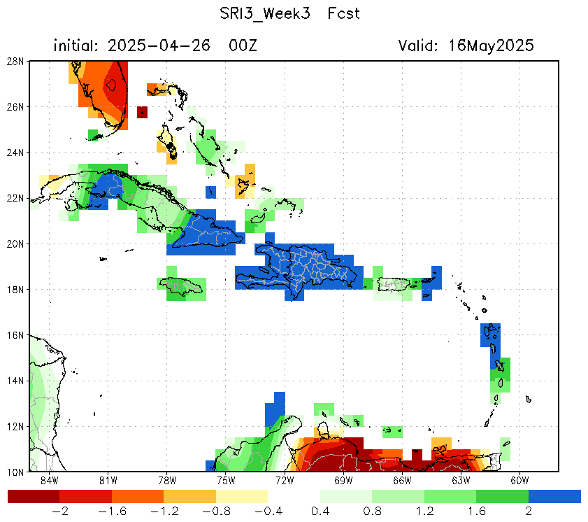
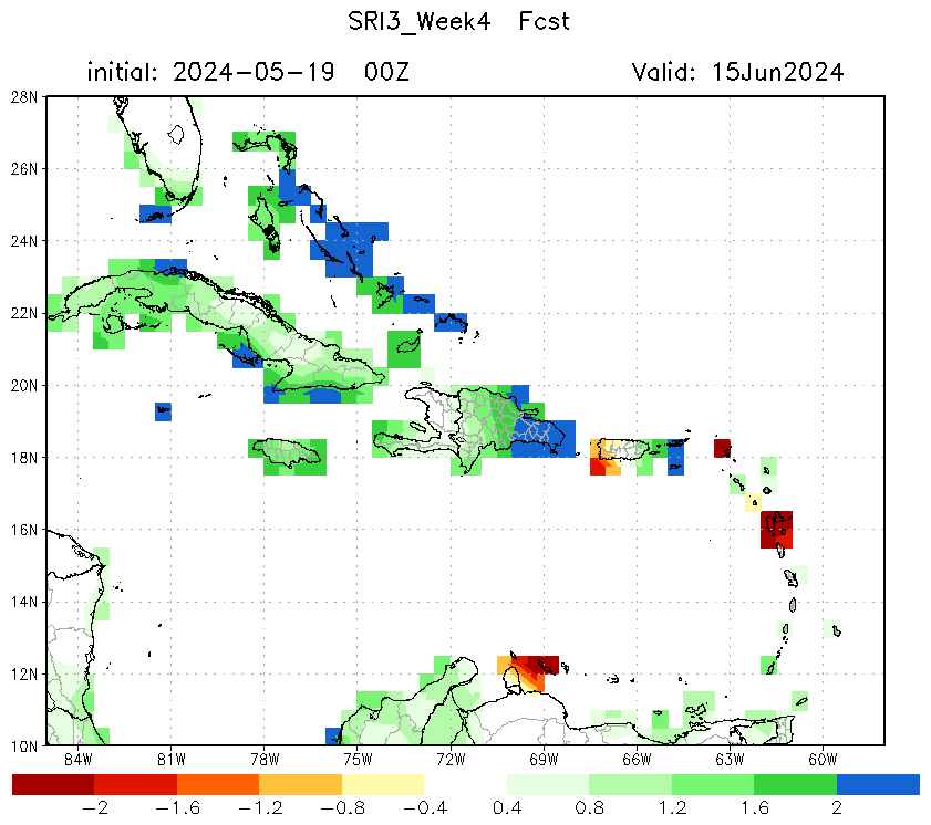
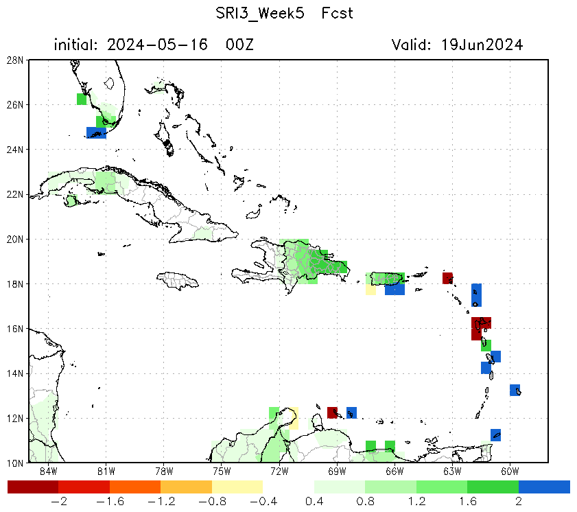
| Std. Runoff Index (SRI3) | 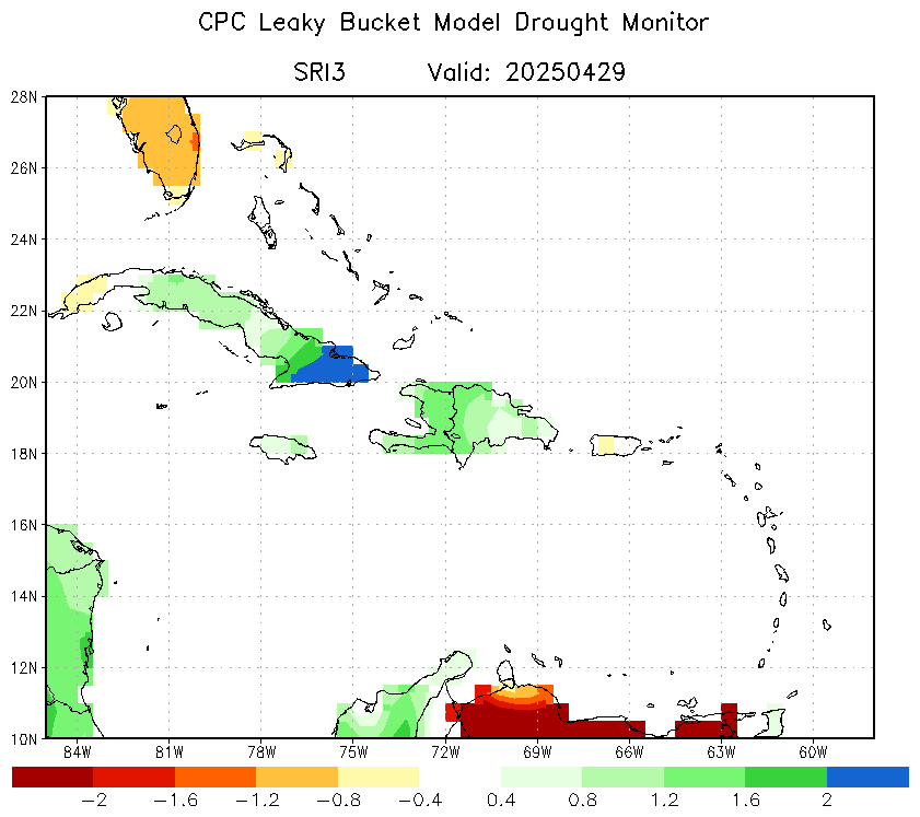 |
 |
 |
 |
 |
 |
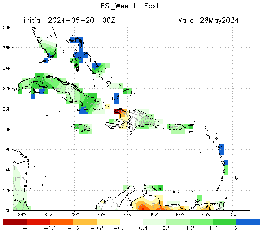
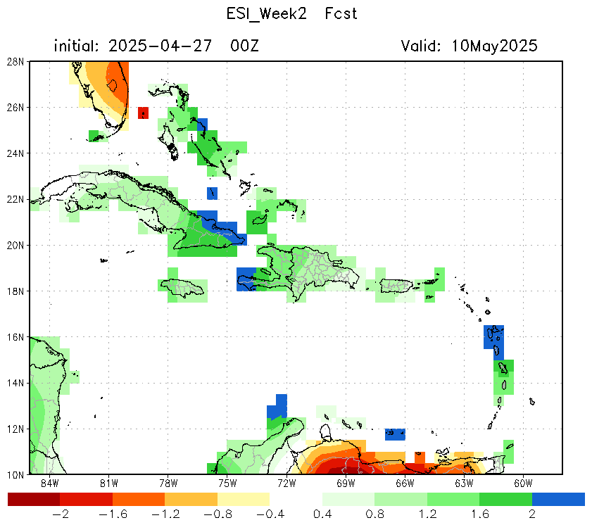
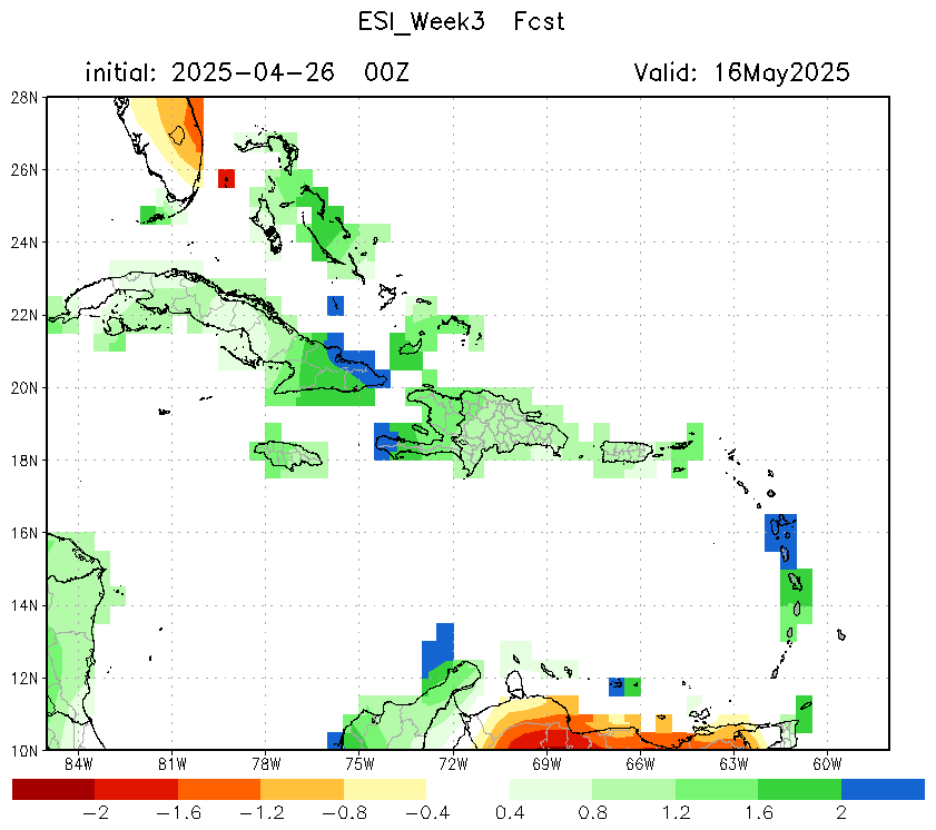
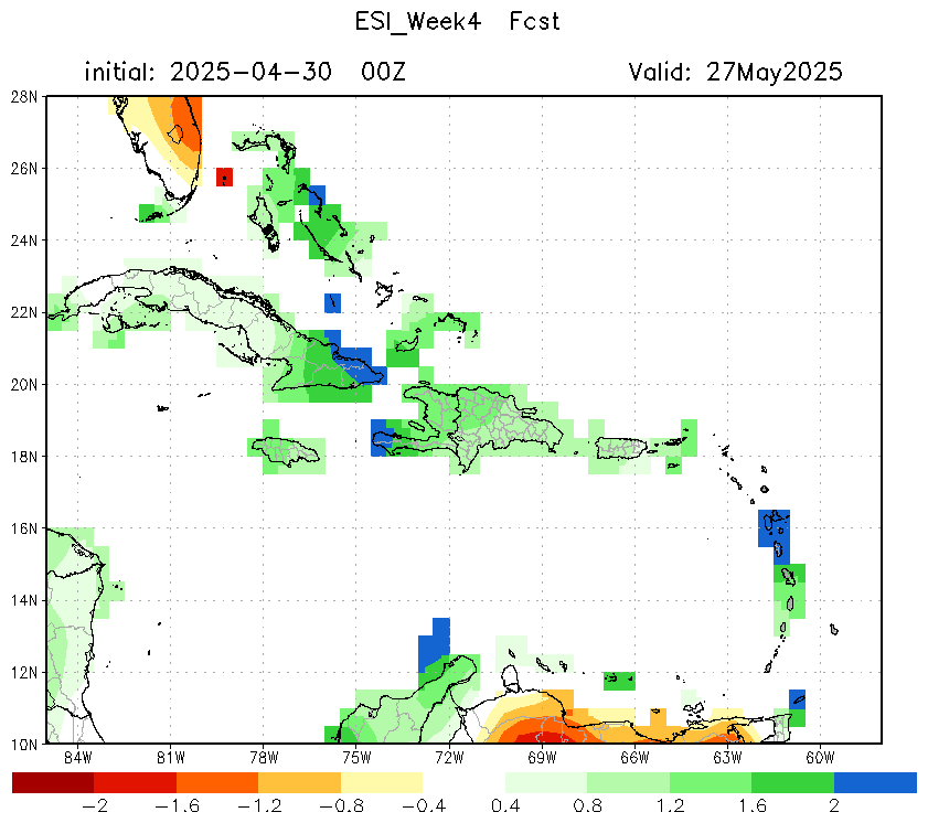
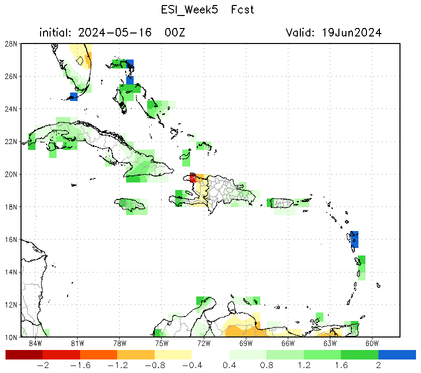
| Evaporiation Stress Index (ESI) | 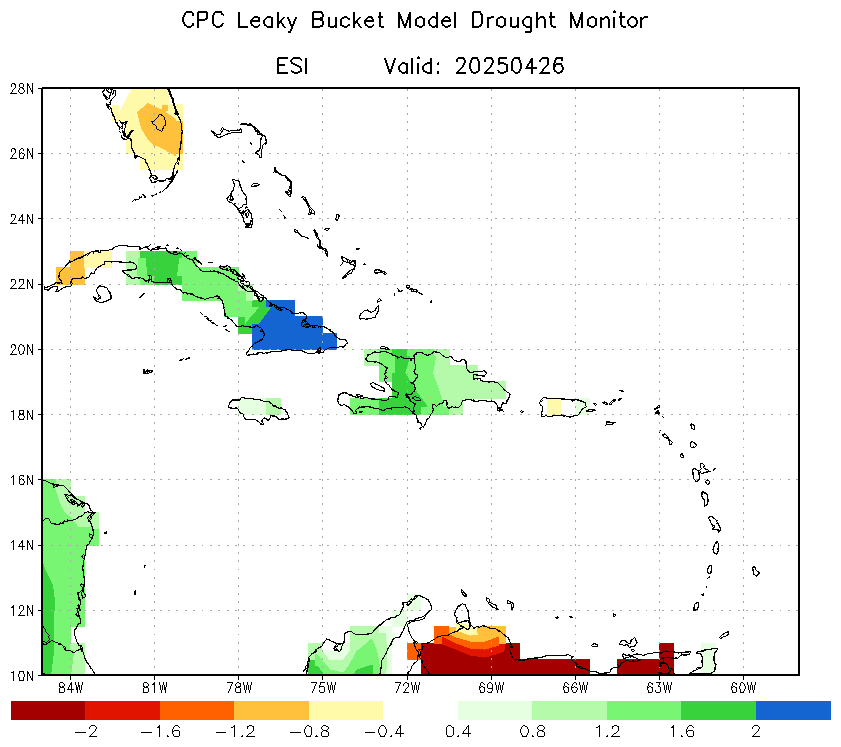 |
 |
 |
 |
 |
 |
Other Drought Monitor
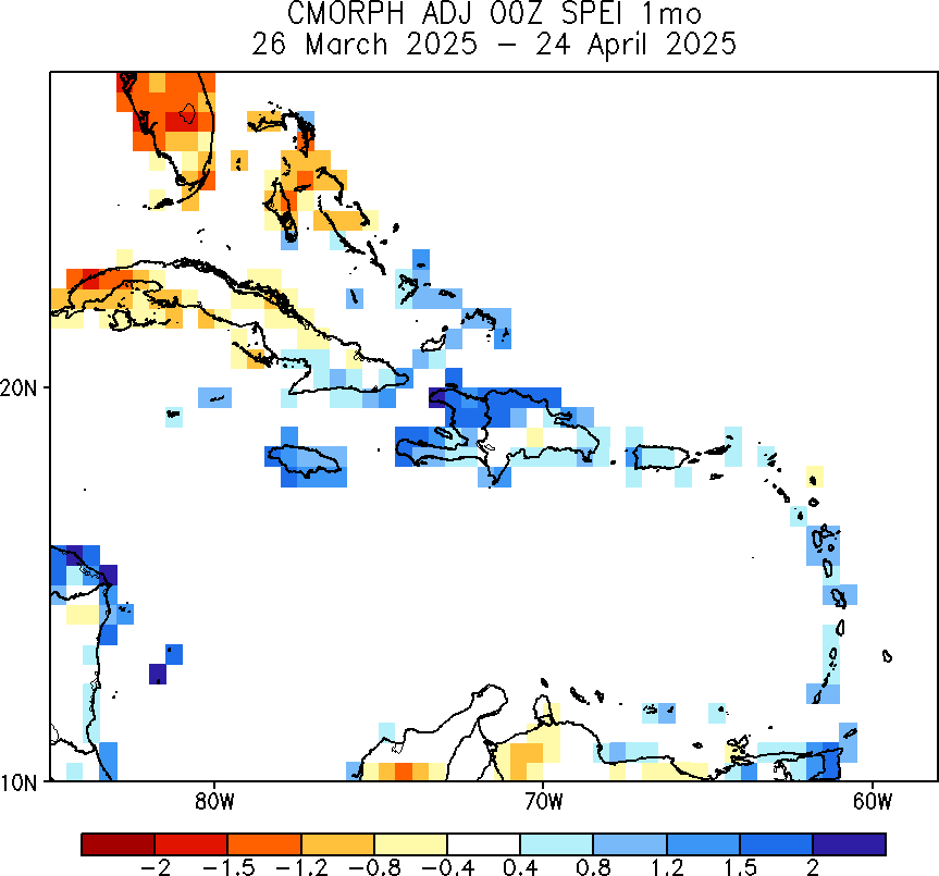
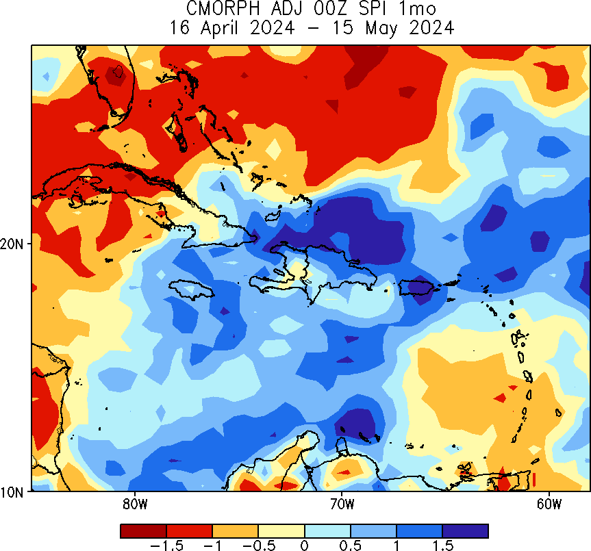
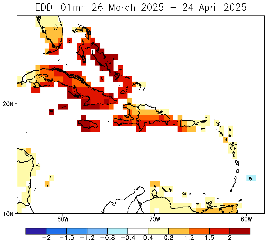
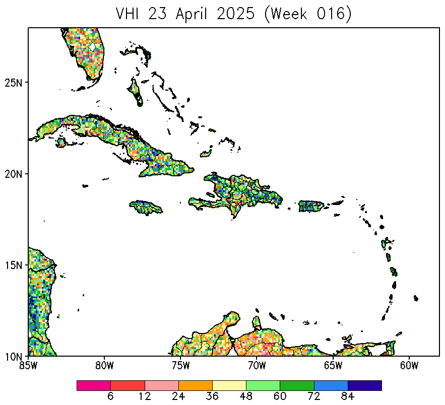
| CMORPH SPEI | CMORPH SPI | EDDI | VHI |
|---|---|---|---|
 |
 |
 |
 |
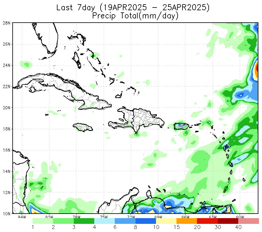
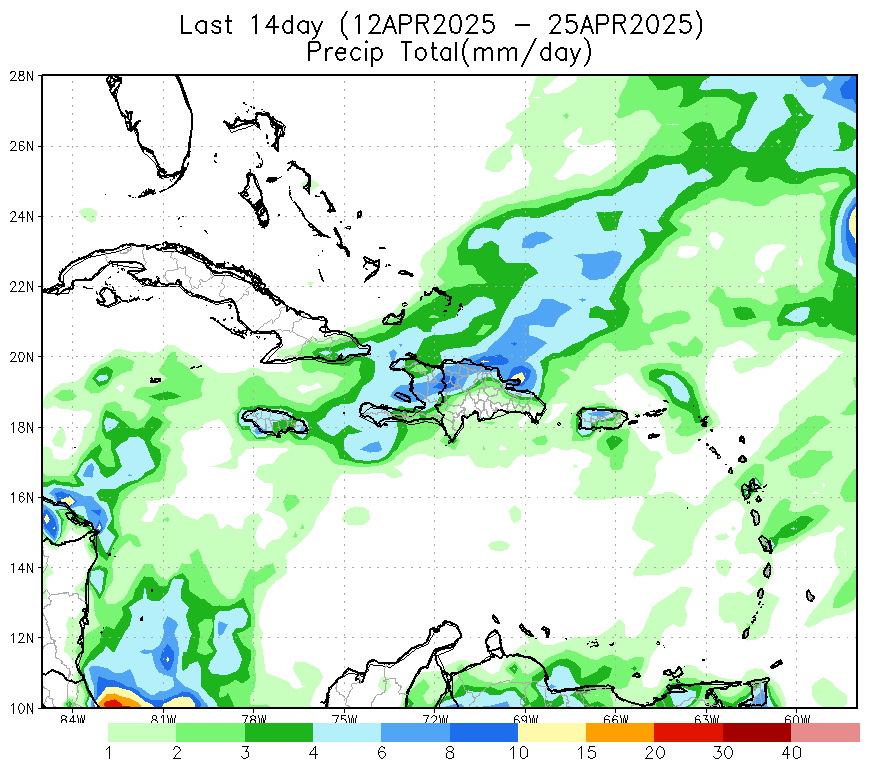
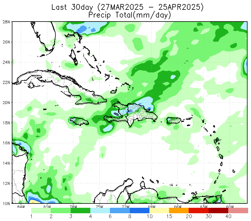
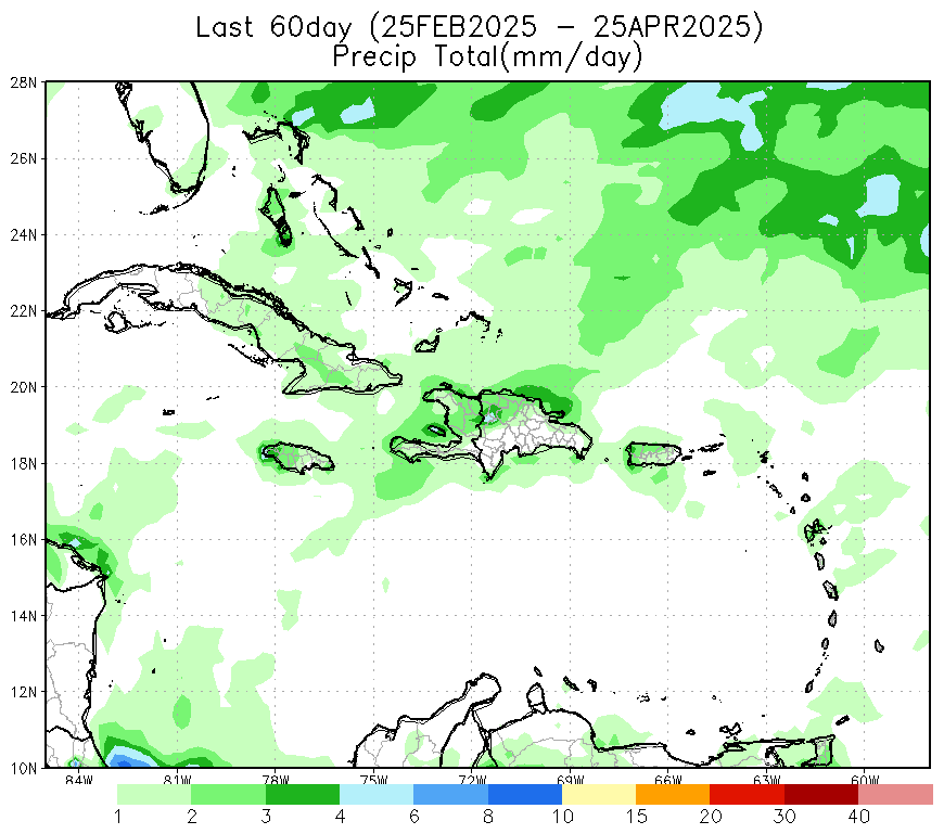
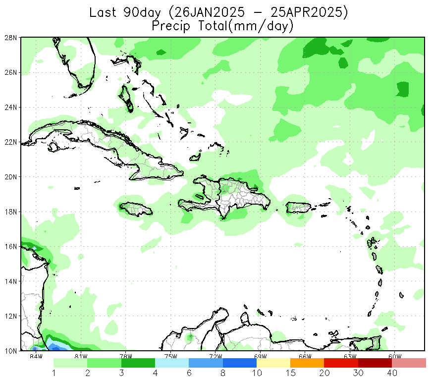
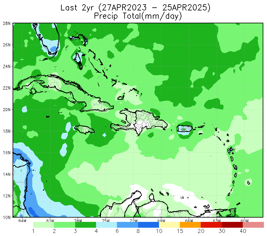
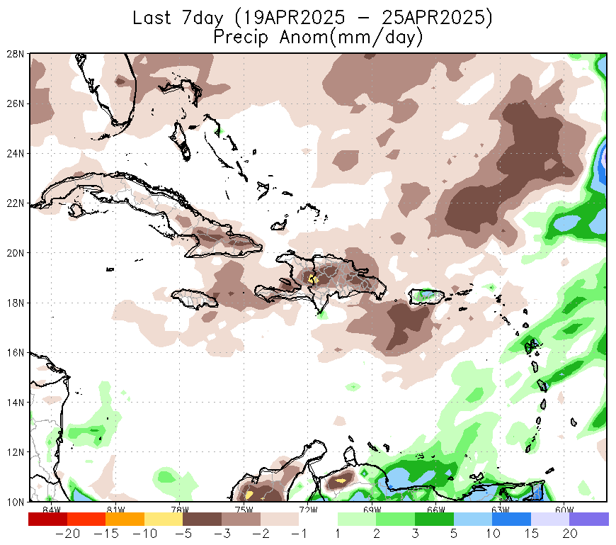
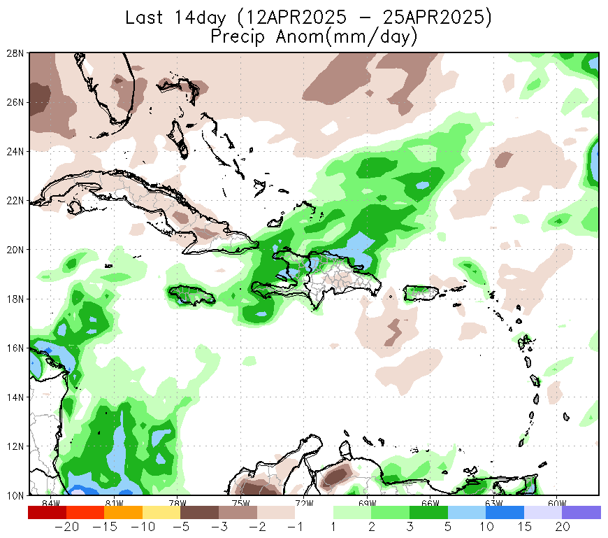
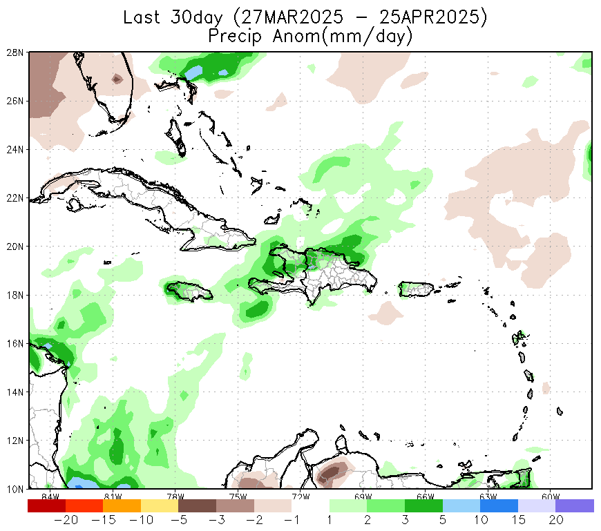
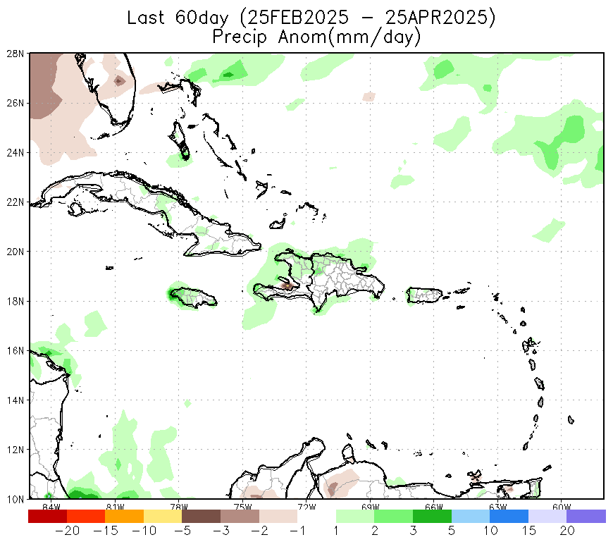
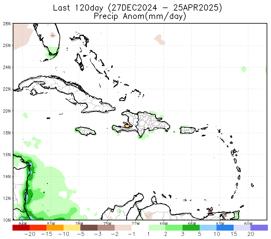
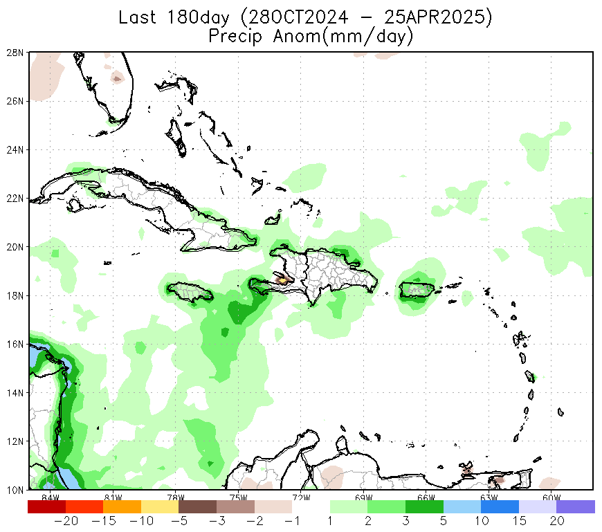
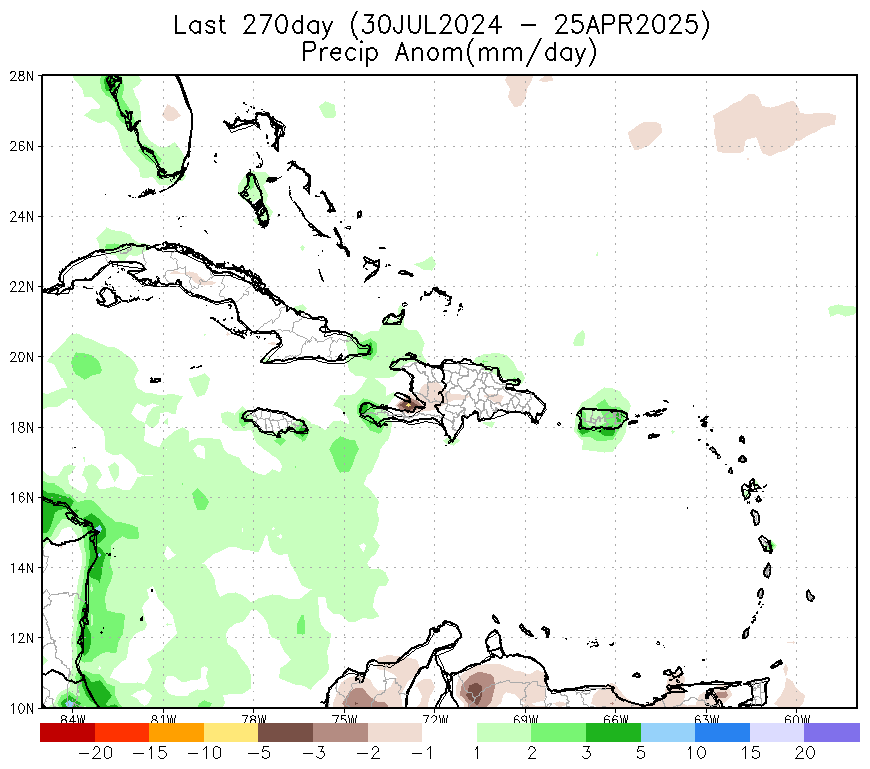
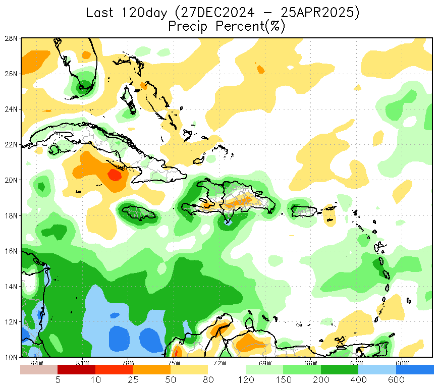
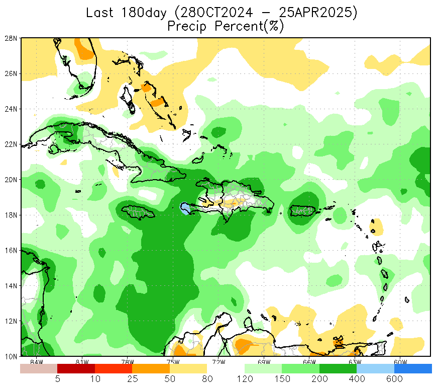
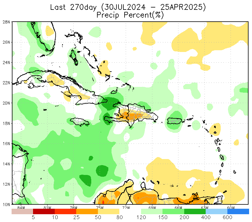
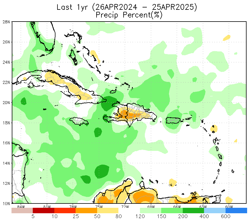
Previous Accumulated Precipitation Deficiency
(Multi-scale Monitoring)
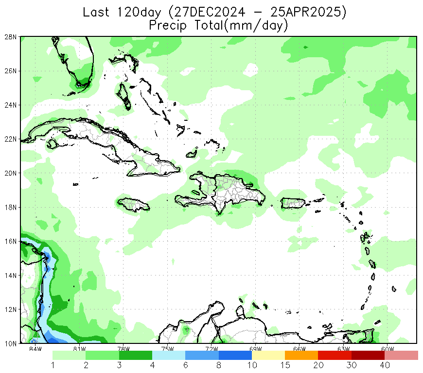
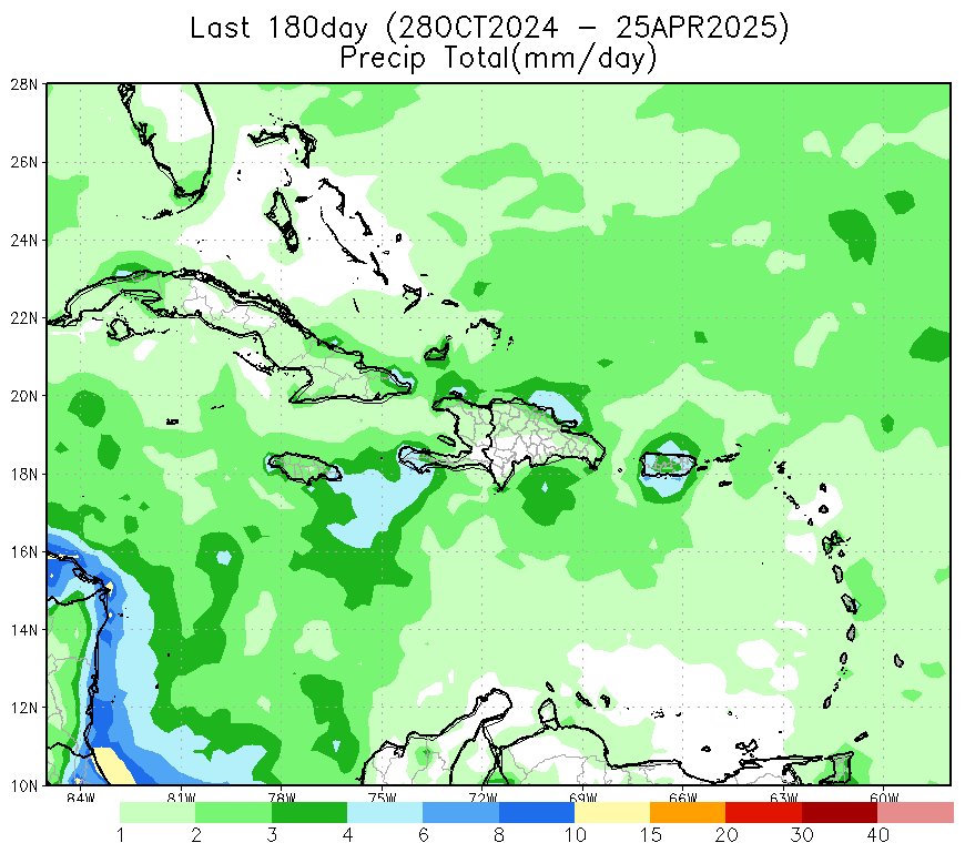
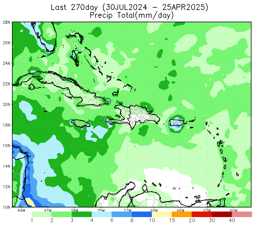
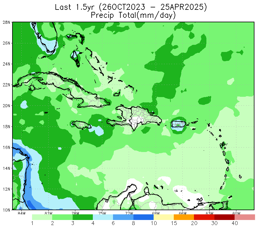
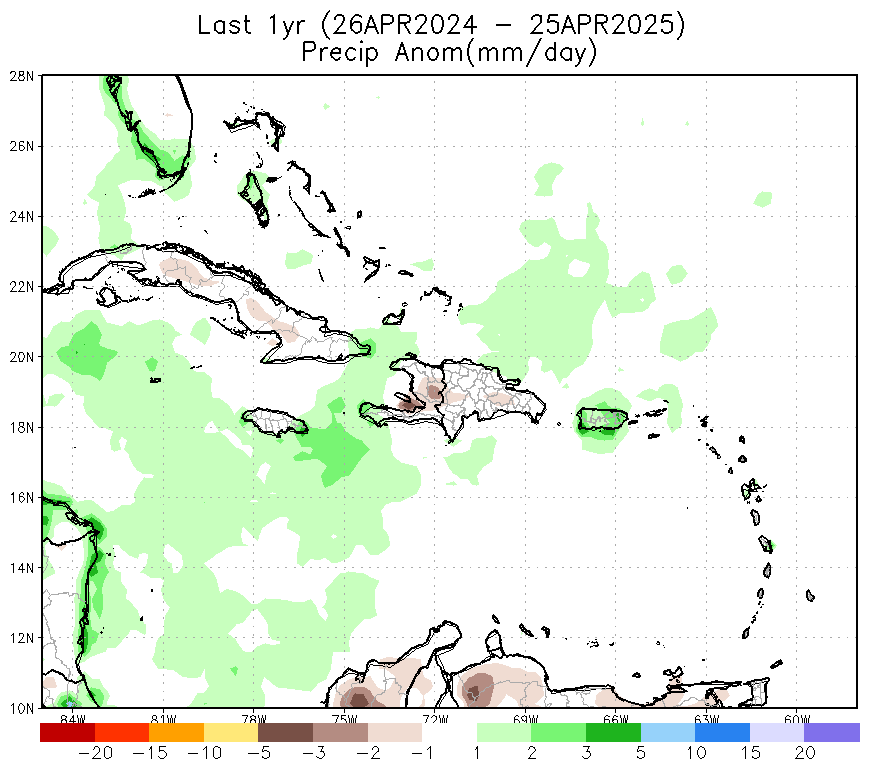
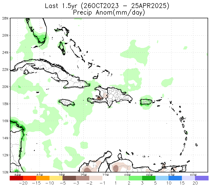
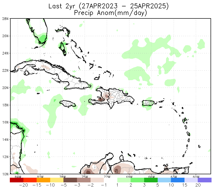
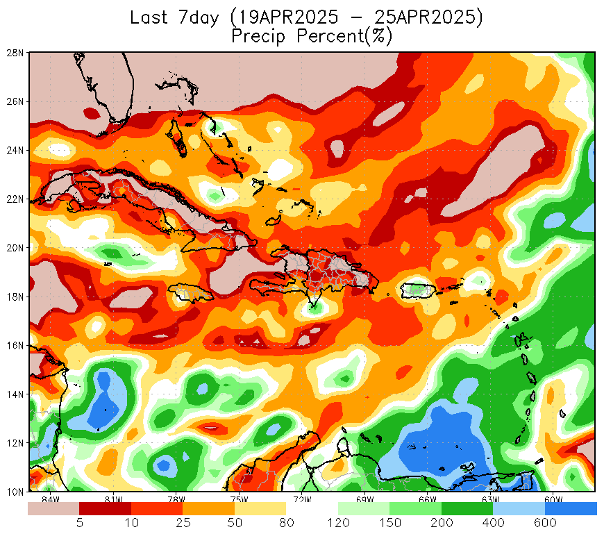
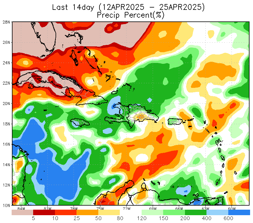
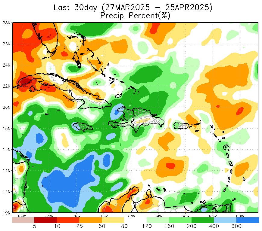
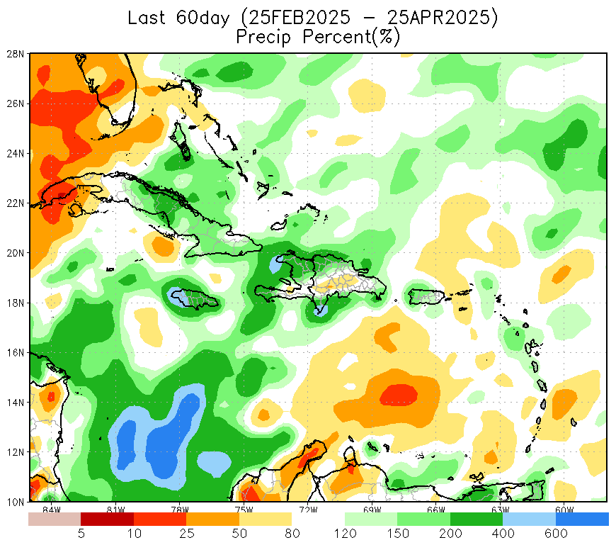
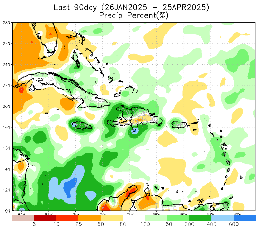
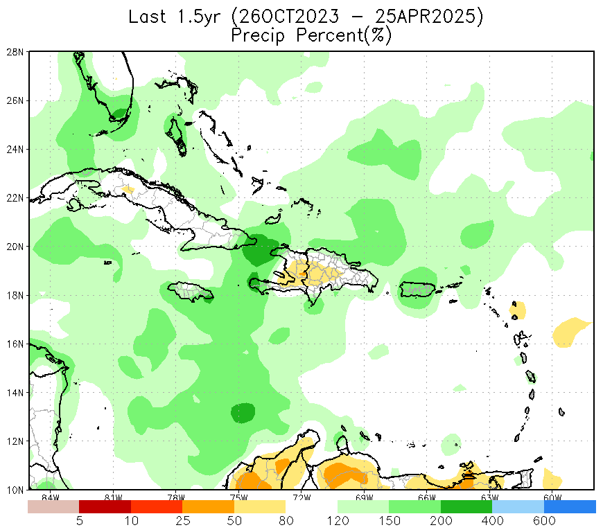
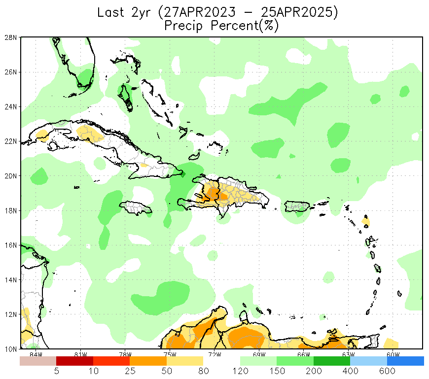
CPC CMORPH consists of satellite precipitation estimates that have been bias corrected and reprocessed using the the Climate Prediction Center (CPC) Morphing Technique (MORPH) to form a global, high resolution precipitation analysis. Data is reprocessed on a global grid with 8km-by-8km spatial resolution. Temporal resolution is 30 minutes over a 20 year period of record (January 1998–present).
| 7day | 14day | 30day | 60day | 90day | 120day | 180day | 270day | 1yr | 1.5yr | 2yr | |
| Total Precipitation (mm) |
|
|
|
|
|
|
|
|

|
|
|
| Precipitation Anomaly (mm) |
|
|
|
|

|
|
|
|
|
|
|
| Precipitation Percent (%) |
|
|
|
|
|
|
|
|
|
|
|
Vegetation Health Monitor