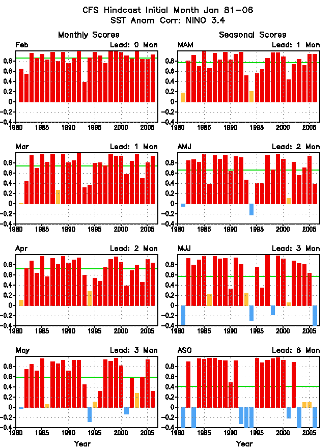
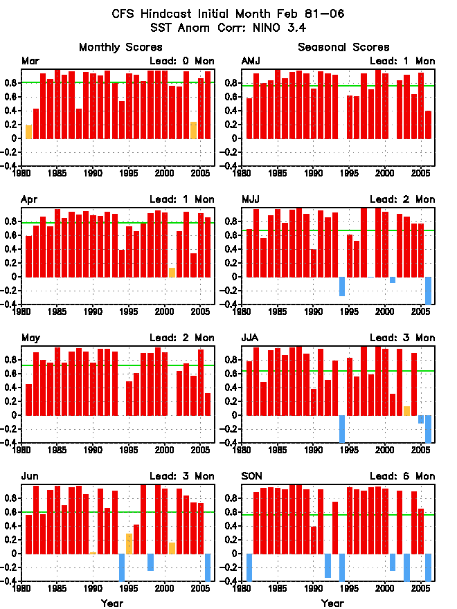
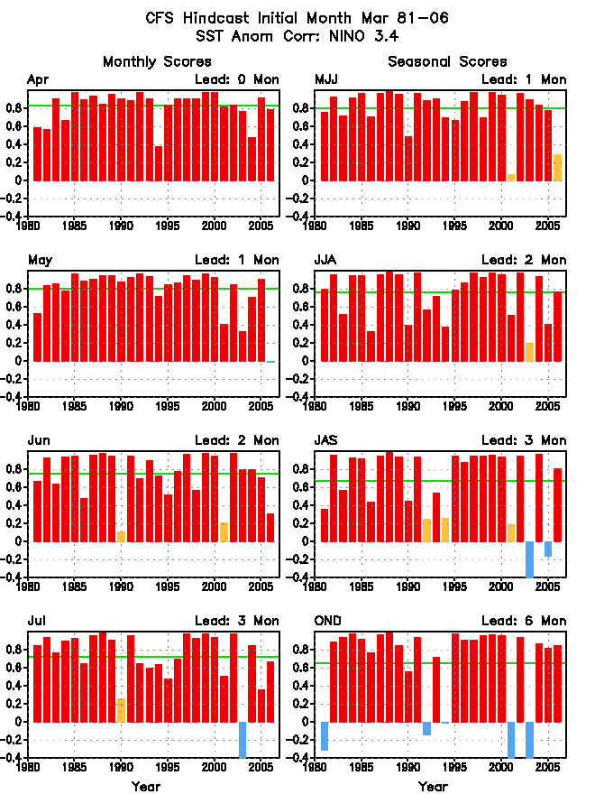
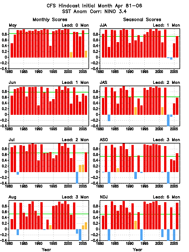
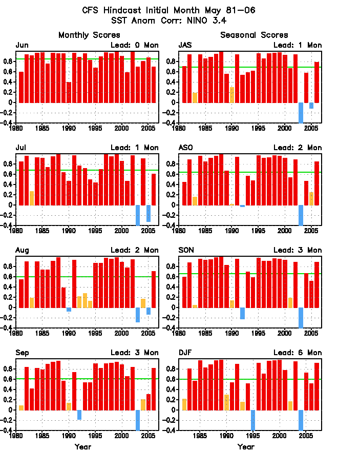
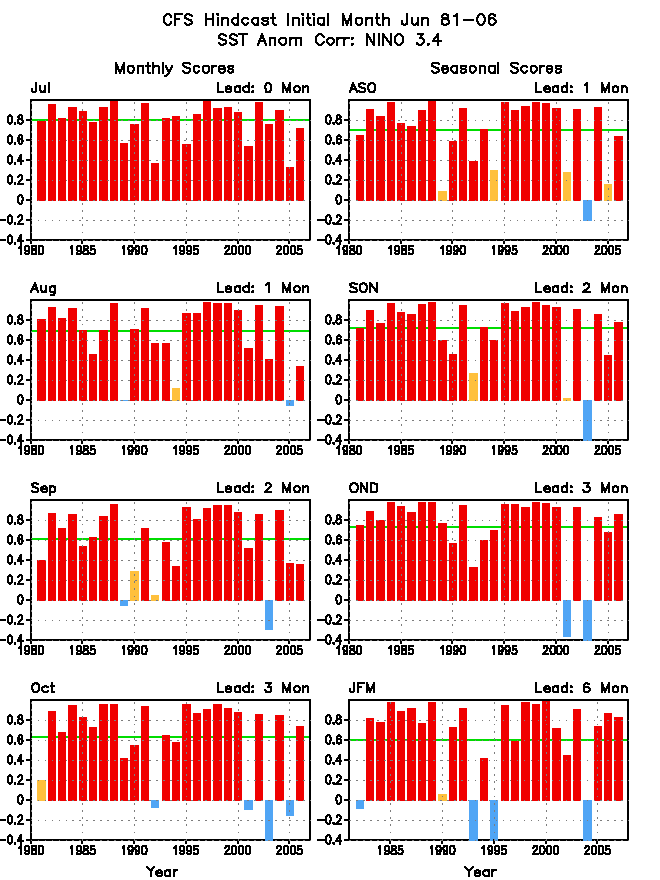
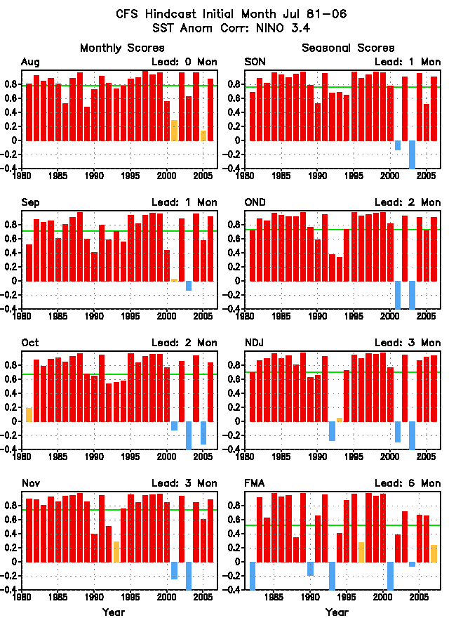
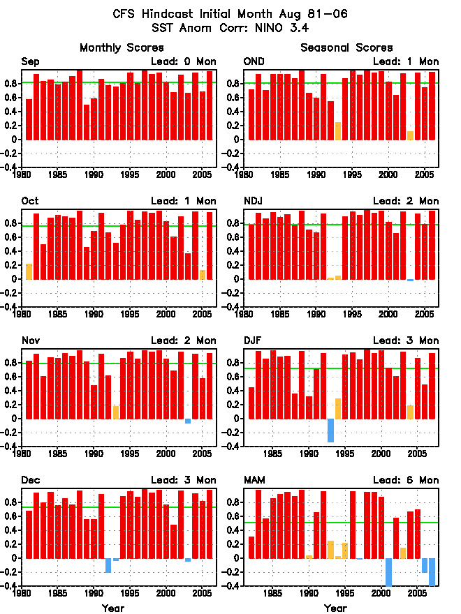
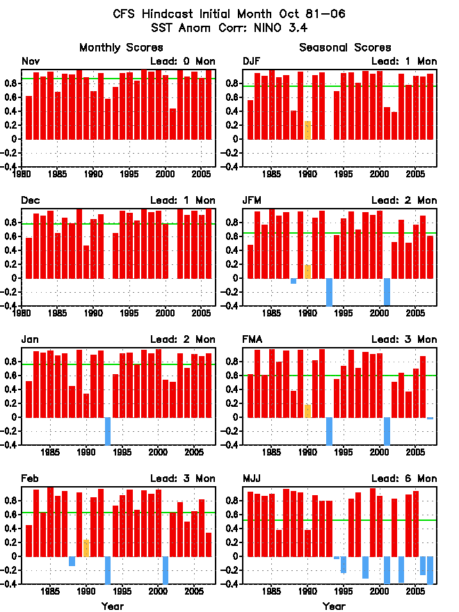
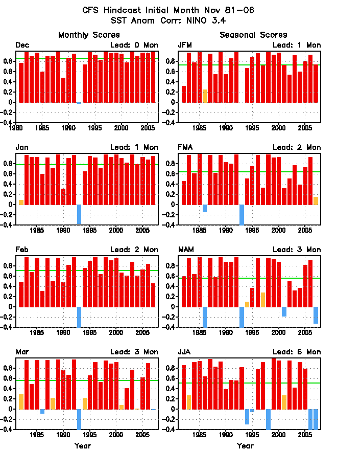
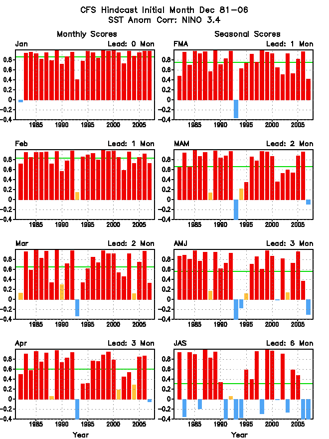
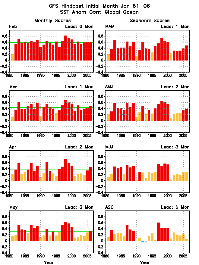
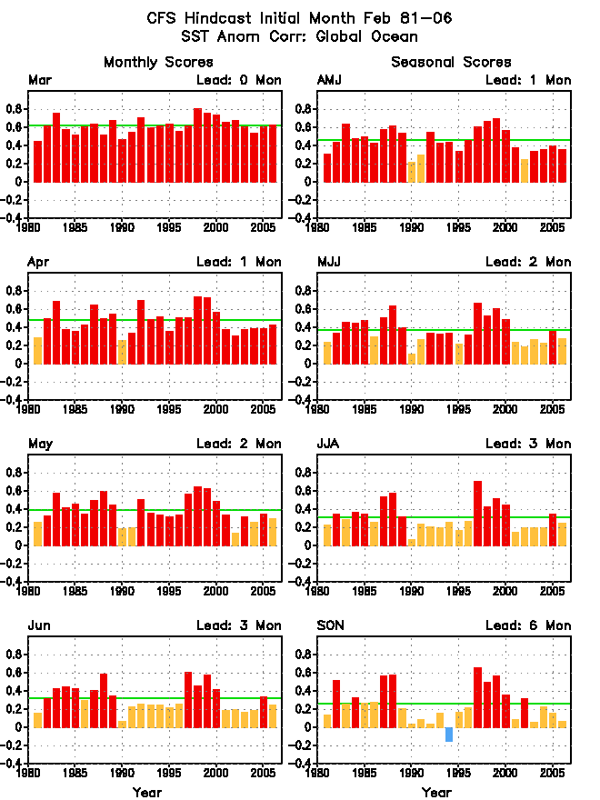
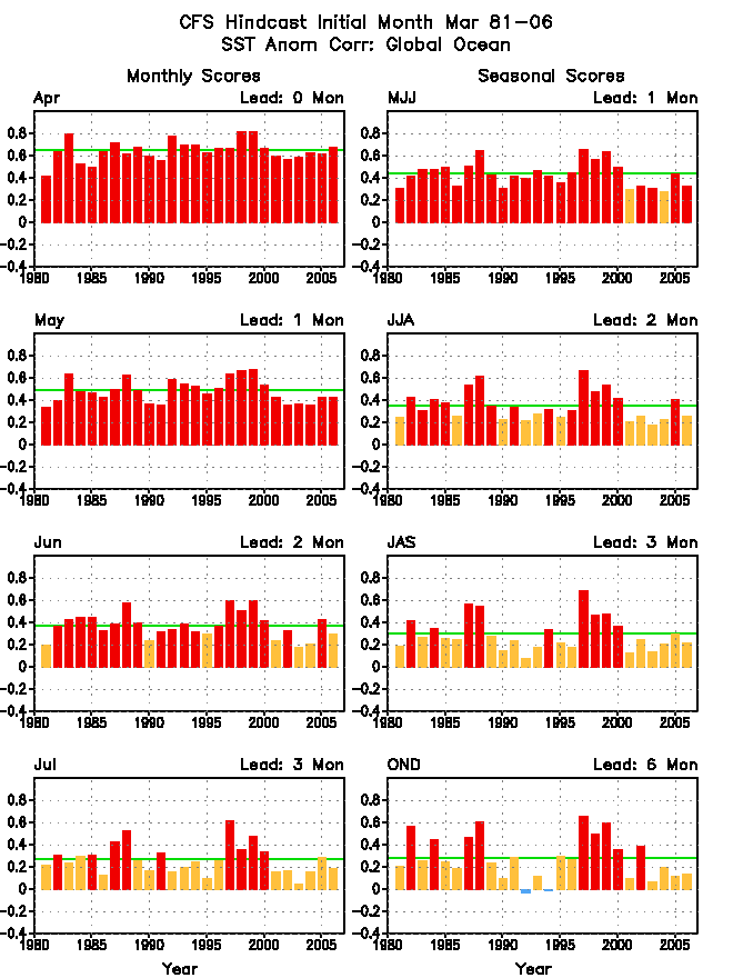
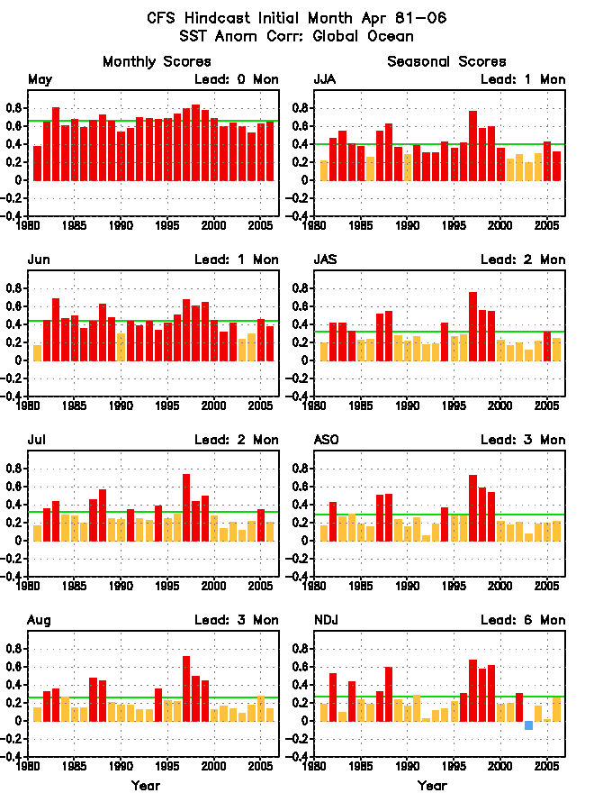
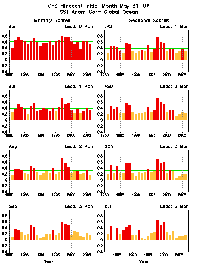
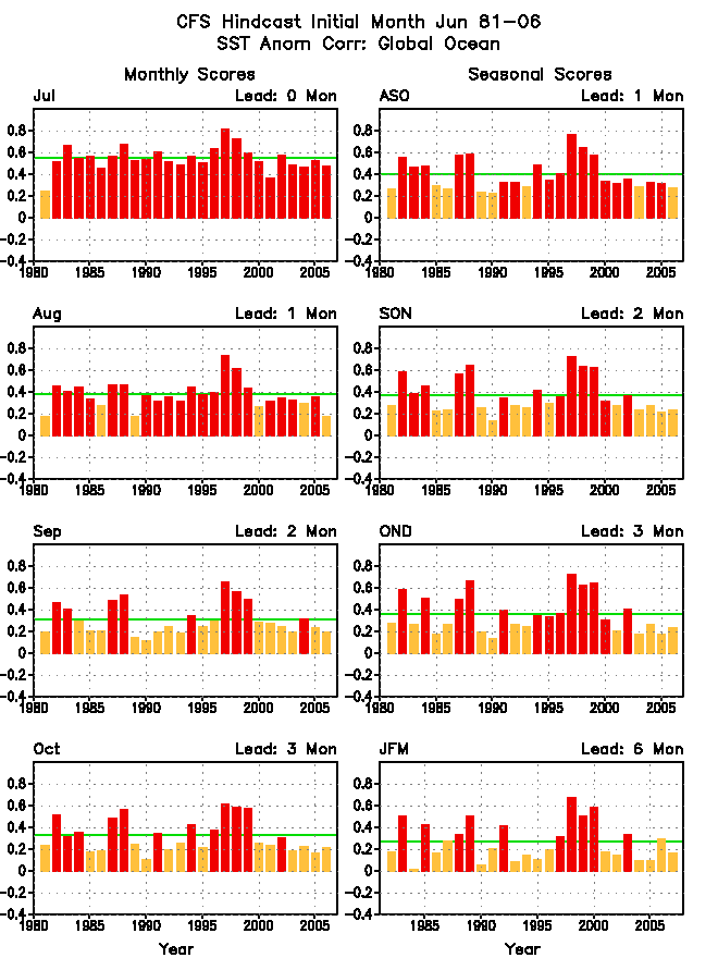
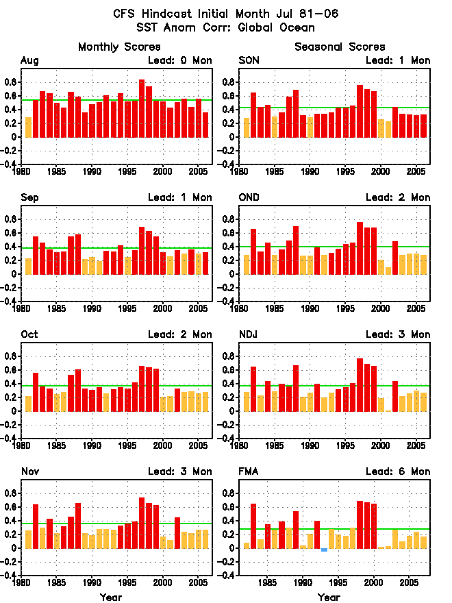
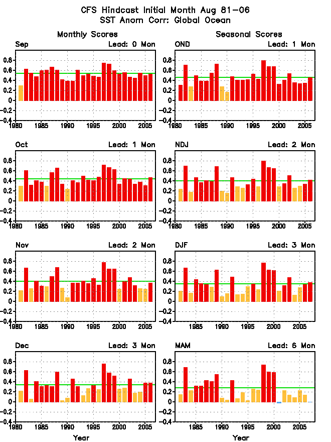
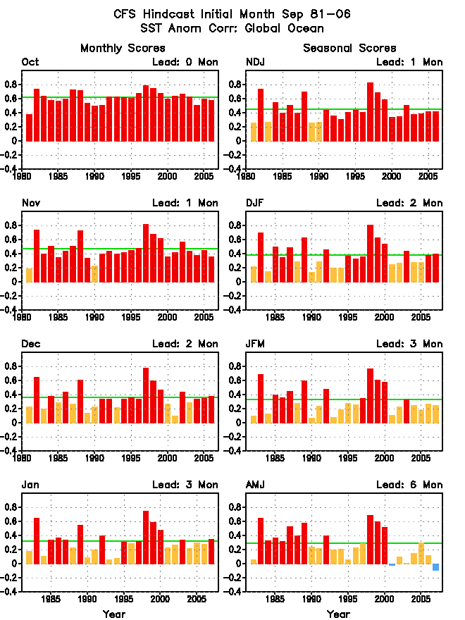
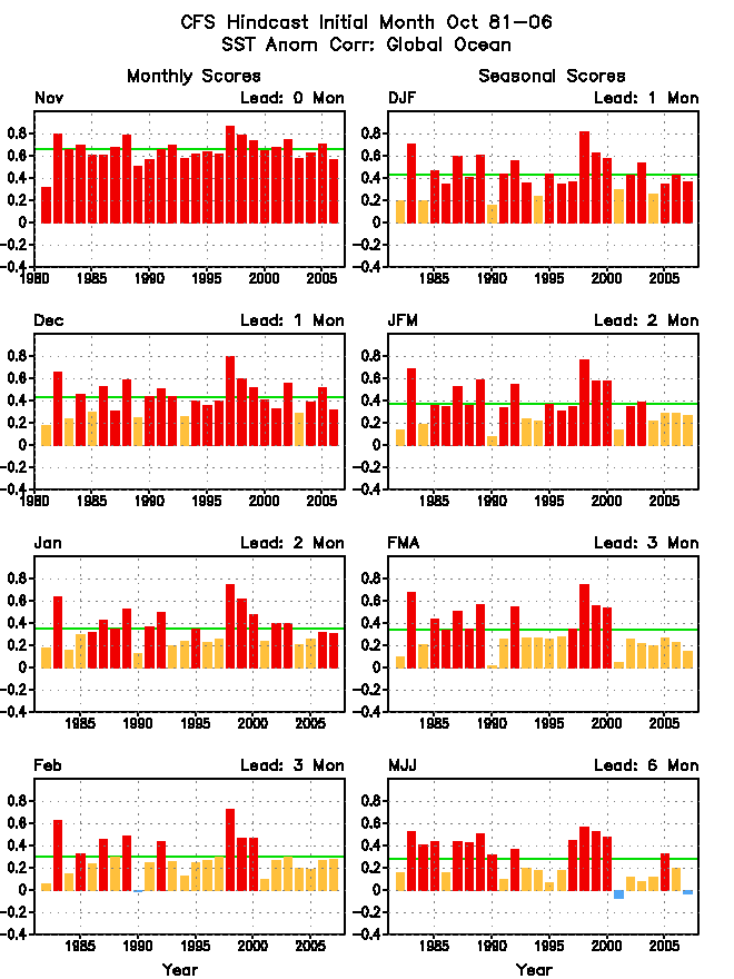
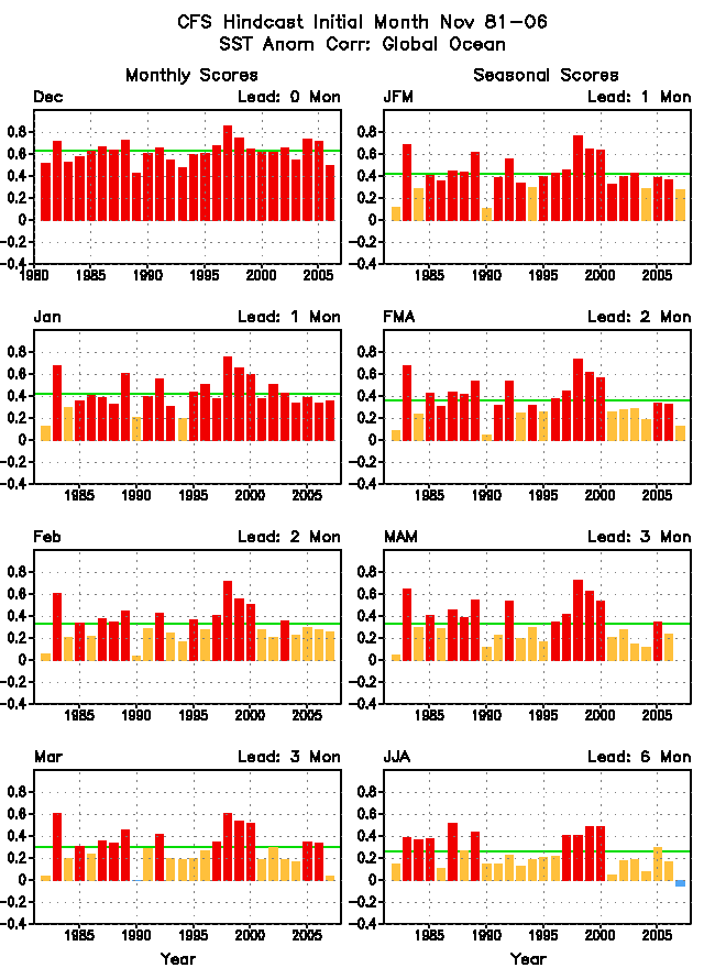
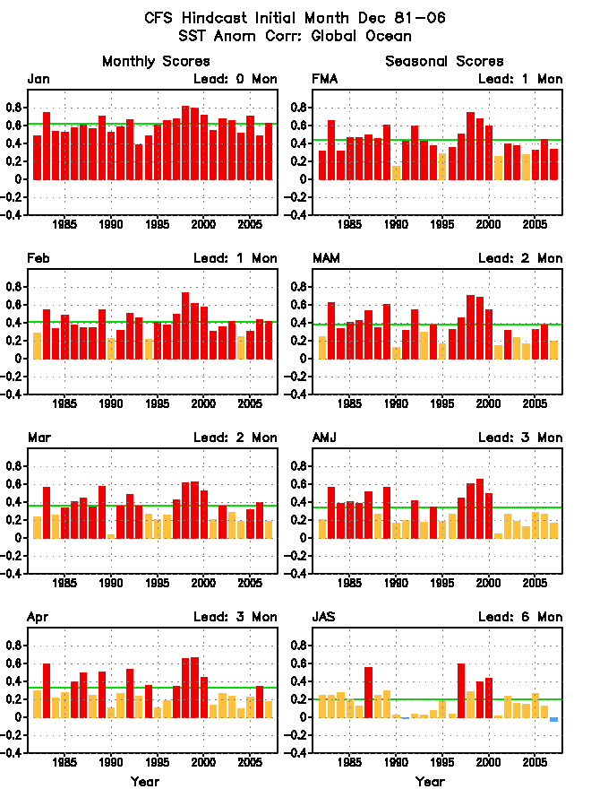
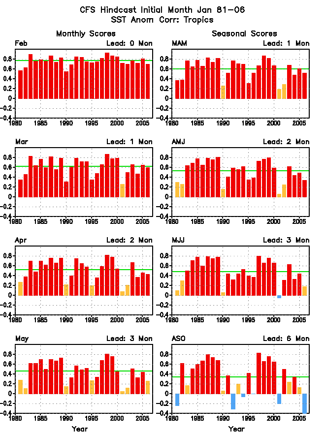
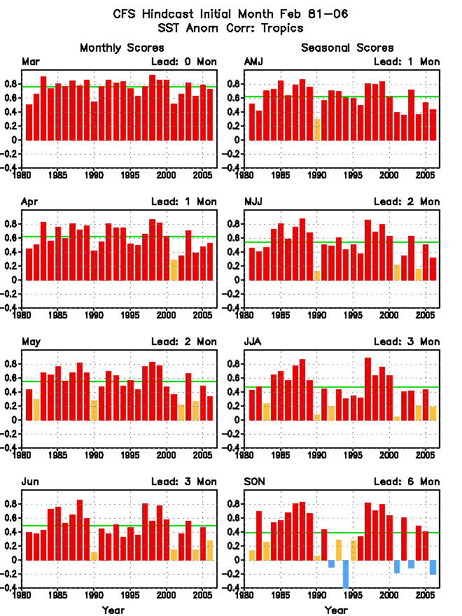
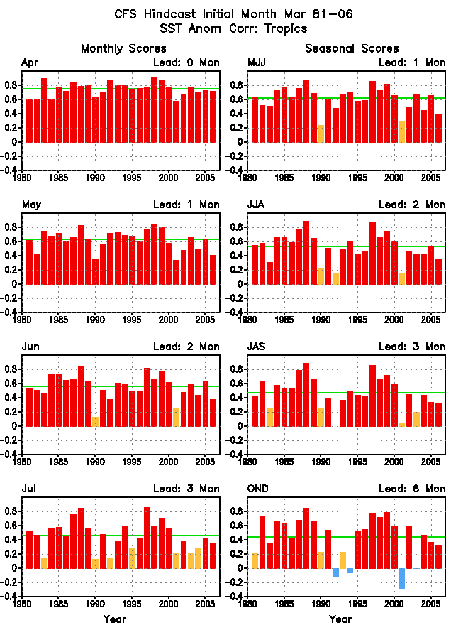
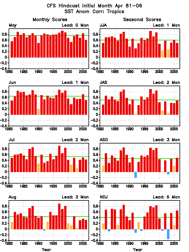
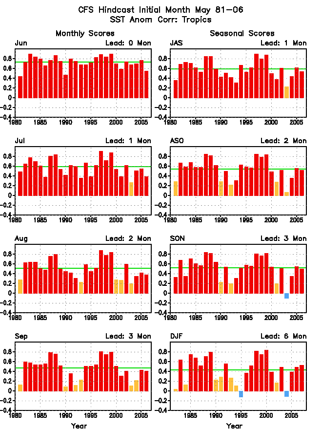
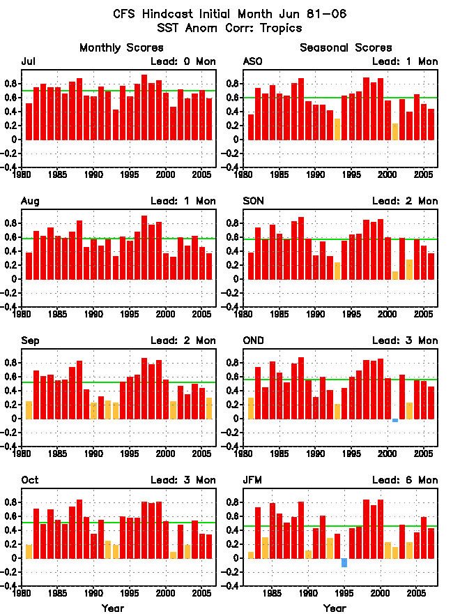
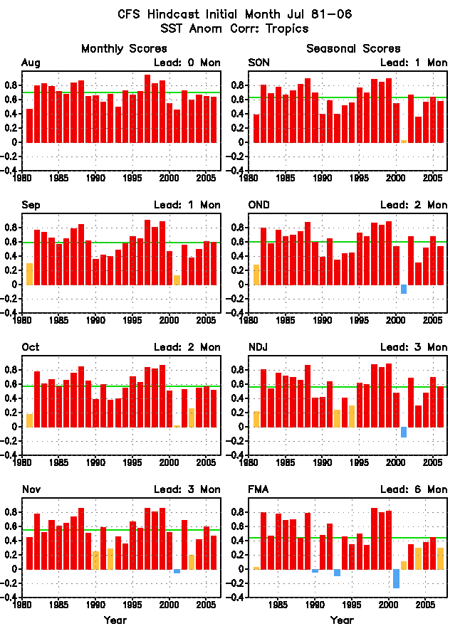
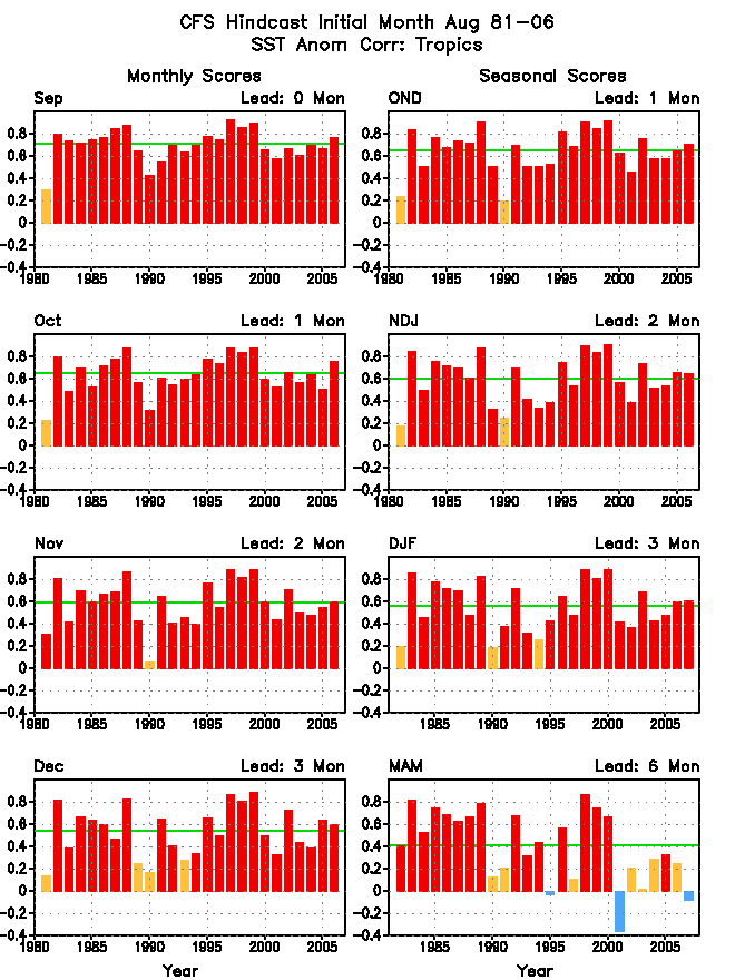
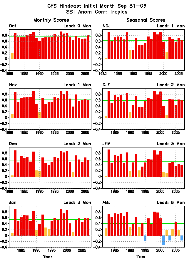
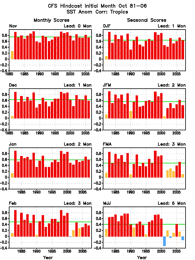
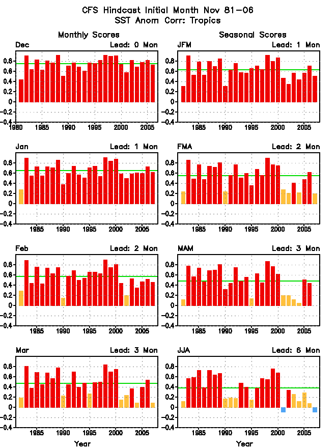
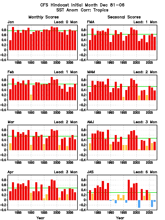
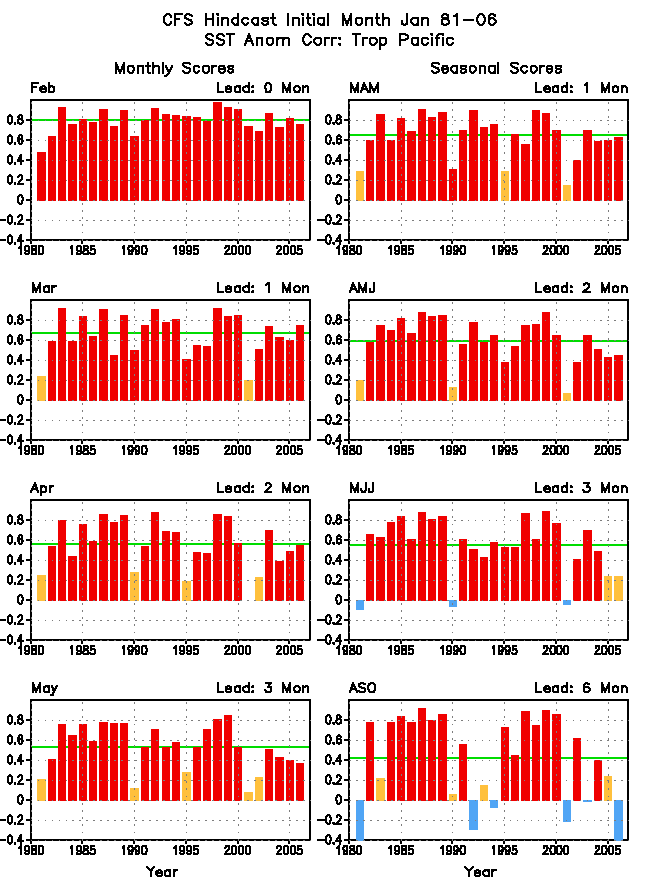
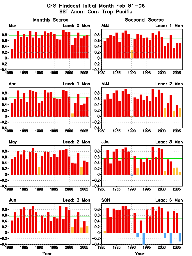
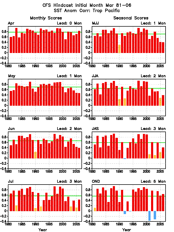
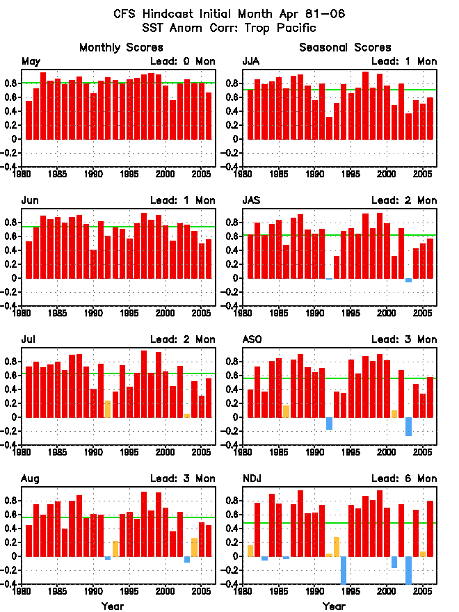
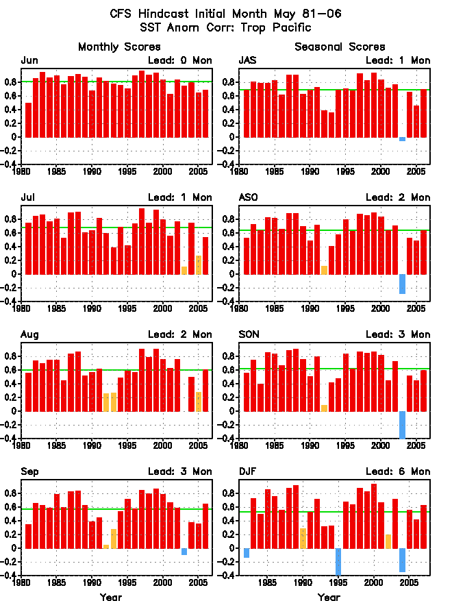
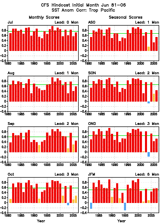
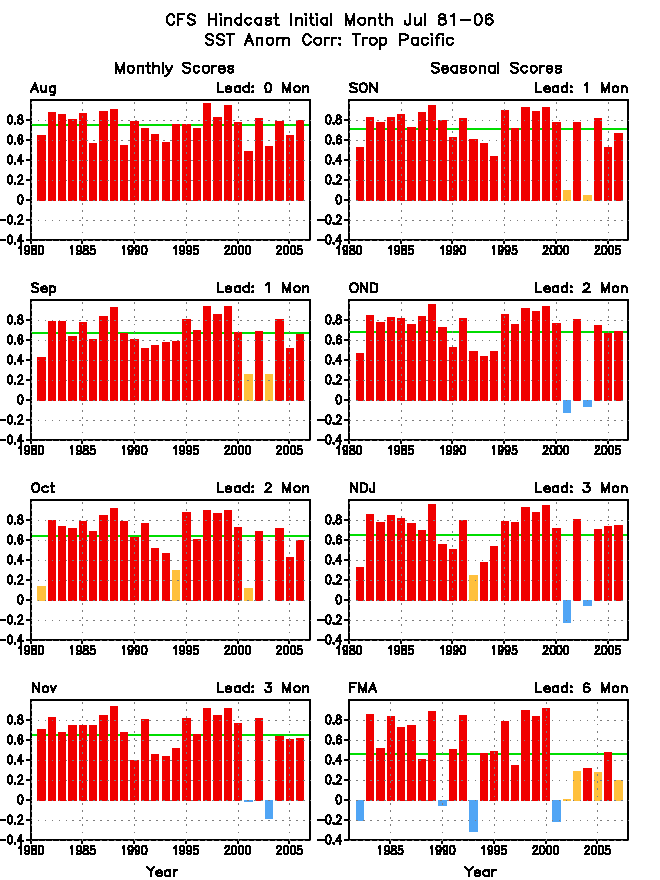
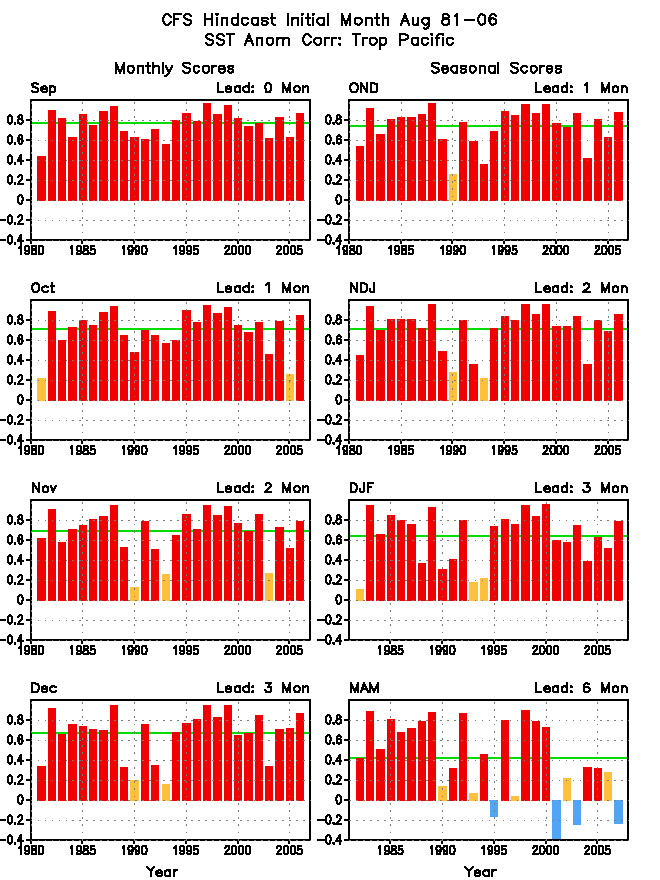
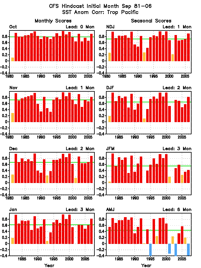
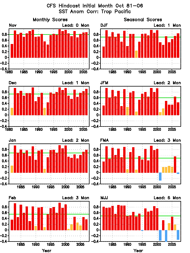
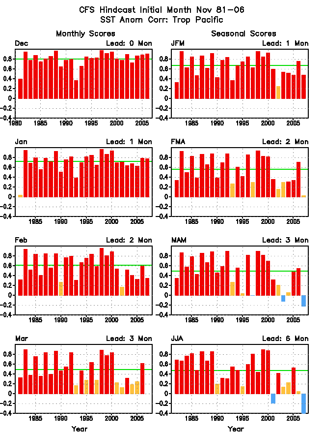
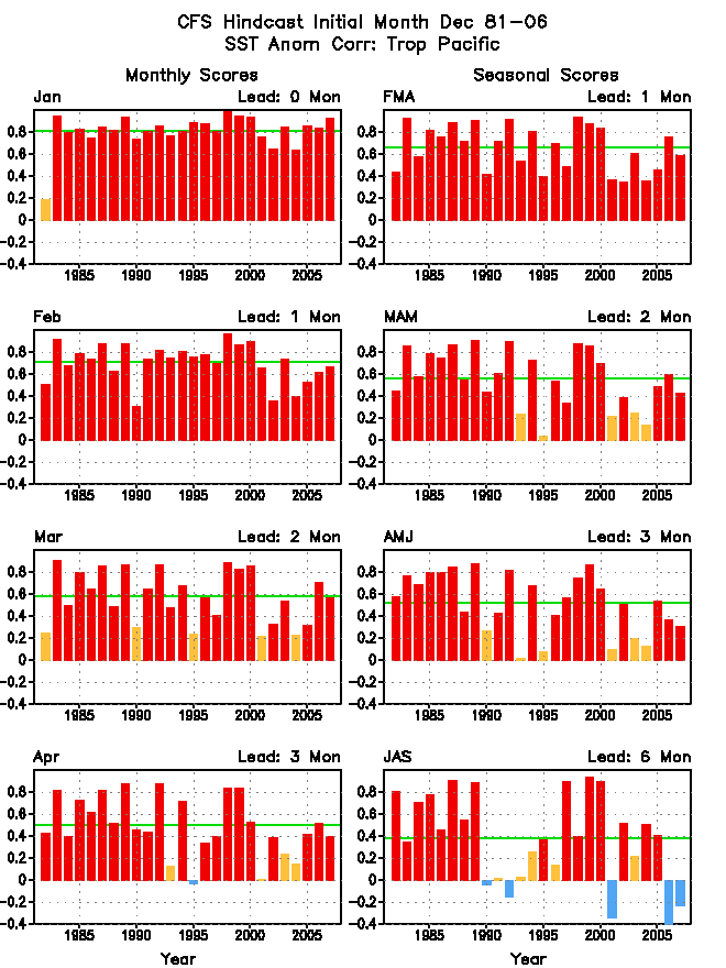
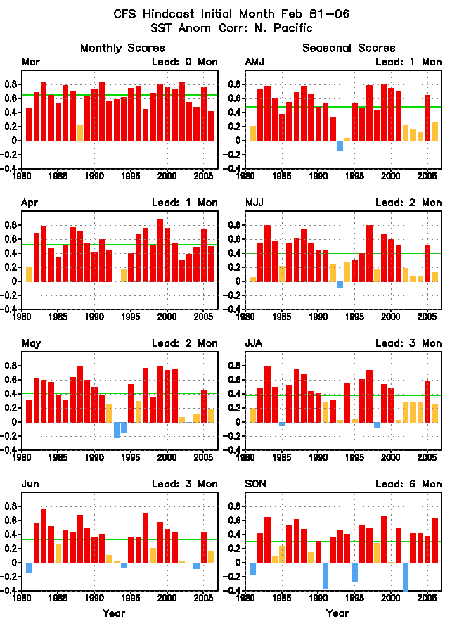
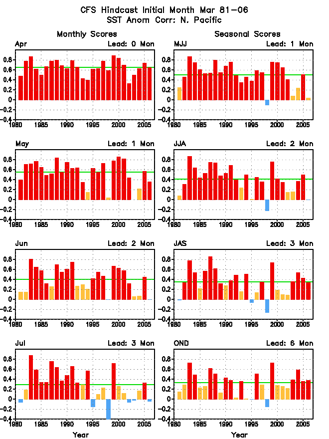
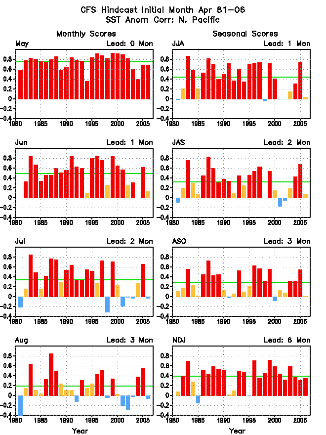
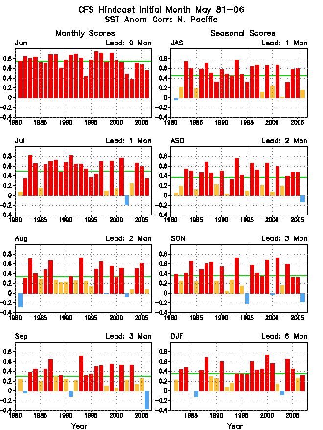
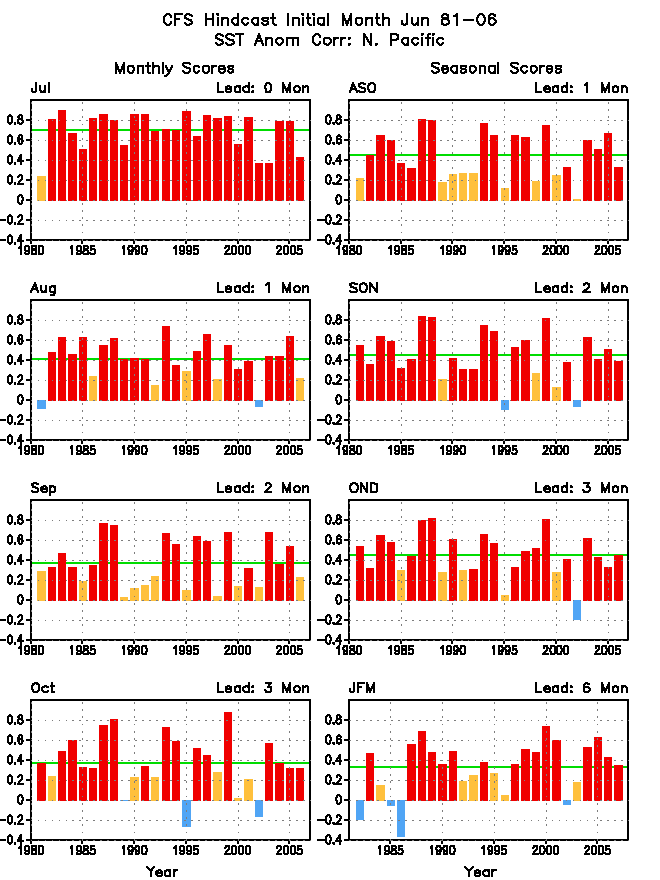
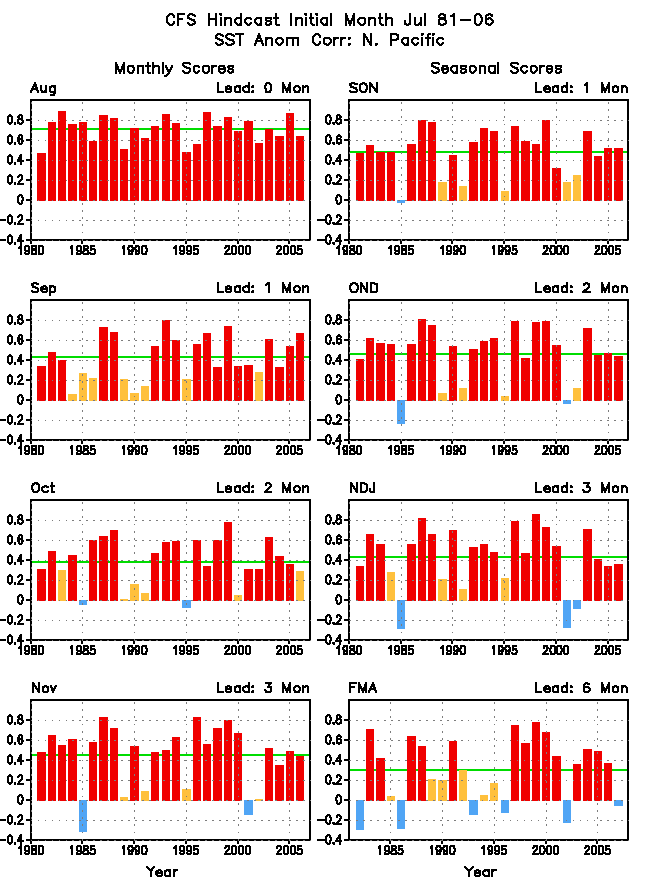
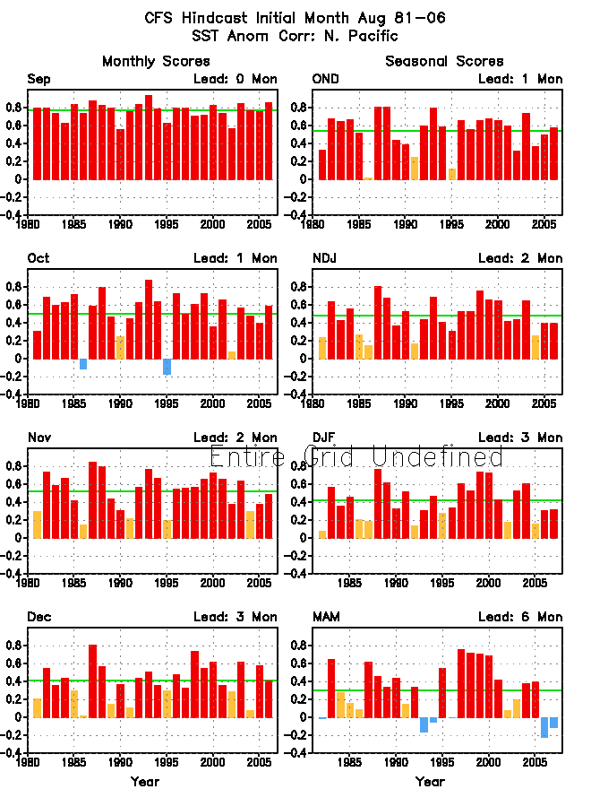
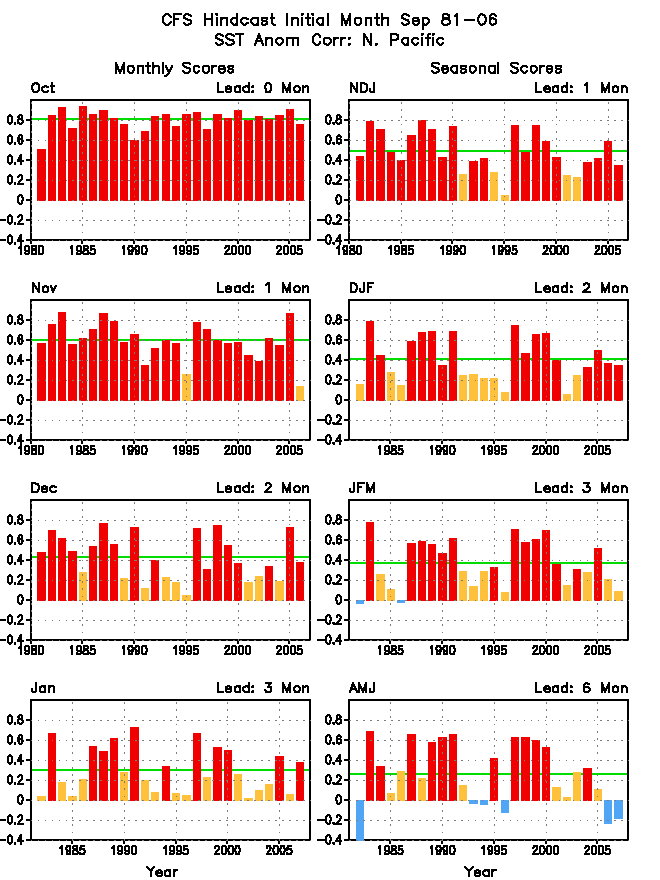
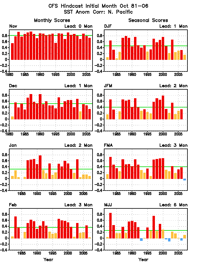
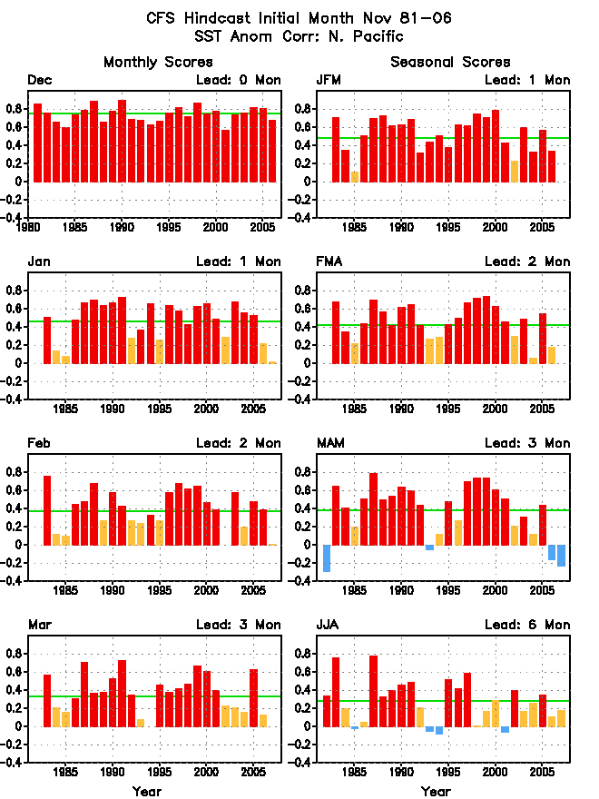
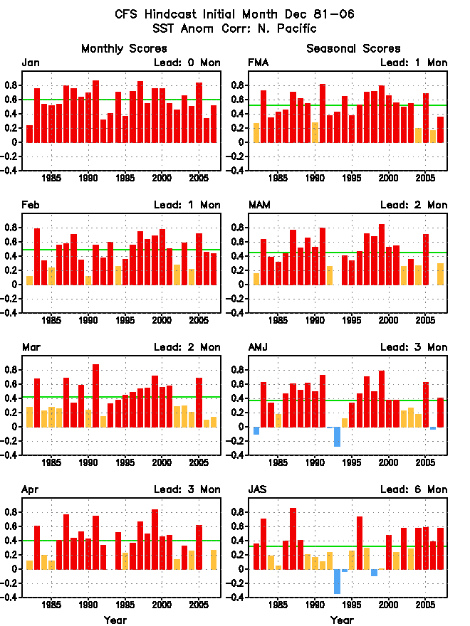
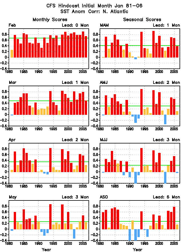
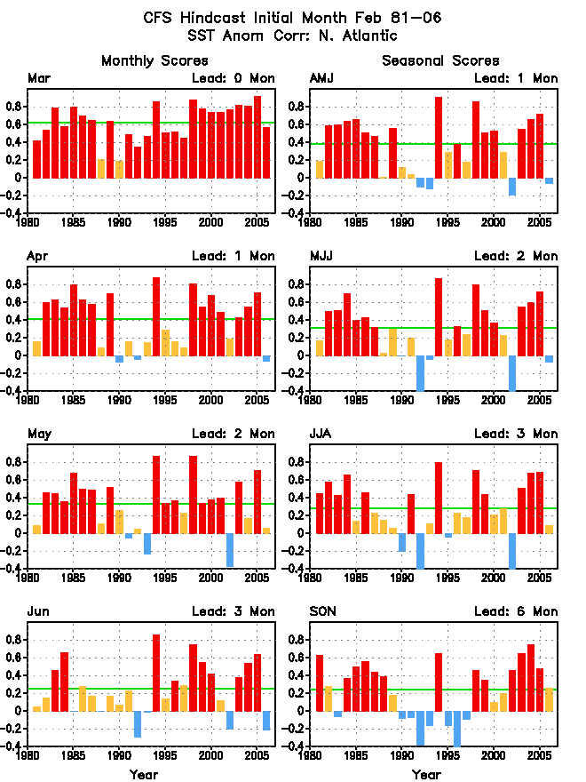
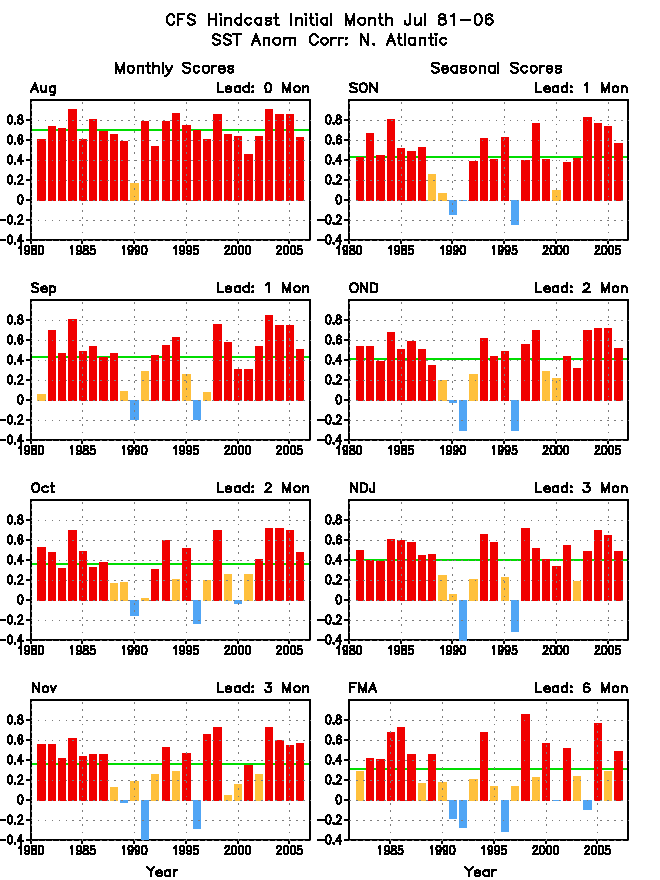
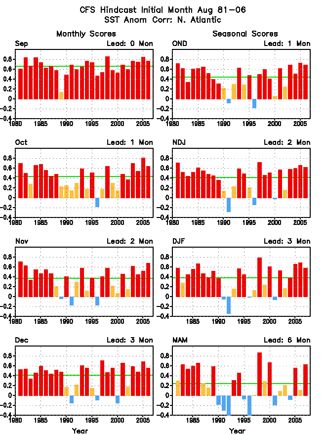
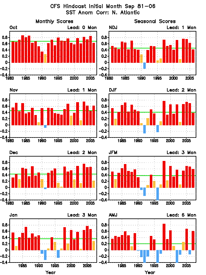
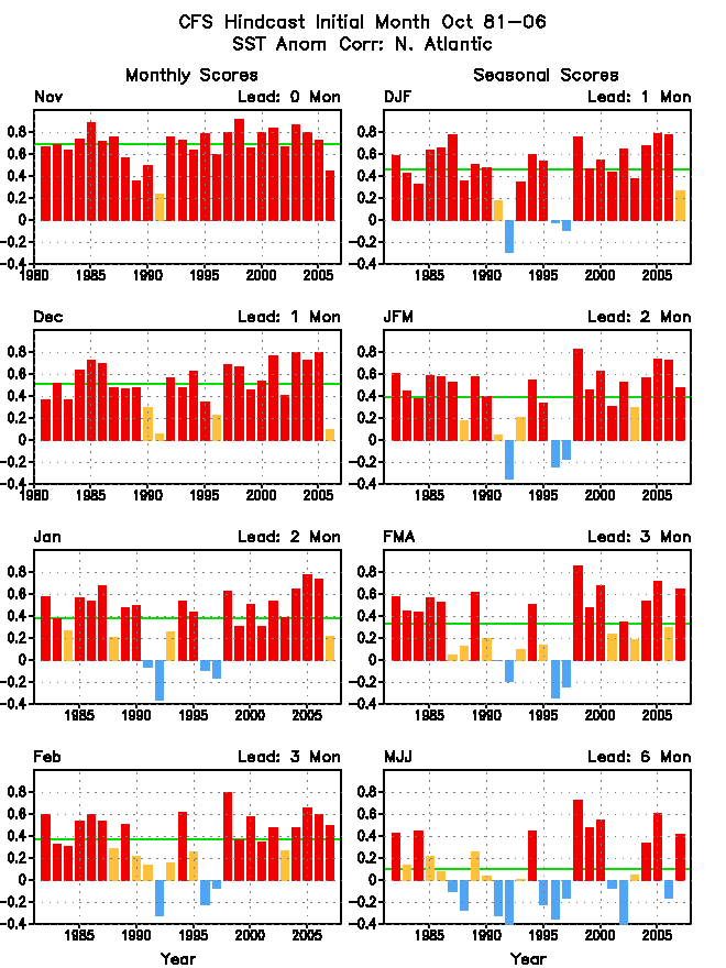
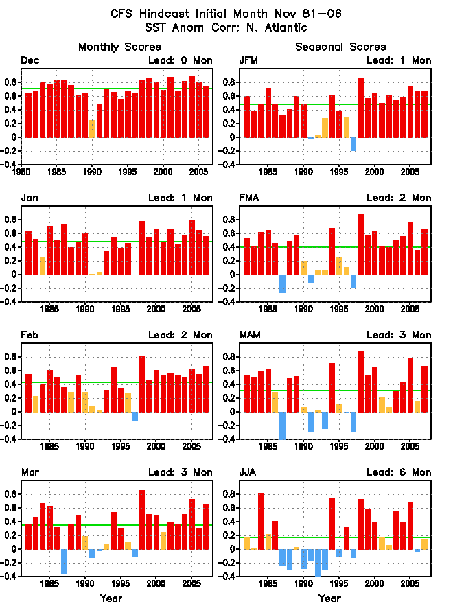
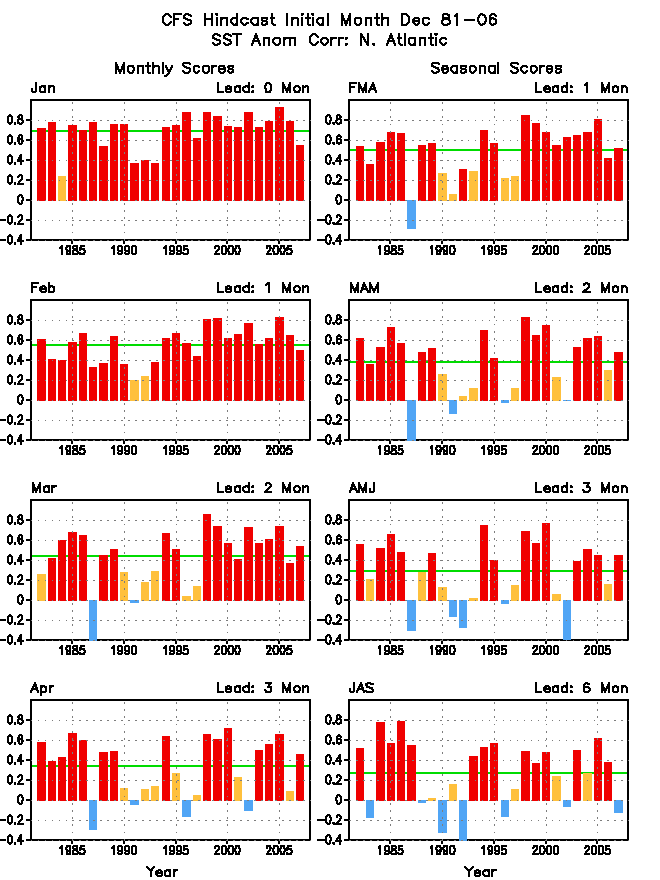
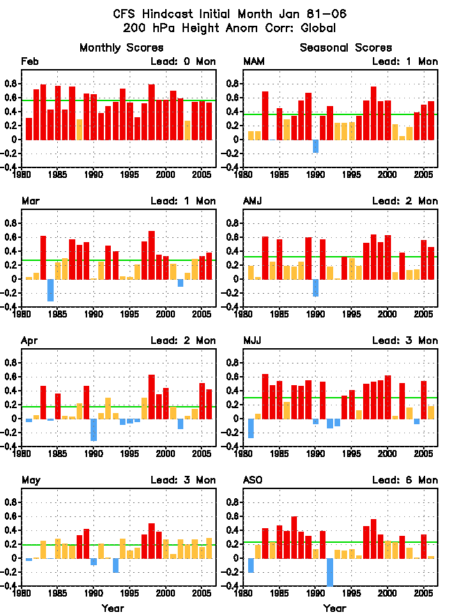
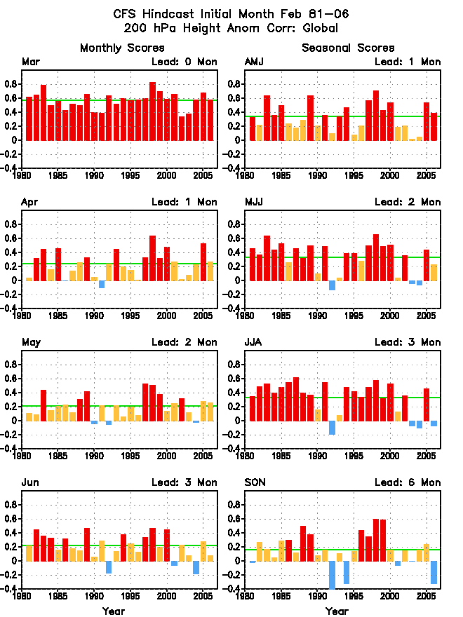
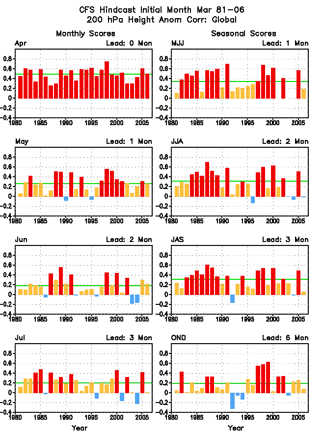
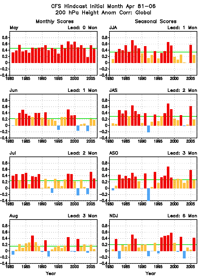
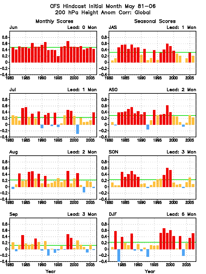
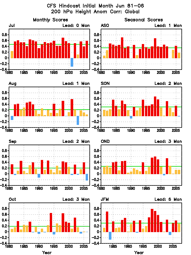
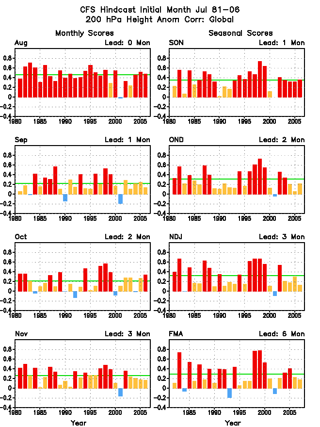
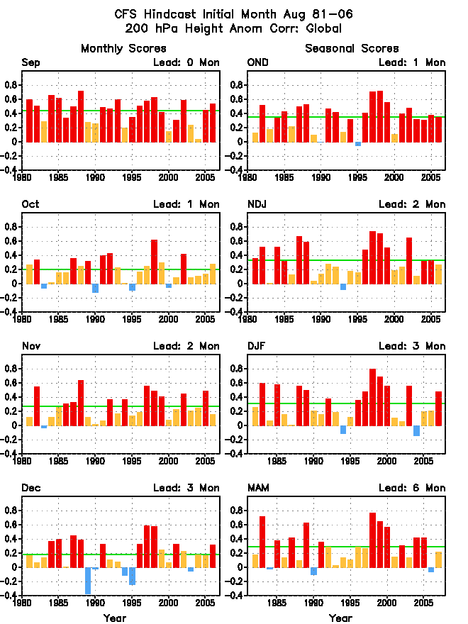
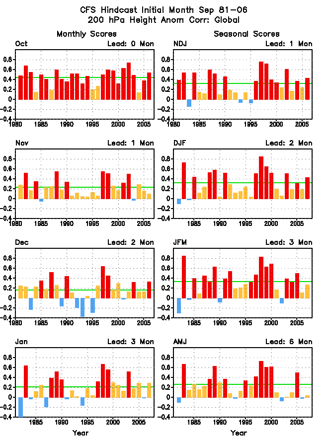
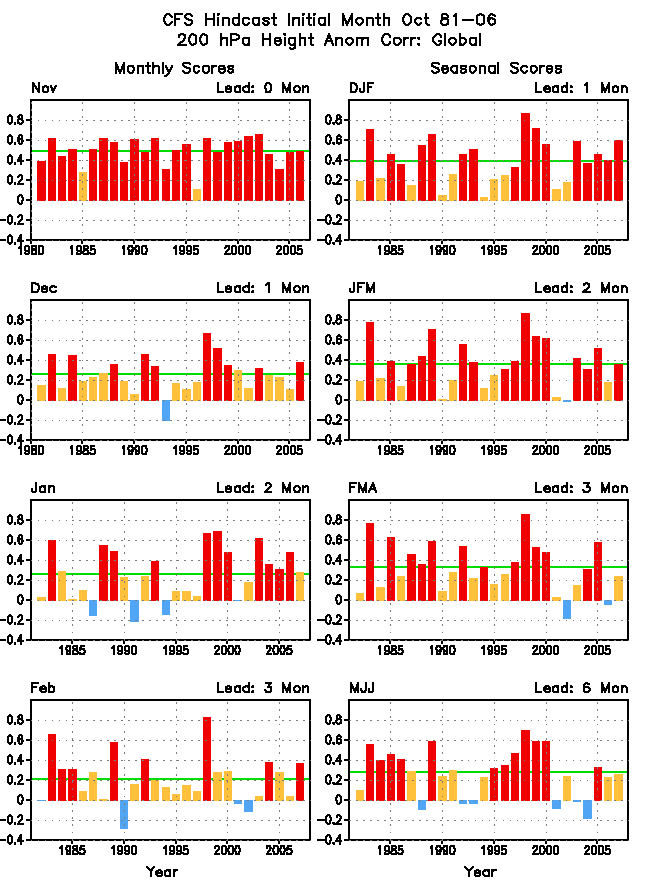
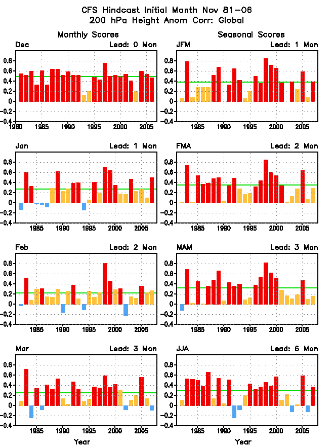
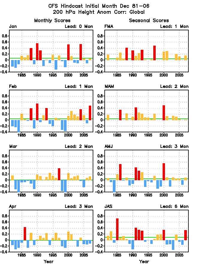
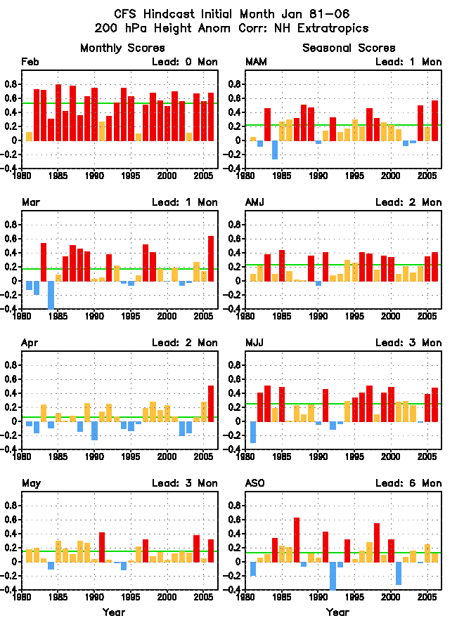
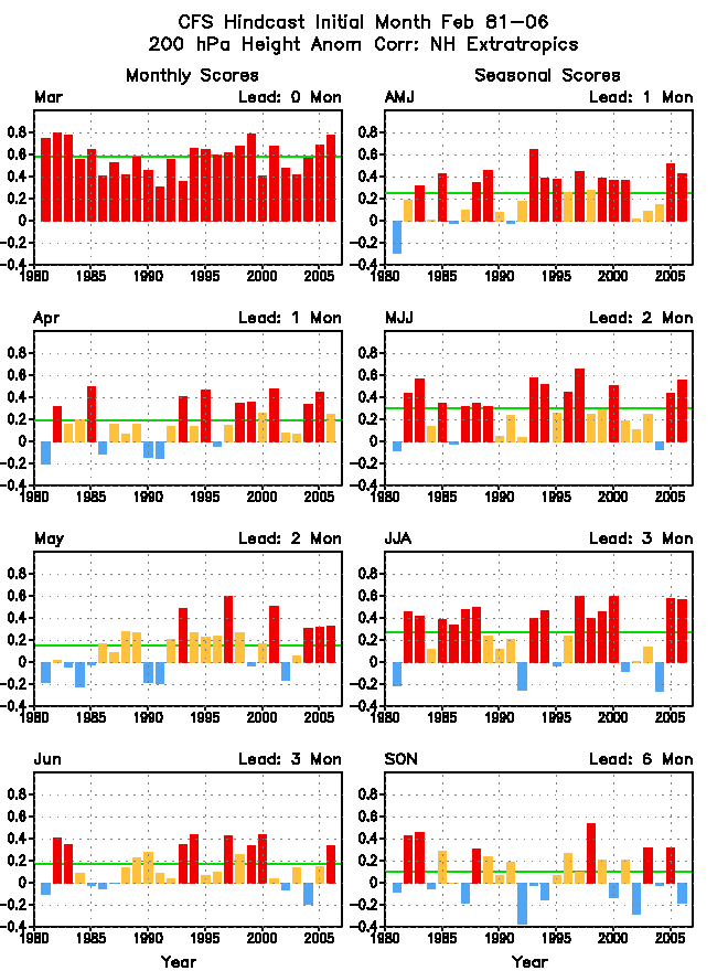
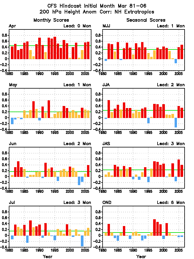
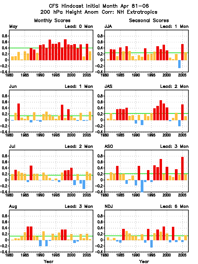
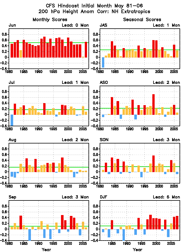
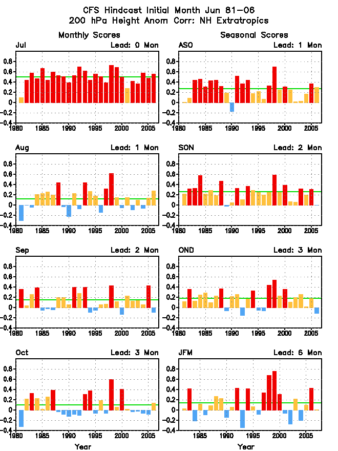
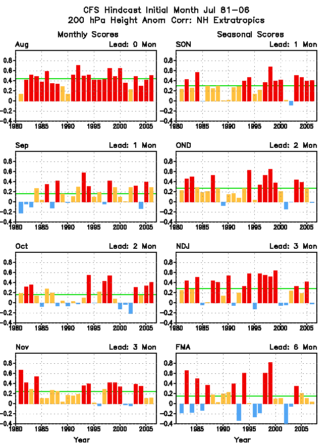
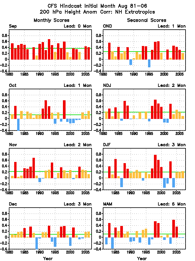
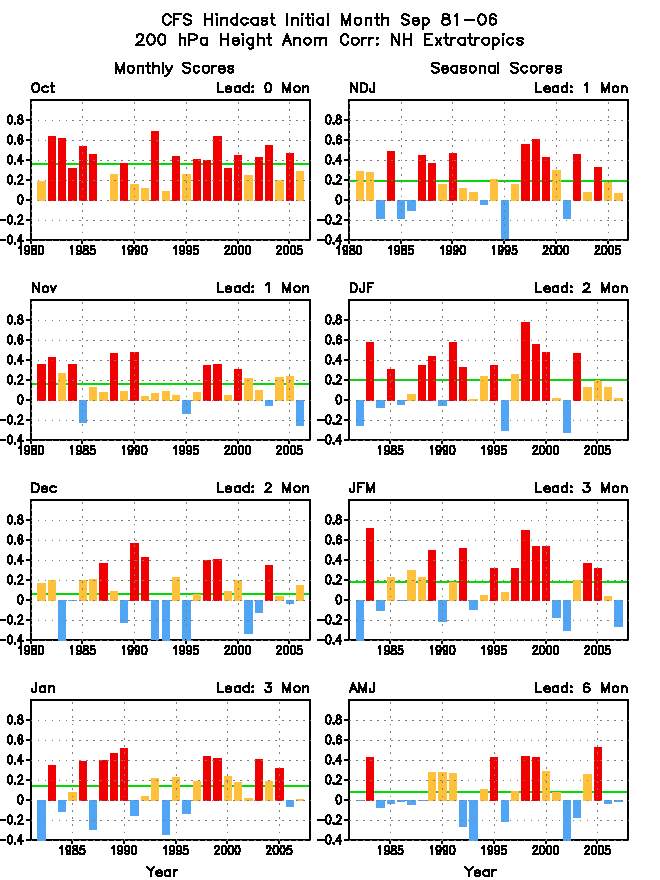
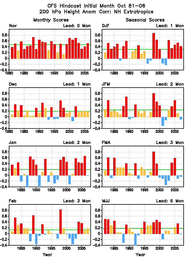
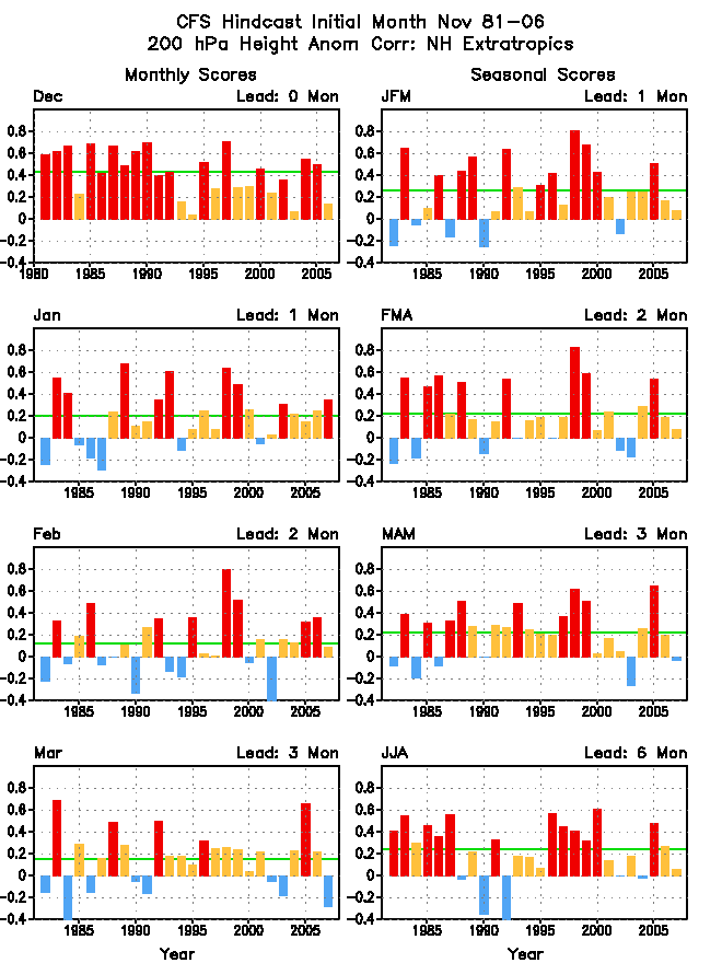
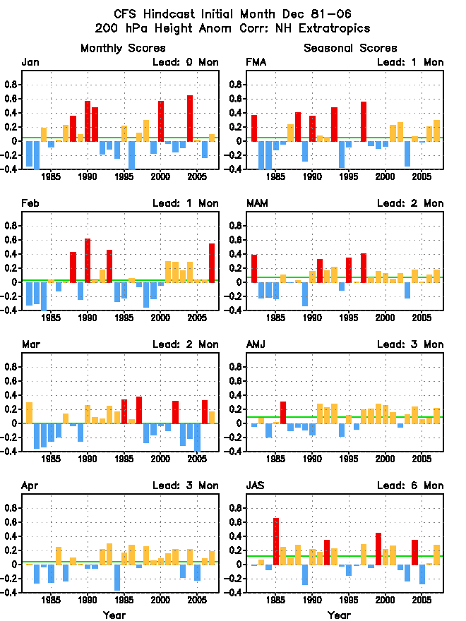
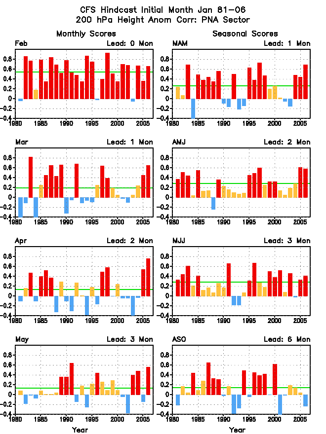
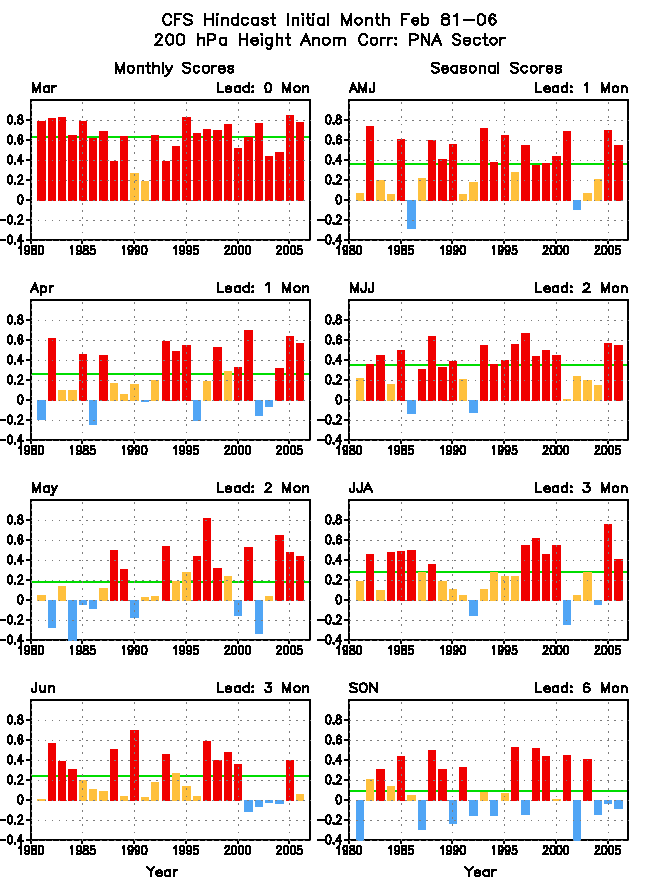
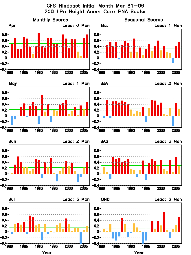
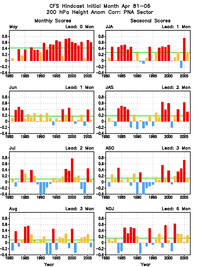
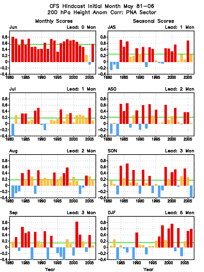
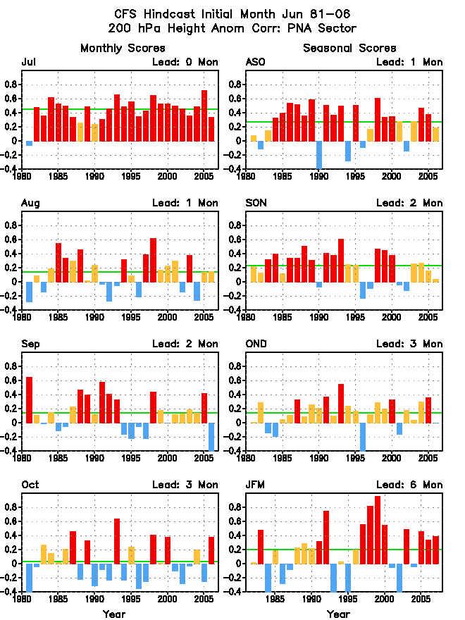
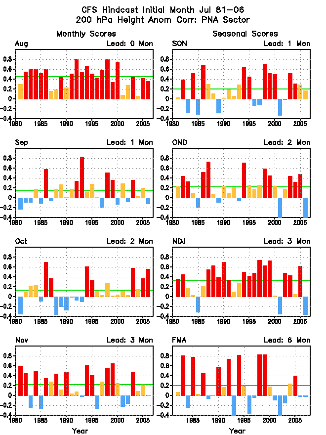
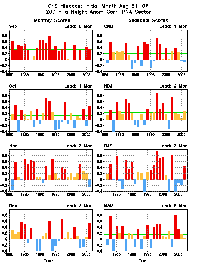
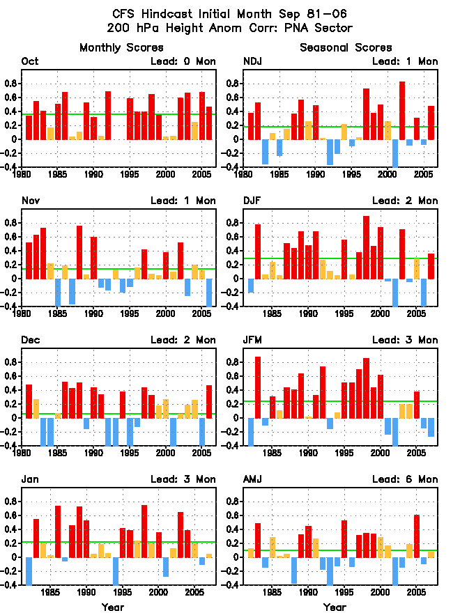
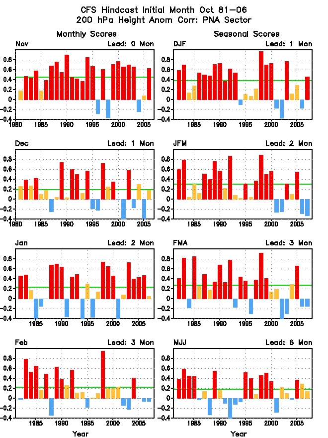
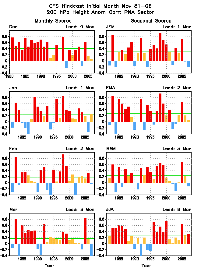
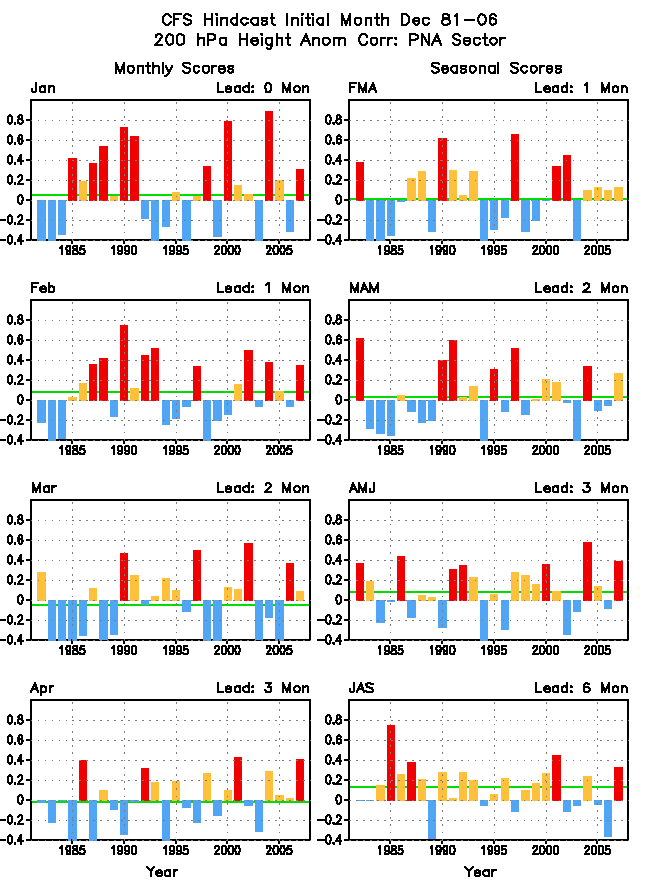
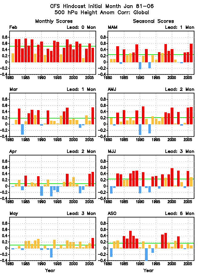
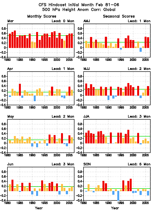
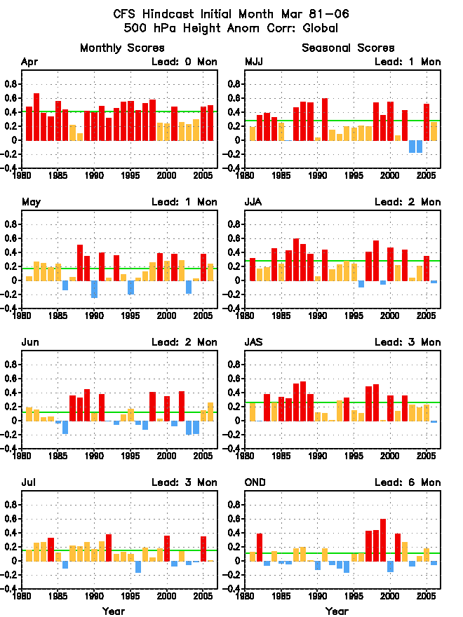
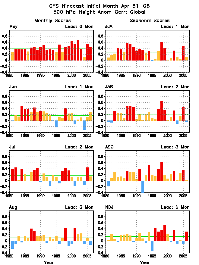
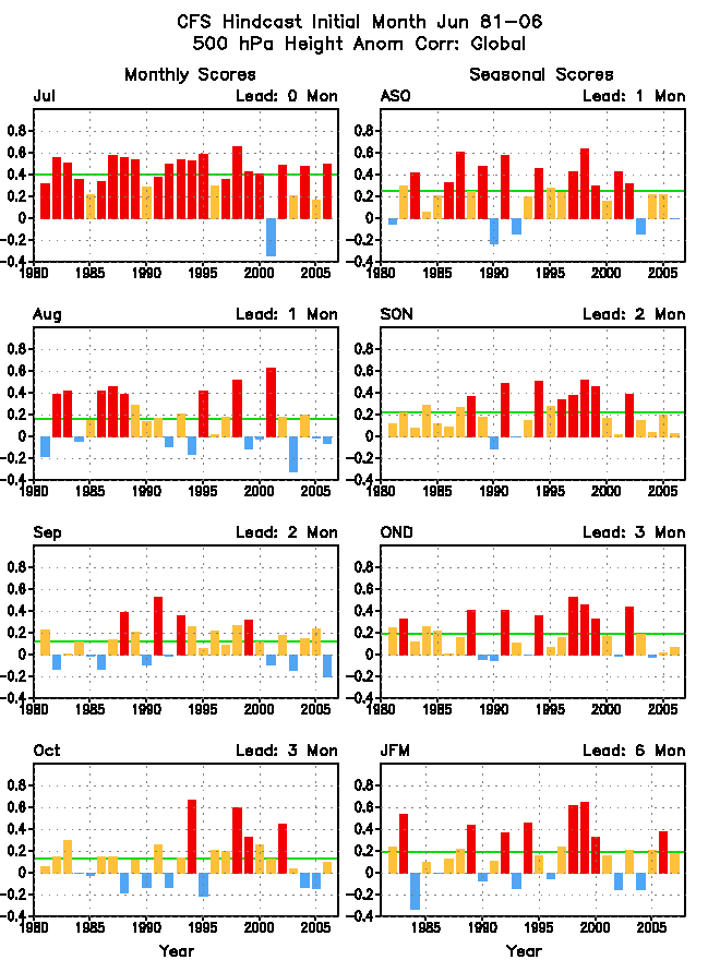
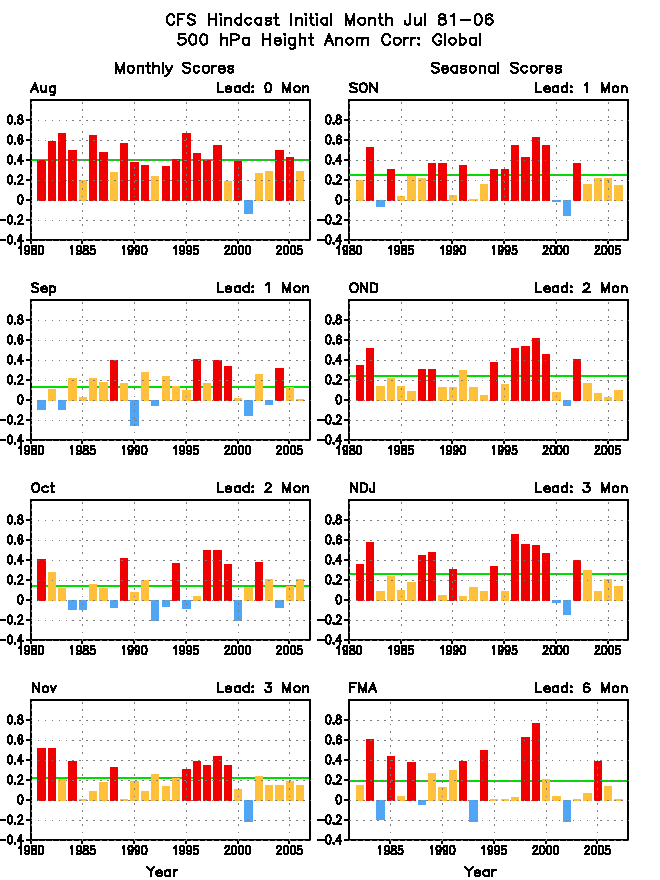
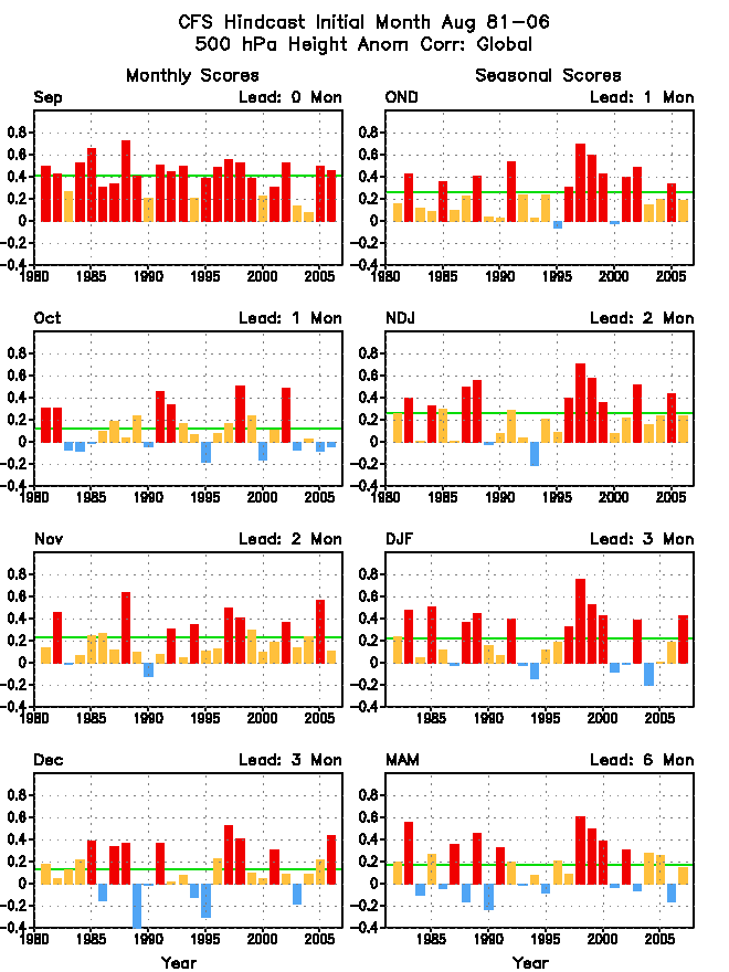
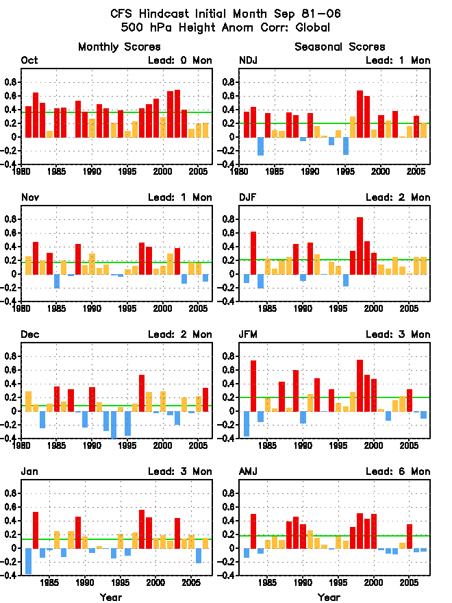
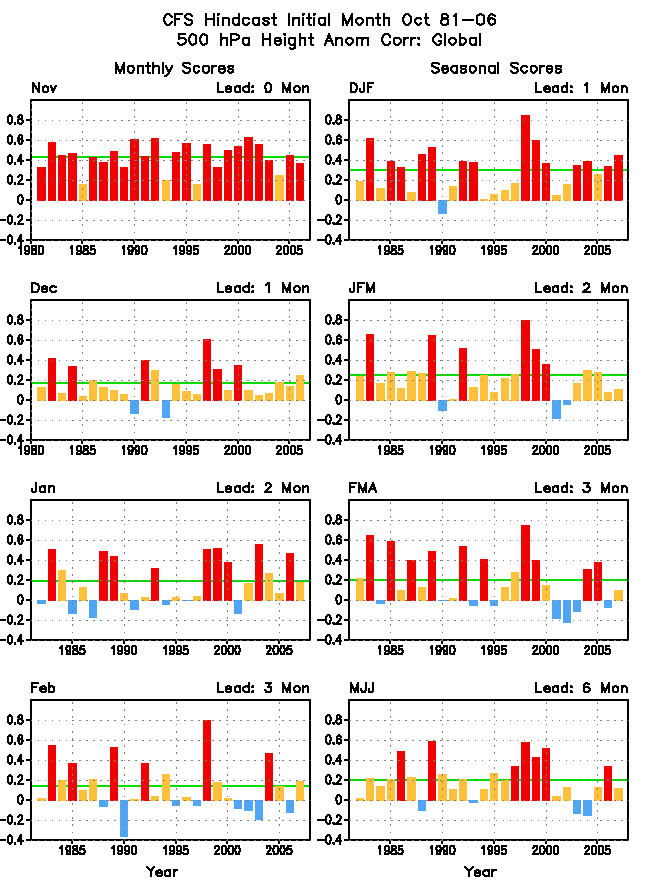
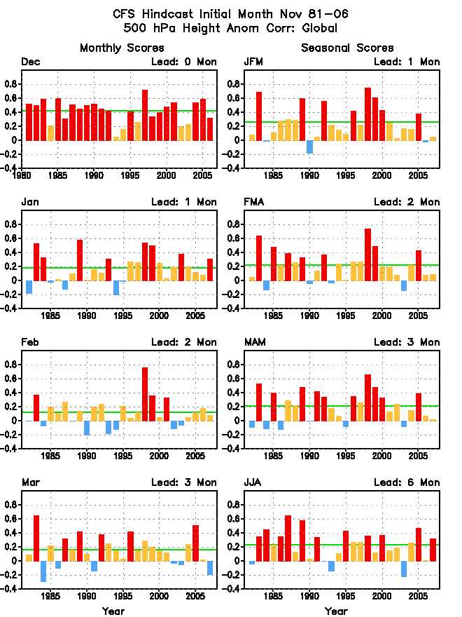
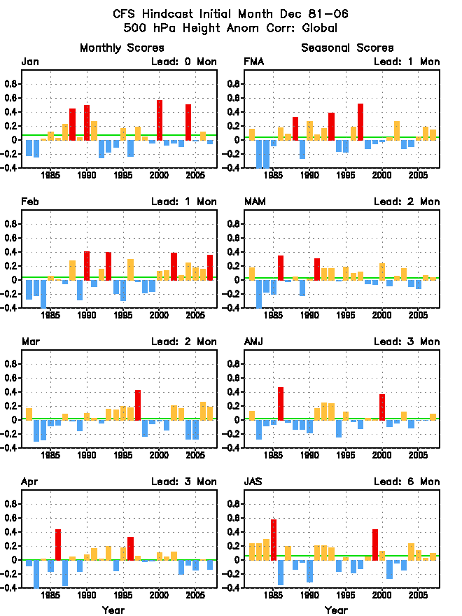
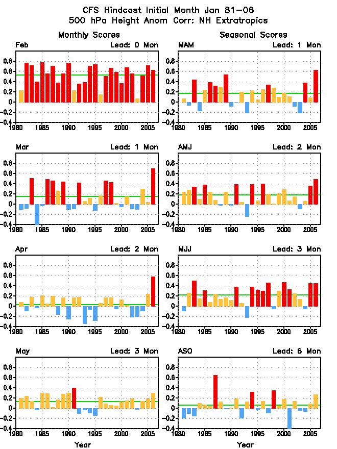
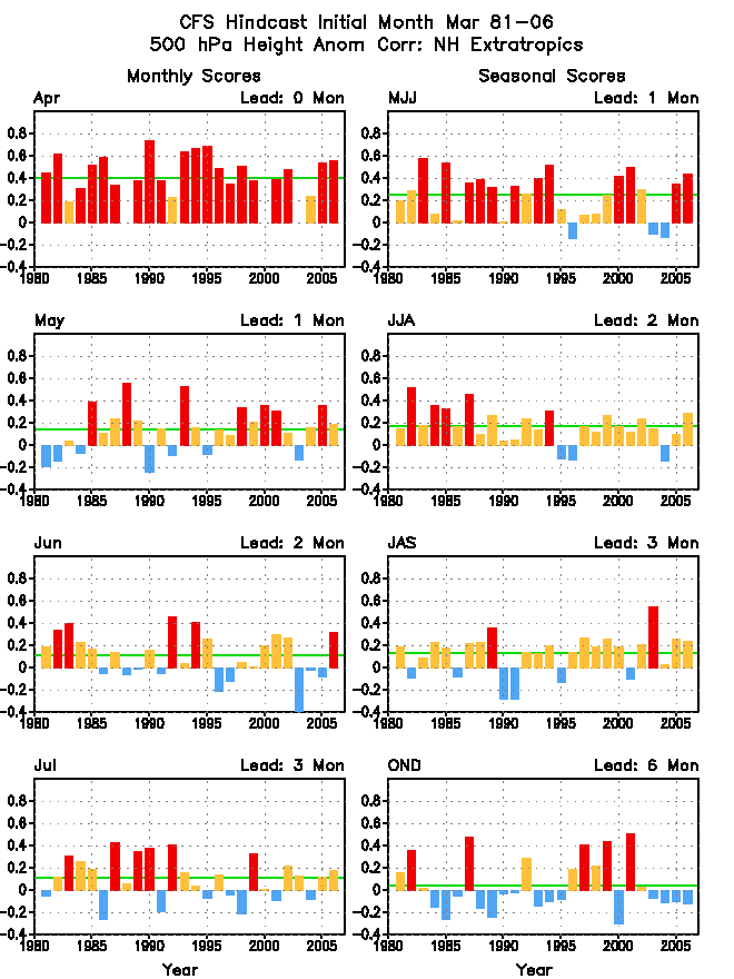
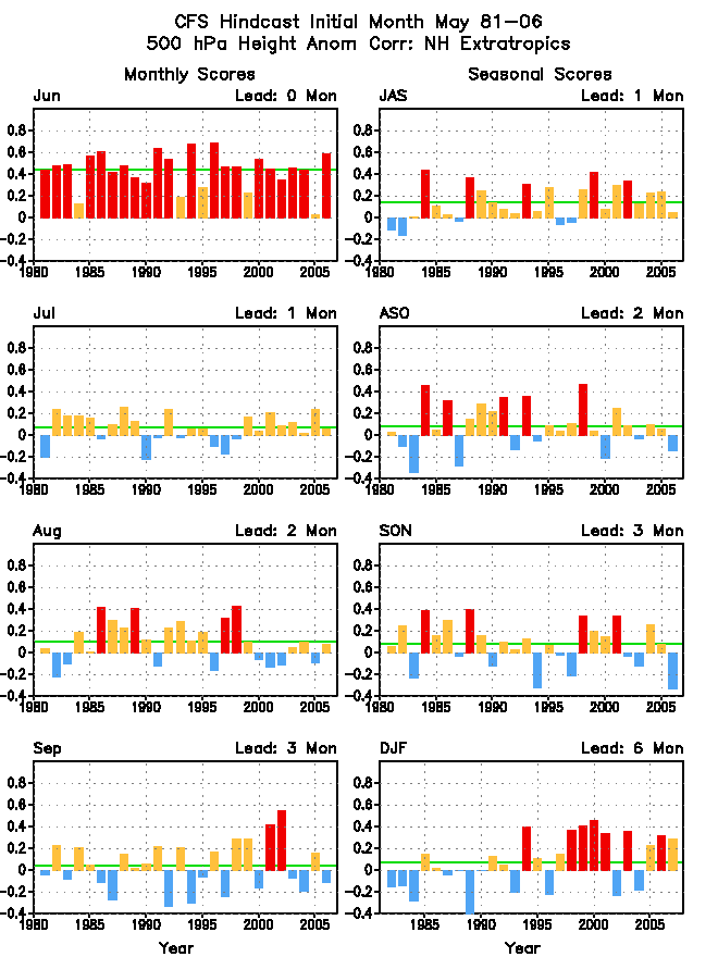
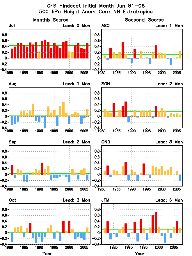
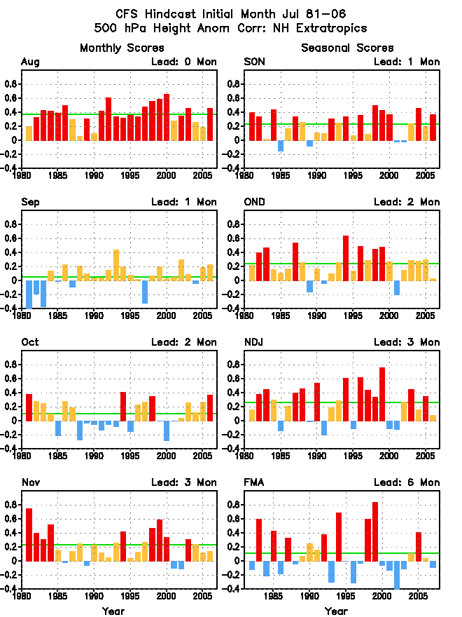
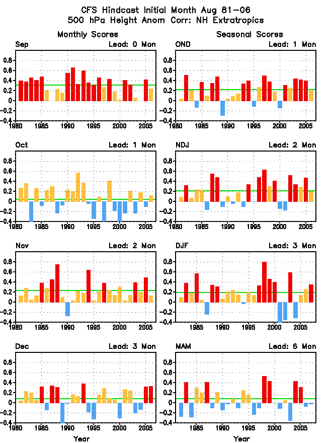
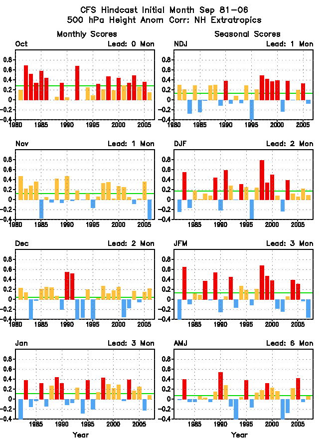
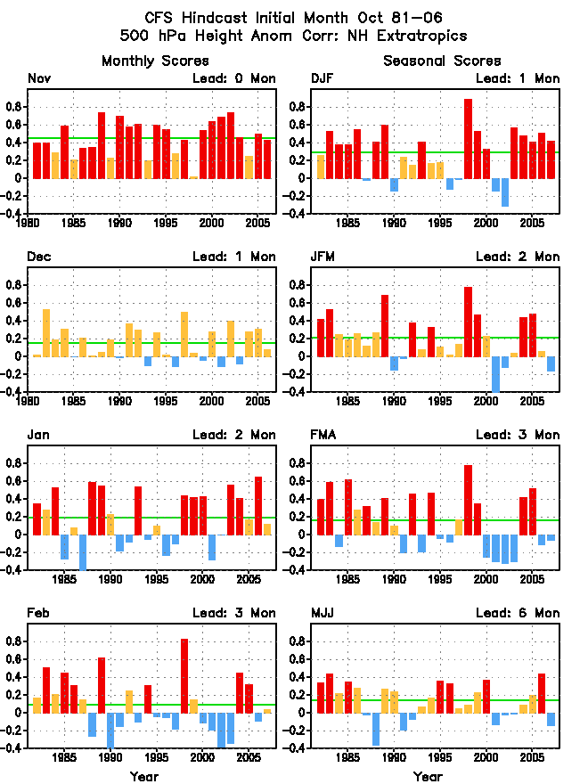
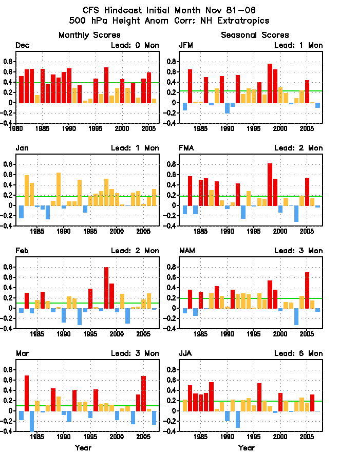
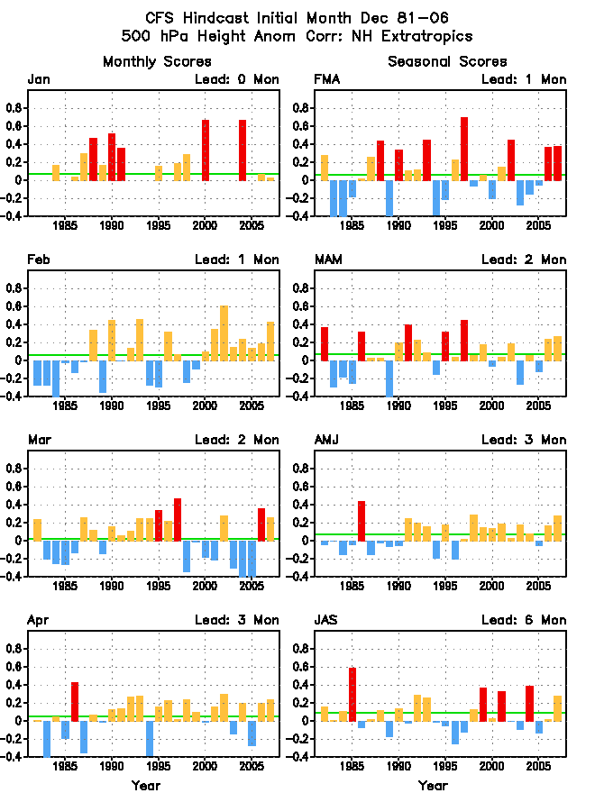
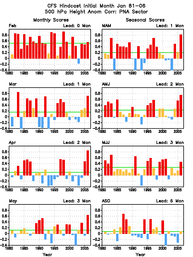
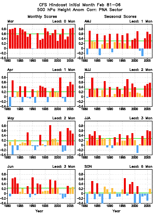
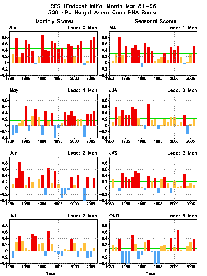
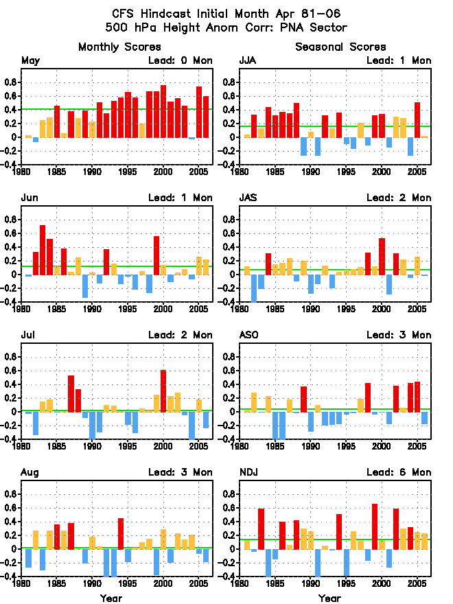
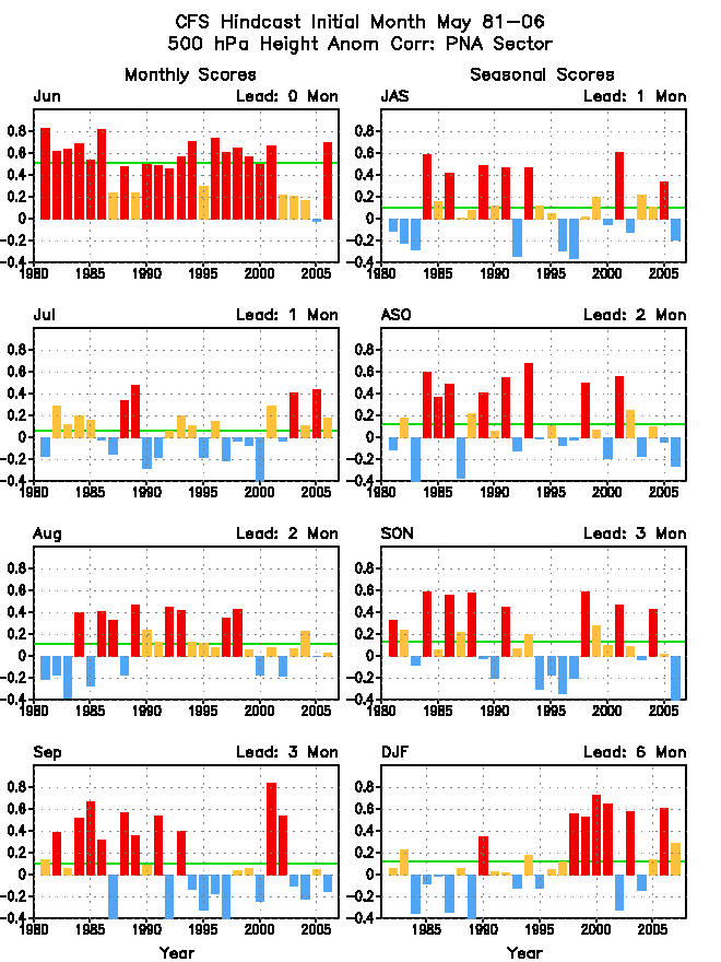
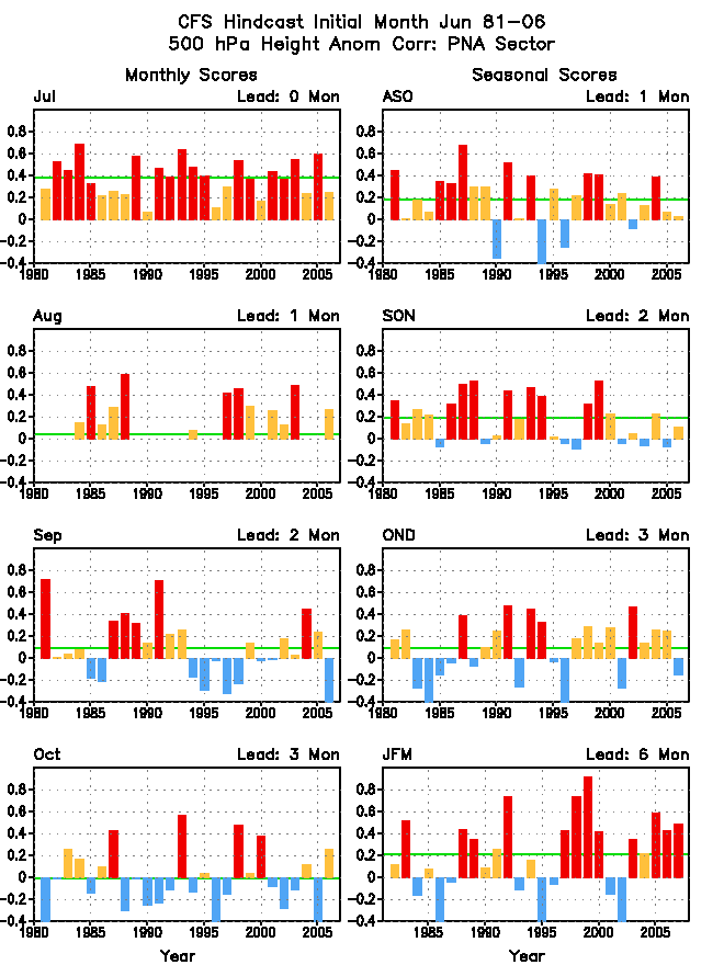
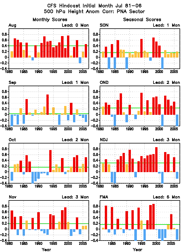
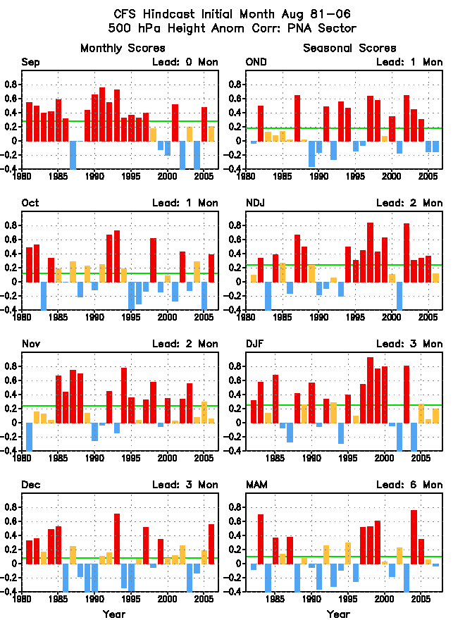
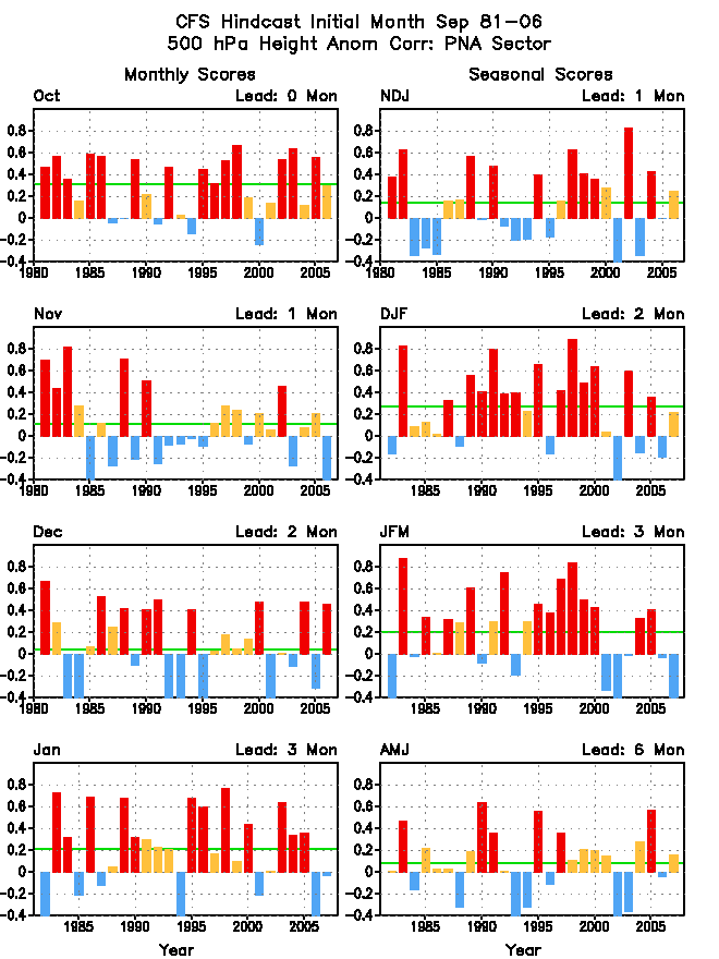
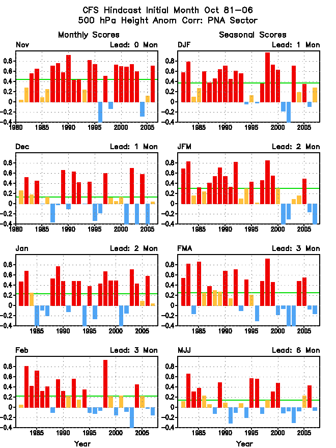
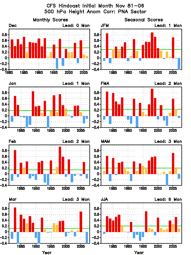
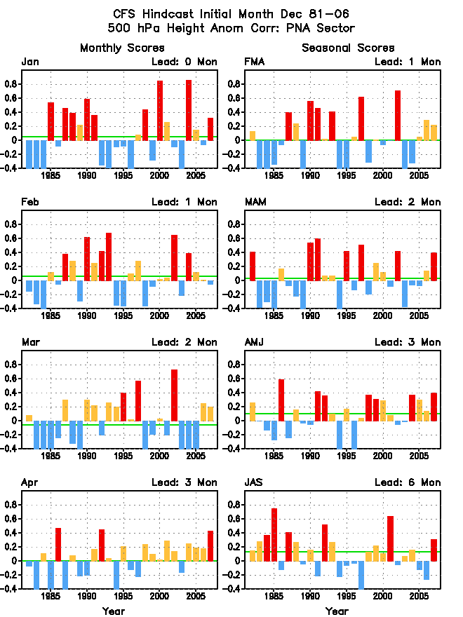
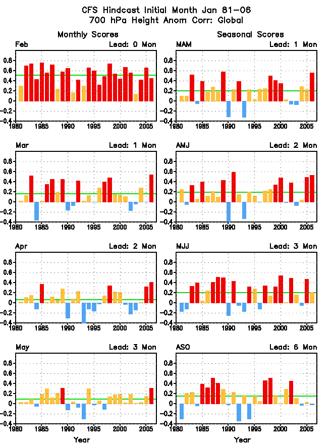
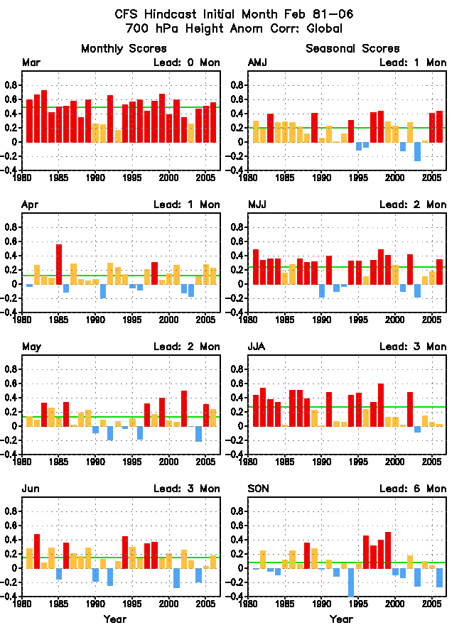
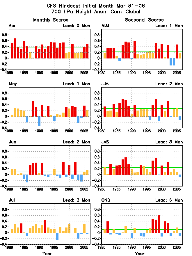
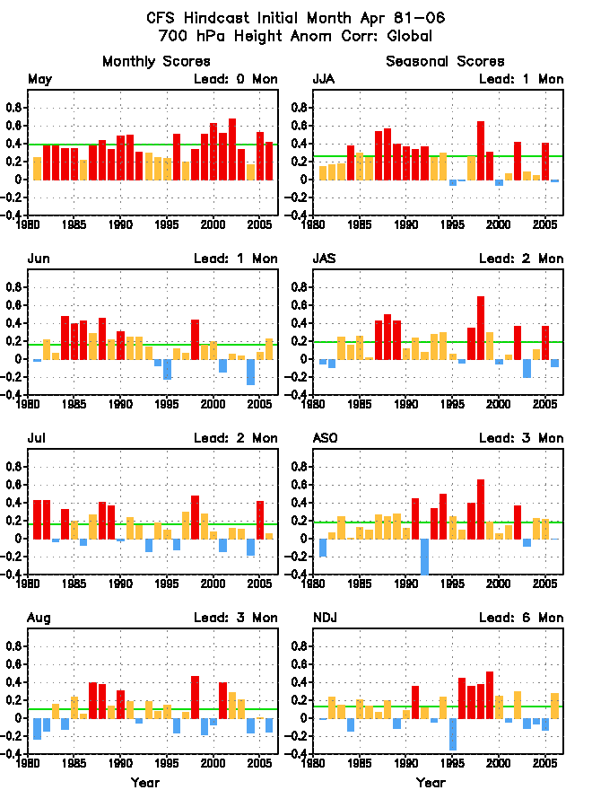
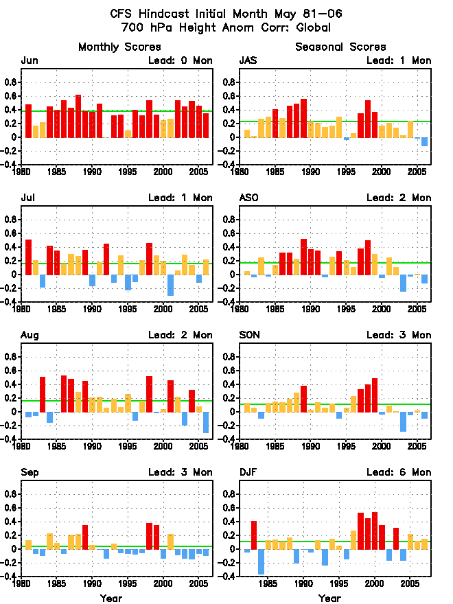
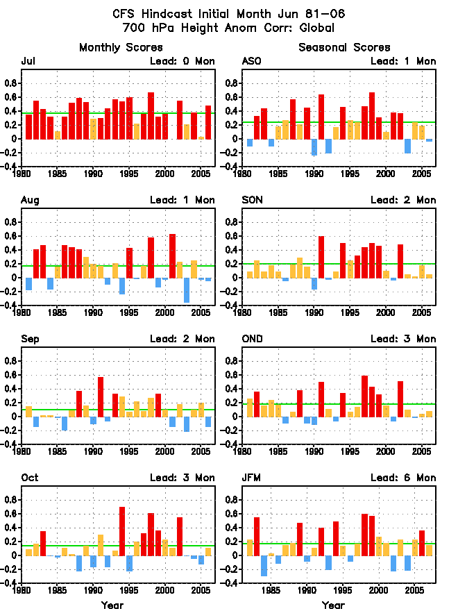
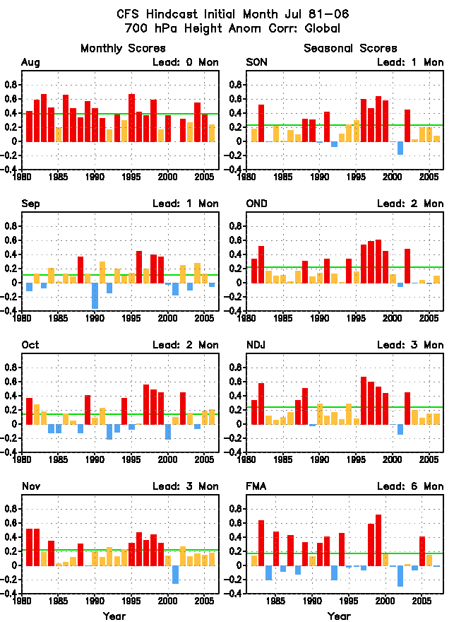
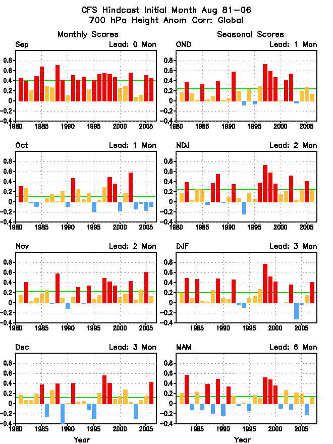
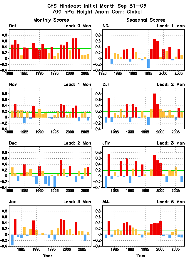
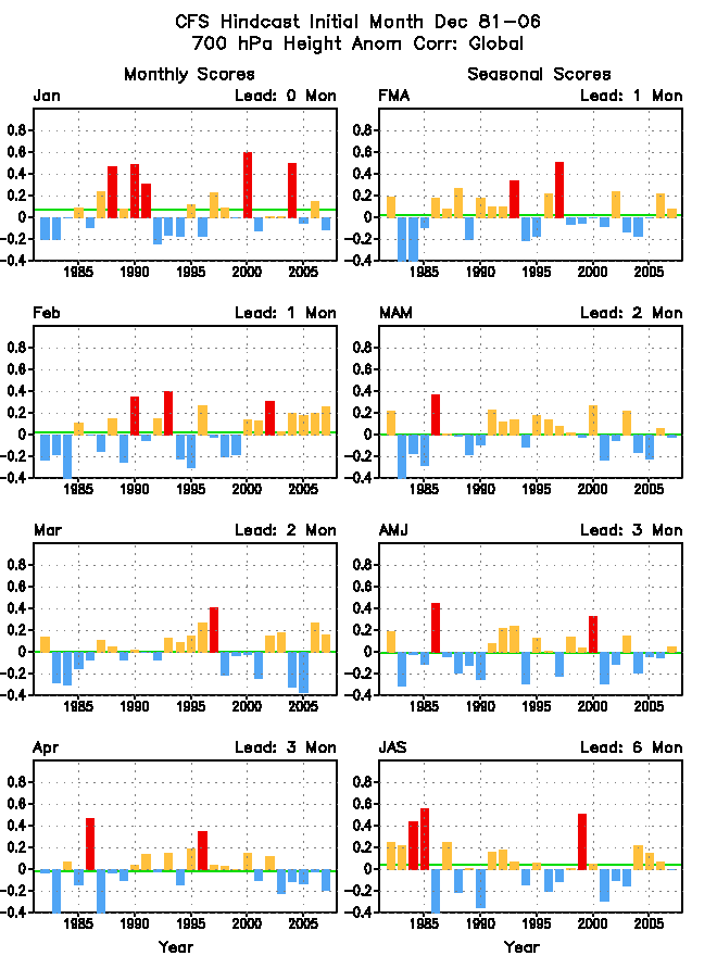
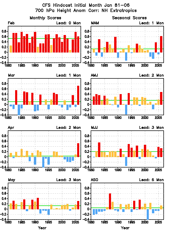
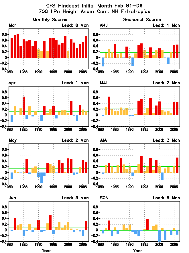
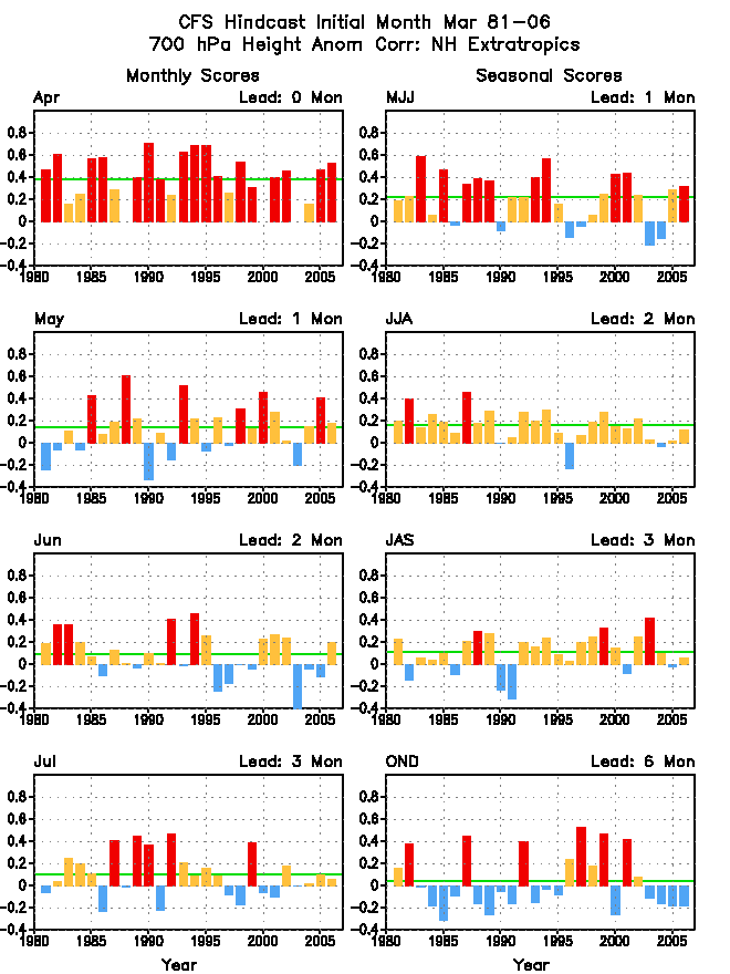
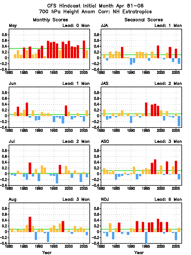
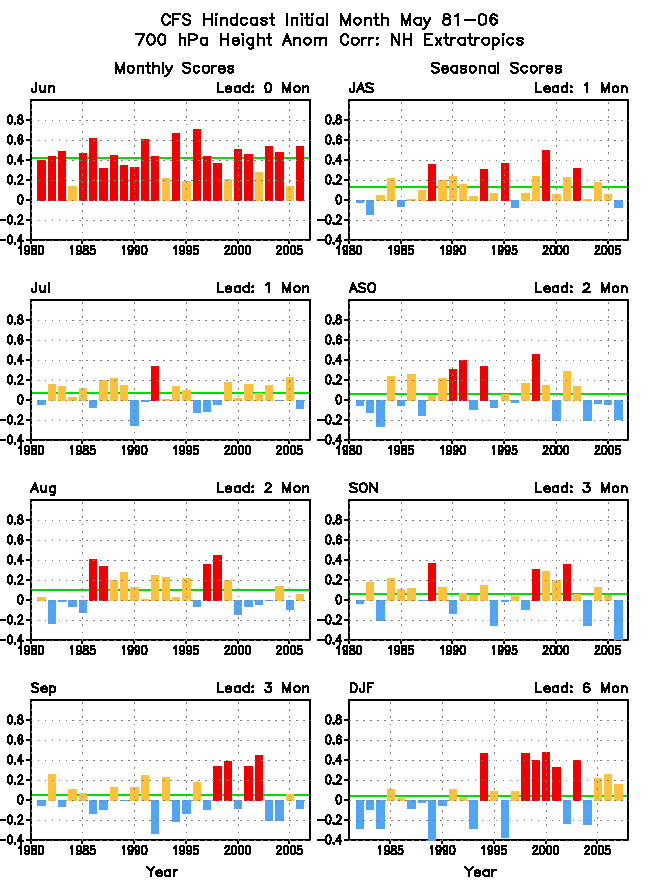
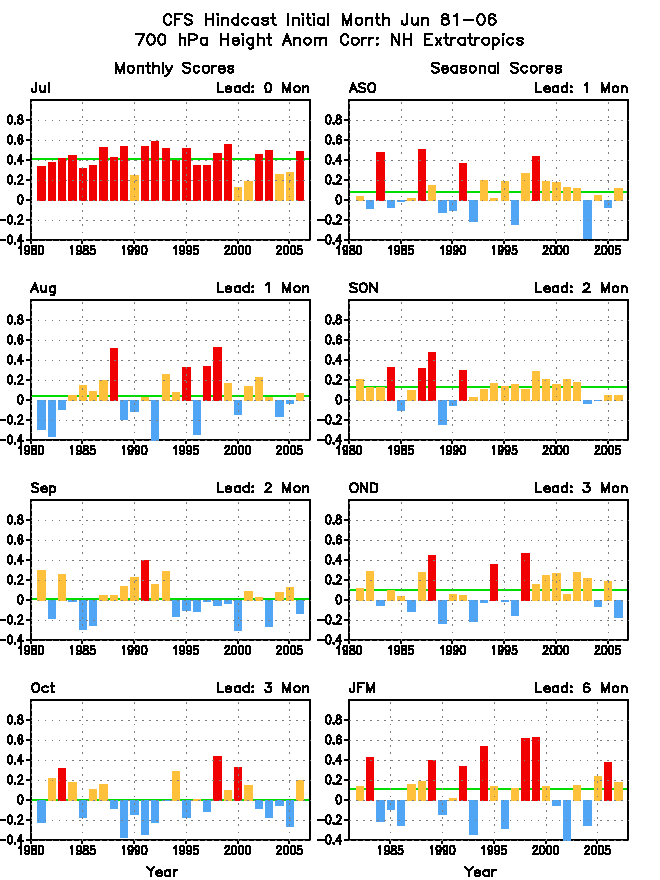
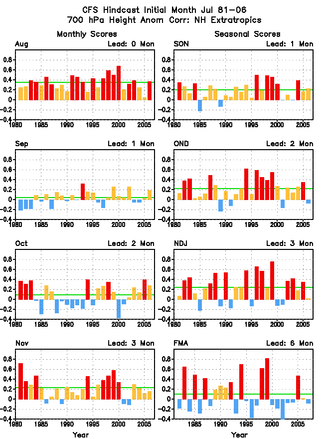
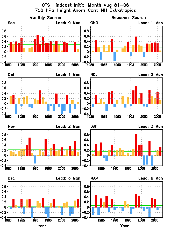
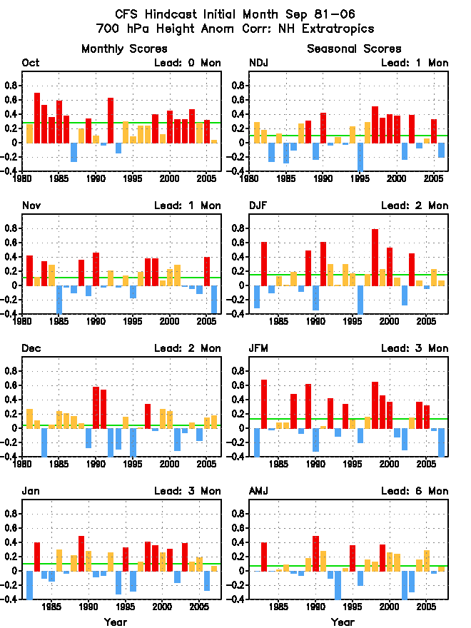
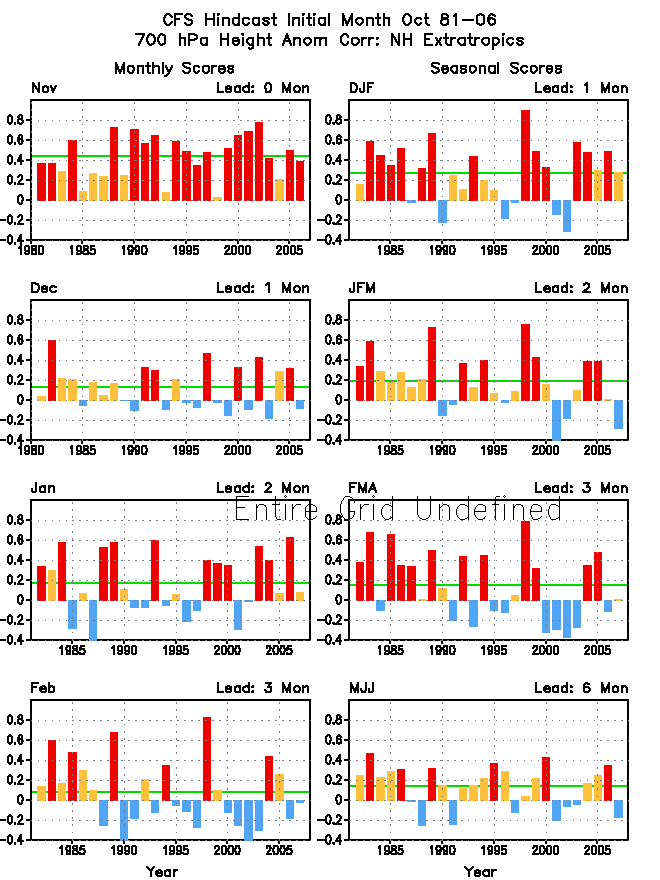
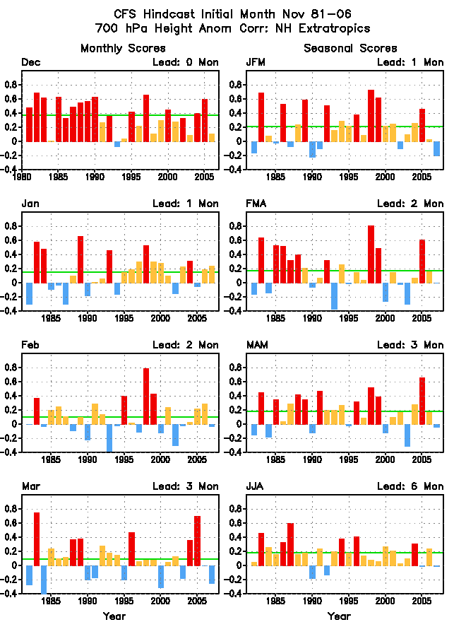
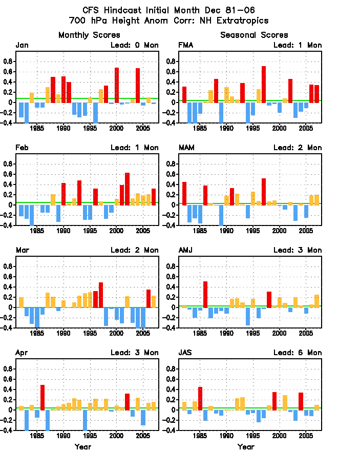
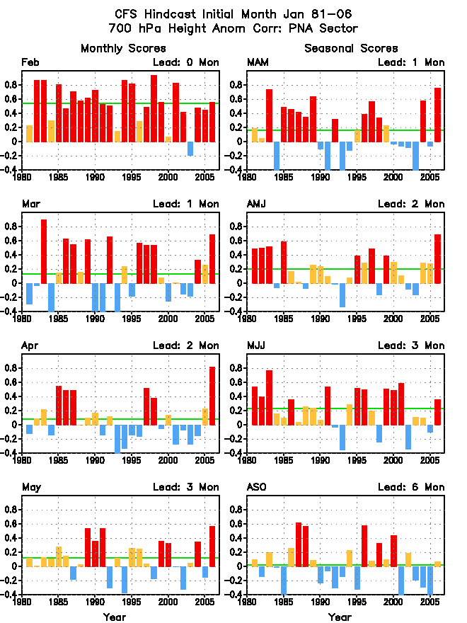
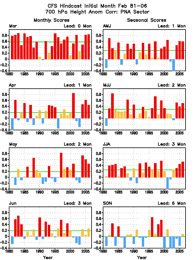
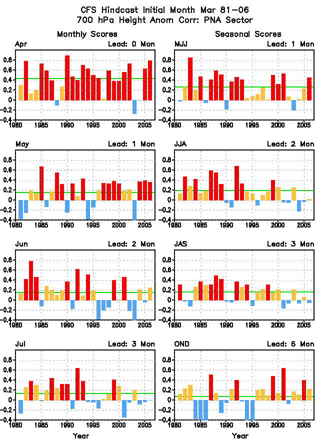
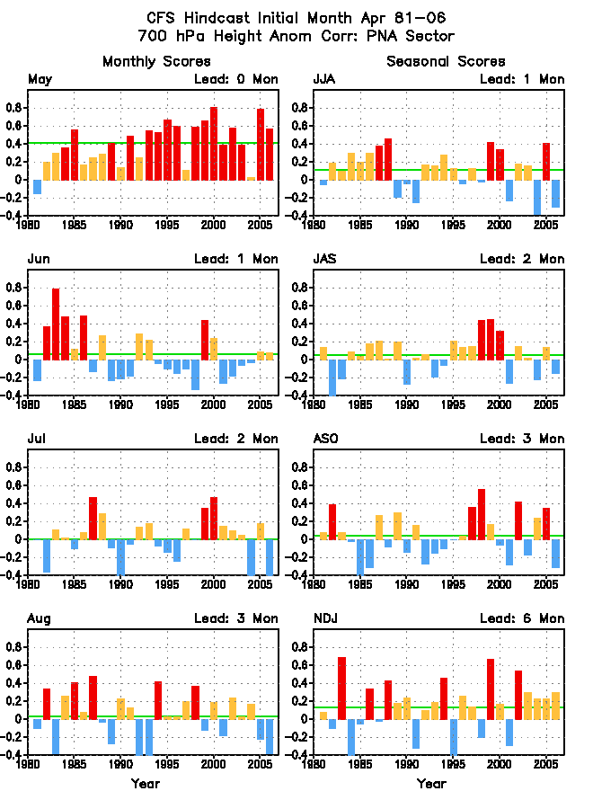
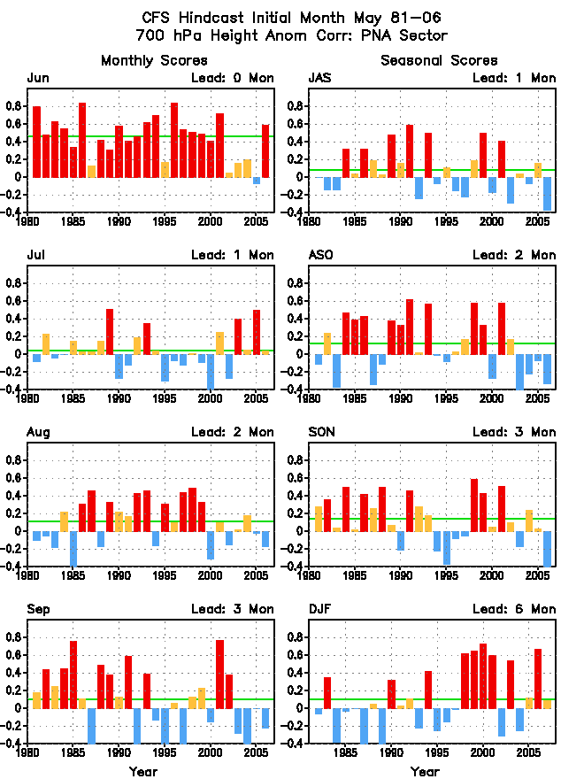
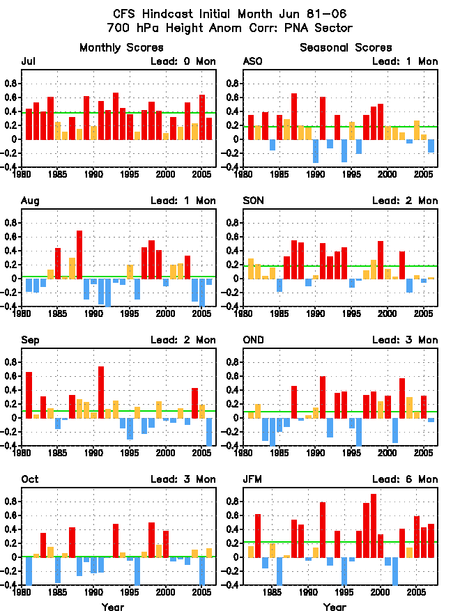
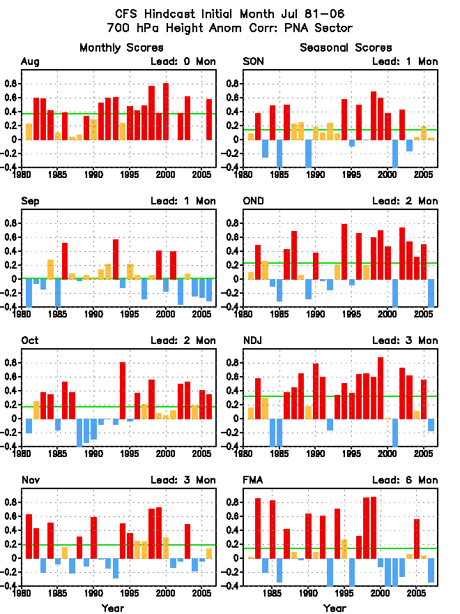
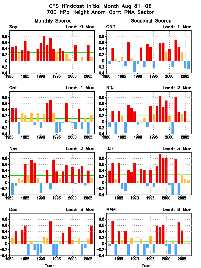
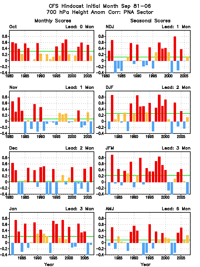
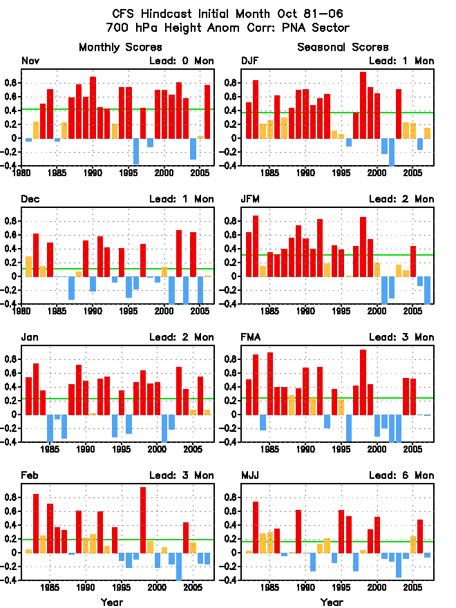
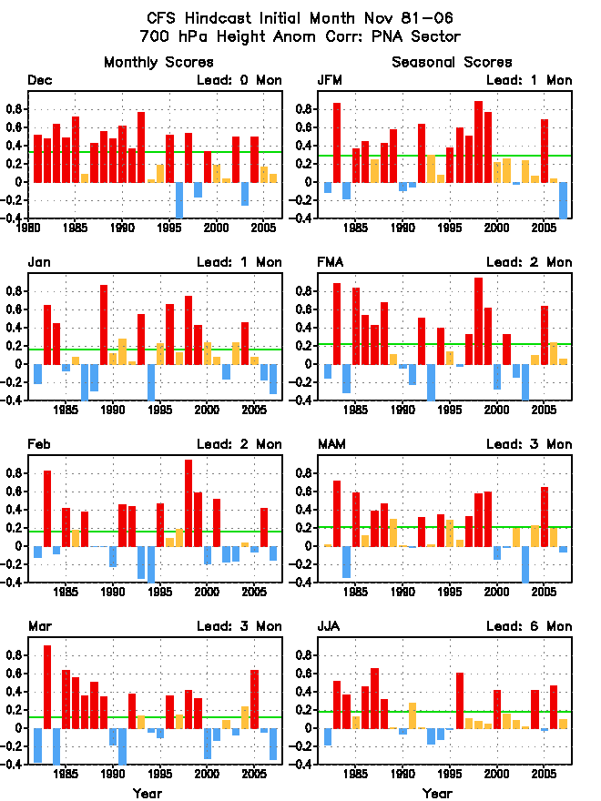
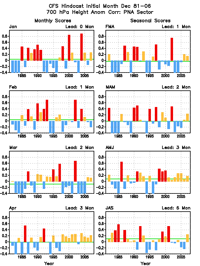
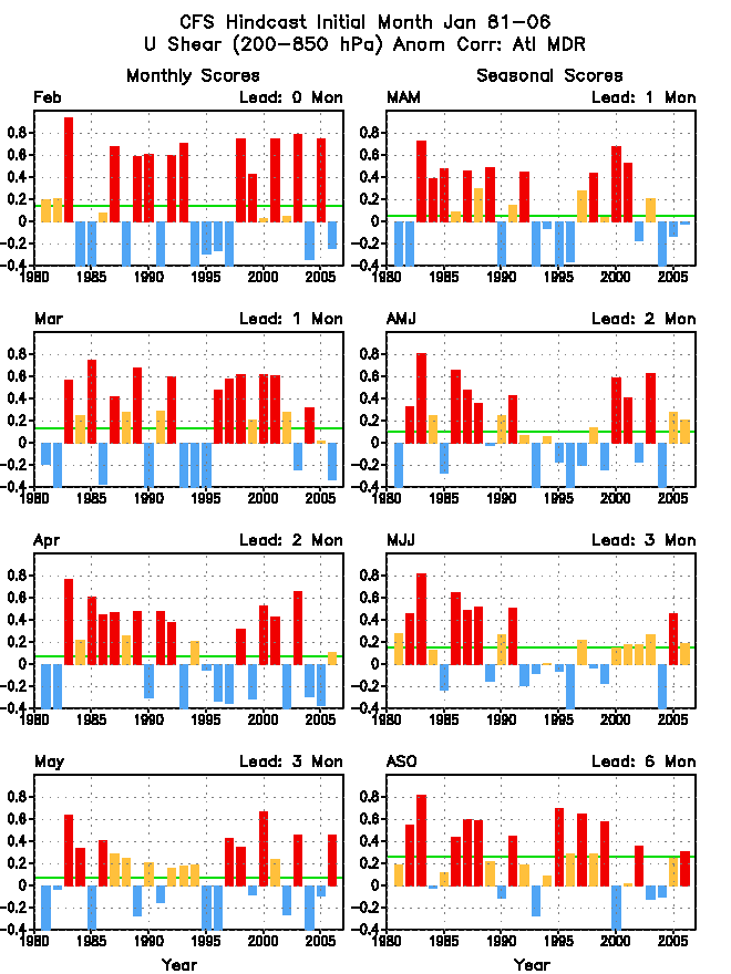
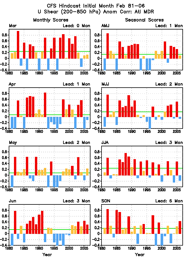
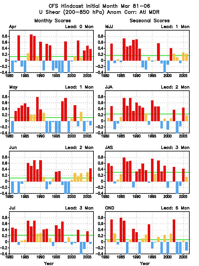
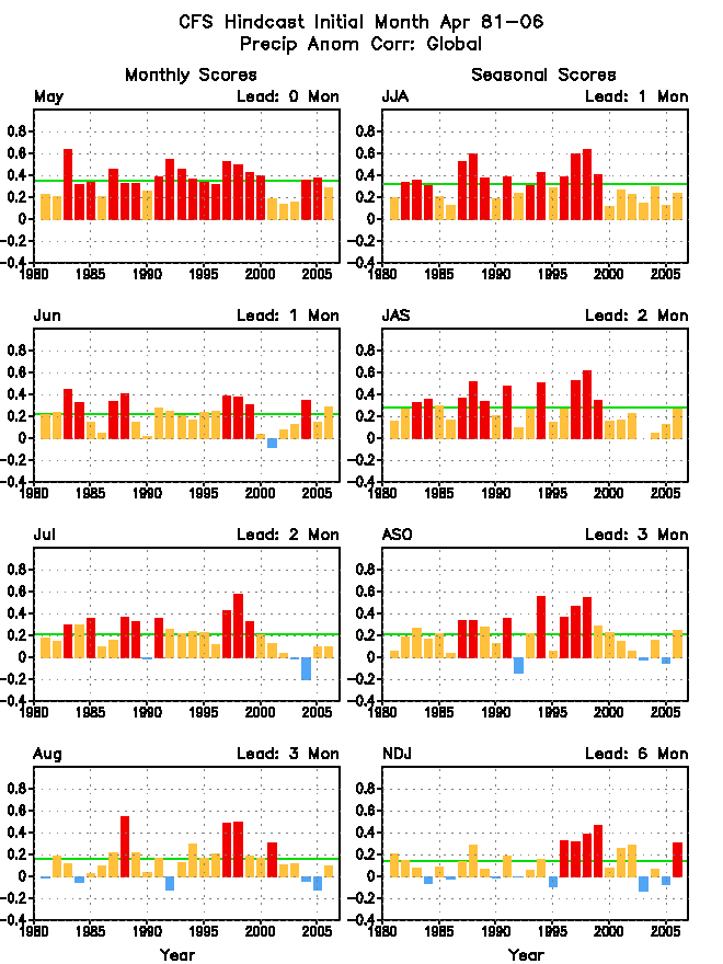
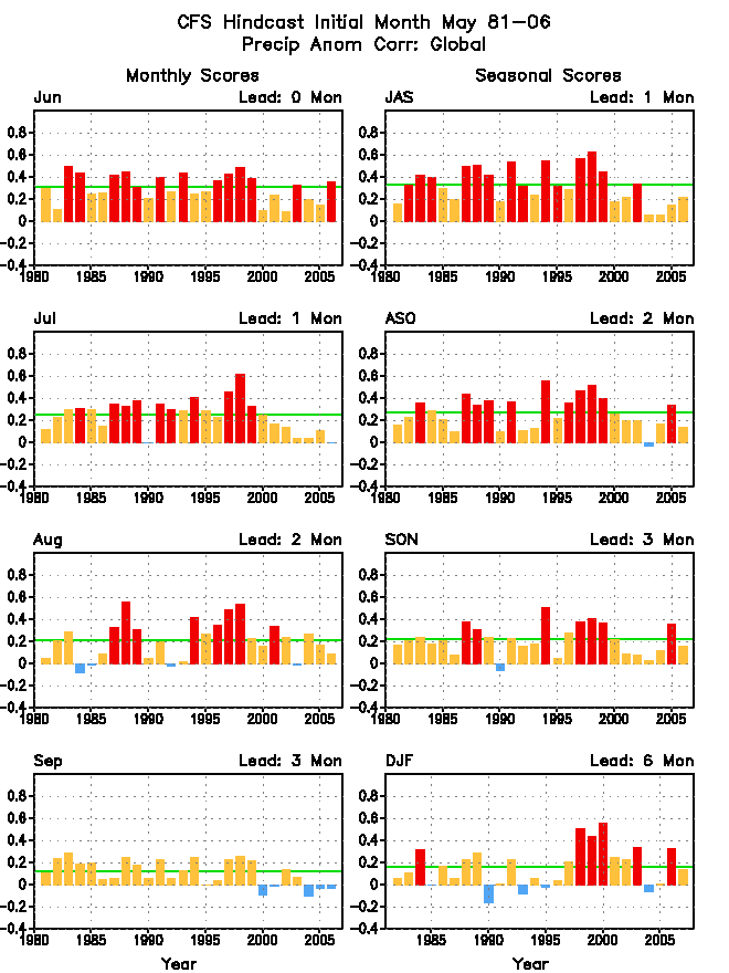
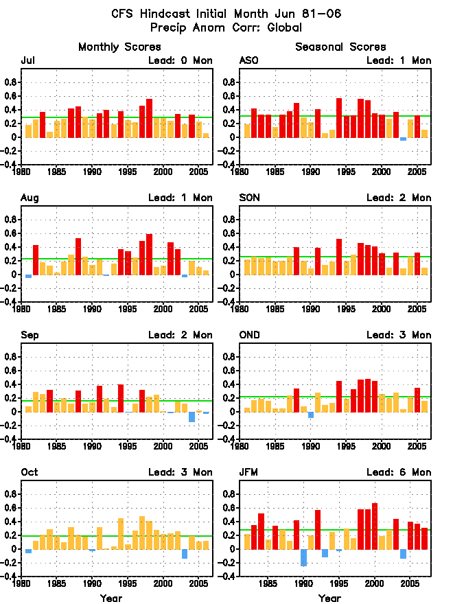
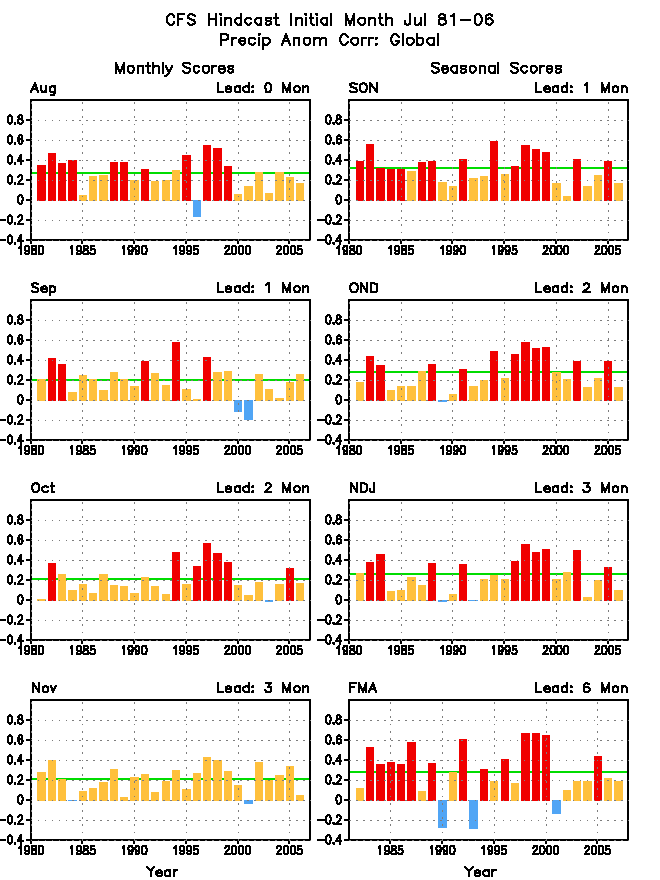
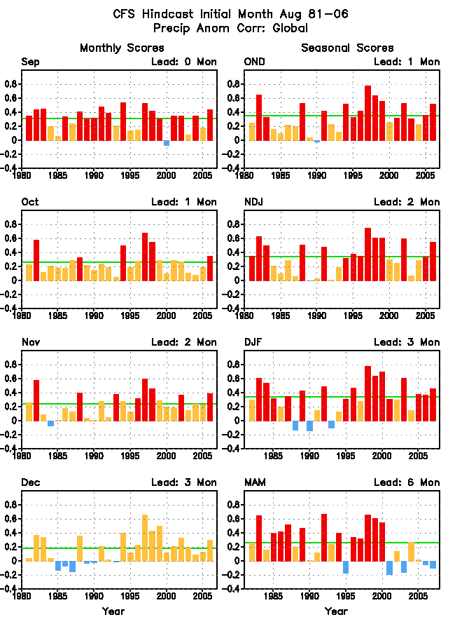
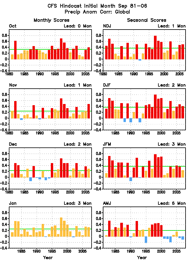
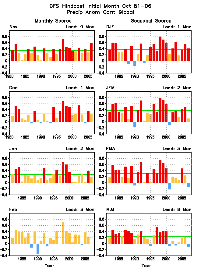
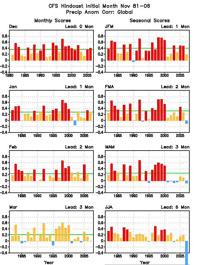
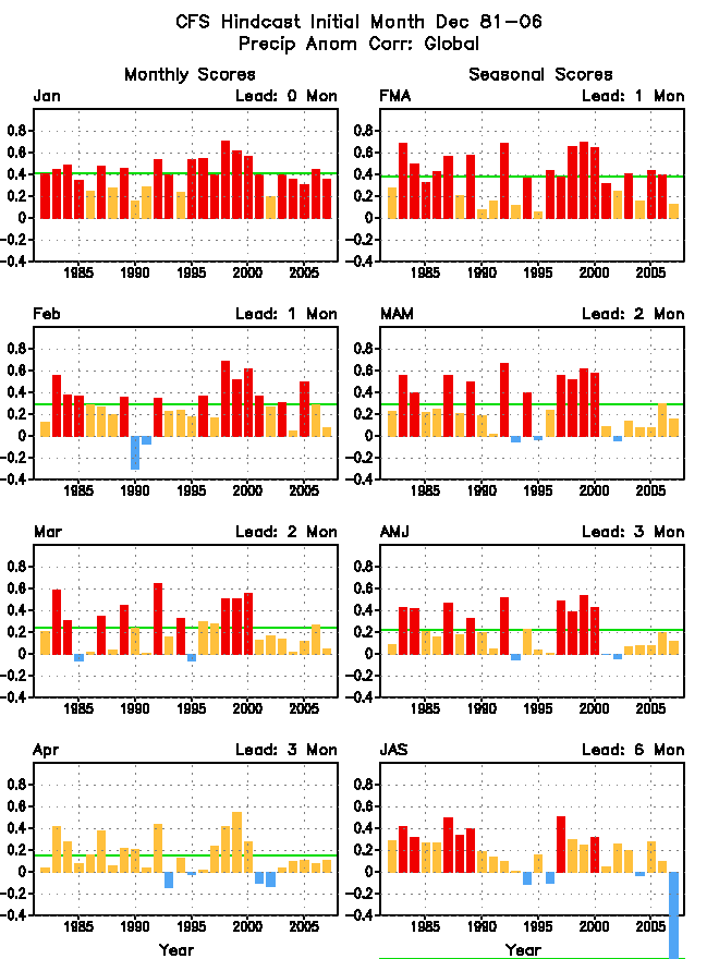
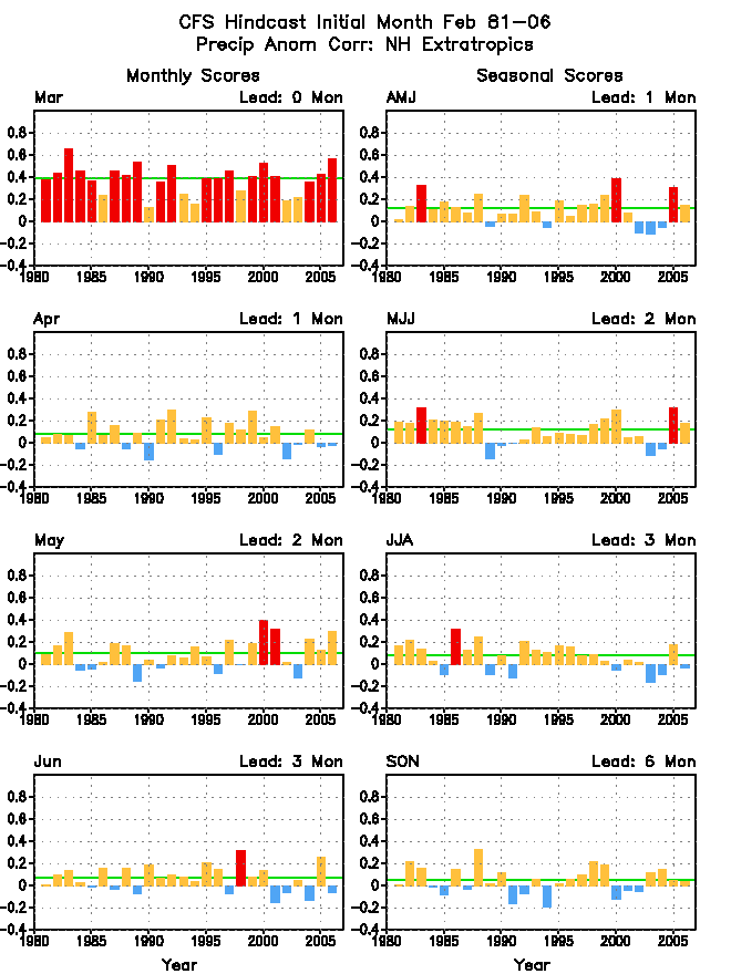
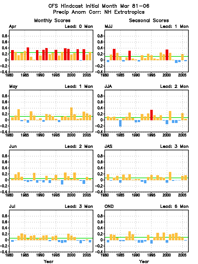
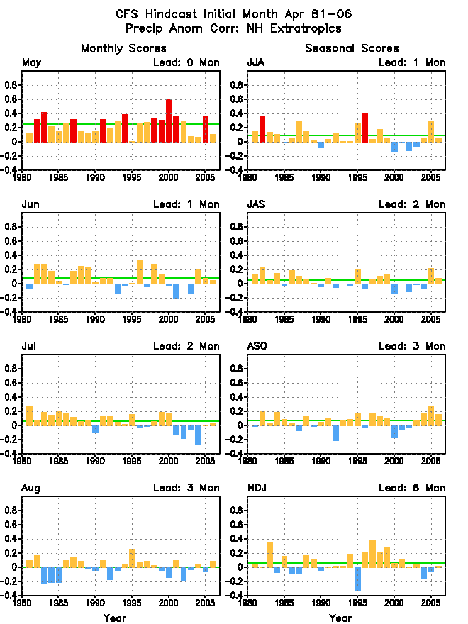
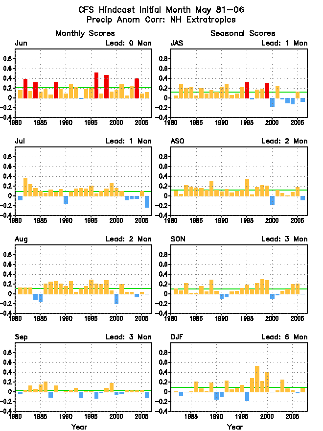
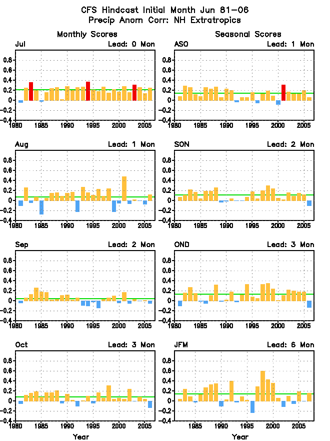
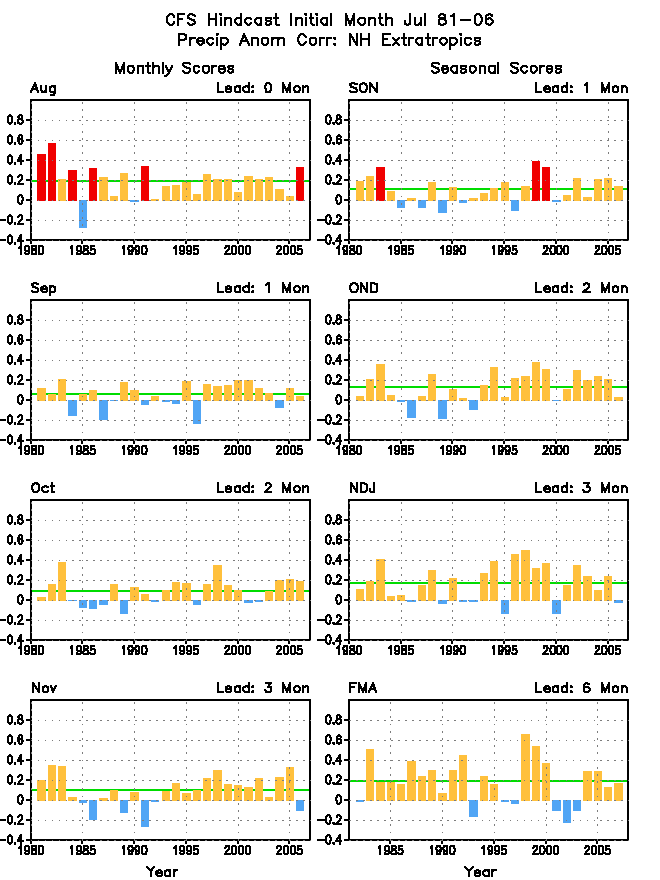
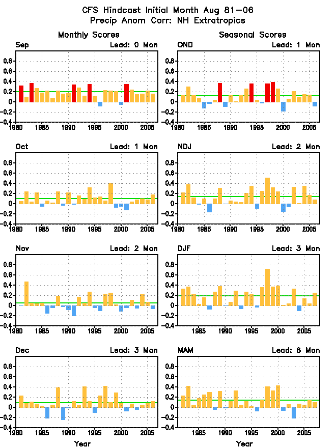
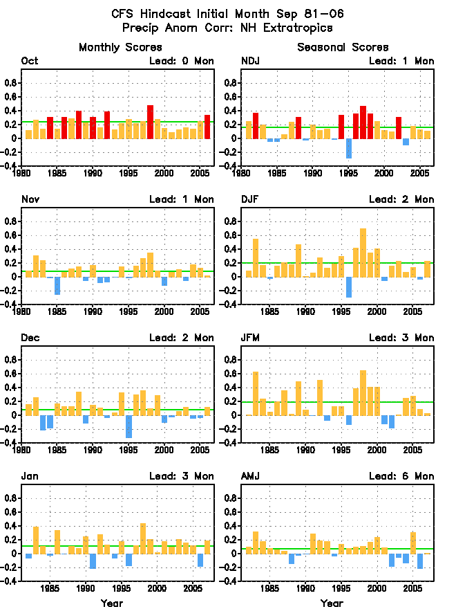
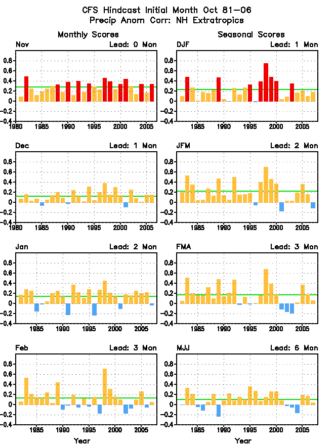
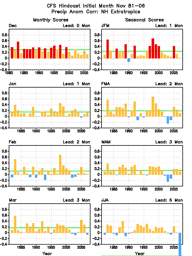
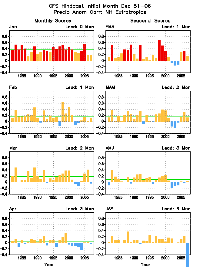
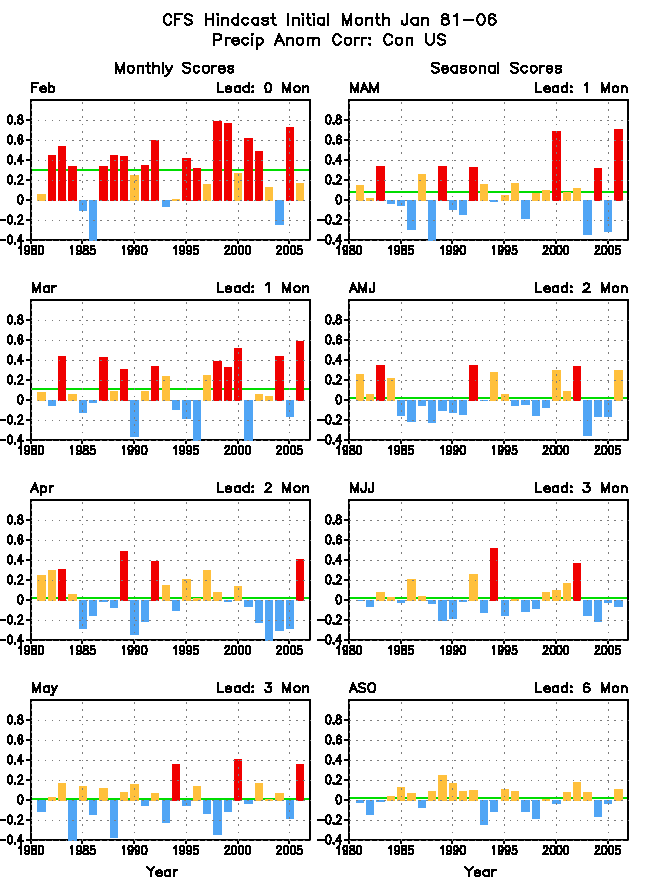
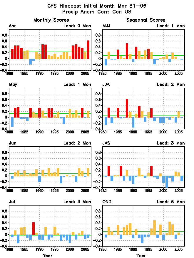
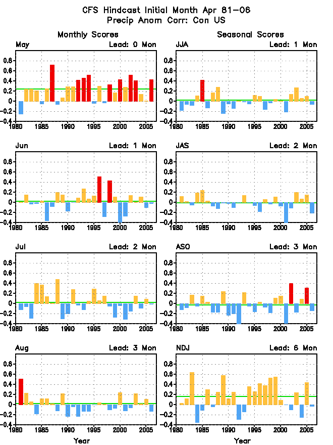
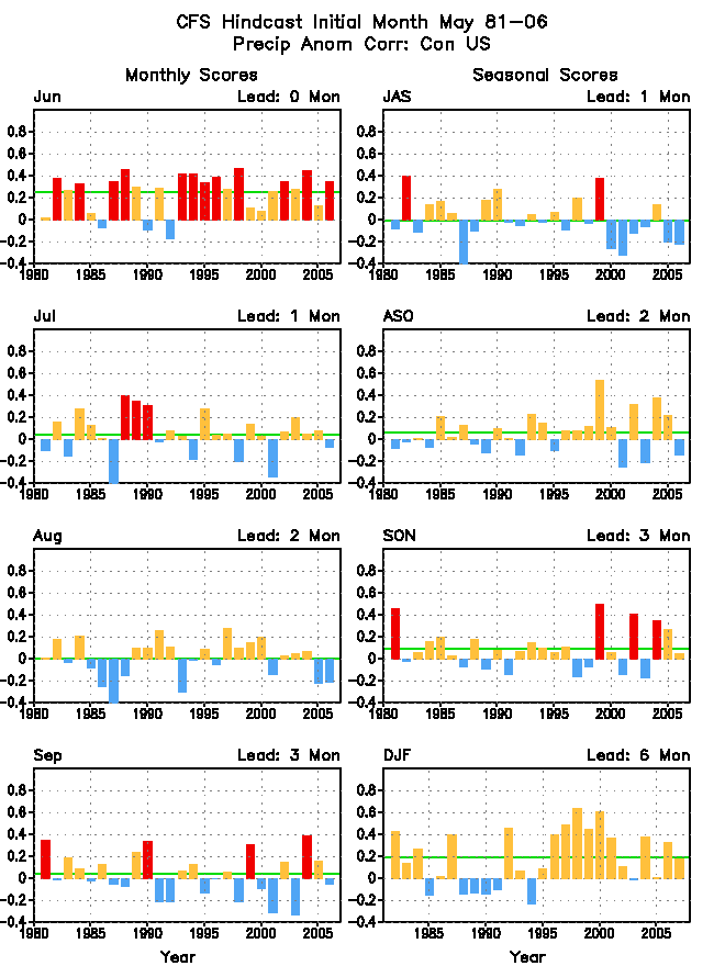
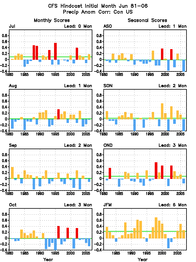
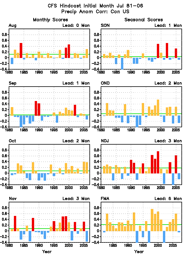
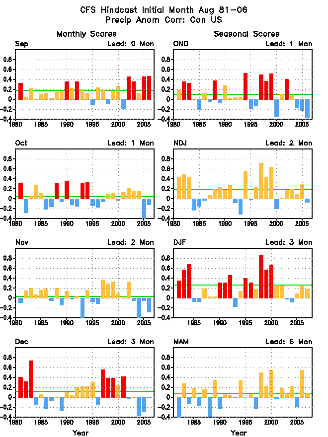
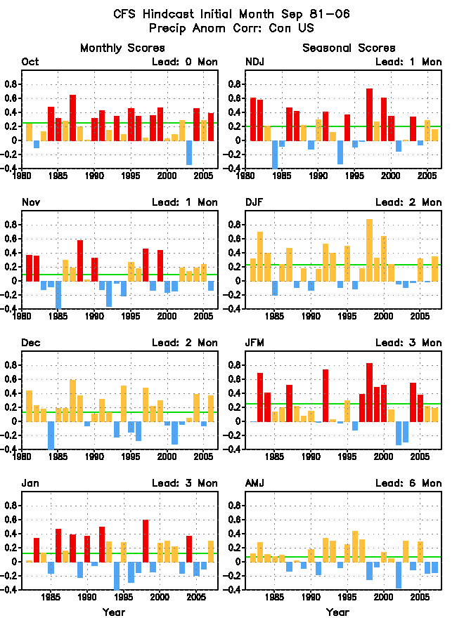
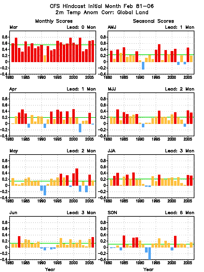
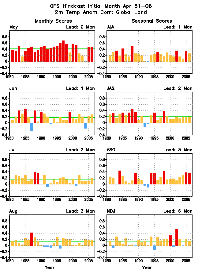
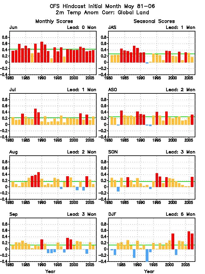
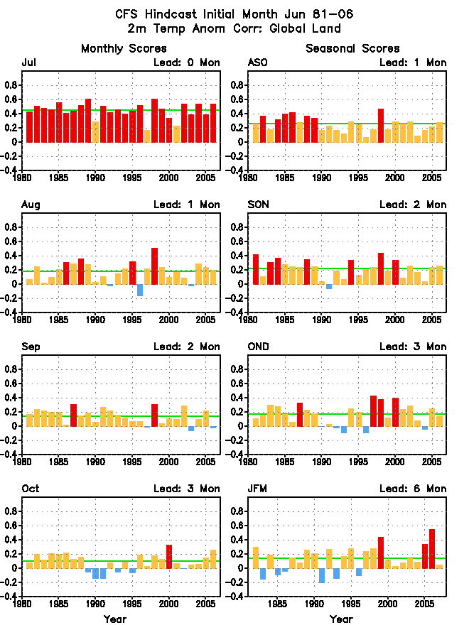
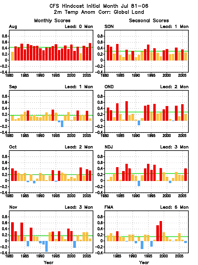
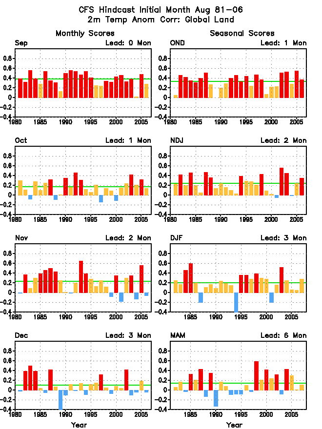
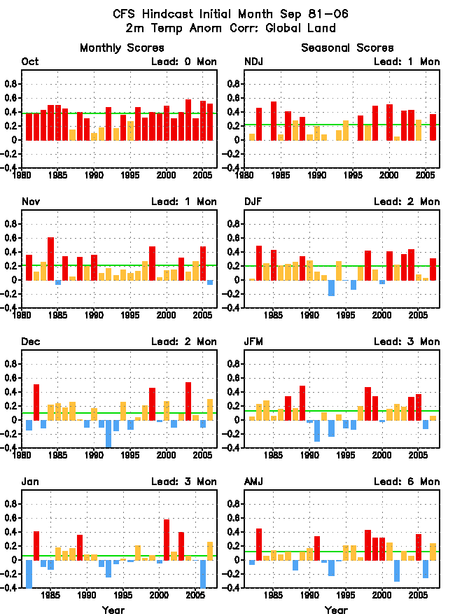
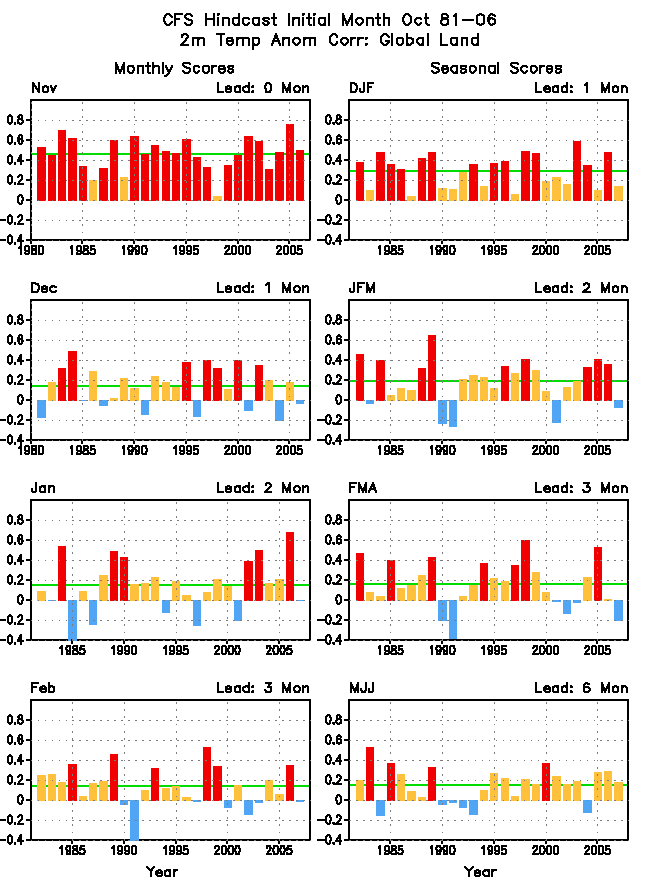
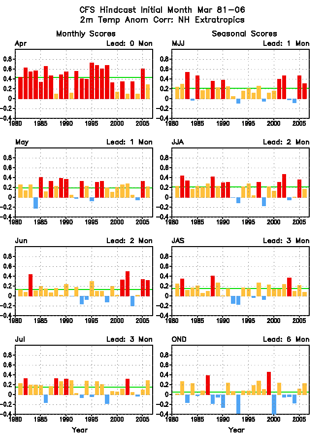
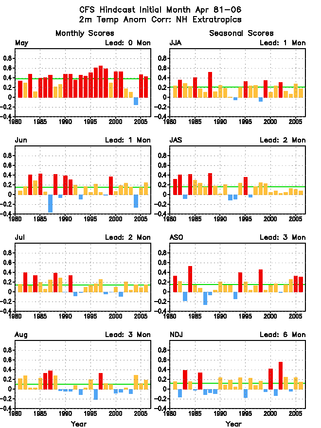
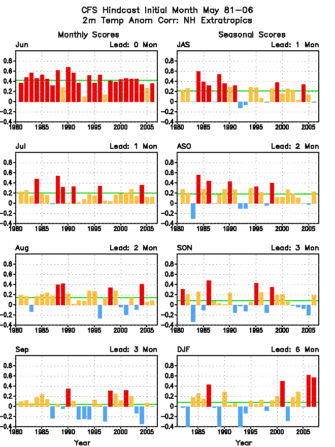
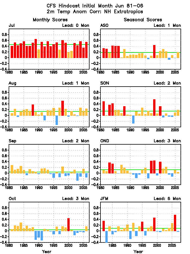
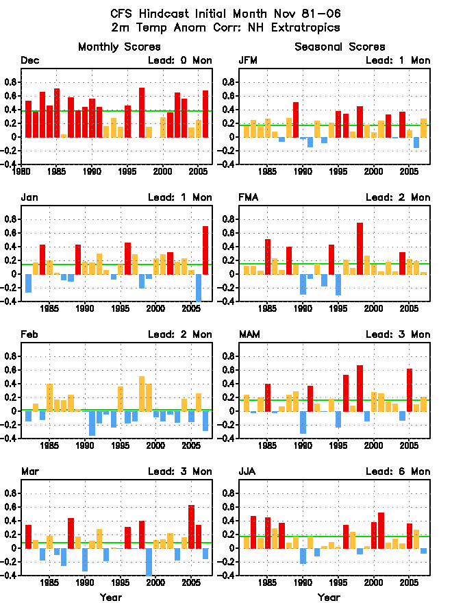
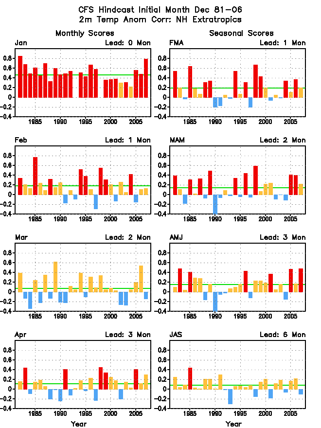
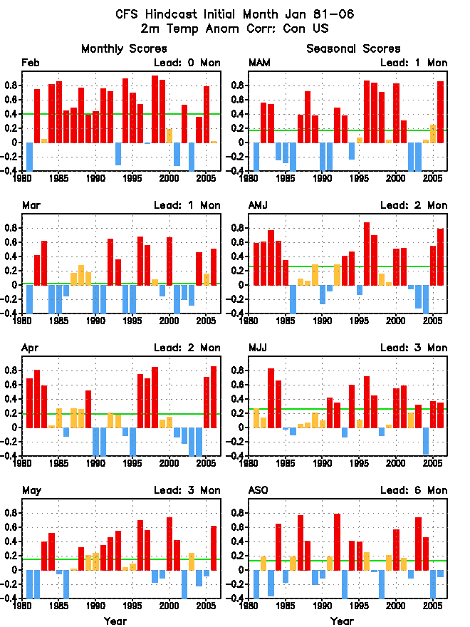
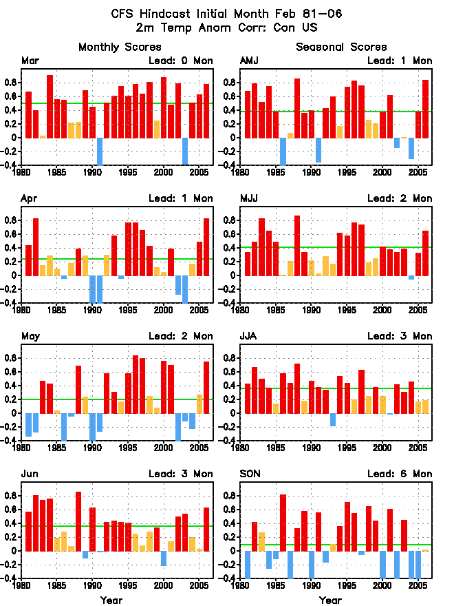
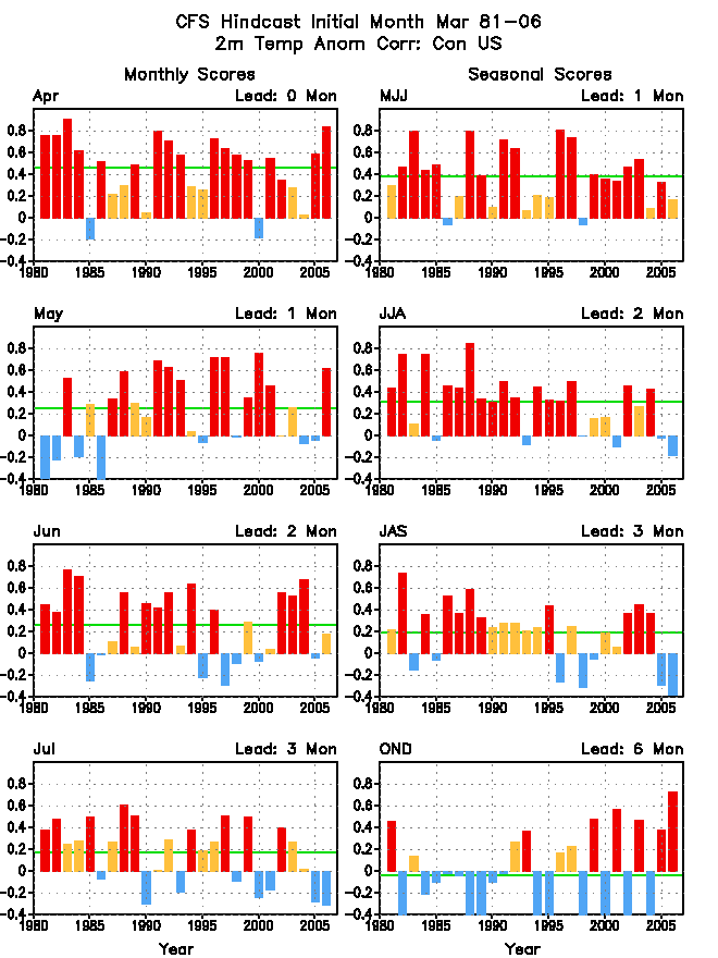
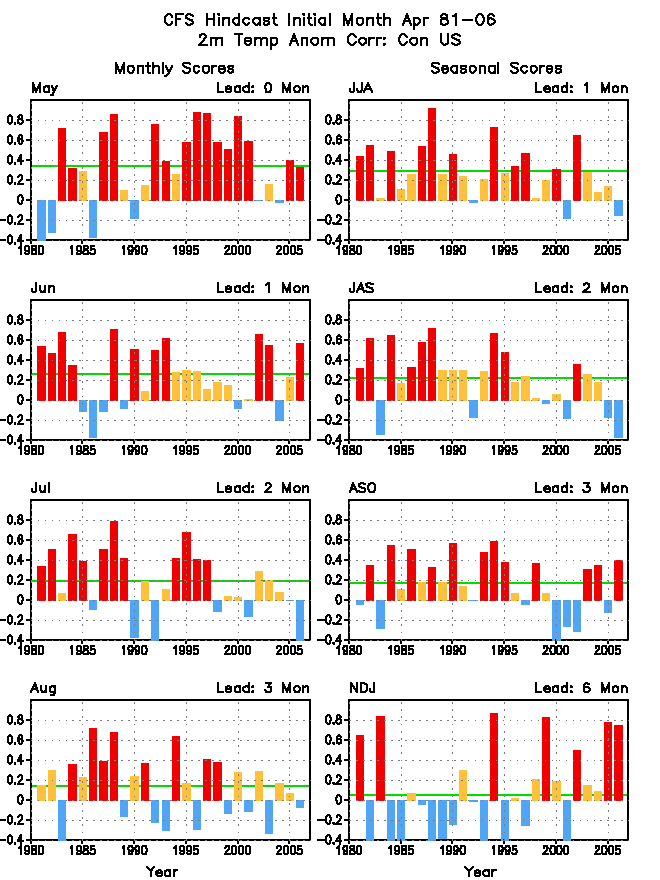
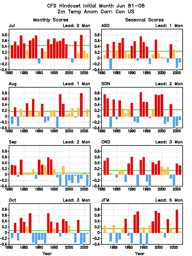
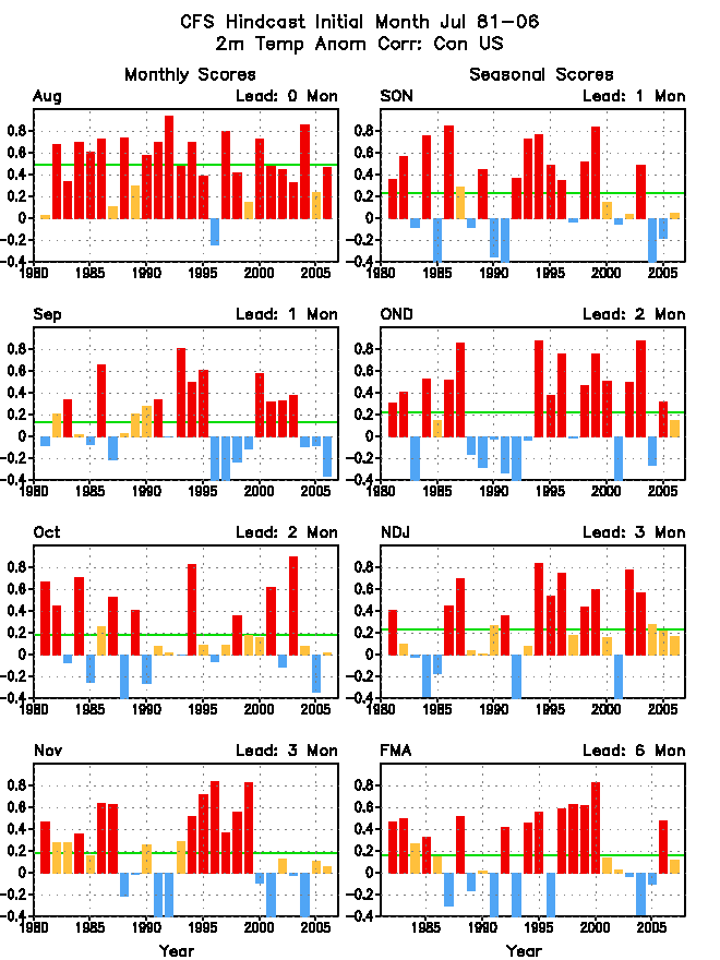
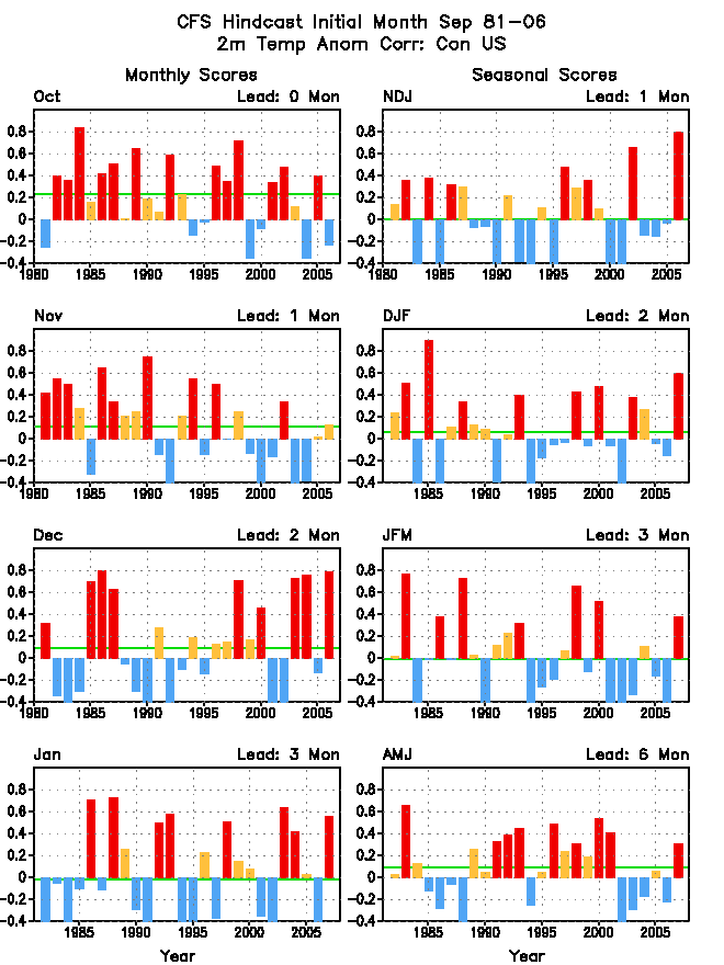
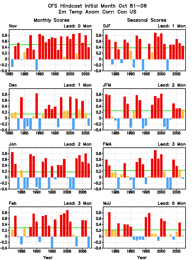
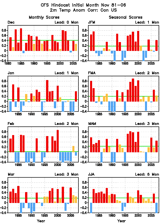
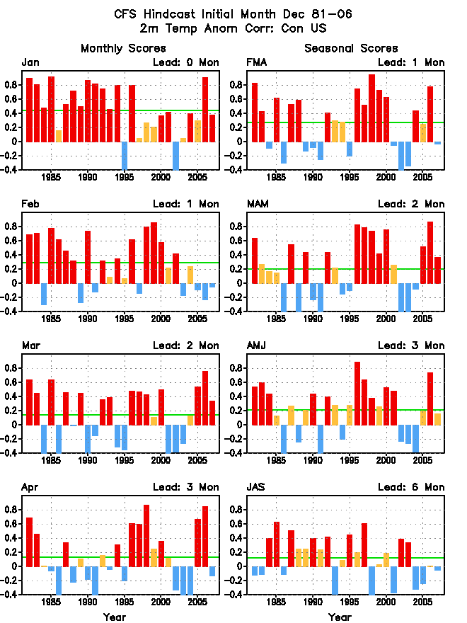
Spatial anomaly correlation
Spatial anomaly correlation is calculated for each starting month for all
hindcast year. Correlation for different areas is calculated for different variables, including:
Nino34 region (190E-240E/5S-5N), global, global tropics (20S-20N), tropical Pacific (20S-20N),
North Pacific (20N-60N), North Atlantic (10N-40N), hurricance MDR region (20W-80,10N-20N),
PNA sector (20-70N,180-60W), norther hemisphere (20N-70N), and the continental United States (US).
| Variable\Start month |
Jan |
Feb |
Mar |
Apr |
May |
Jun |
Jul |
Aug |
Sep |
Oct |
Nov |
dec |
| SST (Nino34) |
 |
|
|
|
|
|
|
|
|
|
|
|
| SST (global) |
|
|
|
|
|
|
|
|
|
|
|
|
| SST (global tropics) |
|
|
|
|
|
|
|
|
|
|
|
|
| SST (tropical Pacific) |
|
|
|
|
|
|
|
|
|
|
|
|
| SST (north Pacific) |
|
|
|
|
|
|
|
|
|
|
|
|
| SST (north Atlantic) |
|
|
|
|
|
|
|
|
|
|
|
|
| z200 (global) |
|
|
|
|
|
|
|
|
|
|
|
|
| z200 (northern hemisphere) |
|
|
|
|
|
|
|
|
|
|
|
|
| z200 (PNA sector) |
|
|
|
|
|
|
|
|
|
|
|
|
| z500 (global) |
|
|
|
|
|
|
|
|
|
|
|
|
| z500 (northern hemisphere) |
|
|
|
|
|
|
|
|
|
|
|
|
| z500 (PNA sector) |
|
|
|
|
|
|
|
|
|
|
|
|
| z700 (global) |
|
|
|
|
|
|
|
|
|
|
|
|
| z700 (northern hemisphere) |
|
|
|
|
|
|
|
|
|
|
|
|
| z700 (PNA sector) |
|
|
|
|
|
|
|
|
|
|
|
|
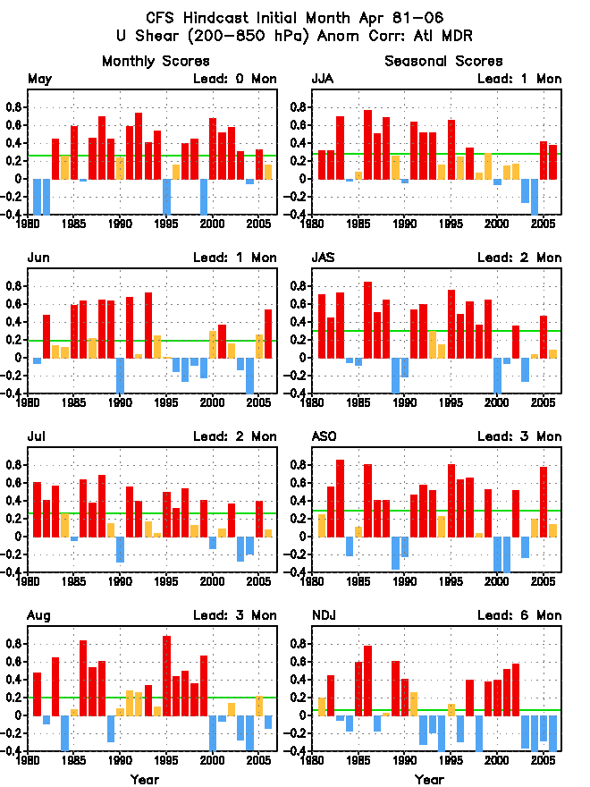
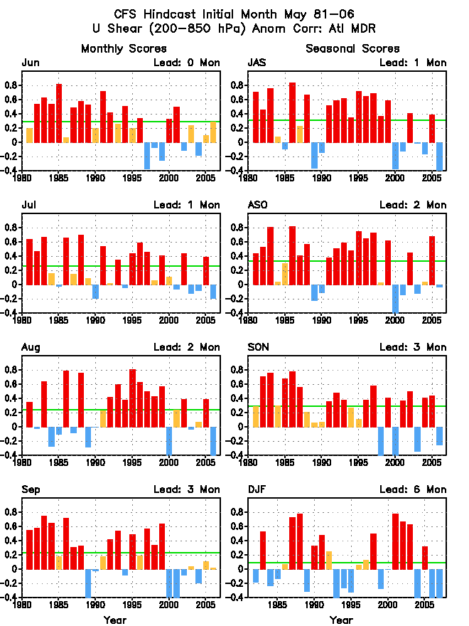
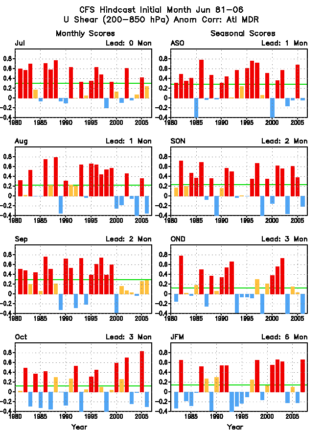
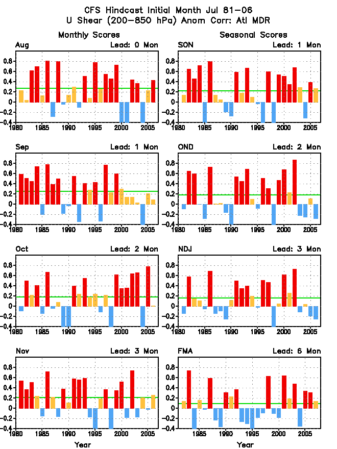
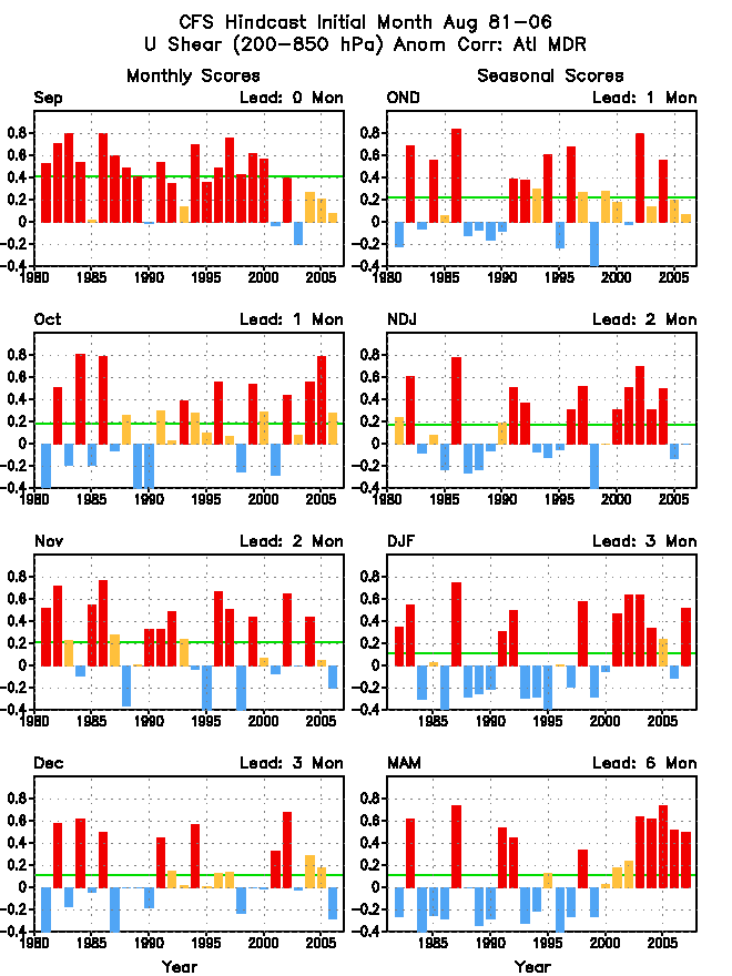
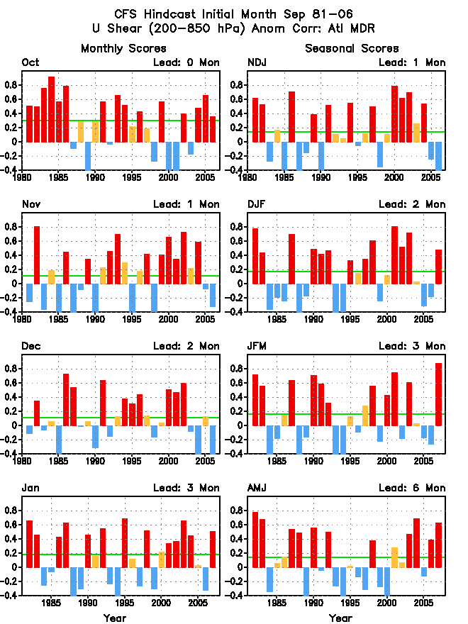
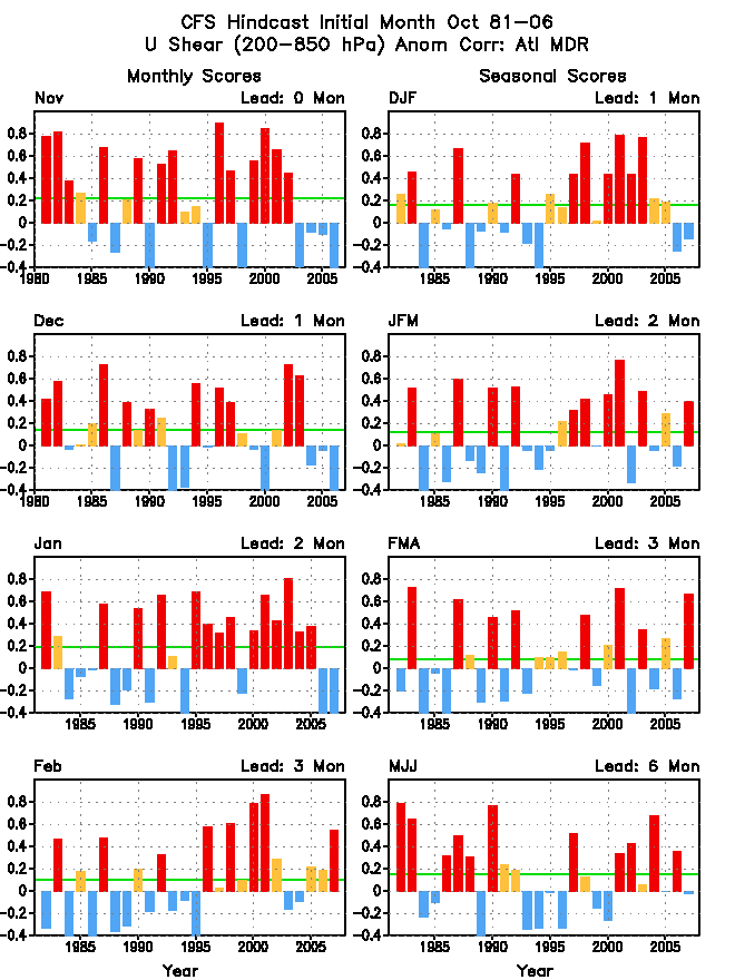
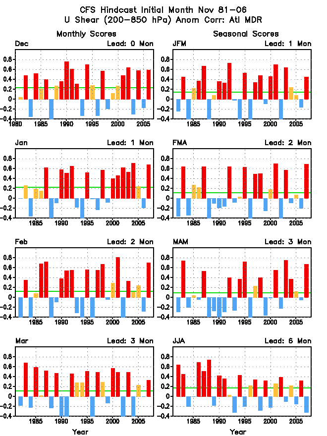
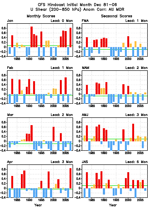
| u200-u850 (MDR) |
|
|
|
|
|
|
|
|
|
|
|
|
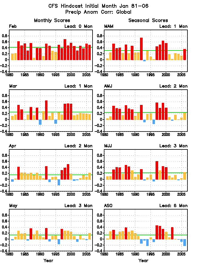
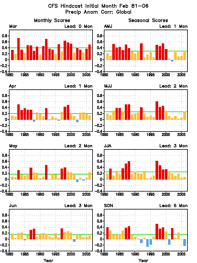
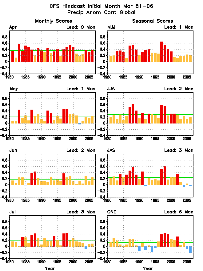
| precipitation (global) |
|
|
|
|
|
|
|
|
|
|
|
|
| precipitation (northern Hemisphere) |
|
|
|
|
|
|
|
|
|
|
|
|
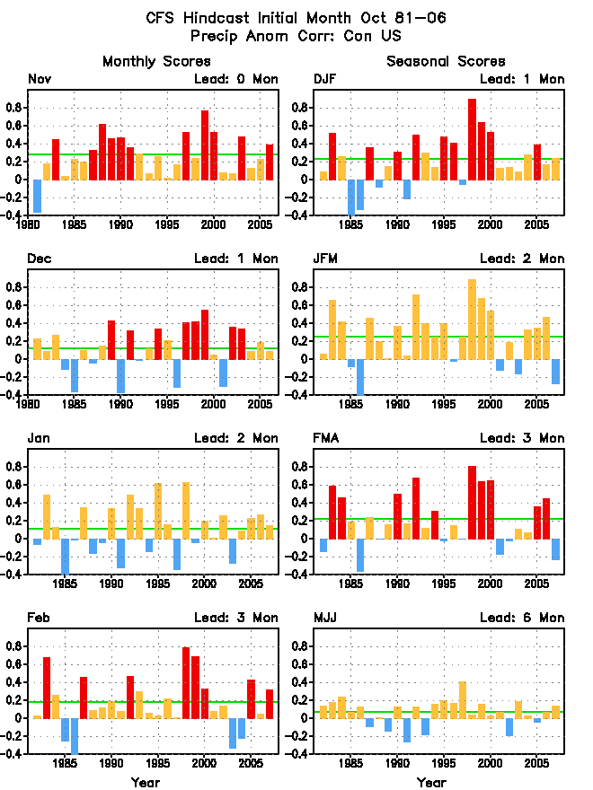
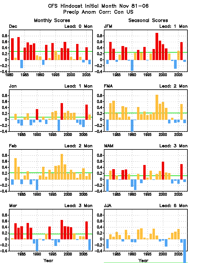
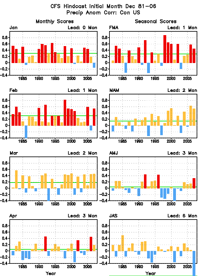
| precipitation (US) |
|
|
|
|
|
|
|
|
|
|
|
|
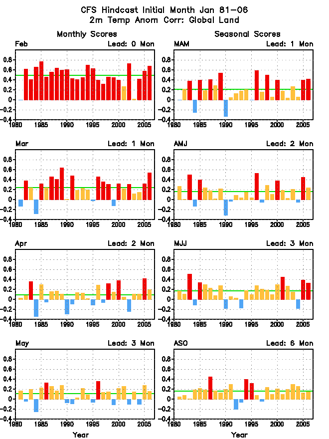
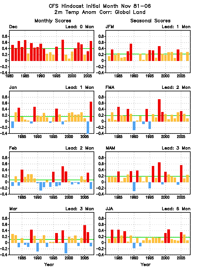
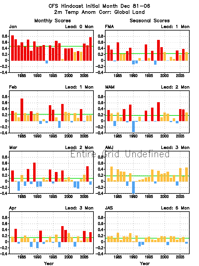
| T2m (global land) |
|
|
|
|
|
|
|
|
|
|
|
|
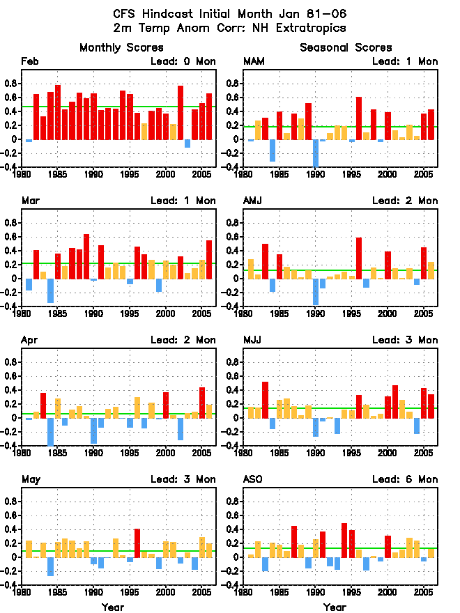
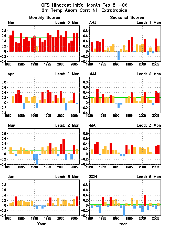
| T2m (northern hemisphere land) |
|
|
|
|
|
|
|
|
|
|
|
|
| T2m (US) |
|
|
|
|
|
|
|
|
|
|
|
|