The Tropospheric Seasonally Varying Mean Climate over the Western
Hemisphere (1979-1995)
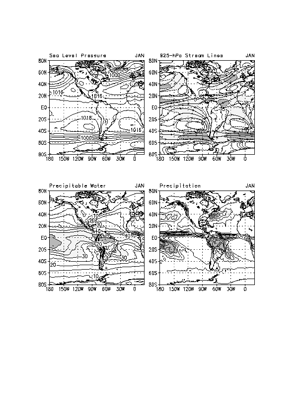
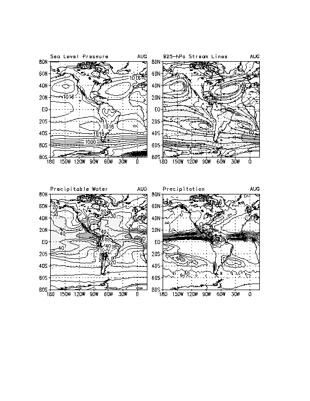
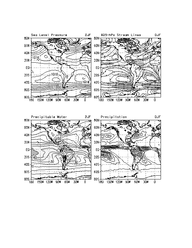
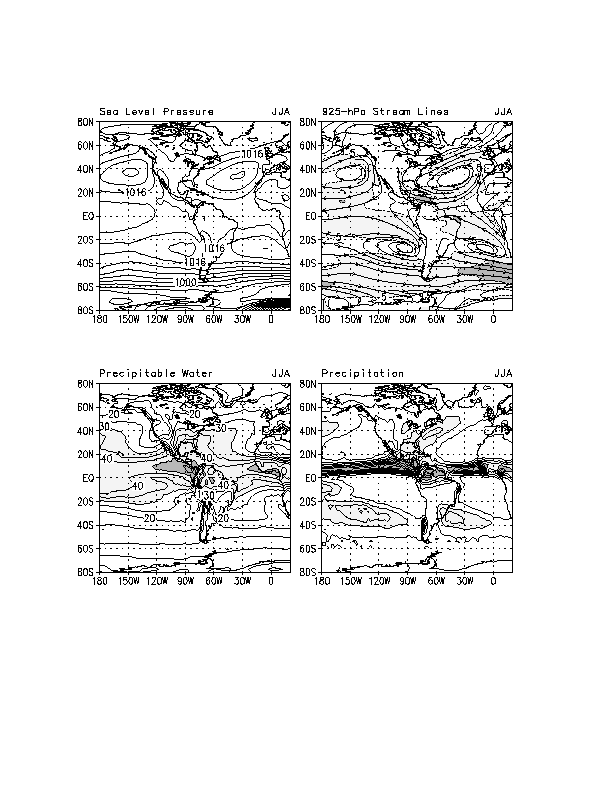
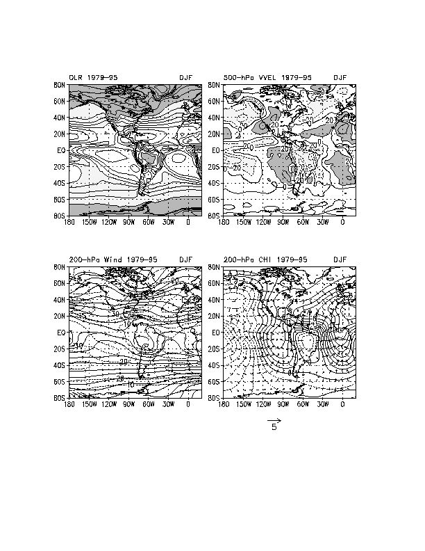
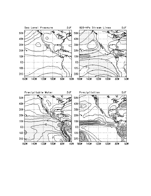
Large seasonal variations in SLP are evident over the middle and high latitudes of the North Pacific and North Atlantic Oceans (e.g., compare Figs. 5, 12, 17 and 19). Strong cyclonic flow and low pressure dominate the regions of the Aleutian Islands and Iceland during the boreal winter (Fig. 17), while during the boreal summer (Fig. 19) high pressure and anticyclonic flow prevail over the middle latitudes of both oceans. There is a marked northwestward shift from winter to summer in the central positions, and an increase in central pressures, of the North Pacific and North Atlantic subtropical high pressure systems. The opposite trend in pressure is evident over the US, with SLP being higher during winter and lower during summer.
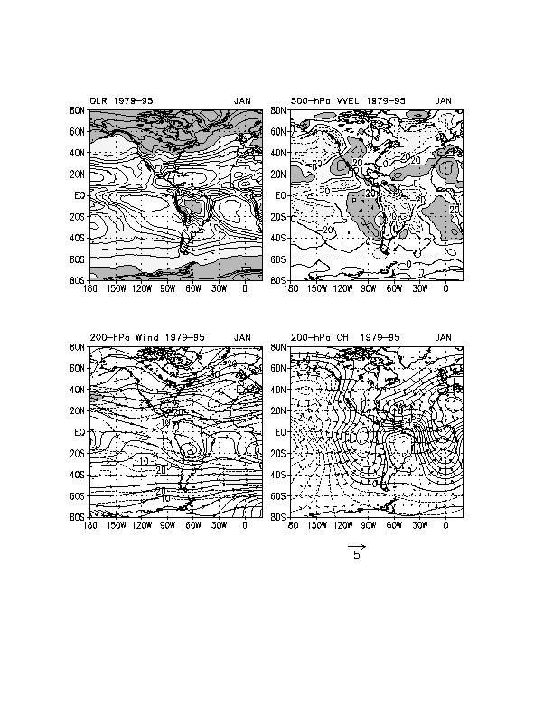
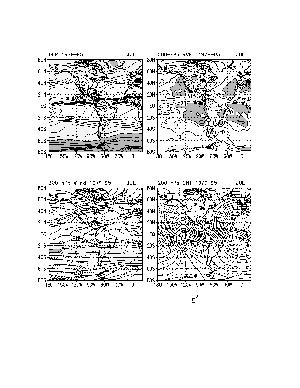
The westerlies over the central North Pacific and eastern North America weaken and the maxima (jet streams) shift northward from winter to summer (Figs.21, 27, 33 and 35). The northward shift of the westerlies over eastern North America is most pronounced, with the maximum westerlies shifting from the Southeast US during January-March to southern Canada during July and August. The upper-tropospheric circulation over North America switches from cyclonic during winter to anticyclonic during summer, associated with the seasonal variation in thermal forcing over the continent.
The strong jet exit region over the eastern North Pacific during boreal winter (Fig. 33) is accompanied by a pattern of ascending (descending) motion in the left (right) front quadrant of the jet. Precipitation is heaviest over the eastern Pacific in the poleward portion of the jet exit region (Fig. 17). Orographic effects enhance upward vertical motion and precipitation along the west coast of North America from British Columbia south through the northwestern US. The maximum in precipitation over the eastern North Pacific is weaker during summer (Fig. 19) and does not extend as far eastward. This is consistent with the increase in SLP and northwestward shift of the subtropical high over the eastern North Pacific, and the weaker jet exit region during summer (compare Figs. 17, 19, 33, and 35).
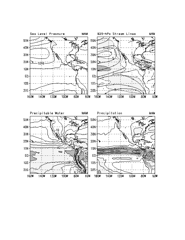
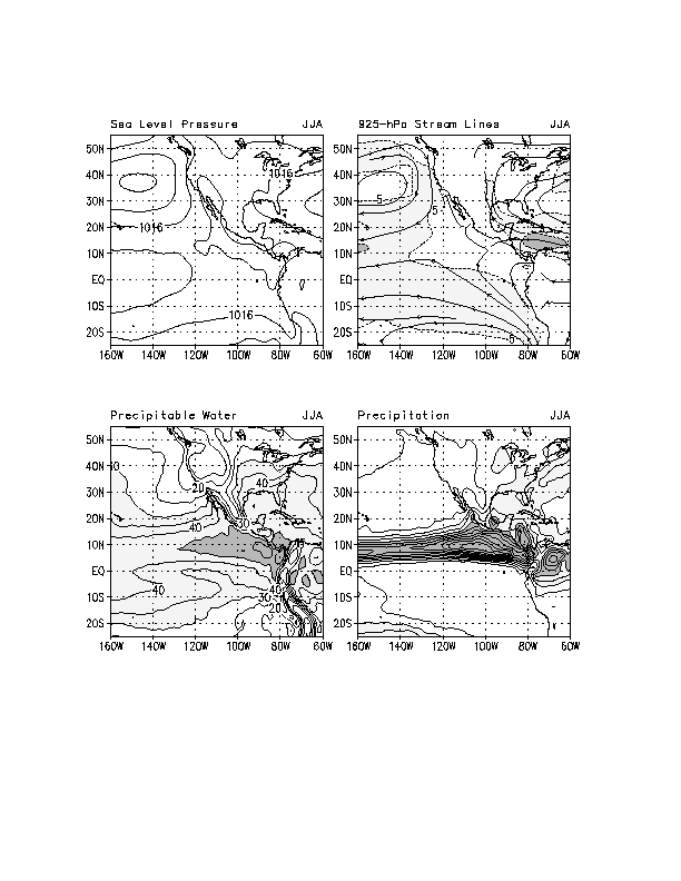
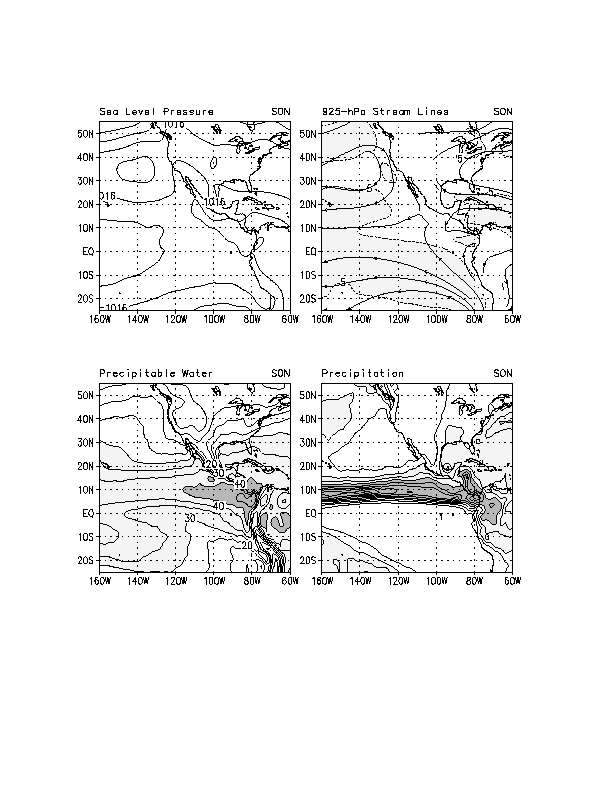
Weak low-level southerly flow over the southern US during winter (Fig. 81) is replaced by substantially stronger southerly flow during the spring, summer and fall seasons (Figs. 82, 83 and 84) . Precipitable water increases over the southern US during spring, reaches a maximum during summer and decreases in the fall. The annual cycle of precipitable water in this region partly reflects the annual cycle in the low-level advection of moisture from the Gulf of Mexico northward over the region, and partly reflects the increase in temperature and moisture carrying capacity of the air during the warm season. Over the north-central US and western High Plains precipitation is greatest during summer in association with the higher amounts of precipitable water and lower static stability.