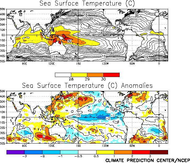
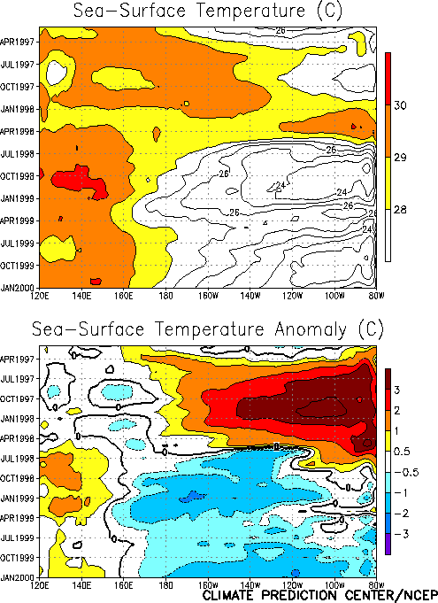
Mature cold episode conditions continued throughout
the tropical Pacific during January, as sea surface temperatures (SST) remained more than
1.0°C below normal across most of the equatorial Pacific east of 170°E, and dropped to
more than 2.0°C below normal between 135°W and 115°W (Fig. T18).
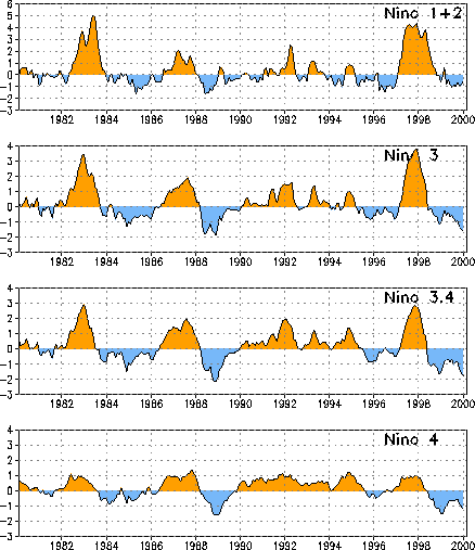
In association with this cooling, the SST indices in the Niño 3 and Niño 3.4 regions
decreased to -1.6 and -1.8, respectively. These are the lowest index values observed in
these regions since the 1988/89 cold episode, and are also lower than the anomalies
observed last winter (Fig. T5). However, SSTs in the
central Pacific have remained near 1.0°C below normal, which as not as low as the
anomalies observed last winter (Table T2, Fig. T5).
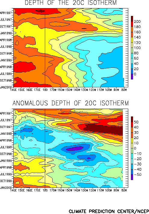
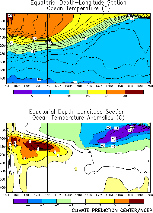
The oceanic thermocline remained shallower than normal across the east-central and
eastern equatorial Pacific during the month, and again deepened in the west-central and
western Pacific (Fig. T15). Consistent with this pattern,
temperatures at thermocline depth remained more than 5°C below normal in the east-central
Pacific, and increased to 5-6°C above normal in the western Pacific (Fig.
T17). This overall thermocline structure has been extremely persistent since the
beginning of the current La Niña episode.
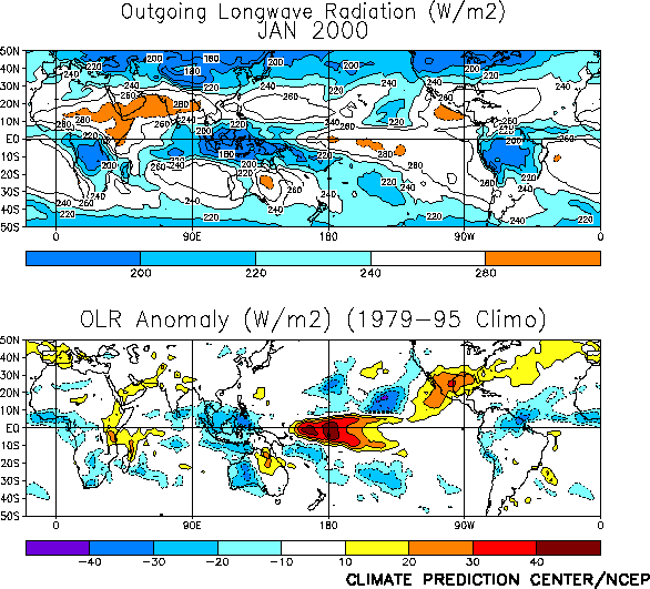
Tropical convection [as inferred from anomalous outgoing longwave radiation (OLR)] was
suppressed over the western and central equatorial Pacific during January, and enhanced
over Indonesia (Fig. T25). Convection has been suppressed
across the central equatorial Pacific since the onset of cold episode conditions in late
May 1998 (Fig. T8).
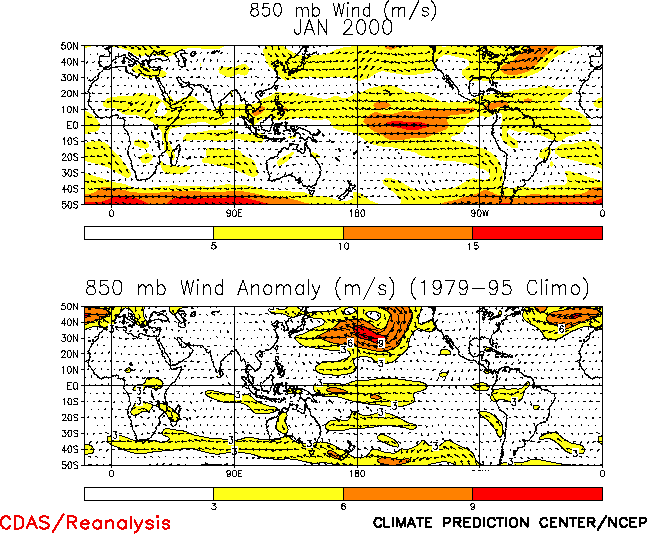
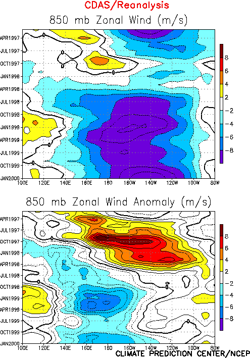
The pattern of tropical convection over the central and western Pacific was again
accompanied by low-level (850 hPa) easterly wind anomalies across the central and western
tropical Pacific (Fig. T20). Anomalous easterlies have
prevailed in this region since May 1998 (Fig. T7). The
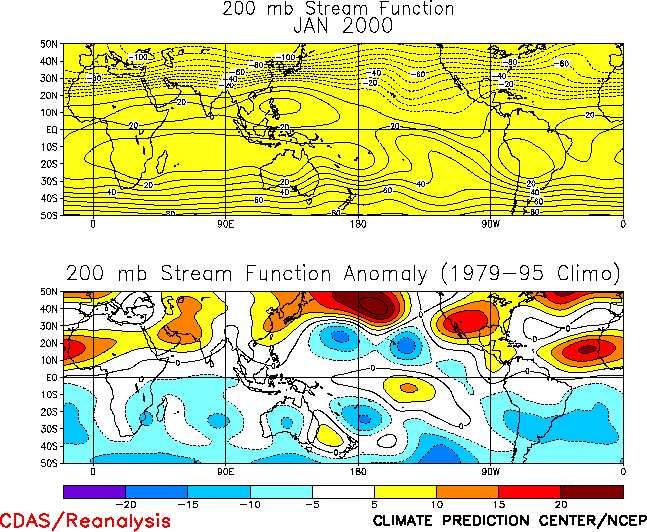
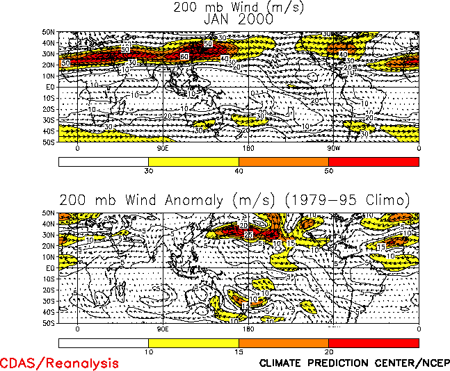
upper-level atmospheric circulation (200 hPa) in the Tropics and subtropics also remained
consistent with mature cold episode conditions, with well-developed upper-level troughs
observed over the low-latitudes of the central Pacific in both hemispheres (Fig. T22) and enhanced equatorial westerlies observed across
the central Pacific (Fig. T21).
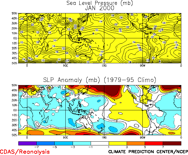
The pattern of sea level pressure (SLP) anomalies during January featured positive
anomalies across the tropical Pacific and negative anomalies over Indonesia and the
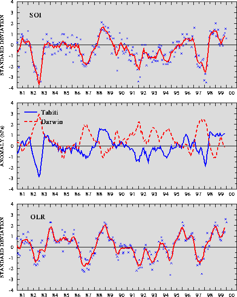
eastern Indian Ocean, which is consistent with the ongoing cold episode (Fig. T19). This anomalous SLP pattern is indicated by
positive values of the Southern Oscillation Index (SOI) (Table T1,
Fig. T1) and the equatorial SOI (Fig.
T2), which were 0.6 and 2.7, respectively during January.
Editor’s Note: The climatology used to compute SST anomalies has been
changed from the 1950-79 period to the 1961-90 base period. The change affects the Niño
index anomalies in Table T2, the time series in Fig. T5, and the anomalies in Figs. T9 and T18.


