|
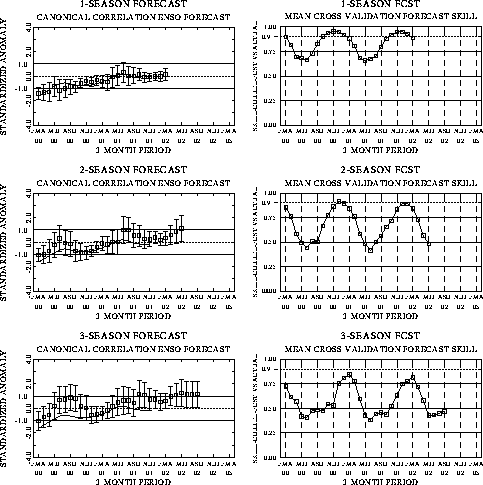
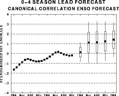
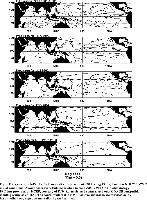
The canonical correlation analysis (CCA) forecast
of SST in the central Pacific (Barnett et al. 1988, Science, 241, 192-196;
Barnston and Ropelewski 1992, J. Climate, 5, 1316-1345), is shown in Figs.
F1 and F2. This forecast is produced
routinely by the Prediction Branch of the Climate Prediction Center. The predictions from
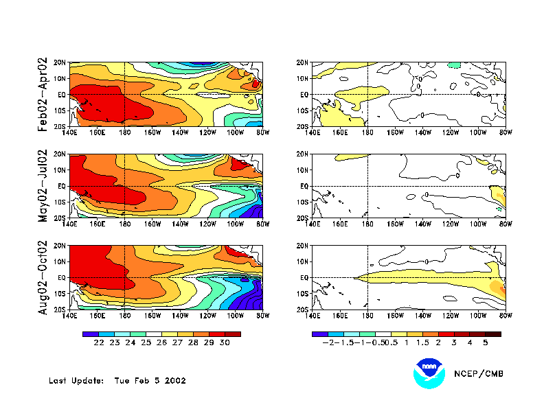
the National Centers for Environmental Prediction (NCEP) coupled ocean/atmosphere model
(Ji et al. 1998, Mon. Wea. Rev, 126, 1022-1034) are presented in Figs. F3 and F4. Predictions from the latest
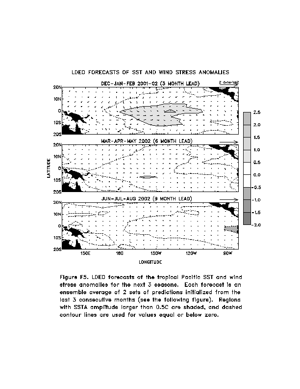
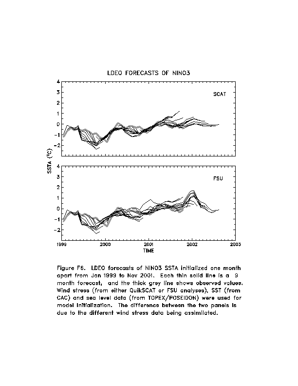
version of the LDEO model (Chen, D., M. A. Cane, S. E. Zebiak, Rafael Canizares and A.
Kaplan, 2000, Geophys. Res. Let., accepted) are shown in Figs. F5 and F6. Predictions using linear
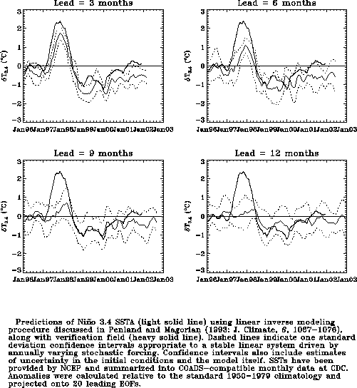
inverse modeling (Penland and Magorian 1993, J. Climate, 6, 1067-1076) are
shown in Figs. F7 and F8.
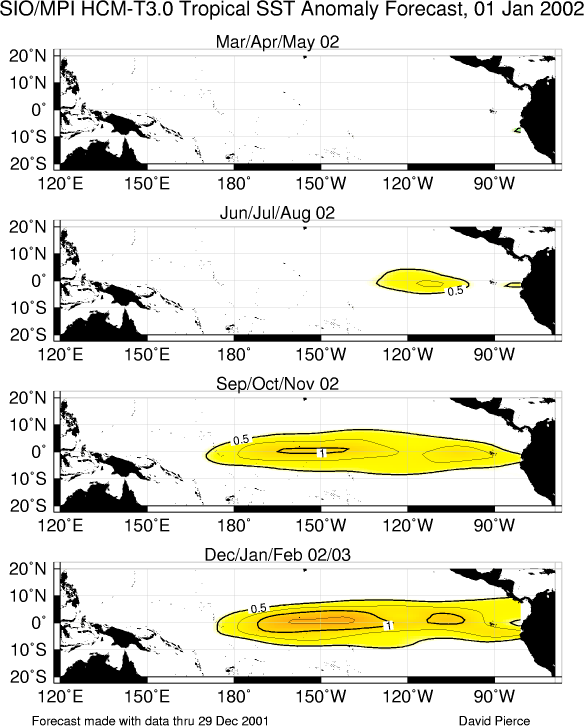
Predictions from the Scripps / Max Planck Institute (MPI) hybrid coupled model (Barnett et
al. 1993, J. Climate, 6, 1545-1566) are shown in Fig. F9.
Predictions from the ENSO-CLIPER statistical model (Knaff, J. A. and C. W. Landsea
1997, Wea. Forecasting, 12, 633-652) are shown in Fig. F10.
The CPC and the contributors to the Forecast
Forum caution potential users of this predictive information that they can expect only
modest skill.
Outlook
Based on the observed oceanic and atmospheric circulation patterns and their recent
evolution, and the time of year, it seems most likely that warm episode (El Niño)
conditions will develop in the tropical Pacific during the next 3 months.
Discussion
The evolution towards a warm episode in the tropical Pacific continued during January
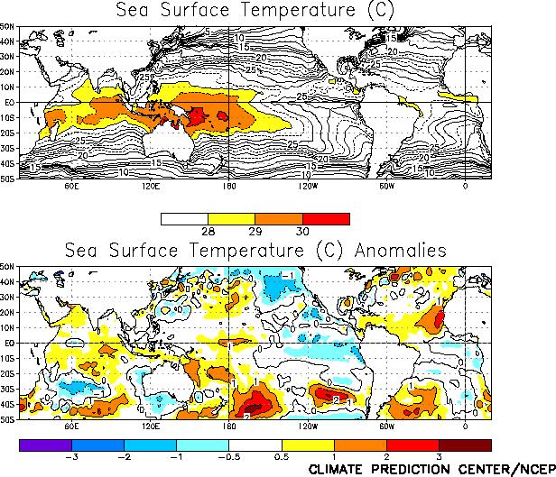
2002. Since June 2001 sea surface temperatures (SSTs) have become anomalously warm in the
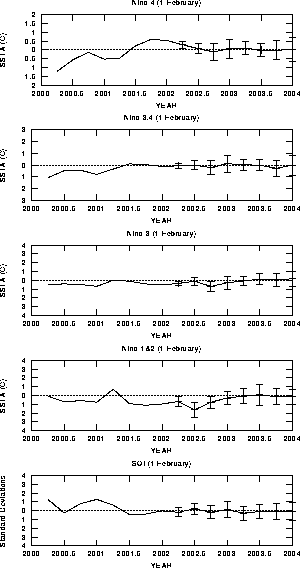
central equatorial Pacific (Fig. T9), with anomalies
exceeding +1°C in the vicinity of the date line during January 2002 (Fig.
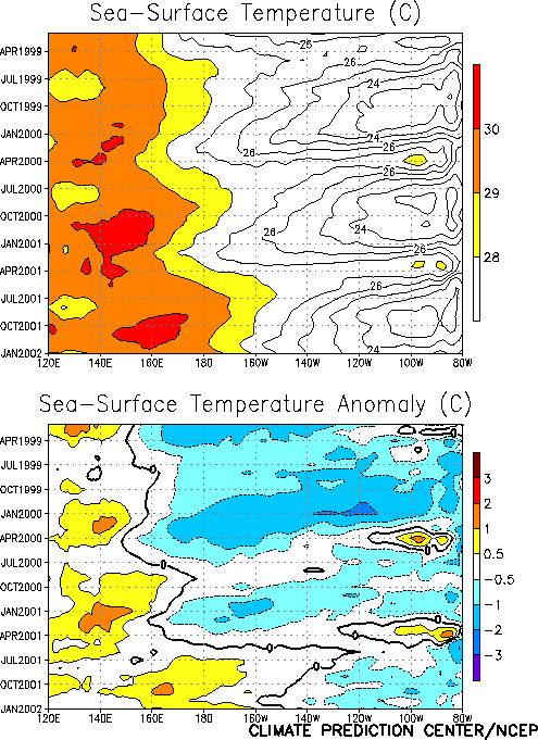
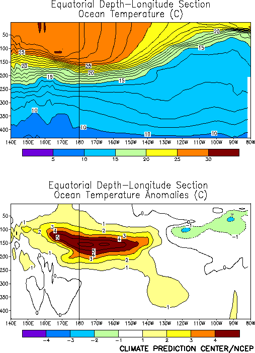
T18). Warmer-than-normal subsurface waters continued to expand eastward beyond the
date line during the month (Fig. T15). A
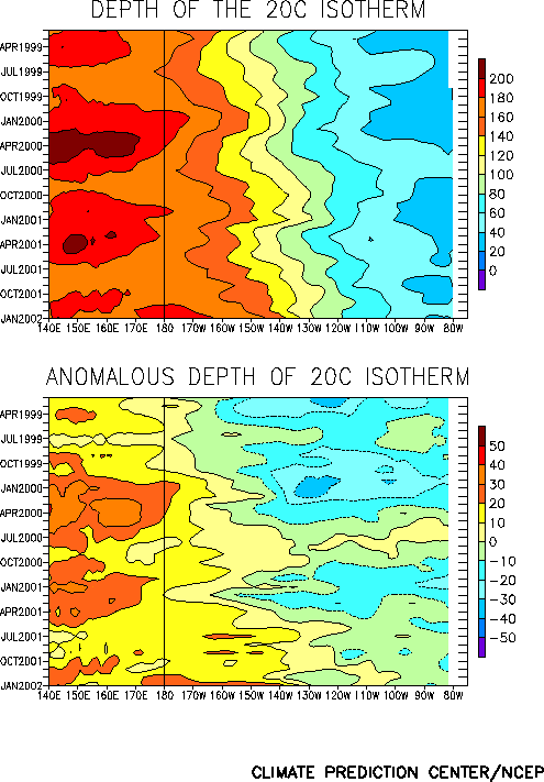
substantial increase in subsurface temperature anomalies was observed in the central and
west-central equatorial Pacific during the month (Fig. T17).
In recent months many tropical Pacific atmospheric and oceanic variables have been
influenced by intraseasonal (30-60 day) fluctuations associated with the Madden-Julian
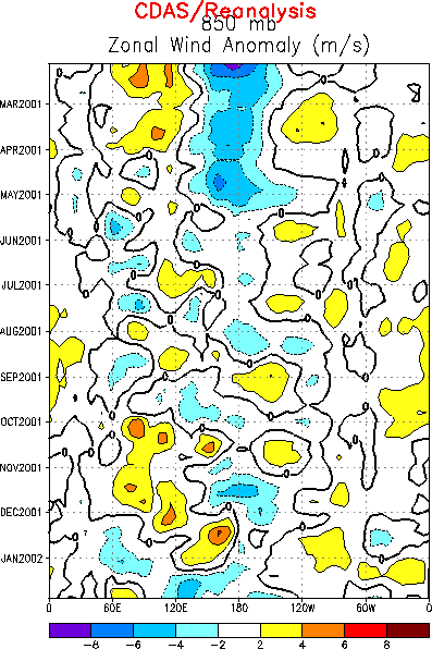
Oscillation (MJO). Alternating periods of low-level easterly and westerly wind anomalies
over the western and central Pacific have been consistent with this activity (Fig. T13). December 2001 featured significant low-level
westerly anomalies over the western and central equatorial Pacific. This activity
generated a strong eastward propagating oceanic Kelvin wave that contributed to a
deepening of the oceanic thermocline and warming of the sea-surface temperatures in the
vicinity of the date line during January. Due to the ongoing Kelvin wave, an increase in
subsurface temperature anomalies and SST anomalies is occurring in the eastern tropical
Pacific. Strong MJO activity observed over the Indian Ocean and west Pacific during late
January may contribute to another period of westerly low-level wind anomalies over the
central and western equatorial Pacific during February. This may be the impetus for
additional Kelvin wave activity that could arrive in the eastern equatorial Pacific by
late March.
The latest statistical and coupled model predictions (Figs. F1,
F2, F3, F4, F5, F6, F7, F8, F10) show a spread from near-normal
to moderate warm-episode conditions during the next 3-6 months. All such models have
relatively low skill during the transition phases of ENSO. Considering the SST
predictions, the time of year, and the observed oceanic and atmospheric circulation
patterns, it seems most likely that warm episode (El Niño) conditions will develop in the
tropical Pacific during the next 3 months.
Weekly updates of SST, 850-hPa wind, OLR, and
the equatorial subsurface temperature structure are available on the Climate Prediction
Center homepage at: http://www.cpc.ncep.noaa.gov (Weekly Update).
|


