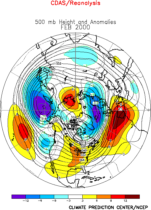
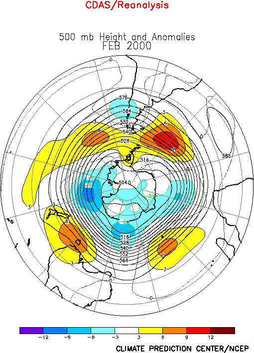
The extratropical circulation during February featured
above-normal heights over the lower mid-latitudes of the central North Pacific, and across
the United States and North Atlantic to south-central Europe (Figs. E9,
E11). The circulation also featured below-normal heights
across the high latitudes of both the North Pacific and North Atlantic Ocean basins. Over
the North Atlantic, the anomalous circulation reflected a very strong positive phase of
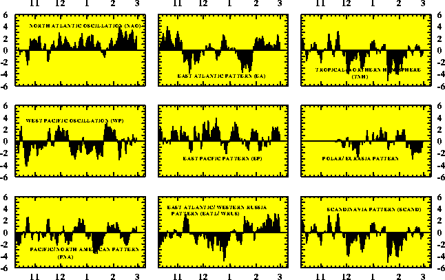
the North Atlantic Oscillation (Table E1, Figs. E6, E7). The NAO has been primarily in
the positive phase since December 1998, and was a contributing factor to the anomalous
warmth observed over large portions of North America during both the 1998/99 and 1999/2000
winter seasons.
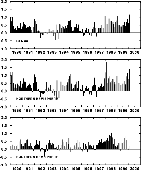
Overall, global mean temperature anomalies averaged 1.2°C during February, which is
the second largest value in the historical record dating back to 1950 (Fig. E2, top). This anomalous warmth was due almost entirely to
conditions in the Northern Hemisphere, which also recorded its second largest mean anomaly
(1.4°C) since 1950 (Fig. E2, middle). In contrast,
Southern Hemisphere temperatures have been near-average for the past four months (Fig. E2, bottom).
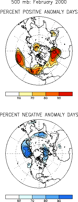
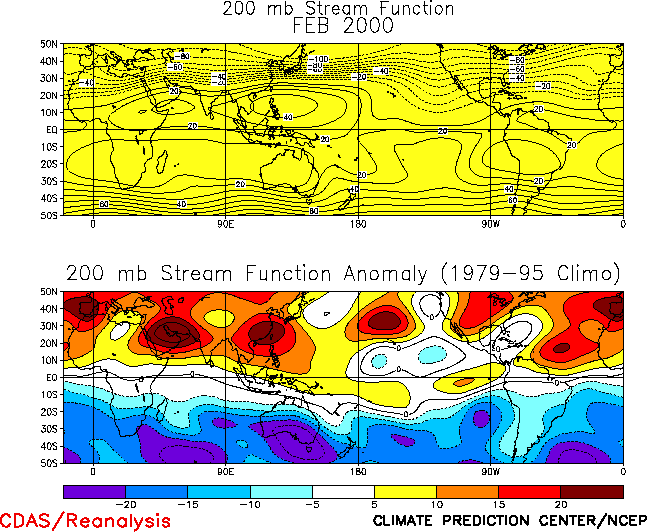
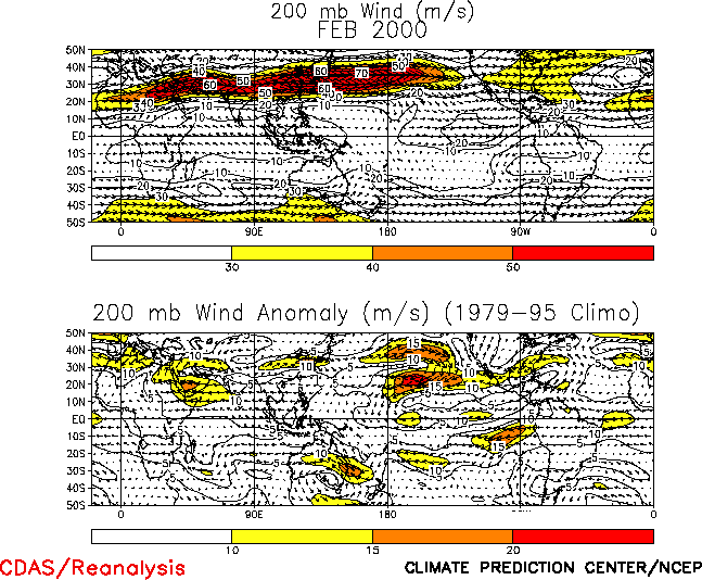
In the subtropics, there was again considerable symmetry of the upper-level circulation
anomalies during February in both hemispheres (Fig. T22,
bottom). Notable aspects of this anomaly pattern included amplified troughs over the
mid-Pacific of both hemispheres, and anticyclonic circulation anomalies extending eastward
in the Northern Hemisphere from the Atlantic Ocean to Asia and in the Southern Hemisphere
from the Atlantic Ocean eastward to Australia. This overall pattern was also prominent
throughout 1999 in association with ongoing La Niña conditions, and is a leading mode of
atmospheric variability on both the interannual and interdecadal time scales.
a. North America
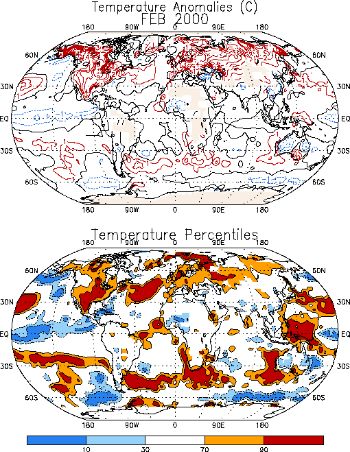
Exceptionally warm temperatures were observed across the United States, southern
Alaska, Mexico, and central Canada, during February, with temperatures averaging 3°-5°C
above average and exceeding the 90th percentile over much of the central and
southwestern U.S. and Mexico (Fig. E1). The month also
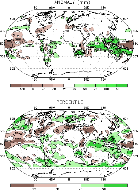
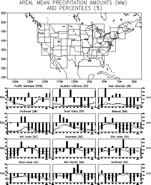
featured exceptionally dry conditions over the eastern seaboard of the U.S. (Figs. E3, E5) and a continuation of very dry
conditions in the Gulf Coast states.
Rainfall has also been substantially below-average in the southwestern U.S. and
northwestern Mexico since August (see box labeled Southwest in Fig.
E5). This dryness reflects an early end to the regions’ monsoon rains in
August, and a nearly complete absence of measurable rainfall since October. This region
typically receives below-average rainfall during the cool season in association with La
Niña conditions.The Gulf Coast region also recorded significantly below-normal rainfall
during November 1999 - February 2000 (Fig. E5), which is
typical of mature La Niña conditions. However, it is likely that the extreme rainfall
deficits observed in this region during the period were also partly linked to the strong
positive phase of the NAO (Table E1).
Other regions of the United States that have accumulated large precipitation deficits
during the past several months include 1) the Midwest, which has recorded below-average
precipitation since July 1999, 2) the Southeast, which has recorded below-average
precipitation since November 1999, 3) the Great Lakes region, which has recorded
below-average precipitation since March 1999, 4) the Northeast, which has recorded
substantially below-average precipitation in many months since April, and 5) the
Mid-Atlantic region, which has recorded substantially below-average precipitation since
November 1999.
b. North Atlantic/ Europe
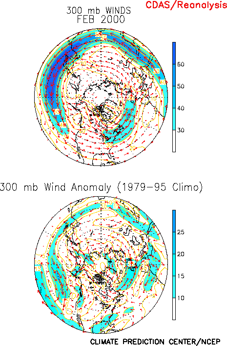
The atmospheric circulation over the North Atlantic again featured the strong positive
phase of the North Atlantic Oscillation (NAO) (Figs. E6, E7, Table E1), which was associated with
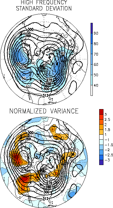
an enhanced jet stream (Fig. E10, right) and increased
storminess (Fig. E13, right) across the high latitudes of
the North Atlantic and into northern Europe/ Southern Scandinavia. The pattern was also
associated with an anomalous anticyclonic circulation and reduced storminess across the
east-central Atlantic and southern Europe. These conditions contributed to above-average
temperatures across northern Europe, Scandinavia and large portions of central Russia (Fig. E1), to above-average precipitation over portions of
northern Europe and Great Britain (Fig. E3), and to
below-average rainfall across southern Europe, northwestern Africa and large portions of
the Middle East.
2. Southern Hemisphere
In the Southern Hemisphere extratropics, the circulation during February featured a
continuation of above-normal heights over large portions of the middle latitudes (Fig. E15). Over the central and eastern South Pacific, the
above-normal heights were located immediately poleward of the La Niña-related subtropical cyclonic circulation anomalies, which is similar to the anomaly pattern also observed in
the Northern Hemisphere (Fig. T22, bottom).
a. Australia
Anomalously wet (Fig. E3) conditions again covered
northern Australia during February, with above-average rains also observed in the arid
interior. In contrast, below-average rains were again reported in portions of southeastern
Australia during the month. This region has recorded below-average rainfall in almost
every month since April1999, with the most significant deficits observed since June.
Overall, totals since April were generally more than 200 mm below average across nearly
all of Victoria, which includes major cities such as Melbourne and Sydney. The state of
Victoria has recorded significantly below-average rainfall since late 1996, with December
1996-present deficits exceeding 500 mm throughout the region. These long-term moisture
deficits have led to severe drought over most of southeastern Australia.
b. Southern Africa
Monsoon-like rains during February were again above-average over central and
southeastern Africa, with totals exceeding the 90th percentile throughout the
region (Fig. E3, bottom) for the second consecutive month.
Two-month totals rainfall totals reached 250-1365 mm in this region, and moisture
surpluses ranged from 100-1000 mm. The increased rainfall during February occurred partly
in association with Tropical Cyclone Eline, which produced extremely heavy downpours
throughout southern Africa. Extreme rainfall amounts from this storm contributed to
devastating floods in the low-land areas of Mozambique, which killed hundreds and left
tens of thousands homeless.
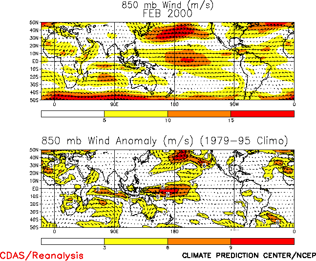
The above-average rainfall during January and February was also associated with an
anomalous large-scale circulation pattern that featured 1) enhanced low-level easterly
winds across the central Indian Ocean in association with an amplification and poleward
shift of the Mascarene High (Fig. T20, bottom), 2) an
anomalous low-level circulation center over south-central Africa, with anomalous westerly
winds across southern Africa between 10°-20°S, and 3) anomalous upper-level easterly
winds in association with a poleward extension of the subtropical high (Fig. T22) and a corresponding poleward shift of the main
upper-level westerly winds to south of the continent (Fig. T21).Overall,
these conditions were associated with confluence extending southwestward along the
Mozambique coast, and with anomalous large-scale convergence across southeastern Africa
and the Mozambique Channel. Collectively, these conditions represented an enhanced
monsoonal circulation over southeastern Africa. This anomaly pattern was linked to the
large-scale pattern of anticyclonic streamfunction anomalies at upper levels previously
noted in the lower and middle latitudes of both hemispheres (Fig.
T21, bottom).


