Tropical
Highlights - February 2002
The evolution toward a Pacific warm episode
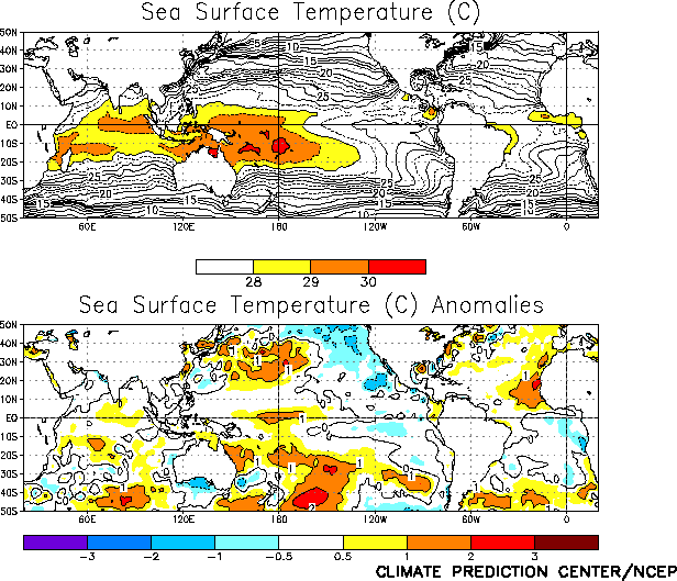
continued during February 2002, with an area of SST anomalies exceeding +1.0°C persisting
near the date line (Fig. T18) and the corresponding
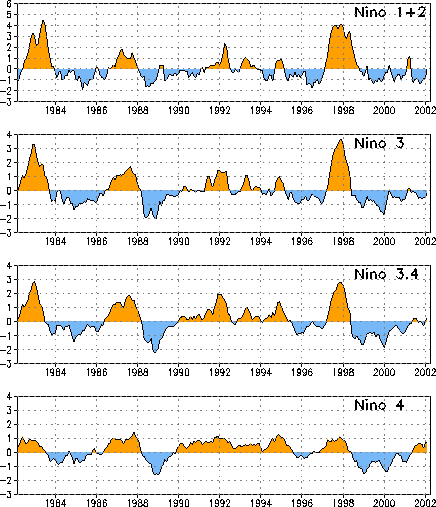
Niño-4 region SST index increasing to +0.8 (Fig. T5, Table T2). SST anomalies across the east-central and eastern
equatorial Pacific returned to normal during February, as indicated by increases in the
SST index values to -0.2 in the Niño-3 region and to 0.0 in the Niño 1+2 region (Fig. T18, Table T2). By late
in the month, SST anomalies exceeded +1.0°C in the extreme eastern equatorial Pacific
(not shown).
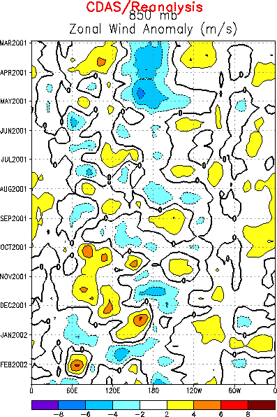
The warming of the eastern equatorial Pacific resulted from the arrival of a strong
oceanic Kelvin wave that had been triggered during December in association with an
MJO-related westerly wind burst over the west-central equatorial Pacific (Figs. T13, T20). This Kelvin wave has
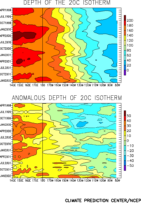
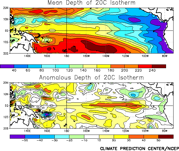
resulted in an anomalous deepening of the oceanic thermocline throughout the equatorial
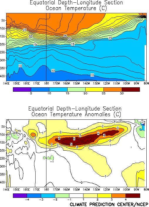
Pacific from 170°E to 90°W (Figs. T15, T16), and by an increase in subsurface temperatures to 4-5°C above normal in that region (Fig.
T17, bottom). This increasingly large build-up of anomalously warm waters at depth
is consistent with the continued evolution toward a Pacific warm episode.
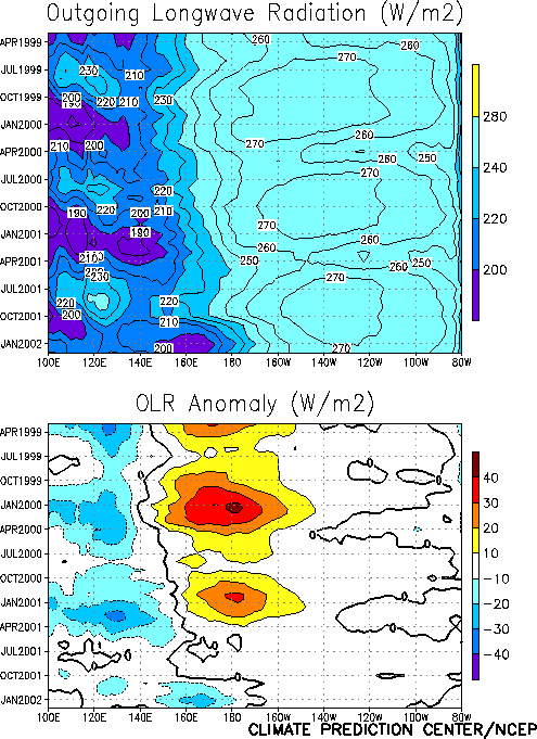
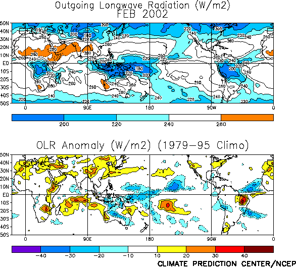
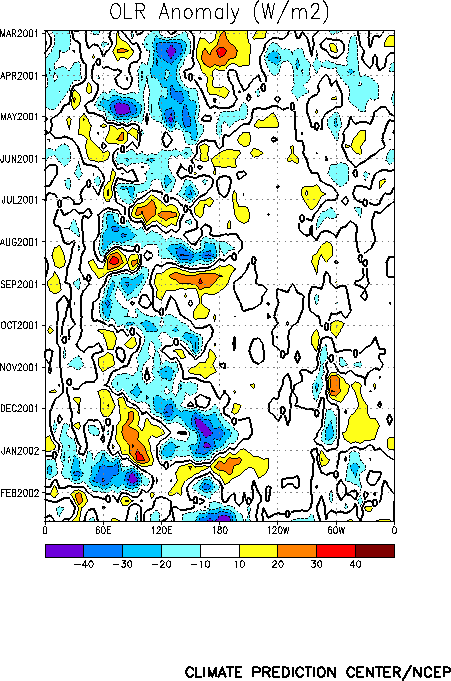
Accompanying this evolution deep tropical convection extended across the central
equatorial Pacific to between 160°E- 180° during February (Fig.
T8). This location represents the farthest eastward extent of the deep tropical
convection recorded since the end of the last warm episode in mid-1998 (Fig. T8, top). However, equatorial convection has remained absent
east of the date line throughout this 3 ½ year period (Fig. T25,
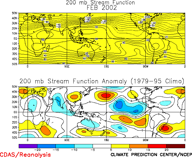
top), which has contributed to the persistence of cyclonic streamfunction anomalies at
200-hPa in the subtropics of both hemispheres (Fig. T22,
bottom) flanking the region of suppressed convection [indicated by negative anomalies
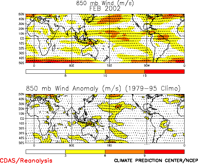
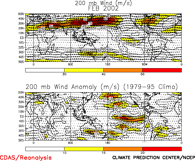
of outgoing longwave radiation]. During February, a strong anomalous cyclonic couplet over
the central Pacific was associated with a large westerly anomalies (Fig.
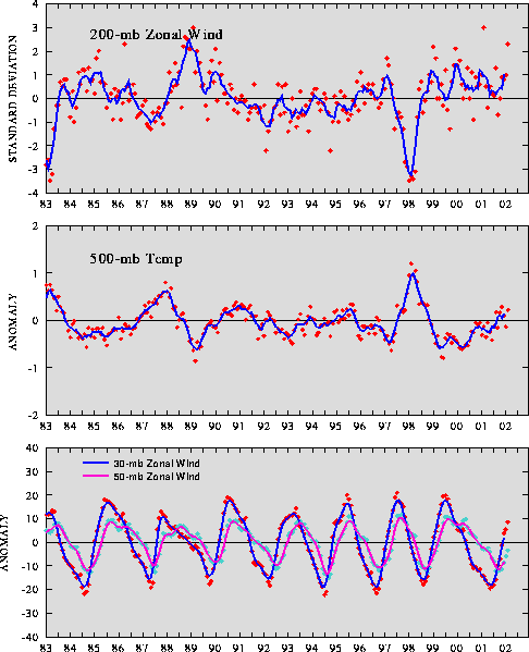
T21) and a large value of the 200-hPa wind index (Table T1,
Fig. T3).
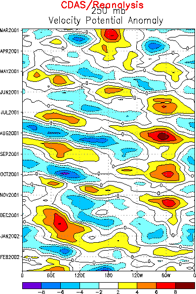
Tropical convection and the associated atmospheric circulation anomalies have also
exhibited strong intraseasonal variability during the past several months (Figs. T11, T12, T13).
MJO-related tropical convection during February was enhanced over the central Pacific (Fig. T25).
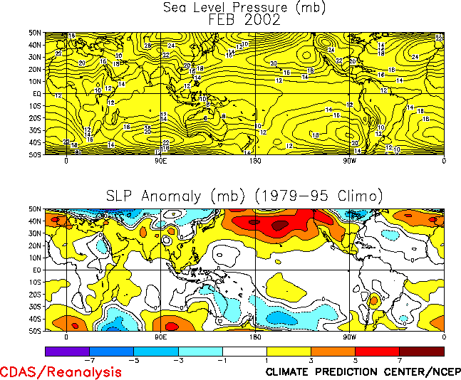
The sea level pressure (SLP) pattern during February featured positive anomalies
throughout most of the global Tropics (Fig. T19). This
pattern was associated with a positive value of the Tahiti - Darwin Southern Oscillation
Index (SOI) (0.9) (Table T1) and a near-zero value of the
equatorial SOI (–0.1). |


