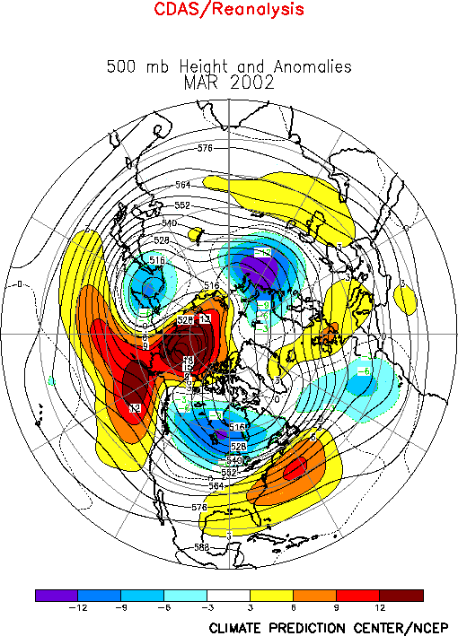
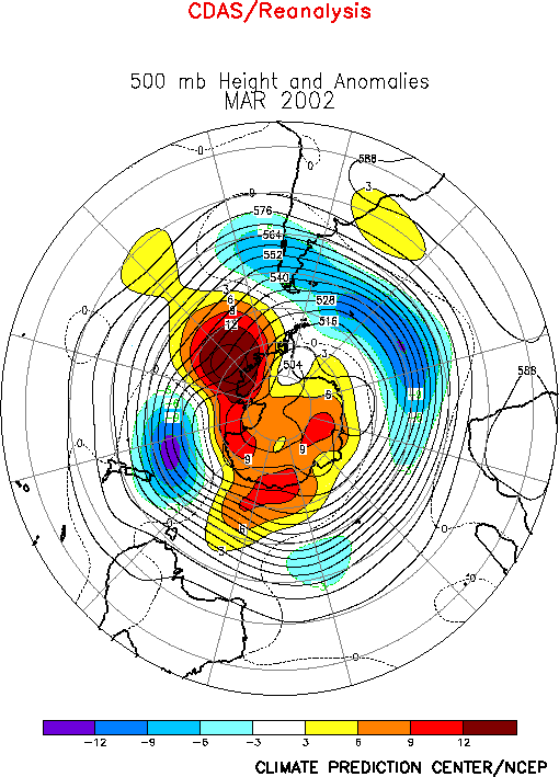
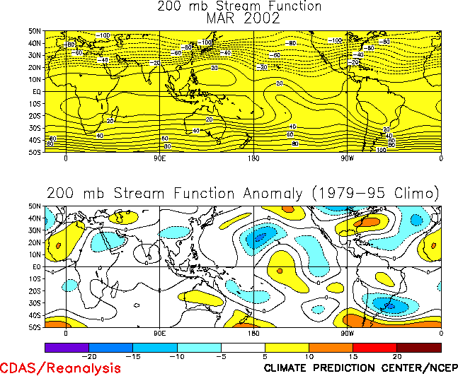
The Northern Hemisphere circulation
during March featured above-average 500-hPa heights over the high latitudes of the North
Pacific, the southeastern United States, the central North Atlantic, and across southern
Europe and the Middle East, and below-average heights over Canada, northwestern Russia,
and eastern Siberia (Figs. E10, E12).
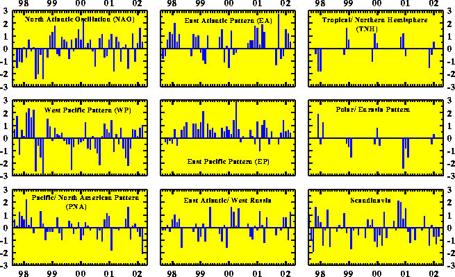
These anomalies reflected the strong negative phase (-2.1) of the Pacific/ North American
(PNA) teleconnection pattern (Table E1, Figs. E7, E8), and were associated with
pronounced departures from normal in the positions of the mean jet streams and the mean
upper-level ridges and troughs throughout the Pacific/ North American sector. They also
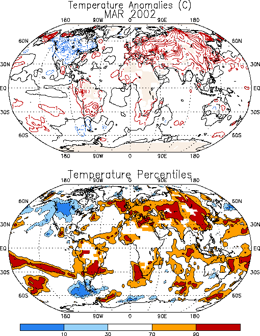
reflected the continuation of above-average heights, above-average surface temperatures (Fig. E1) and below-average rainfall across southern Europe and
the Middle East (Fig. E3).a. North Pacific and North
America
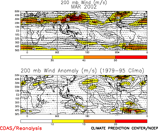
The strong negative PNA pattern during March was accompanied by easterly
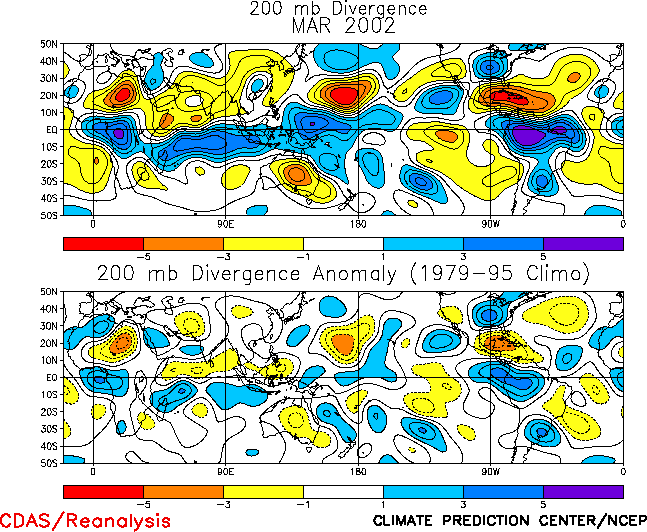
wind anomalies at 200-hPa throughout the exit region of the East Asian jet stream (Fig.
T21, E11, right), in association
with a westward retraction of that jet core toward Asia. Consistent with this anomalous
jet structure an enhanced thermally-indirect transverse ageostrophic circulation was
evident throughout the jet exit region (located near the date line), and was accompanied
by enhanced upper-level divergence north of the jet core and enhanced convergence south of
the jet core (Fig. T23). Consistent with these conditions
the locations of the downstream upper-level ridge and trough axes were shifted
approximately 30° westward to the eastern North Pacific and
the central United States, respectively (Fig. E10). This
shift contributed to anomalous northwesterly flow across western Canada and the
north-central United States (Fig. E11), and led to
below-average surface temperatures over much of North America (Fig.
E1). These conditions contrast to the well above-average surface temperatures
observed throughout the continent during February.
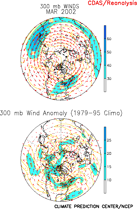
Over the United States the circulation during March also featured a well-defined jet
core (300-hPa westerly winds exceeding 20 ms-1 above normal) extending
northeastward from the central Plains States to Maine (Fig. E11).
Climatologically the jet core begins over the mid-Atlantic region in association with the
entrance region of the North Atlantic jet stream, and then extends northeastward across
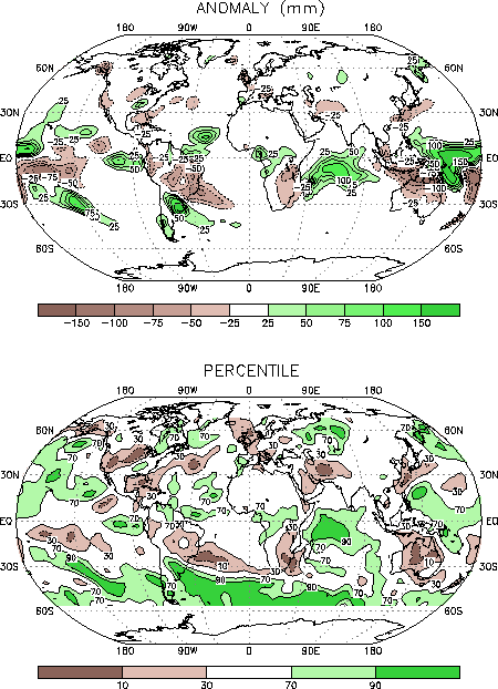
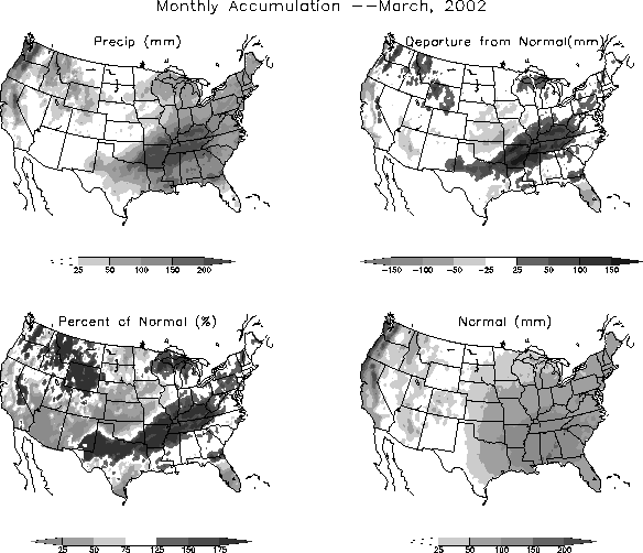
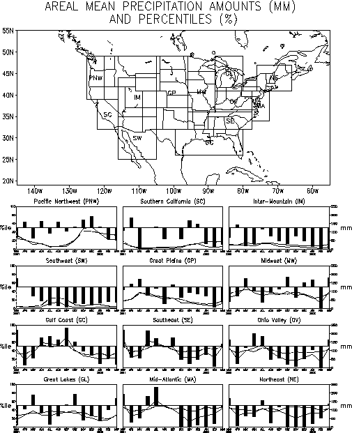
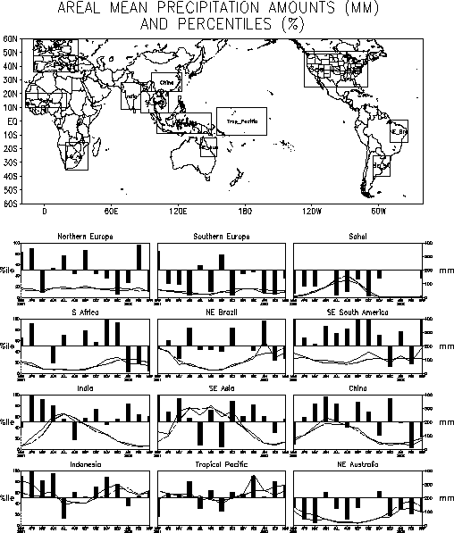
the North Atlantic to Great Britain. During March above-average precipitation was observed
along the entire equatorward flank of the anomalous jet entrance region from central Texas
northeastward to Pennsylvania (Fig. E6), and near-average
precipitation was recorded over most of the remainder of the eastern half of the country.
This represents a marked change from the significantly below-average precipitation and
large precipitation deficits that had dominated the eastern U.S. since October 2001 and
the Ohio Valley since August (Fig. E5).
b. Europe and Asia
The combination of the positive phase of the NAO (+0.5; Table
E1) and above-average heights across the Middle East led to exceptionally warm
surface temperatures across most of Eurasia during March (Fig. E1),
with the largest anomalies exceeding 6°C over central Russia
and 4°C over northern China and Mongolia. In southern Russia
this anomalous warmth was accompanied by reduced snow cover extent and an overall
northward retreat of the main winter snow pack. Accompanying these conditions the jet
stream winds and associated storm activity were confined to the high latitudes, resulting
in below-average precipitation across the Middle East and south-central Russia. These
conditions are similar to those observed during February, when above-average 500-hPa
heights and record/ near-record surface temperatures covered most of Asia, and
significantly below-average precipitation was observed across the Middle East.
2. Southern Hemisphere
The Southern Hemisphere circulation during March featured above-average 500-hPa
heights over the high latitudes of the eastern South Pacific and the polar region (Fig. E16). This anomaly pattern contrasts with the persistent
pattern of below-average heights that had previously dominated the high latitudes of the
eastern South Pacific and polar region since October 2001.
Also during March below-average heights were observed in the southern extratropics from
southern South America eastward to the central Indian Ocean, while above-average heights
and anticyclonic circulation anomalies (Fig. T22, bottom)
were observed across the middle latitudes of South America and the South Atlantic. This
overall anomalous circulation was associated with a poleward shift in the main belt of
westerly winds toward higher latitudes, which was accompanied over South America by a
poleward shift of the mean cold frontal boundary to southern Argentina. To the north of
this boundary significantly above-average surface temperatures (exceeding the 90th
percentile) were observed across central Argentina and southern Brazil during the month (Figs.
E1, E4), and below-average rainfall
covered central Brazil (Fig. E3). To the south of the mean
frontal boundary conditions were significantly cooler and wetter than normal, with
temperatures dropping below the 30th percentile over southern Argentina and
rainfall totals exceeding the 90th percentile in the region poleward of 30°S (Figs. E3, E4).
The overall poleward shift in the main westerlies also contributed to significantly
below-average rainfall across southern Africa for a third consecutive month (Fig. E4). The South African monsoon season typically lasts
from November-April. To date the 2001-2002 rainy season featured above-average rainfall in
the heavy agricultural region of eastern South Africa during November and December, and
below-average rainfall during January-March.
In Australia near- to above-average surface temperatures were observed during March.
However, below-average temperatures were again observed over south-central Australia,
which represents a continuation of cooler-than-average conditions that began in that
region in October 2001 (Fig. E1). Below-average rainfall
was also observed across much of Australia during the month, with totals dropping below
the 10th percentile in the northern latitudes (Fig. E3).
In northeastern Australia rainfall totals have been below average since December 2001 (Fig. E4), which is consistent with the overall transition to
generally above-average rains over the central equatorial Pacific that occurred in that
month.


