Tropical
Highlights - March 2002
The steady evolution toward a Pacific warm episode
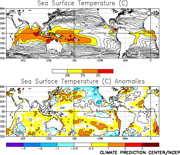
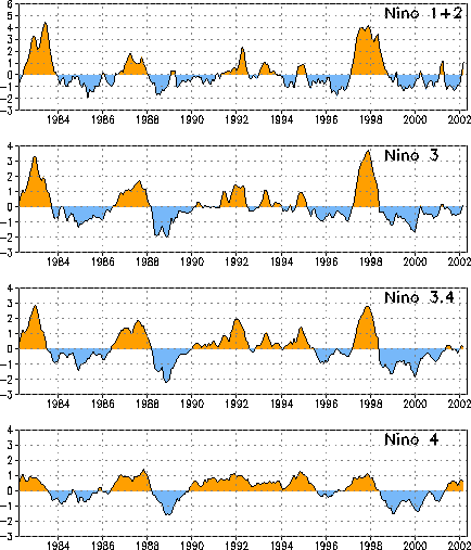
continued during March 2002, with above-normal sea surface and subsurface temperatures now
observed across most of the equatorial Pacific (Figs. T17, T18). Sea surface temperatures (SSTs) were warmer than normal in
all four Niño index regions for the first time since the end of the
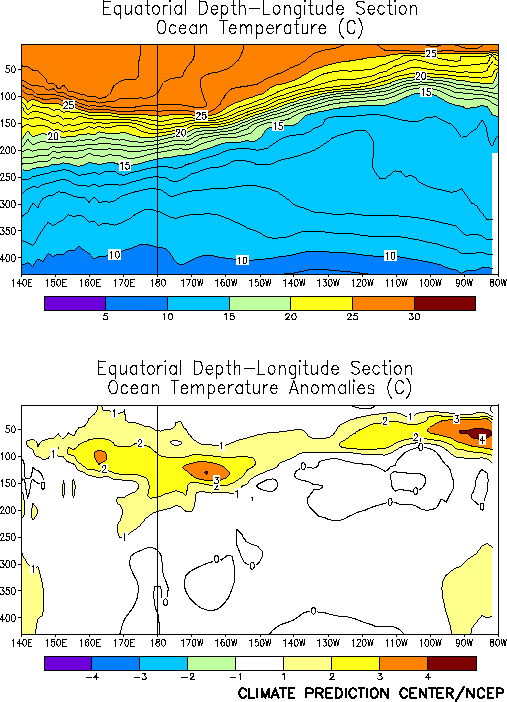
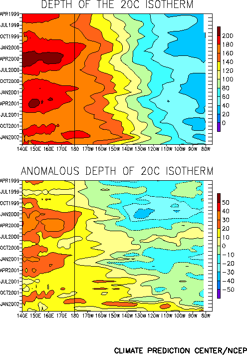
1997-98 warm episode in May 1998 (Fig. T5, Table T2). Also, the oceanic thermocline remained deeper than
normal across the entire equatorial Pacific during the month (Fig.
T15), with temperatures at thermocline depth averaging 1°-3° C above normal. However, the thermocline has shoaled during the
past few months between 170°-110°
W (Fig. T15), which has been accompanied by a decrease in
the temperature anomalies in this region from +4° C to +1-2° C during March (Fig. T17).
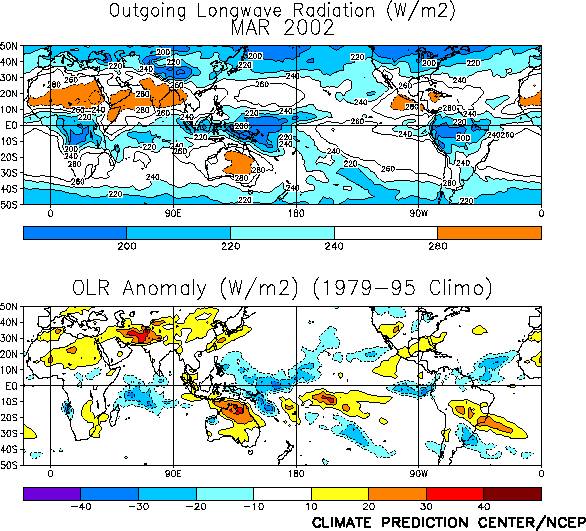
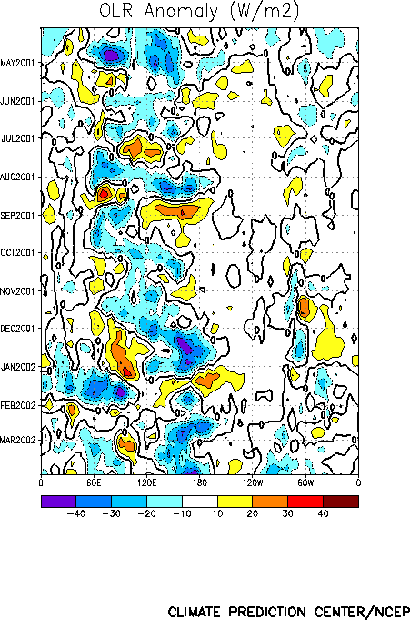
Deep tropical convection extended across the west-central equatorial Pacific between
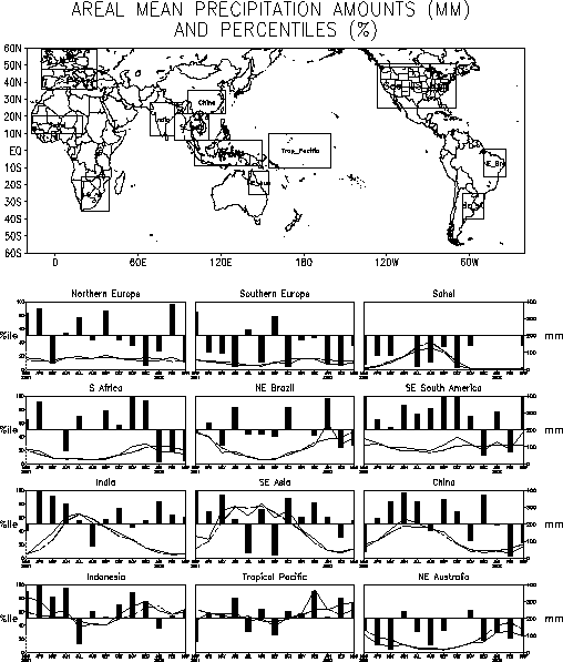
140° - 170° E during March (Fig. T8, top), while suppressed convection and below-average
rainfall was observed across northern Australia (Figs. T25, E4). This dipole pattern of anomalous tropical convection has
persisted since December 2001 (Fig. T11), and is
consistent with the development of above-average SSTs over the central and east-central
equatorial Pacific. Tropical convection was also observed over the eastern equatorial
Pacific and coastal Peru and Ecuador during March (Fig. T25)
in association with anomalously warm SSTs in that region.
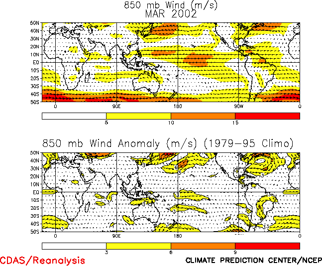
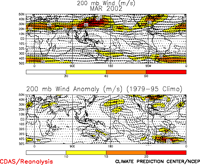
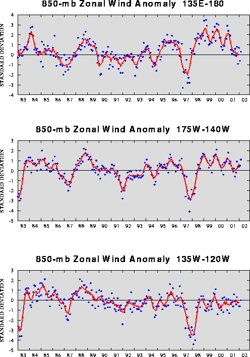
The low-level (850-hPa) and upper level (200-hPa) winds remained near normal across the
equatorial Pacific during March (Figs. T20, T21). For most of the past year the low-level equatorial winds
have generally been near normal over the Pacific basin (Table T1,
Fig. T4), while the upper-level winds have fluctuated between
near-normal and stronger-than-normal westerlies. As such, no El Niño signal is yet evident in these wind
patterns.
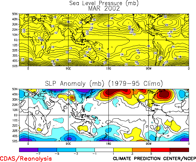
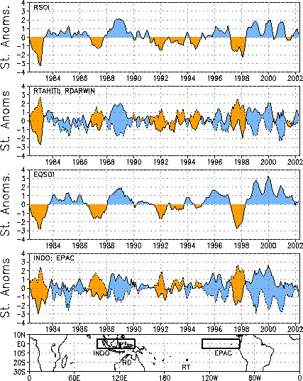
The tropical sea level pressures (SLP) during March featured a wave-1 anomaly pattern,
with negative anomalies over the Indian and Pacific Oceans and positive anomalies
elsewhere (Fig. T19). This pattern was associated with a
negative value of the Tahiti - Darwin Southern Oscillation Index (SOI) (-0.9) (Table T1) and a small positive value of the equatorial SOI
(0.4). After remaining strongly positive for the 3 ½ year period ending November 2001,
the equatorial SOI has oscillated around zero since December 2001 (Fig.
T2). |


