Tropical Highlights - March 1999
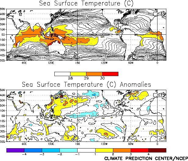
Mature cold episode (La Niña) conditions continued throughout the tropical Pacific during
March 1999, as sea surface temperatures (SSTs) remained more than 1°C below normal across the central
equatorial Pacific (Fig. T18
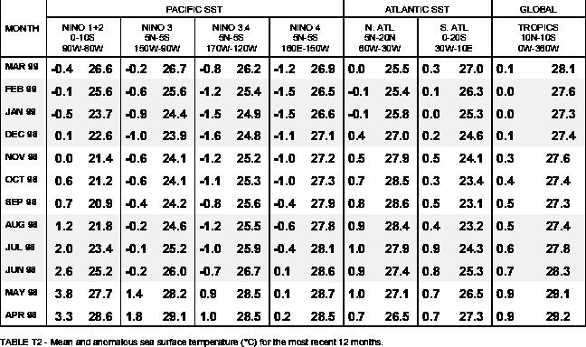
). However, SST anomalies in all four Niño regions increased during the
month (Table T2). In the eastern Pacific some of this increase in SST is related to the normal annual cycle,
which features a peak in SSTs during the MarchApril period.
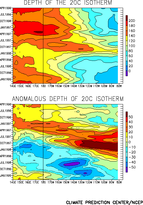
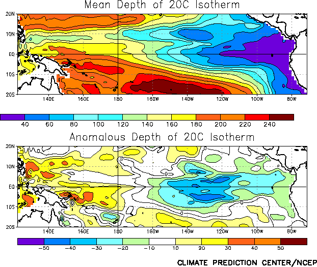
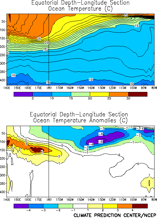
The oceanic thermocline remained shallower than normal throughout the central and eastern
Pacific east of 165°W during the month and deepened west of 165°W
(Figs. T15, T16). Consistent with this
sub-surface oceanic structure, equatorial ocean temperatures at thermocline depth remained more than
4°C below normal in the central and eastern Pacific, and increased to more than 3°C above-normal in
the western Pacific (Fig. T17
).
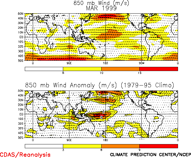
Low-level (850-hPa) equatorial easterly winds were observed across the entire Pacific
during March (Fig. T20
). The largest easterly wind anomalies were observed over the western equatorial
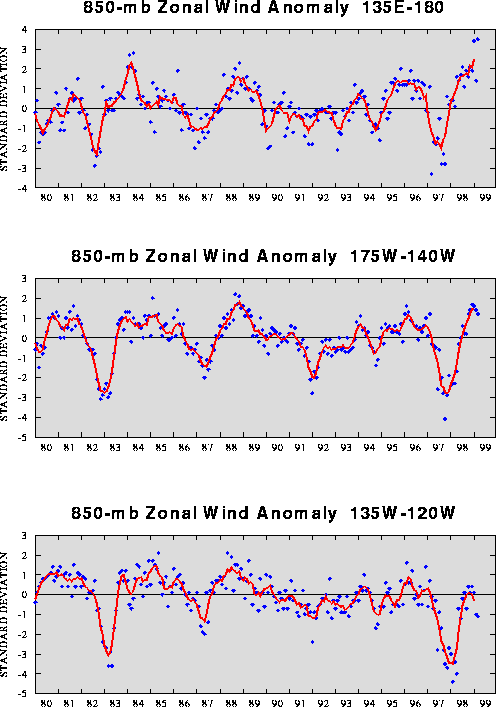
Pacific, where winds averaged 9-12 ms-1 above normal. These anomalies resulted in the largest zonal wind
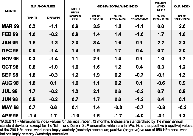
index (3.5) over the western Pacific observed in the historical record back to 1979 (Fig. T4). In contrast,
the winds were slightly weaker than normal (westerly anomalies) over the eastern Pacific (Table T1, Fig. T20). Westerly wind anomalies were also observed over the eastern Indian Ocean, which contributed to
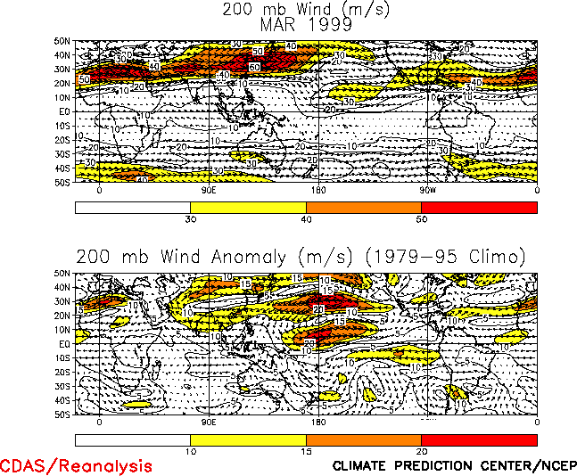
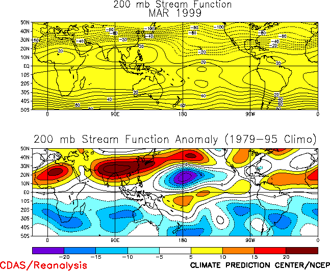
low-level convergence and enhanced convection over Indonesia. At upper levels, enhanced equatorial westerly
winds over the central Pacific during the month were associated with an anomalous subtropical cyclonic
circulation couplet centered near the date line
(Figs. T21, T22). This pattern of upper and lower level winds
was again associated with an enhanced equatorial Walker circulation (Fig. T29).
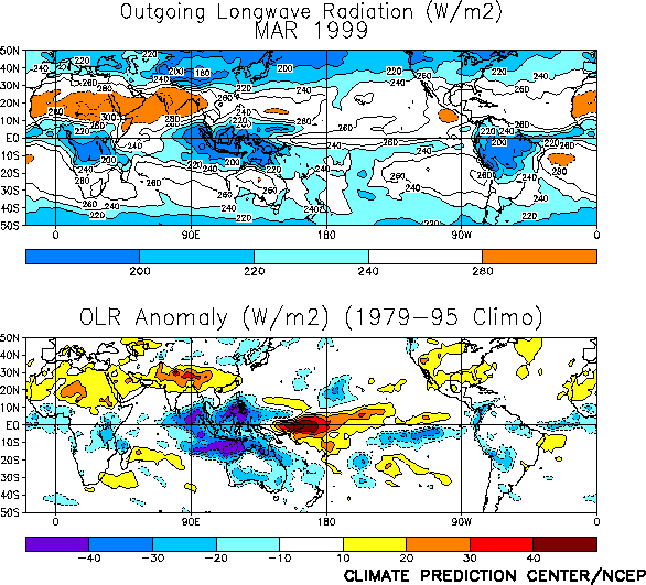
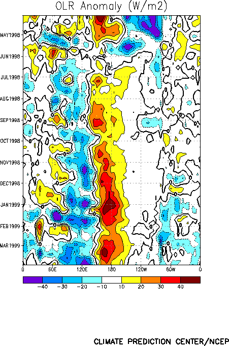
Tropical convection during March [as inferred from anomalous outgoing longwave radiation
(OLR)] remained suppressed across the western and central equatorial Pacific and enhanced across Indonesia
(Fig. T25). This pattern of convection has persisted since June 1998 and is consistent with a continuation
of mature cold episode conditions (Fig. T11). The OLR index has averaged 2.0 over the past four
months (Table T1), indicating substantially reduced convection in the equatorial central Pacific. Since the
beginning of the year, tropical instraseasonal (Madden-Julian Oscillations) activity has increased, and has
contributed to enhanced convection over Indonesia during January and March (Fig. T11).
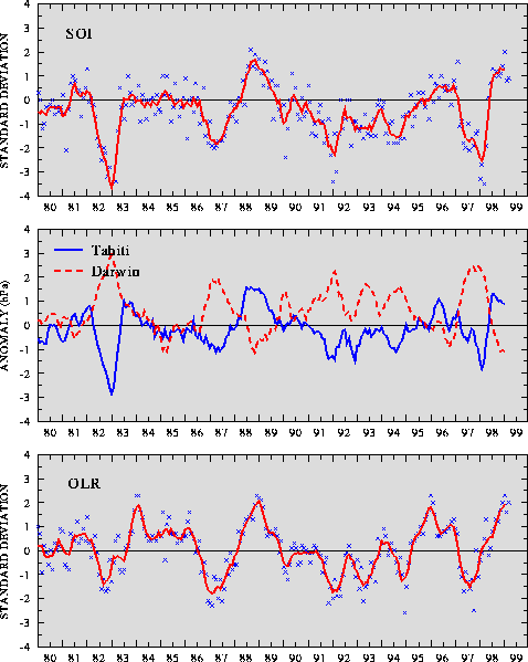
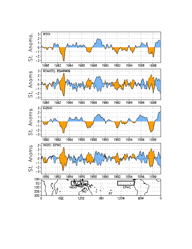
During March, the Southern Oscillation Index (SOI) was 0.9 (Table T1, Fig. T1) while the equatorial SOI was 2.9 (Fig. T2). The equatorial SOI has exceeded 1.0 for the past 5 months and
has better depicted the continued strength of the cold episode than the conventional SOI. These index
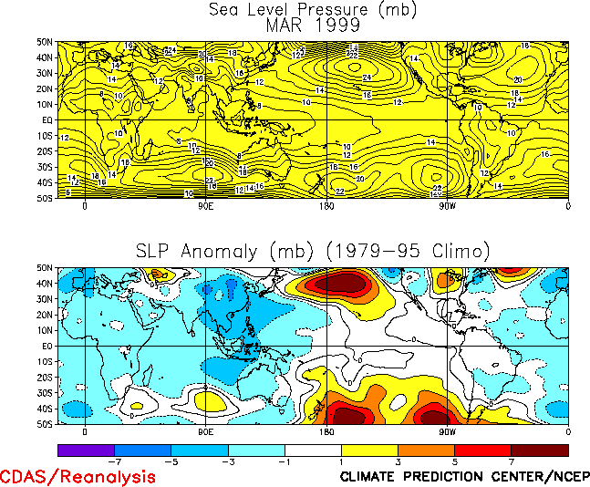
values have been associated with above-normal sea level pressure (SLP) over the central Pacific and
below-normal SLP over Indonesia and the eastern Indian Ocean (Fig. T19).
| 

