Tropical
Highlights - April 2000
Oceanic cold episode conditions have weakened
across the tropical Pacific during the past few months, but the atmospheric circulation
continues to reflect mature cold episode conditions. Sea surface temperatures (SST)
remained more than 1.0°C below normal across the central equatorial Pacific between
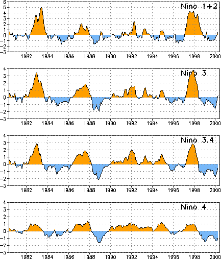
160°E and 160°W (Fig. T18). However, above-average SSTs
were observed in the eastern Pacific during April (Fig. T18, Table T2). The SST indices in all four Niño regions increased
during April (Table T2), with positive indices recorded in
the Niño 1+2 region for the first time since March 1999, and in the Niño 3 region for
the first time since May 1998 (Fig. T5).
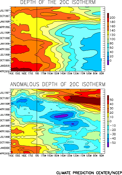
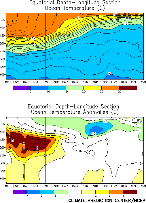
The oceanic thermocline remained much deeper than normal in the west-central and
western Pacific during April and also deepened in the eastern Pacific (Fig. T15). In the west oceanic temperatures were more than
5.0°C above normal during April at thermocline depth (Fig. T17).
Across the east-central and eastern Pacific, the deepening thermocline has resulted in a
lessening of negative temperature anomalies at thermocline depth, with temperatures more
than 2.0°C below normal observed only between 110°W and 140°W during the month (Fig. T17).
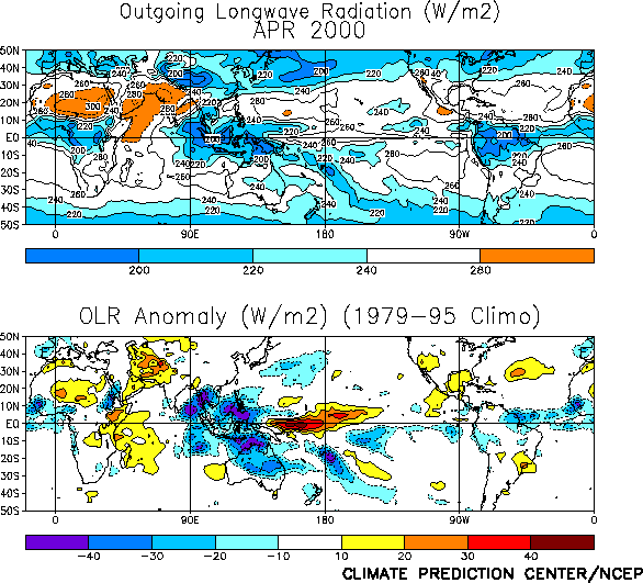
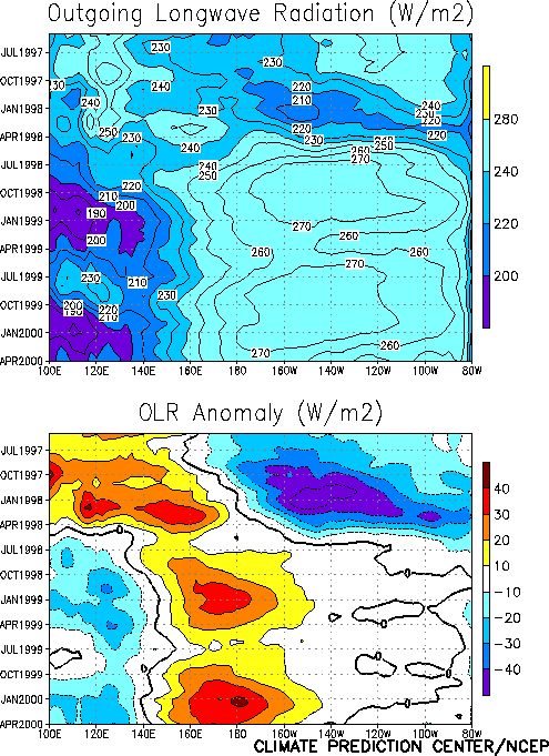
The pattern of tropical convection during April [as inferred from anomalous outgoing
longwave radiation (OLR)] remained consistent with ongoing cold episode conditions, and
featured suppressed convection over the western and central equatorial Pacific and
enhanced convection over Indonesia and the Indian Ocean (Fig. T25).
This pattern has persisted since the onset of cold episode conditions in late May 1998 (Fig. T8). Elsewhere, the Atlantic ITCZ was enhanced from
northeastern Brazil to southwestern Africa during the month (Fig.
T25).
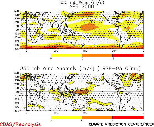
The pattern of tropical convection over the central and western Pacific was again
accompanied by an enhanced Walker circulation across the central equatorial Pacific (Fig. T29), with low-level (850 hPa) easterly wind anomalies
across the central and western tropical Pacific greater than 6 m s-1 between
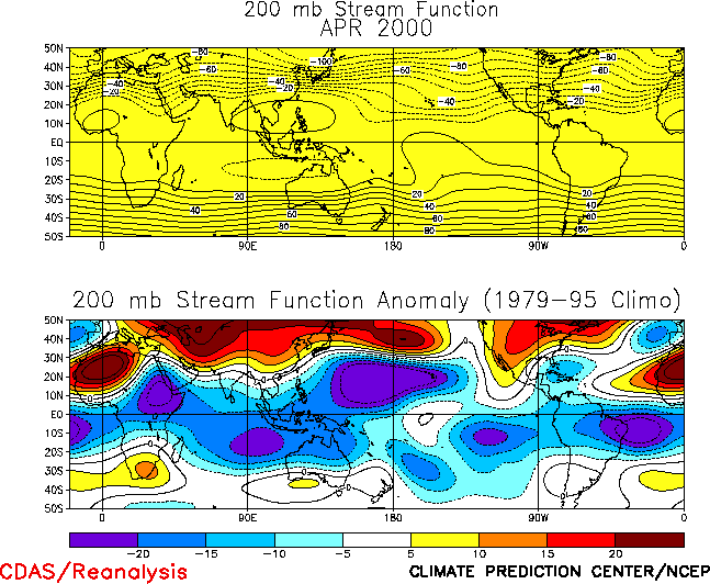
140°E and 170°W (Fig. T20). At upper-levels (200-hPa),
troughs were observed over the low-latitudes of the central Pacific in both hemispheres,
with amplified subtropical ridges dominating most of the remainder of both hemispheres (Fig. T22).
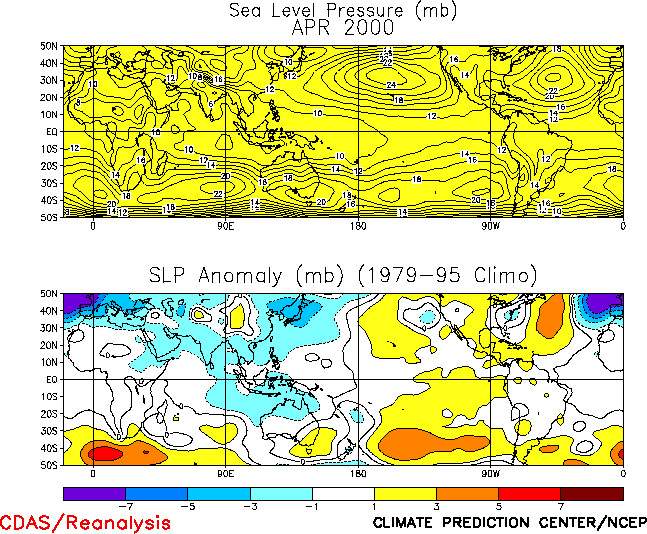
The sea level pressure (SLP) pattern across the Tropics during April featured positive
anomalies across the tropical central and eastern Pacific and negative anomalies over the
Indian Ocean and Indonesia (Fig. T19). This pattern is
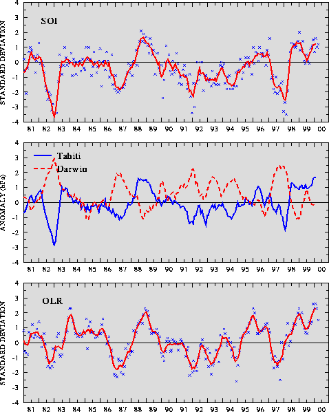
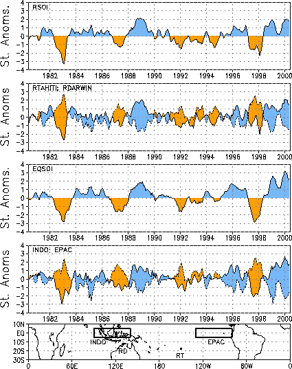
consistent with ongoing cold episodes, and was associated with positive values of both the
Southern Oscillation Index (1.2)(SOI) (Table T1, Fig. T1) and the equatorial SOI (2.2) (Fig.
T2). |


