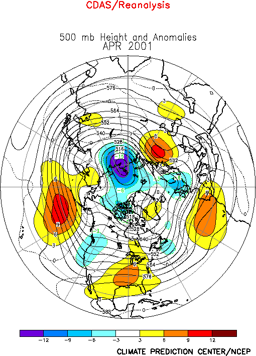
The Northern Hemisphere circulation
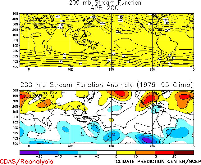
was dominated by above-normal 500-hPa heights in the middle latitudes during April (Fig. E10), and by anticyclonic circulation anomalies at 200
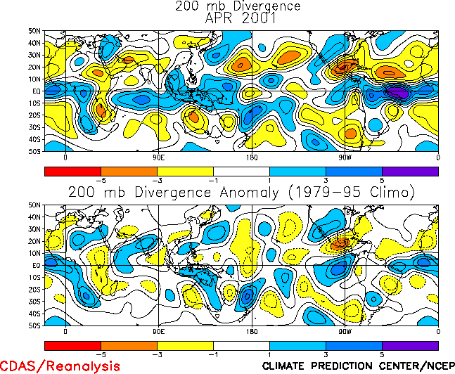
hPa across most of the subtropics (Fig. T22, bottom). The
exception was the eastern subtropical Pacific, where cyclonic circulation anomalies were
again evident in the subtropics in response to the ongoing La Niña-related pattern of
tropical convection. Similar anomaly patterns were also evident in the Southern Hemisphere
middle and low latitudes (Figs. E16, T22,
bottom). This strong inter-hemispheric symmetry of the upper level circulation
features is the leading mode of atmospheric variability on the interannual time scale, and
is indicative of continued strong forcing from the Tropics.a.
United States
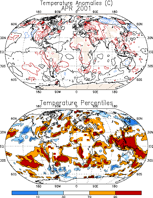
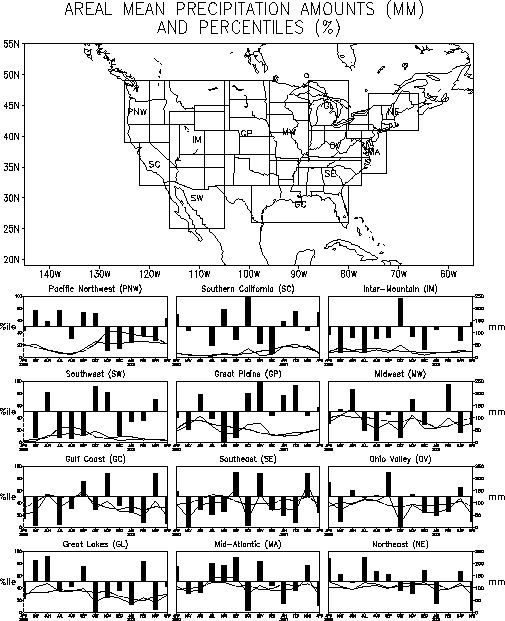
The prominent temperature and precipitation anomalies during April occurred over the
United States), where the eastern half of the country experienced significantly
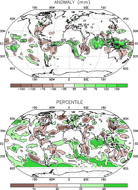
above-average temperatures (Fig. E1) and below-average
rainfall (Fig. E3). This warmth was associated with the
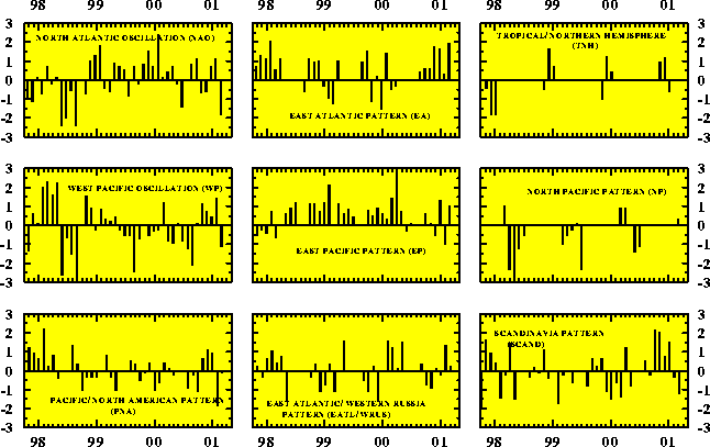
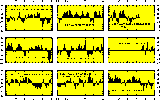
development of the strong positive phase of the North Atlantic Oscillation (NAO) (Table E1, Fig. E7) during the second
half of the month (Fig. E8). During this period a large
region of above-normal heights developed across the eastern half of the country, and the
mean Hudson Bay trough that normally extends southward to cover the eastern United States
disappeared. This circulation pattern resulted in an enhanced transport of mild air from
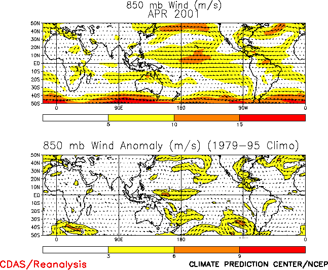
the Gulf of Mexico to the central and east-central U.S. (Fig. T20).
Upper-level convergence (Fig. T23) and large-scale sinking
motion of this warm air downstream of the anomalous ridge axis then contributed to a
nearly complete lack of rainfall over parts of the Gulf Coast and mid-Atlantic states, and
to exceptionally dry conditions in the northeast and Ohio Valley regions (Fig. E5).
b. Europe
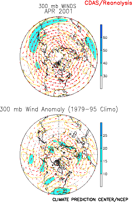
Western Europe was influenced during April by an upper-level ridge over the
east-central North Atlantic and an upper-level trough over northern Europe (Fig. E10). This circulation was accompanied by enhanced jet
stream winds (Fig. E11) which contributed to increased
storminess and above-average precipitation across northern Europe (Fig.
E3). It also resulted in large-scale sinking motion and below-average rainfall
over the western Mediterranean Sea.
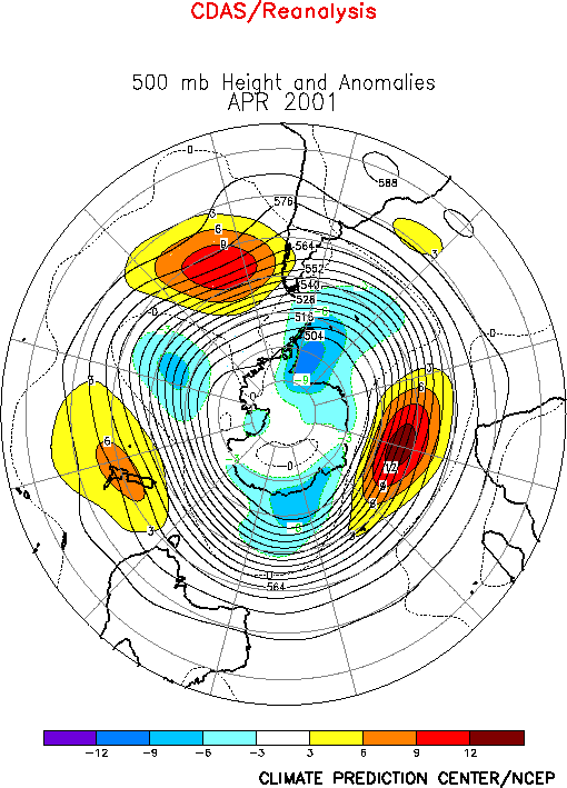
2. Southern Hemisphere
The Southern Hemisphere circulation was also dominated by above-normal 500-hPa heights
in the middle latitudes (Fig. E16), and by anticyclonic
circulation anomalies at 200 hPa across most of the subtropics (Fig.
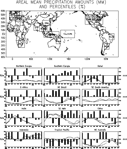
T22, bottom). Abnormally dry conditions were observed over central and eastern
Brazil, eastern Africa and Madagascar, and over many sections of Australia (Fig. E3). The dry conditions in Brazil have persisted since
the beginning of 2001, with rainfall deficits of more than 400 mm in some areas.
One of the more unique aspects of the Southern Hemisphere conditions during April was
significantly above-average rainfall across western Africa in the area south of the
equator (Fig. E3). This rainfall occurred across the
normally very arid regions of western South Africa, Botswana, and Namibia, and produced
totals in many areas exceeding the 90th percentile. Above-average rains also
covered central and southeastern South Africa, which is the third consecutive month of
enhanced rainfall during that region’s rainy season (Fig. E4).


