Extratropical Highlights - May 1999
1. Northern Hemisphere
a. North Pacific and North America
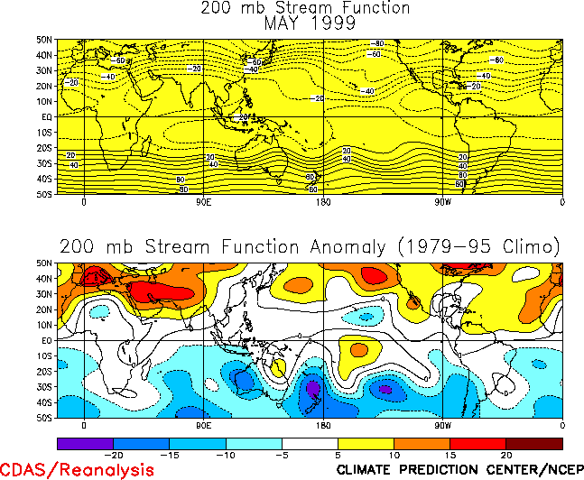
The circulation over the North Pacific during May featured a well-developed cyclonic
circulation anomaly across the low latitudes of the central and eastern Pacific, and an
anticyclonic circulation anomaly across southern Asia (Fig. T22,
bottom). These conditions reflected a strengthening of the mid-Pacific trough in the
region east of the date line (Fig. T22, top) and a
confinement of the mean low-latitude ridge to the Indonesian and Indian Ocean sectors.
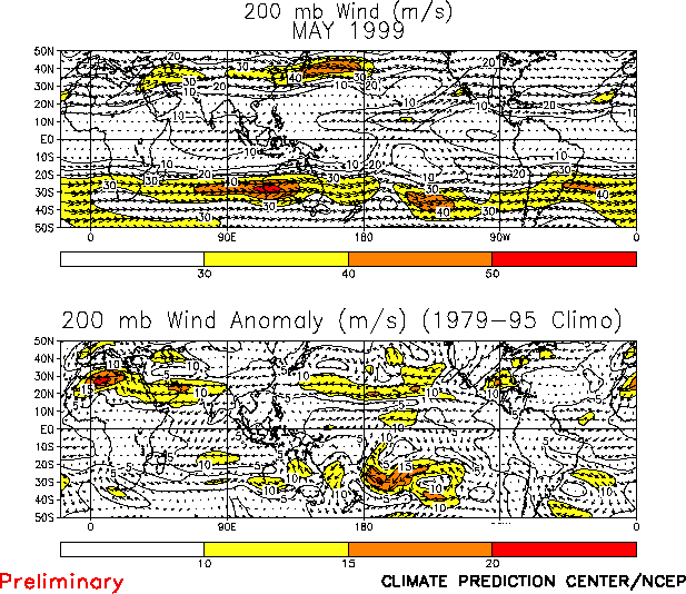
They were accompanied by a pronounced westward retraction of the East Asian jet stream
toward Asia (Fig. T21), and by an extremely
well-developed diffluent flow and jet exit region over the central North Pacific. Each of
these circulation features has persisted since February, consistent with ongoing La Niña
conditions and the accompanying patterns of tropical convection and deep tropospheric
heating. Similar features were also evident in the large-scale atmospheric circulation
over the South Pacific during the period.
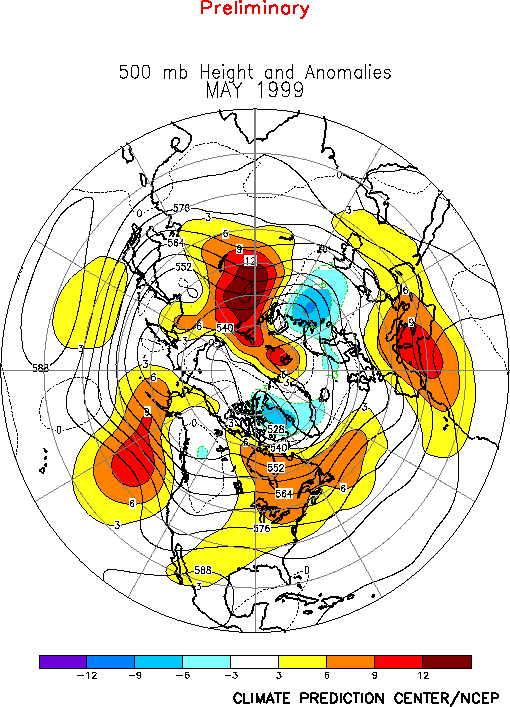
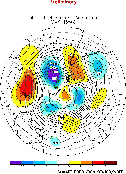
At higher latitudes above-normal heights dominated the upper-level circulation over the
North Pacific during May (Fig. E9 ). These conditions
contrast with the persistent upper-level trough which had dominated the region for the
past three months. Farther east, positive height anomalies also covered the eastern half
of Canada during the month, while negative height anomalies were observed across western
Canada. This anomaly pattern reflected a complete disappearance of the long-wave ridge and
trough features normally located over western and eastern Canada, respectively. Over
eastern Canada, the mean Hudson Bay trough has been substantially weaker than normal since
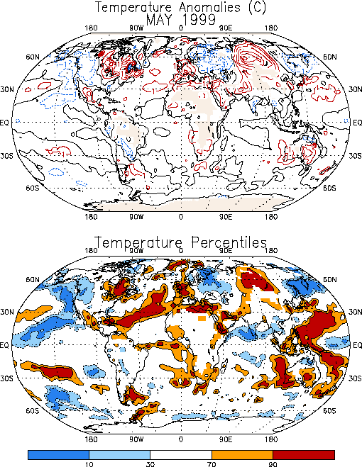
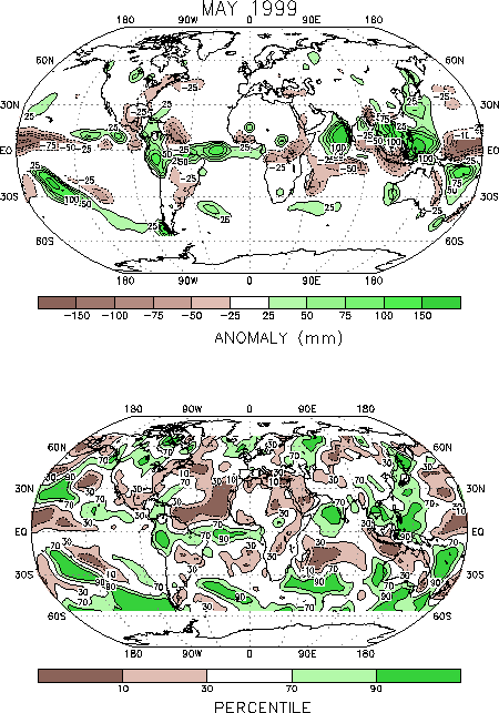
February, which has contributed to above-normal temperatures throughout the region (Fig. E1) during the period. During May this flow pattern also
contributed to substantially drier than normal conditions across the Ohio Valley and
northeastern regions of the United States (Figs. E3, E5).
b. North Atlantic, Europe, Asia
The circulation during May featured above-normal heights over the western North
Atlantic and most of Europe, and below-normal heights over the eastern North Atlantic and
central Russia (Fig. E9). These conditions were associated
with well above-normal temperatures over central Siberia, the central Atlantic, and
central Europe, and with below-normal temperatures over portions of Scandinavia and
western Russia (Fig. E1). They were also associated
with reduced precipitation across the Mediterranean Sea, northern and northeastern Africa,
the Middle East, and northeastern Europe (Fig. E3).
2. Southern Hemisphere
The Southern Hemisphere extratropical circulation during May featured above-normal
heights in the middle latitudes and below-normal heights at high latitudes (Fig. E15). At lower latitudes, the circulation featured a
well-defined low-latitude ridge over the eastern Indian Ocean and Australia and a
large-amplitude trough east of the date line (Fig. T22).
Overall, these conditions were associated with abnormally weak winds at jet stream level
across the middle latitudes of the eastern South Pacific (Fig.
T21), and a poleward shift of the main jet stream to higher latitudes. These
conditions and their Northern Hemisphere counterparts are consistent with ongoing strong
La Niña conditions.
|


