|
Forecast Forum - MAY 1999
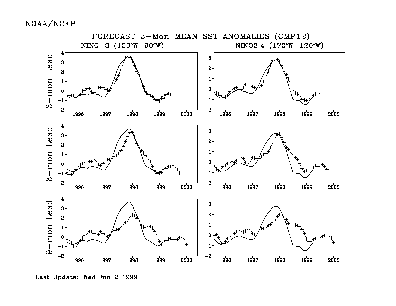
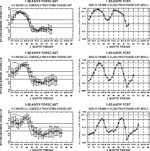
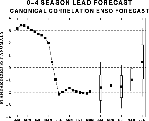
The canonical correlation analysis (CCA) forecast of SST in the central Pacific
(Barnett et al. 1988, Science, 241, 192-196; Barnston and Ropelewski 1992, J.
Climate, 5, 1316-1345), is shown in Figs. F1 and F2. This forecast is
produced routinely by the Prediction Branch of the Climate Prediction Center. The
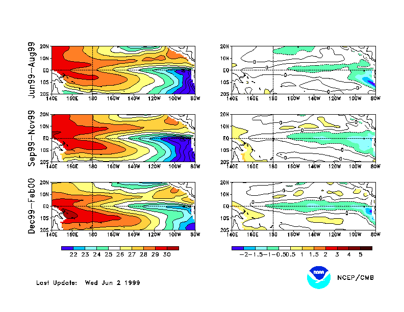
predictions from the National Centers for Environmental Prediction (NCEP) coupled
ocean/atmosphere model (Ji et al. 1998, Mon. Wea. Rev, 126, 1022-1034) are
presented in Figs. F3 and F4. Predictions from the Cane and Zebiak model (Cane et
al. 1986, Nature, 321, 827-832; Zebiak and Cane 1987, Mon. Wea. Rev.,
115, 2262-2278) are shown in Figs. F5 and F6. Predictions from the modified
Cane and Zebiak model (Chen et al. 1998, Geophys. Res. Let., 103,
2387-2840), referred to in the figures as LDEO3, are shown in Figs. F7 and F8.
Predictions using linear inverse modeling (Penland and Magorian 1993, J. Climate, 6,
1067-1076) are shown in Figs. F9 and F10. Predictions from the Scripps / Max Planck
Institute (MPI) hybrid coupled model (Barnett et al. 1993, J. Climate, 6,
1545-1566) are shown in Fig. F11.
The CPC and the contributors to the Forecast Forum caution potential users of
this predictive information that they can expect only modest skill.
Discussion and Outlook
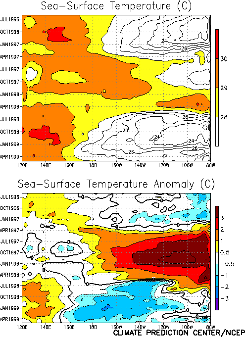
Cold episode conditions continued to dominate the tropical Pacific oceanic and
atmospheric circulation during May. Sea surface temperature (SST) anomalies decreased in
the central equatorial Pacific (Table T2), but the overall
pattern remained similar to that observed in recent months (Figs. T9,
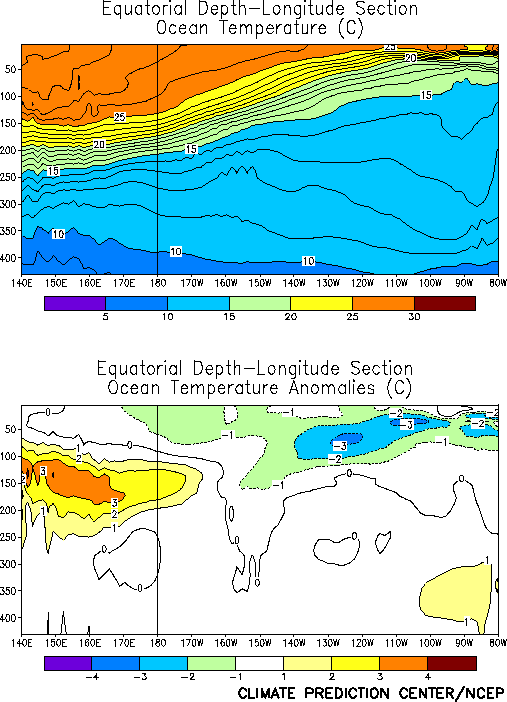
T18). The pattern of equatorial subsurface temperature
anomalies has also been highly persistent, with negative temperature anomalies in the
upper ocean throughout the region east of the date line and positive anomalies in the
western Pacific below about 50 m depth (Fig. T17). The
positive subsurface temperature anomalies have shown little evidence of an eastward shift
in recent months, consistent with the continuation of cold episode conditions.
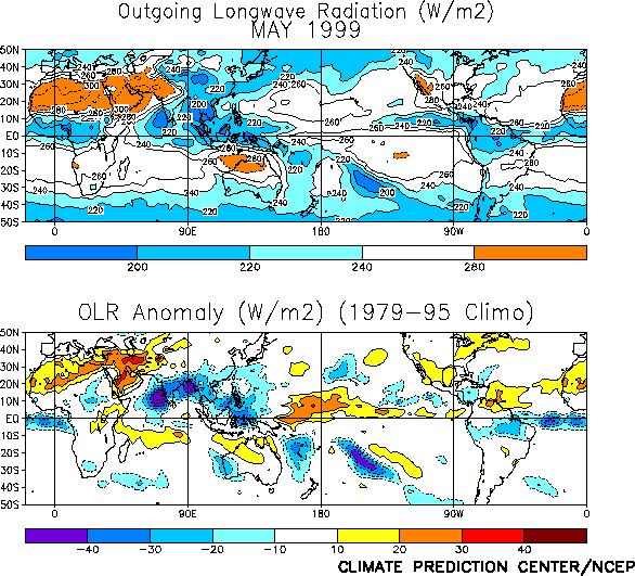
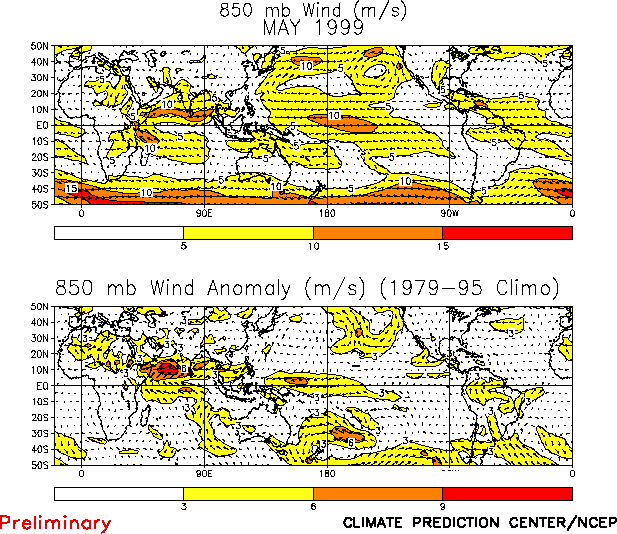
The pattern of tropical convection during May (as inferred from Outgoing Longwave
Radiation (OLR) measured by NOAA's polar-orbiting satellites) was again suppressed over
the western and central equatorial Pacific and enhanced over Indonesia/ Malaysia and the
Philippines (Fig. T25). This pattern of tropical convection
is consistent with the pattern of low-level (850-hPa) winds, which show easterly anomalies
over the central and west-central tropical Pacific and near normal winds over the eastern
Pacific (Fig. T20).
The latest NCEP coupled model forecast (Figs. F3
and F4) maintains present cold episode conditions in
the tropical Pacific through August 1999 followed by strengthening cold episode conditions
into early 2000. The NCEP statistical model forecast (Figs. F1
and F2) maintains present cold episode conditions through the
same period. Other statistical and coupled model forecasts are generally consistent with
the NCEP forecasts through the remainder of 1999.
Weekly updates of SST, 850-hPa wind and OLR are available on the Climate Prediction
Center homepage at: http://www.cpc.ncep.noaa.gov (Weekly Update).
|


