Tropical Highlights - May 1999
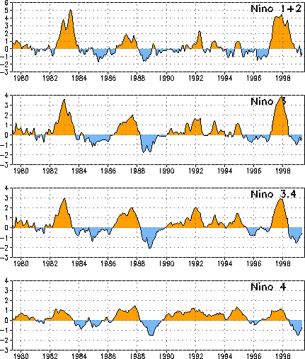
Cold episode (La Niña) conditions weakened throughout the tropical Pacific during the
past few months, as sea surface temperatures (SSTs) have increased throughout the central
Tropical Pacific and SST anomalies have decreased in the east-central and central Pacific
(Table T2, Fig. T5). During May
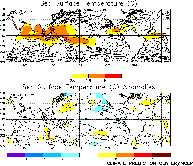
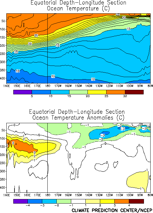
1999, SSTs more than 1.0°C below normal were only observed along the equator between
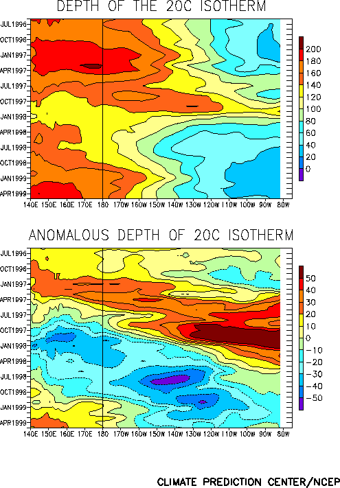
165°E and 170°W (Fig. T18 ). However, the oceanic
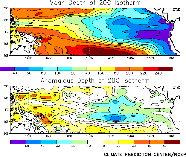
thermocline remained shallower than normal throughout the central and eastern Pacific east
of 165°W and deeper than normal west of 165°W during the month (Figs. T15, T16). Consistent with this
subsurface structure, equatorial ocean temperatures at thermocline depth remained more
than 3°C below normal in the central and eastern Pacific, and more than 3°C above-normal
in the western Pacific (Fig. T17 ).
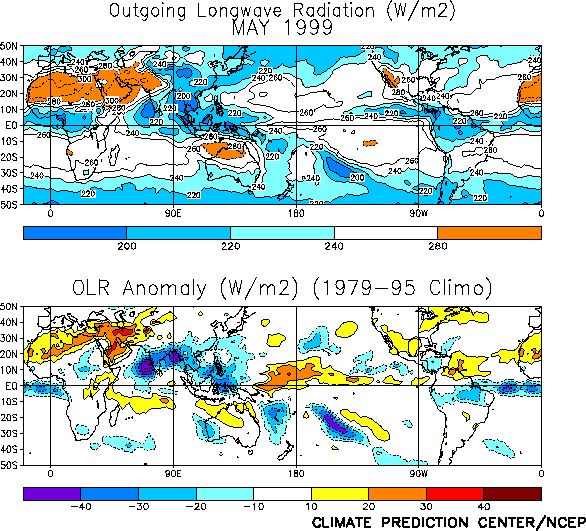
Tropical convection during May [as inferred from anomalous outgoing longwave radiation
(OLR)] remained suppressed across the western and central equatorial Pacific and enhanced
across Indonesia and the Philippines (Fig. T25 ). This
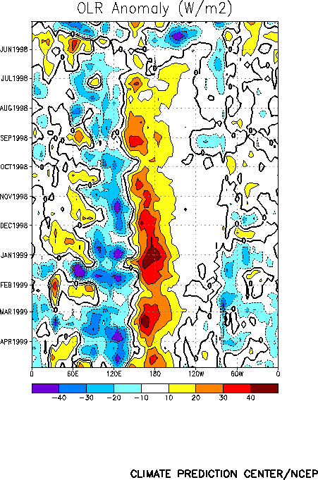
pattern of convection has persisted since June 1998 and is consistent with a continuation
of mature cold episode conditions (Fig. T11). However,
near normal convection was observed over the central equatorial Pacific during the latter
part of the month (Fig. T11) for the first time since
August 1998.
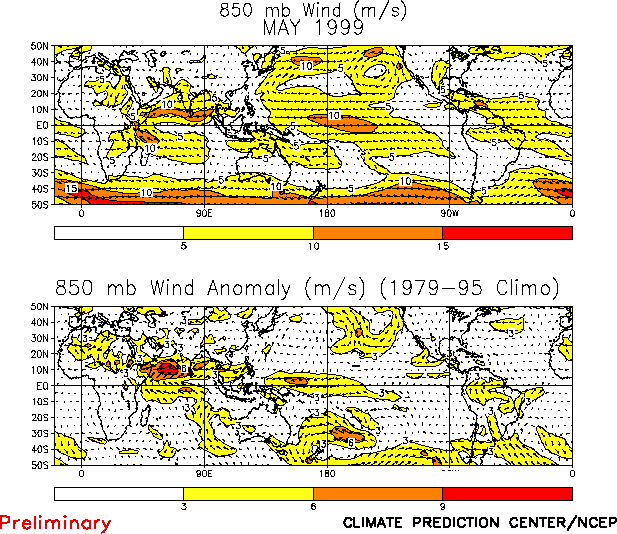
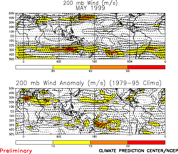
Low-level (850-hPa) equatorial easterly wind anomalies were again observed over the
western equatorial Pacific, where maximum anomalies were near 6 m s-1. In
contrast, the easterlies remained slightly weaker than normal (westerly anomalies) over
the eastern Pacific (Table T1, Fig. T20).
Westerly wind anomalies were also observed north of the equator over the Indian Ocean,
which contributed to enhanced low-level convergence and convection over Southeast Asia (Fig. T25).
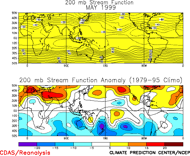
At upper levels of both hemispheres, the circulation reflected amplified troughs over
the low-latitudes of the mid-Pacific and a confinement of the low-latitude ridges to the
Indonesia and Indian Ocean sectors (Fig. T22 ). This
circulation pattern was associated with westerly anomalies at low latitudes of the central
Pacific and easterly anomalies over the tropical Indian Ocean (Figs.
T21). These features have persisted for several months and are consistent with
ongoing La Niña conditions.
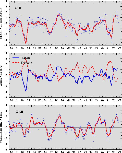
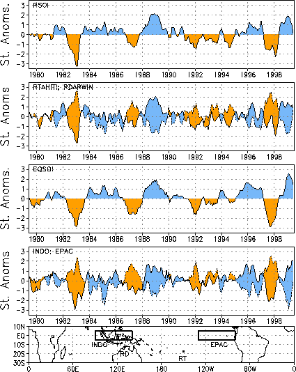
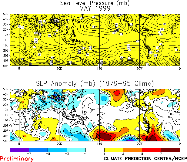
The Southern Oscillation Index (SOI) was 0.1 during May (Table
T1, Fig. T1), which is a substantial decrease from the
May value. However, this decrease is not indicative of a large-scale change in the pattern
of sea level pressure anomalies, since the equatorial SOI was 1.5 for the month (Fig. T2). The equatorial SOI continues to better depict the
continued strength of the cold episode than the conventional SOI. These index values
reflect above-normal sea level pressure (SLP) over the central Pacific and below-normal
SLP over Indonesia and the eastern Indian Ocean (Fig. T19).
Editor's Note: Fig. E3 in the March and April 1999 Climate Diagnostics Bulletin and Fig. T26 in the April 1999 Bulletin were incorrect. Corrected
versions in gif format are available on the CPC anonymous ftp site at ftp.ncep.noaa.gov in
directory pub/cpc/bulletin under the names E3_mar99.gif, E3_apr99.gif, and T26_apr99.gif
|


