Tropical
Highlights - June 2002
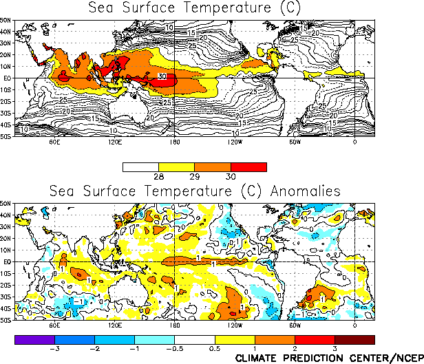
Warm episode (El Niño) conditions were observed in
the tropical Pacific basin during June 2002. SST anomalies were greater than +1°C
throughout the equatorial Pacific between 170°E and 105°W (Fig.
T18) during the month. Consistent with this warmth, the average anomalies in the
Niño 3, Niño 3.4 and Niño 4 regions were all greater than +0.5°C for the first time
since the end of the 1997-98 El Niño episode (Table T2).
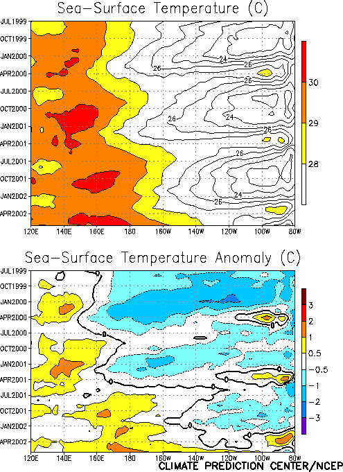
Over the past two months the most rapid surface warming has occurred in the
east-central portion of the basin (between 140°W and 105°W) (Fig.
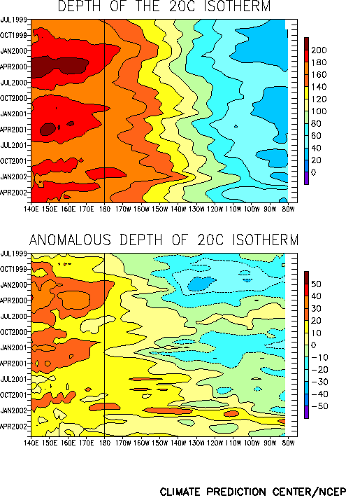
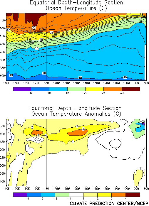
T9). This warming has been accompanied by additional deepening of the oceanic
thermocline throughout the central and east-central equatorial Pacific (Fig. T15). Ocean temperatures at thermocline depth remained
above normal throughout much of the equatorial Pacific (west of 110°W), and were slightly
below normal in the immediate vicinity of the South American Coast (Fig.
T17).
The MJO continues to be a major source of week-to-week and month-to-month variability
in the atmospheric circulation of the Tropics and subtropics. The warming across the
east-central equatorial Pacific during late May and June 2002 resulted from a significant
weakening of the equatorial low-level easterly winds throughout the equatorial Pacific
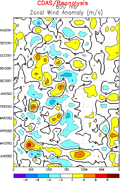
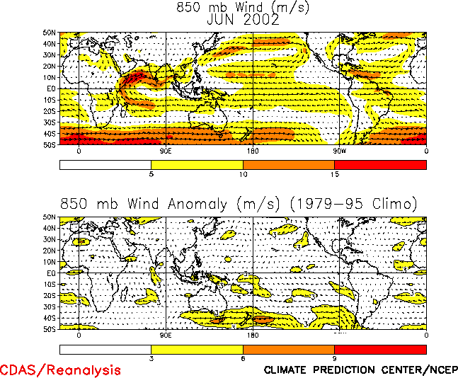
related to the MJO (Fig. T13), although the monthly mean
easterlies were near normal (Table T1, Fig.
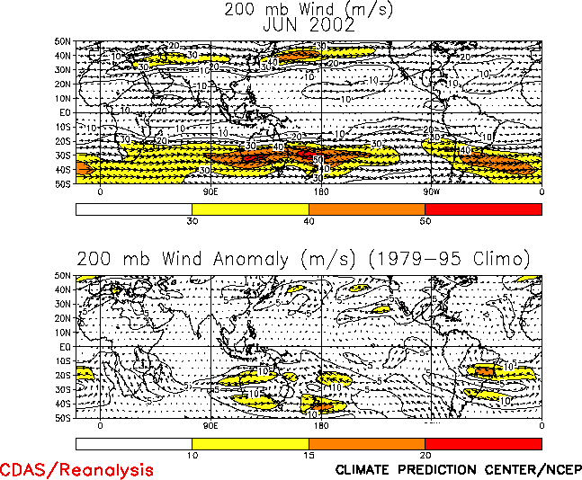
T20). The upper-level (200-hPa) winds were also near normal across the equatorial
Pacific during the month (Fig. T21). Tropical convection
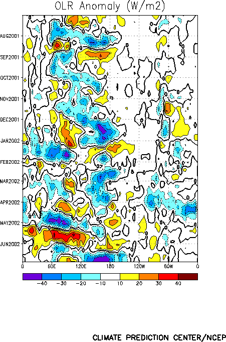
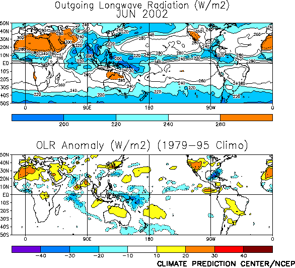
during June was also strongly influenced by the MJO (Fig. T11),
with enhanced convection dominating portions of the western tropical Pacific (between
135°E and the date line) (Fig. T25). While the monsoon
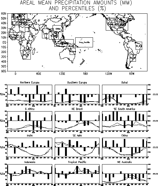
rainfall over peninsular India was near normal, the Sahel rainfall was deficient during
June (Fig. E4).
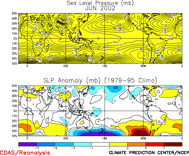
The tropical sea-level pressure (SLP) pattern during June exhibited negative anomalies
over the Pacific Ocean and positive anomalies over most of the remainder of the global
Tropics (Fig. T19). This anomaly pattern was associated
with negative values of the Tahiti-Darwin Southern Oscillation Index (SOI) (Table T1). In spite of the variability associated with the
MJO in recent months, the SOI has been consistently negative since March 2002 (Table T1). |


