Extratropical Highlights - June 1999
1. Northern Hemisphere
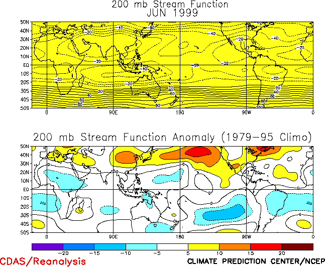
The atmospheric circulation during June was dominated by above-normal heights over
eastern Canada, western Russia, and across the middle latitudes centered near
40°N (Fig.
E9), and by below-normal heights over central Russia. The predominance of above-normal heights over large portions of
the hemisphere contributed to: 1) a well-defined upper-level ridge at low latitudes extending across the
western Pacific, Asia, northern Africa and the North Atlantic
(Fig. T22, Top); 2) exceptionally warm
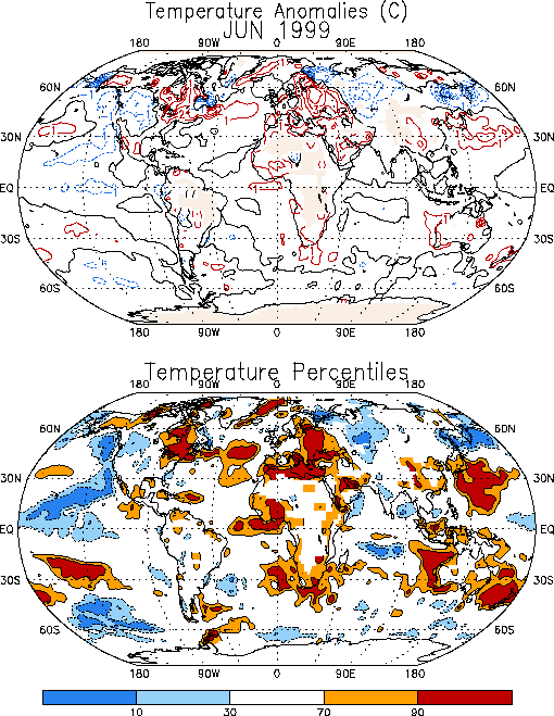
temperatures across eastern Canada (Figs. E1) and warm and dry conditions
(Figs. E3, E5) across the
northeastern United States; and 3) exceptionally warm conditions across eastern Europe and western Russia.
a. Pacific/ North America
Above-normal heights have persisted across the middle latitudes of the western and central
North Pacific since February, in association with ongoing cold-episode conditions. Above-normal heights
have also persisted across eastern Canada during this five-month period, indicating a pronounced weakening
of, and at times a complete disappearance of, the mean Hudson Bay trough. Collectively, these
circulation features have contributed to enhanced westerly flow into western Canada during the period, and to
substantially reduced northwesterly flow and above-normal temperatures across central and eastern
North America.
During June, anomalous warmth covered the eastern half of Canada and the northeastern
United States (Fig. E1
), with temperatures exceeding the 90th percentile across much of the region. During part
of the month temperatures averaged 6-10°C above normal in Labrador and northern Quebec.
Weekly departures of +3°to +6°C were also observed across the remainder of Quebec and the Canadian
Maritime Provinces.
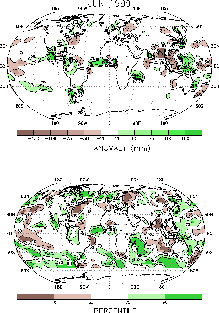
In the northeastern United States anomalous warmth was accompanied by exceptionally dry
conditions, with near-record low rainfall totals recorded in the Northeast and Mid-Atlantic regions
(Fig. E5). In contrast, the Gulf Coast region experienced slightly above-normal rainfall during the month, which is
in marked contrast to the significantly below-normal rainfall totals observed in this region during
February-May.
Elsewhere, temperatures were again below normal over much of the western United States
and southwestern Canada during June in association with an anomalous upper-level trough over the region.
For the April-June period, temperatures throughout the northwestern and west-central United States averaged
in the lowest one-third of the historical distribution.
b. North Atlantic, Europe, Russia
Above-normal heights across southern Europe and northern Africa during June contributed to
significantly warmer than normal (90th percentile) temperatures throughout the region
(Fig. E1). Large
portions of southern Europe also recorded below-normal rainfall during the month.
Abnormally warm temperatures (2°-4°C above normal) were also observed in eastern Europe
and western Russia during June, in association with a pronounced ridge at upper
levels (Fig. E9). Farther
east, drier-than-normal conditions prevailed in the region east of the ridge axis, while below-normal
temperatures were observed in the region east of the downstream trough axis. In this latter region, temperatures
averaged 2°-3°C below-normal during the month, with some areas recording values in the lowest
10th percentile.
c. Asia
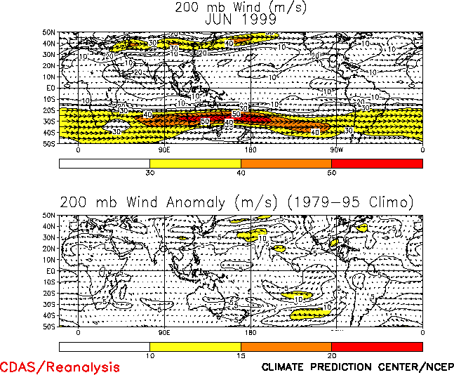
A well-defined upper-level monsoon ridge was evident during June extending from western
Africa across Asia to the western Pacific (Fig. T22, top). This feature was associated with anomalous
easterly flow near 30°N extending from northwestern Africa to the date line
(Fig. T21), and with a
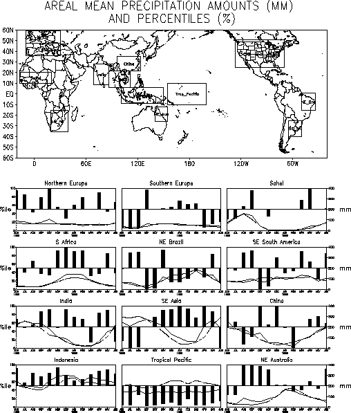
pronounced anticyclonic circulation anomaly centered over China. This latter feature contributed to significantly
below-normal rainfall across southeastern Asia (Fig. E3), with near-record low totals observed for the region as
a whole (Fig. E4
).
2. Southern Hemisphere
The Southern Hemisphere circulation during June featured an anomalous wave-3 pattern in the
middle latitudes, above-normal heights over Antarctica
(Fig. E15), and an anomalous anticyclonic circulation
at lower latitudes throughout the hemisphere (Fig. T22, bottom). These conditions were particularly
prominent over the central and eastern South Pacific, where they were associated with a poleward shift of
the wintertime jet stream (Fig. T21) and with increased storminess and above-normal rainfall across
southern South America (Fig. E3
).
Over the central and eastern Indian Ocean the anomalous circulation reflected an amplified
wave pattern characterized by a large-amplitude trough to the southwest of Australia, a well-defined ridge to
the southeast of Australia, and a pronounced split flow pattern across southern Australia
(Fig. E15). This circulation contributed to above-normal rainfall and increased storminess across the central and
eastern Indian Ocean and in the region south of Australia
(Fig. E3, bottom). It also contributed to
above-normal rainfall over eastern Australia, which was situated within the equatorward branch of the upper-level
westerly flow.
| 

