Forecast Forum
The canonical correlation analysis (CCA) forecast of SST in the central Pacific (Barnett et al.
1988, Science, 241, 192-196; Barnston and Ropelewski 1992,
J. Climate, 5, 1316-1345), is shown in
Figs. F1 and F2. This forecast is produced routinely by the Prediction Branch of the Climate Prediction Center.
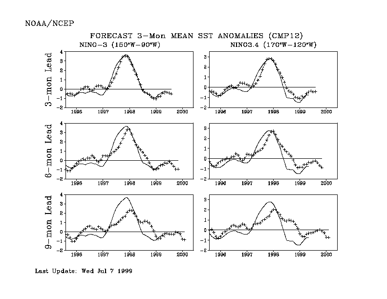
The predictions from the National Centers for Environmental Prediction (NCEP) coupled
ocean/atmosphere model (Ji et al. 1998, Mon. Wea.
Rev, 126, 1022-1034) are presented in
Figs. F3 and F4. Predictions from the Cane and Zebiak model (Cane et al. 1986,
Nature, 321, 827-832; Zebiak and
Cane 1987, Mon. Wea. Rev., 115, 2262-2278) are shown in
Figs. F5 and F6. Predictions from the
modified Cane and Zebiak model (Chen et al. 1998,
Geophys. Res. Let., 103, 2387-2840), referred to in the
figures as LDEO3, are shown in Figs. F7 and
F8. Predictions using linear inverse modeling (Penland
and Magorian 1993, J. Climate, 6, 1067-1076) are shown in
Figs. F9 and F10. Predictions from the
Scripps / Max Planck Institute (MPI) hybrid coupled model (Barnett et al. 1993,
J. Climate, 6, 1545-1566) are shown in
Fig. F11.
The CPC and the contributors to the Forecast Forum
caution potential users of this predictive information that they can expect only modest skill.
Discussion and Outlook
Although cold-episode conditions have weakened substantially since the beginning of the year,
the overall patterns of oceanic temperature and atmospheric circulation in June were similar to those
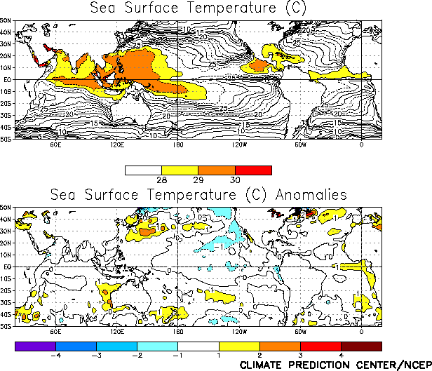
observed during recent months. During June weak negative SST anomalies (Fig. T18) and
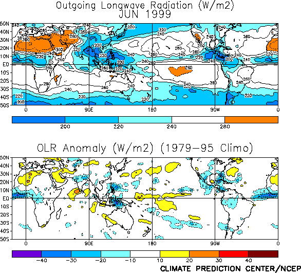
weaker-than-normal convection (Fig. T25) prevailed throughout the equatorial Pacific east of 160°E , and low-level
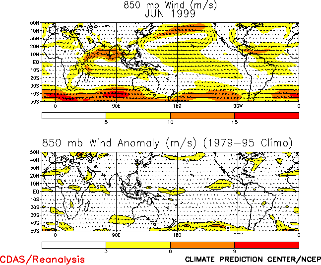
easterlies remained stronger than normal between 150°E and 160°W (Fig. T20).
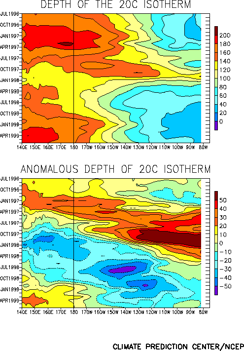
Consistent with these features, the thermocline has been deeper than normal in the western
equatorial Pacific and shallower than normal in the eastern equatorial Pacific. This has resulted in a dipole
pattern of positive/ negative subsurface temperature anomalies in the western/ eastern equatorial Pacific (Fig. T17). The lack of any significant eastward shift in the positive subsurface temperature anomalies in the
west-central equatorial Pacific indicates that the present cold episode is likely to continue for the next
several months. This assessment of the situation is supported by the most recent NCEP coupled model
forecasts (Figs. F3 and F4) and other available coupled model and statistical predictions that indicate cold
episode conditions persisting through the end of 1999 and into the early part of 2000.
Weekly updates for SST, 850-hPa wind, and OLR are available on the Climate Prediction
Center homepage at: http://www.cpc.ncep.noaa.gov (Weekly Update).
|


