|
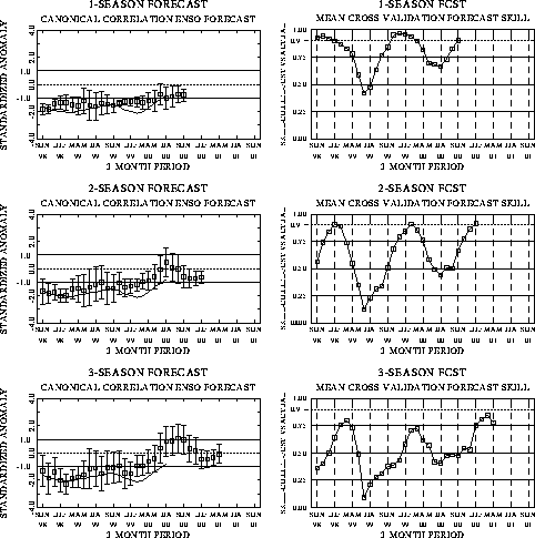
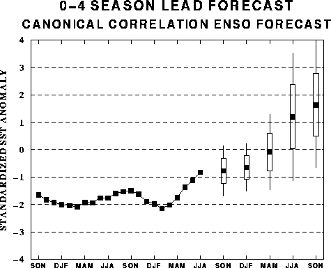
The canonical correlation analysis (CCA) forecast
of SST in the central Pacific (Barnett et al. 1988, Science, 241, 192-196;
Barnston and Ropelewski 1992, J. Climate, 5, 1316-1345), is shown in Figs.
F1 and F2. This forecast is produced
routinely by the Prediction Branch of the Climate Prediction Center. The predictions from
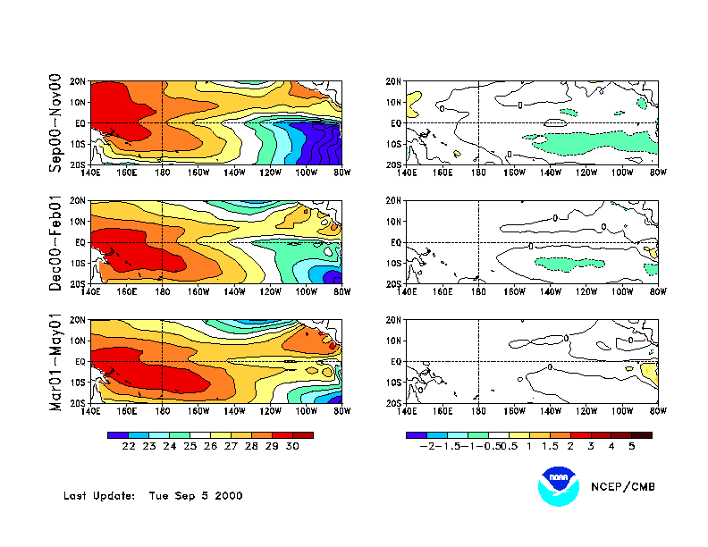
the National Centers for Environmental Prediction (NCEP) coupled ocean/atmosphere model
(Ji et al. 1998, Mon. Wea. Rev, 126, 1022-1034) are presented in Figs. F3 and F4. Predictions from the latest
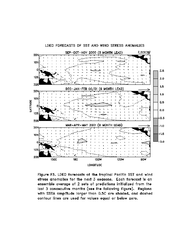
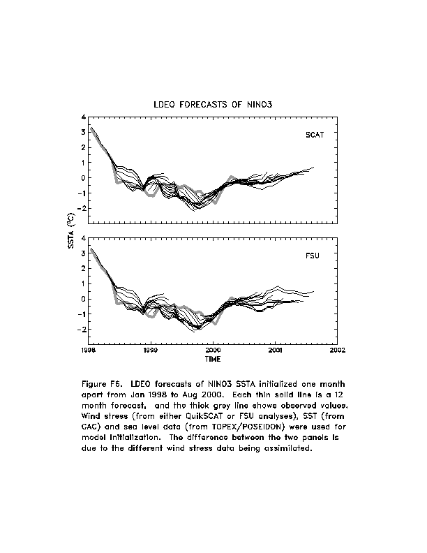
version of the LDEO model (Chen, D., M. A. Cane, S. E. Zebiak, Rafael Canizares and A.
Kaplan, 2000, Geophys. Res. Let., accepted) are shown in Figs. F5 and F6. Predictions using linear
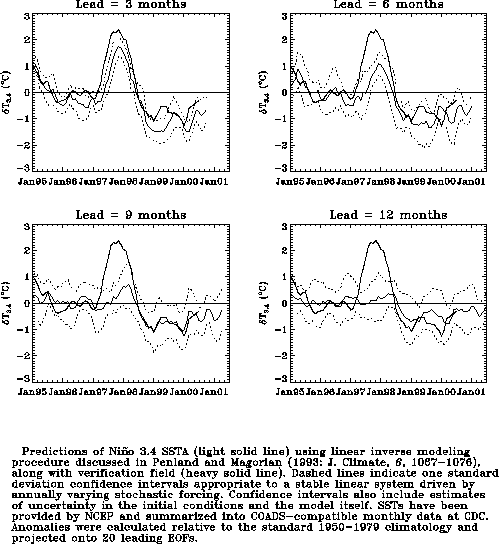
inverse modeling (Penland and Magorian 1993, J. Climate, 6, 1067-1076) are
shown in Figs. F7 and F8.
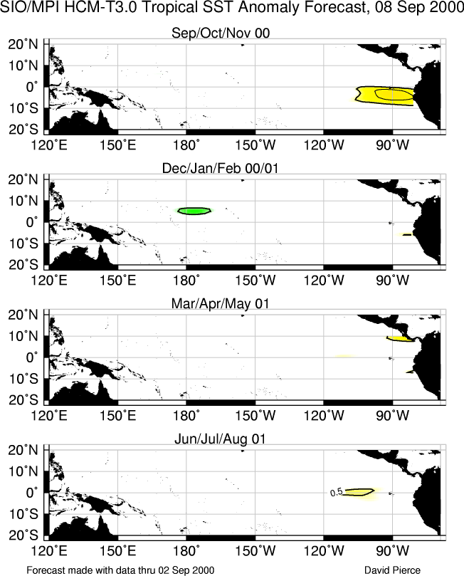
Predictions from the Scripps / Max Planck Institute (MPI) hybrid coupled model (Barnett et
al. 1993, J. Climate, 6, 1545-1566) are shown in Fig. F9.
The CPC and the contributors to the Forecast Forum caution potential users of
this predictive information that they can expect only modest skill.
Outlook
Near-normal conditions are expected in the tropical Pacific through early 2001.
Discussion
Near-normal atmospheric and oceanic conditions prevailed in the tropical
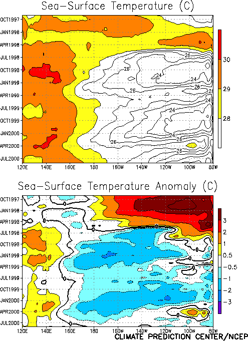
Pacific during August. Weak negative SST anomalies were found across portions of the
central and eastern tropical Pacific during the month (Fig. T18),
but they continue to decrease in magnitude (Fig. T9). The
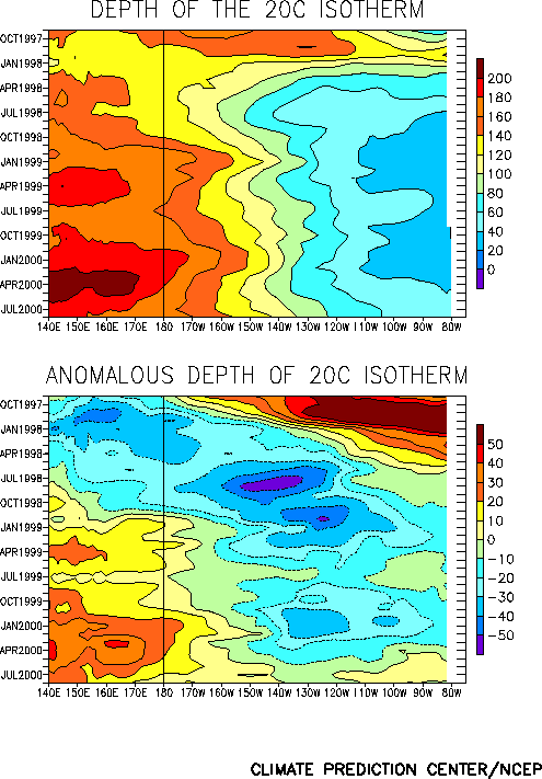
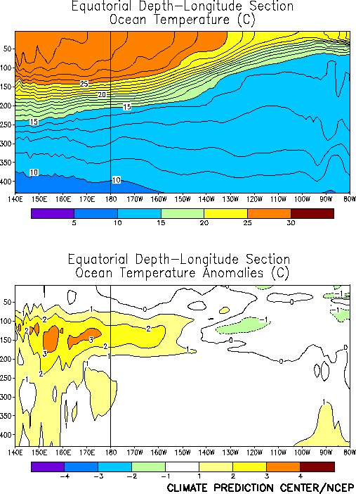
oceanic thermocline remained deeper-than-normal in the equatorial west-central and western
Pacific (Fig. T15), with temperatures averaging up to 3°C
above normal at thermocline depth (Fig. T17). The negative
temperature anomalies that have characterized the subsurface thermal structure in the
eastern Pacific since late 1998 have continued to weaken (Figs. T15,
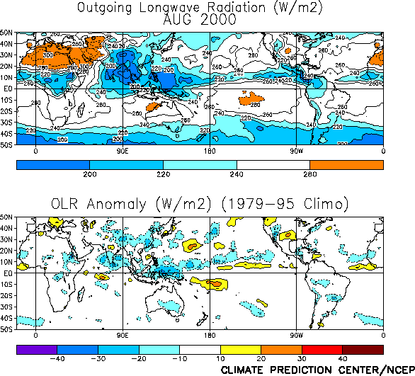
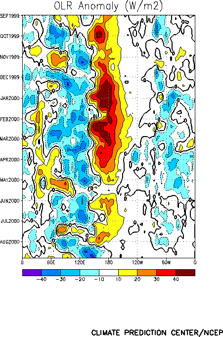
T17). The pattern of tropical convection [as inferred from
anomalous outgoing longwave radiation (OLR)] remained generally consistent with weak cold
episode conditions (Fig. T25), but intraseasonal activity
dominated the pattern over Indonesia and the western Pacific (Fig.
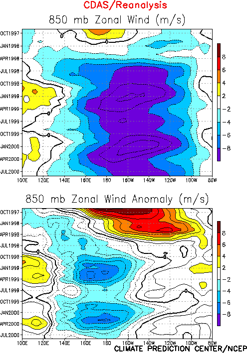
T11). Consistent with the decrease in magnitude of the negative SST anomalies
across the central equatorial Pacific in recent months, the low-level easterly wind
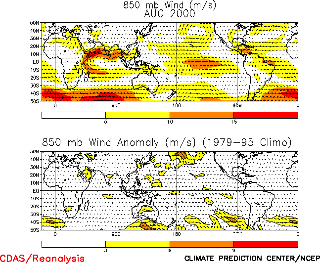
anomalies across the central and western tropical Pacific are very weak (Figs. T7, T20).
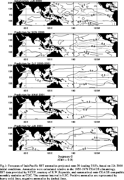
The most recent NCEP statistical and coupled model forecasts (Figs. F1, F2, F3, F4), as well as other available forecasts (Figs. F5, F6, F7, F8, F9),
indicate near-normal conditions through the spring of 2001.
Weekly updates of SST, 850-hPa wind and OLR are available on the Climate Prediction
Center homepage at: http://www.cpc.ncep.noaa.gov (Weekly
Update).
|


