|
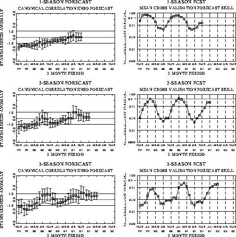
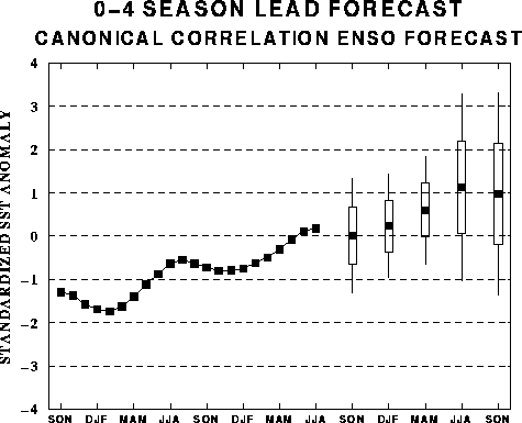
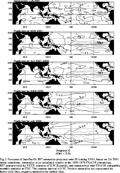
The canonical correlation analysis (CCA) forecast
of SST in the central Pacific (Barnett et al. 1988, Science, 241, 192-196;
Barnston and Ropelewski 1992, J. Climate, 5, 1316-1345), is shown in Figs.
F1 and F2. This forecast is produced
routinely by the Prediction Branch of the Climate Prediction Center. The predictions from
the National Centers for Environmental Prediction (NCEP) coupled ocean/atmosphere model
(Ji et al. 1998, Mon. Wea. Rev, 126, 1022-1034) are presented in Figs. F3 and F4. Predictions from the latest
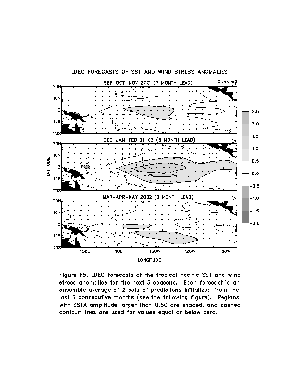
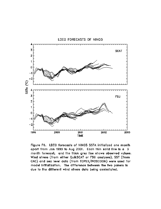
version of the LDEO model (Chen, D., M. A. Cane, S. E. Zebiak, Rafael Canizares and A.
Kaplan, 2000, Geophys. Res. Let., accepted) are shown in Figs. F5 and F6. Predictions using linear
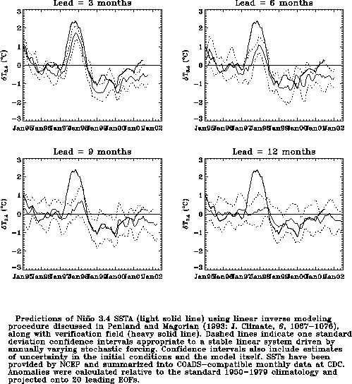
inverse modeling (Penland and Magorian 1993, J. Climate, 6, 1067-1076) are
shown in Figs. F7 and F8.
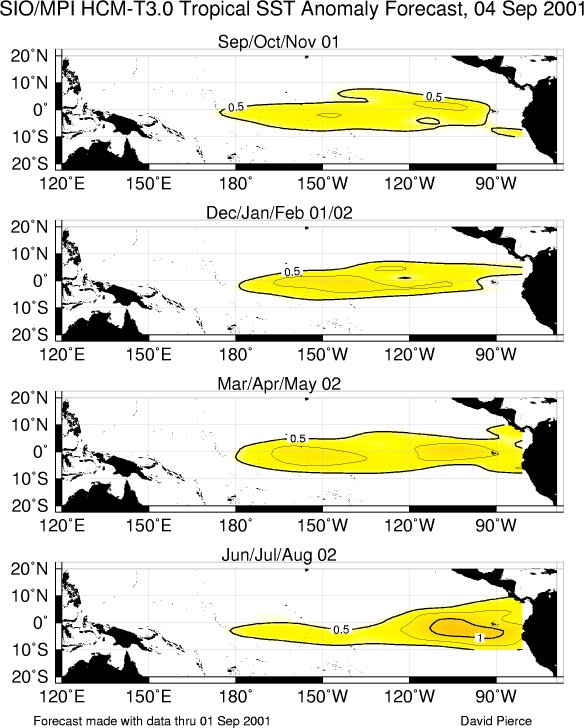
Predictions from the Scripps / Max Planck Institute (MPI) hybrid coupled model (Barnett et
al. 1993, J. Climate, 6, 1545-1566) are shown in Fig. F9.
The CPC and the contributors to the Forecast Forum caution potential users of
this predictive information that they can expect only modest skill.
Outlook
A gradual transition to warm episode conditions is expected to continue in the tropical
Pacific during the remainder of 2001 and into the first half of 2002.
Discussion
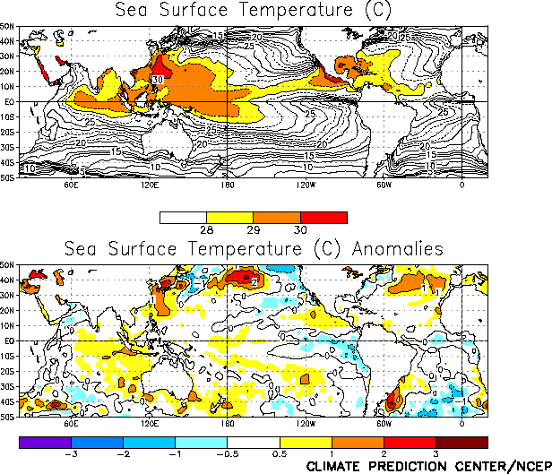
Near-normal atmospheric and slightly warmer-than-normal oceanic conditions prevailed in
the tropical Pacific during August. SST anomalies averaged less than 1°C at all locations
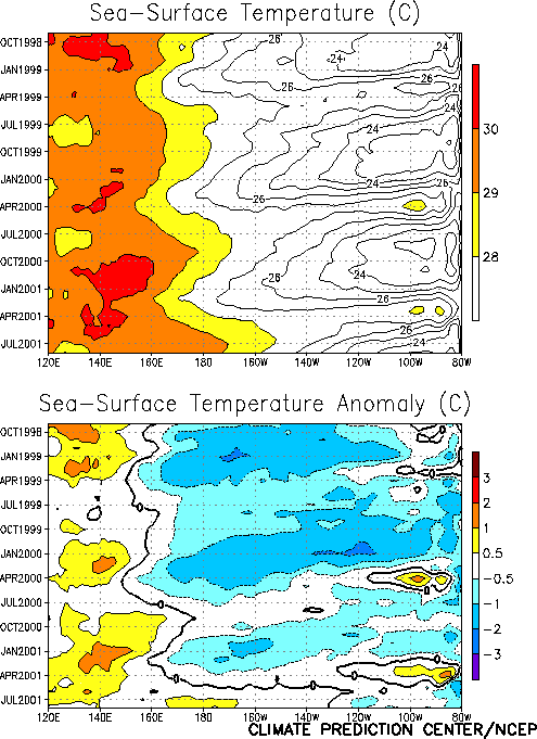
in the tropical Pacific during the month (Fig. T18).
However, SSTs and SST anomalies have steadily increased in the central equatorial Pacific
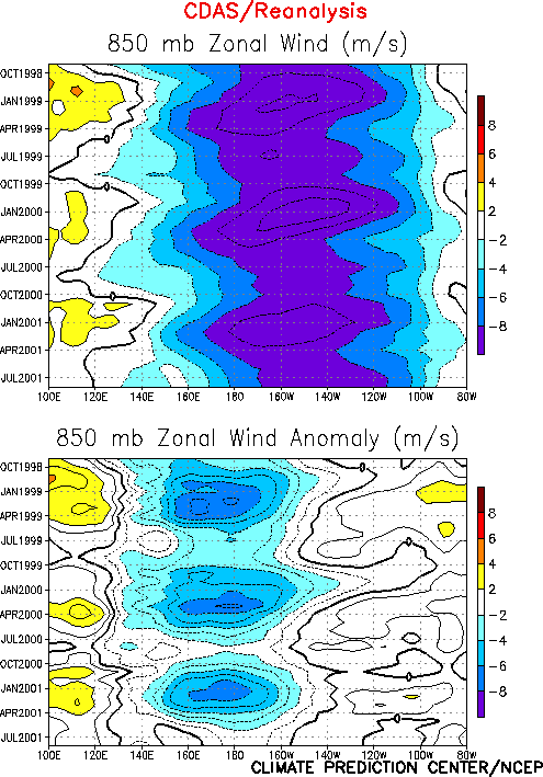
since early 2001 rising to their highest levels since the 1997-1998 warm episode (Fig. T9). Accom-panying this evolution there has been a
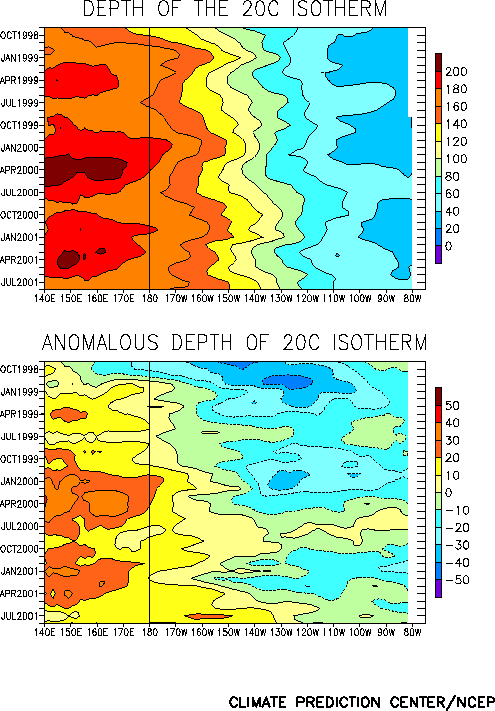
gradual return to near normal low-level winds throughout the equatorial Pacific (Fig. T7). The oceanic thermocline remained deeper-than-normal
in the equatorial central and western Pacific (Fig. T15),
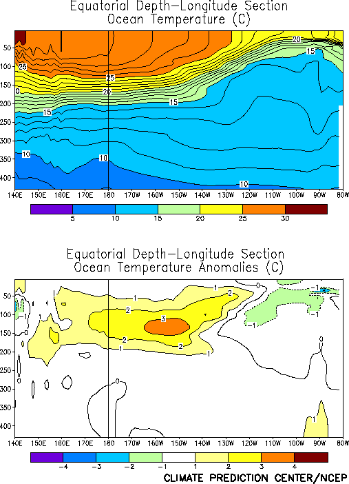
with temperatures averaging up to 3°C above normal at thermocline depth (Fig. T17). Over the past two years there has been a gradual
expansion of the area of positive equatorial subsurface temperature anomalies into the
central Pacific (Fig. T15) and a gradual decrease in the
strength and areal extent of the negative subsurface temperature anomalies in the eastern
Pacific. This evolution is consistent with the decay of the subsurface thermal structure
that characterizes the mature phase of cold episodes and the development of conditions
usually found just prior to warm (El Niño) episodes.
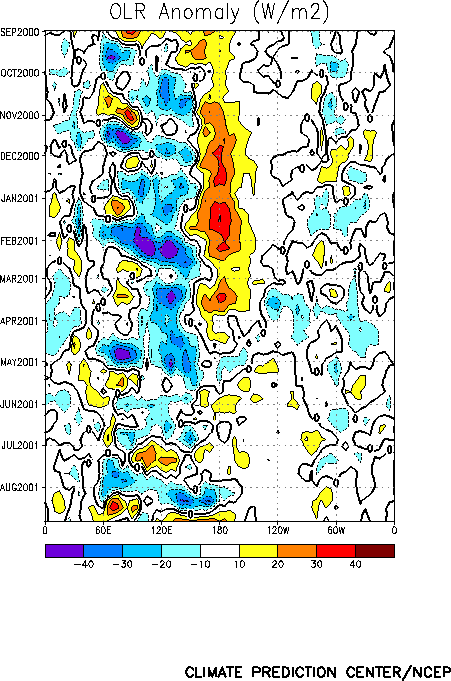
The pattern of tropical convection [as inferred from anomalous outgoing longwave
radiation (OLR)] was strongly modulated by tropical intraseasonal (30-60 day) fluctuations
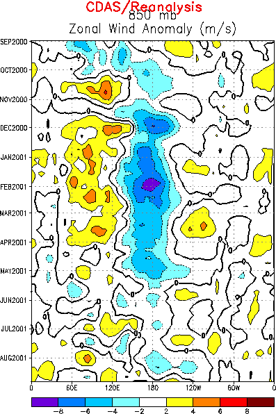
associated with the Madden Julian Oscillation (MJO) (Figs. T11,
T12). Low-level wind fluctuations across the central and
western tropical Pacific were consistent with this activity during the month (Fig. T13). In the past the MJO has been instrumental in
producing low-level westerly wind bursts that are linked to subsequent oceanic warming in
the eastern equatorial Pacific during the onset phase of warm episodes, especially during
the transition seasons (March-May and September-November). Thus, special attention will be
focused on the evolution of the MJO, and any effect that it has on surface and subsurface
ocean temperatures over the next several months.
There is no clear consensus among the latest statistical and coupled model predictions.
However, several of these predictions, including the NCEP statistical (Figs. F1 and F2) and coupled model forecasts (Figs.
F3 and F4), indicate that positive SST
anomalies will continue in the central equatorial Pacific during the remainder of 2001 and
into the first half of 2002. The impacts that this warming will have on global temperature
and precipitation patterns depend to a large degree on its intensity, areal extent, and
location. At the moment, considering both the SST predictions and the observed oceanic and
atmospheric circulation patterns, it seems most likely that the intensity of the warming
will be weak or moderate.
Weekly updates of SST, 850-hPa wind, OLR, and the
equatorial subsurface temperature structure are available on the Climate Prediction Center
homepage at: http://www.cpc.ncep.noaa.gov (Weekly
Update).
|


