Tropical
Highlights - October 2001
ENSO-neutral conditions prevailed across the
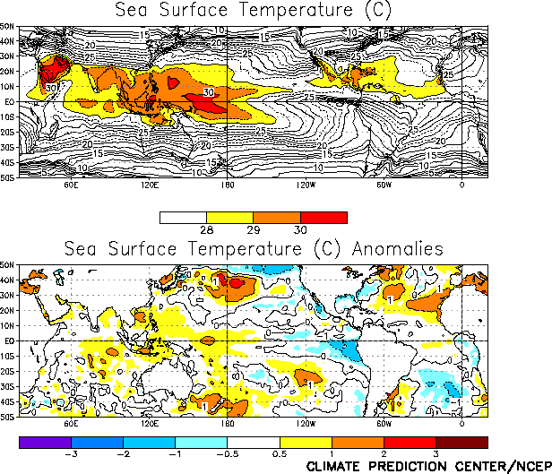
tropical Pacific during October 2001, as indicated by the equatorial atmospheric (Table T1) and sea surface temperature (SST) indices (Table T2). A dipole pattern of weak SST anomalies continued
across the equatorial Pacific during the month (Fig. T18)
which featured positive anomalies (0.5 to 1.0°C above
normal) across the western and central Pacific and negative anomalies (1.0°C below normal) across the eastern Pacific. This pattern
reflected an expansion of the 30°C isotherm in the
region just west of the date line and the persistence of anomalously warm temperatures in
the Niño 4 region (Table T2).
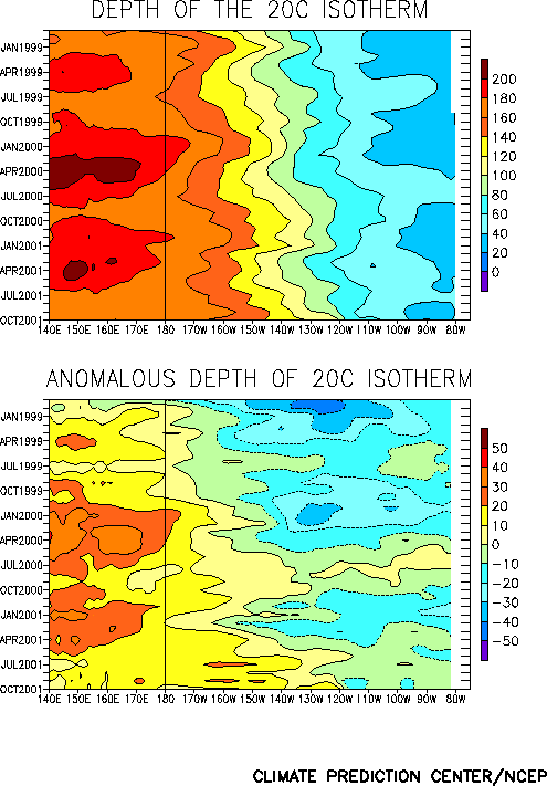
The oceanic thermocline in the equatorial Pacific (indicated by the 20°C isotherm) remained deeper than normal Pacific west of
120°W and slightly shallower than normal in the
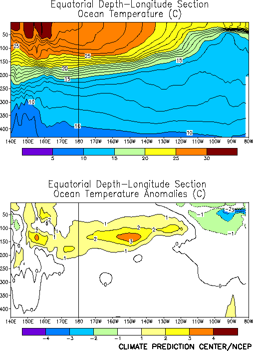
extreme eastern Pacific (Fig. T15). Consistent with these
conditions, temperatures at thermocline depth were 2-3°C
above normal throughout the western and central Pacific and 2-3°C below normal in the east (Fig.
T17). This overall anomaly pattern has persisted since August.
No significant large-scale patterns of anomalous tropical convection were evident
during October (Fig. T25). However, substantial
intraseasonal (Madden-Julian Oscillation-MJO) activity continued to bring strong
intra-monthly variability in tropical convection to the tropical Indian and western
Pacific Oceans, with both regions experiencing enhanced convective activity during the 1st
half of the month (Fig. T11).
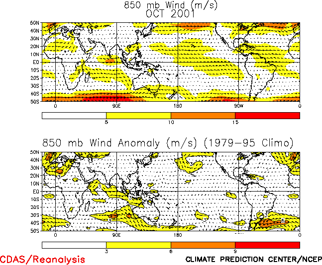
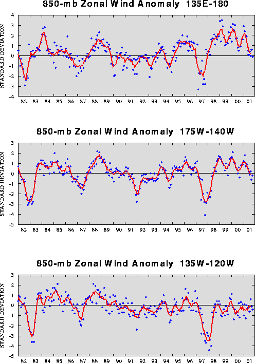
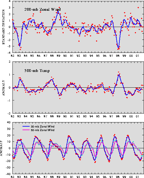
Both the low-level (850-hPa) and the upper-level (200-hPa) winds were near normal
across the equatorial Pacific during October (Figs. T20, T21). The low-level winds have been near-normal across the
equatorial Pacific since April 2001 (Table T1, Fig T4), and the upper-level winds have been near-normal since
February 2001 (Table T1, Fig. T3).
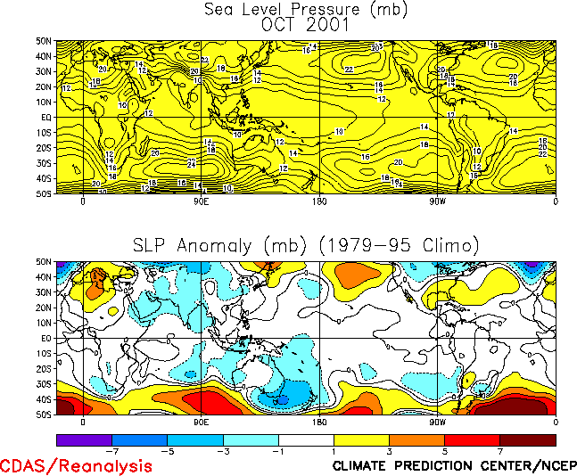
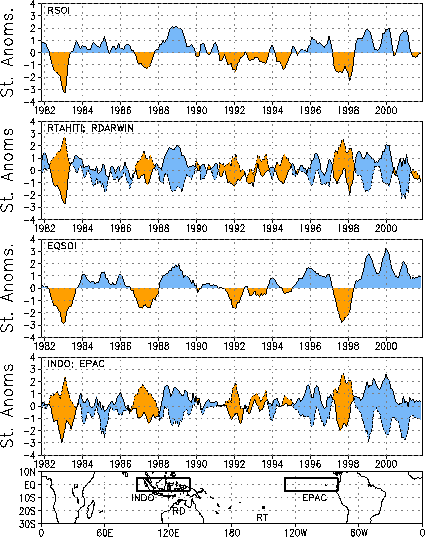
The sea level pressure (SLP) pattern during October featured negative anomalies
extending from the eastern Indian Ocean across Indonesia to the central Pacific (Fig. T19). This pattern was associated with a slightly
negative value of the Tahiti - Darwin Southern Oscillation Index (SOI) (-0.4) (Table T1). The equatorial SOI remained positive during
October (1.0), and has been positive since the beginning of the cold episode in mid-1998 (Fig. T2). |


