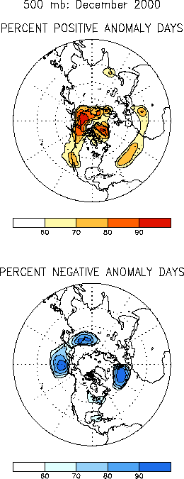
The 500-hPa circulation during
December was dominated by above-normal heights at high latitudes and below-normal heights
in the middle latitudes (Figs. E9, E11).
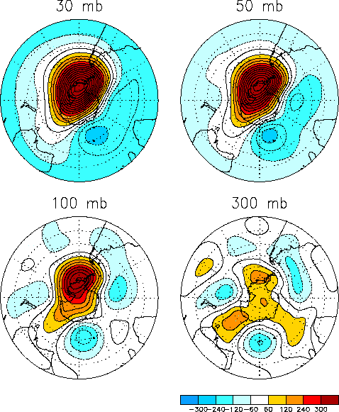
This anomaly pattern also extended well into the middle stratosphere, and remained
prominent even at the 30-hPa level (Fig. S1). This overall
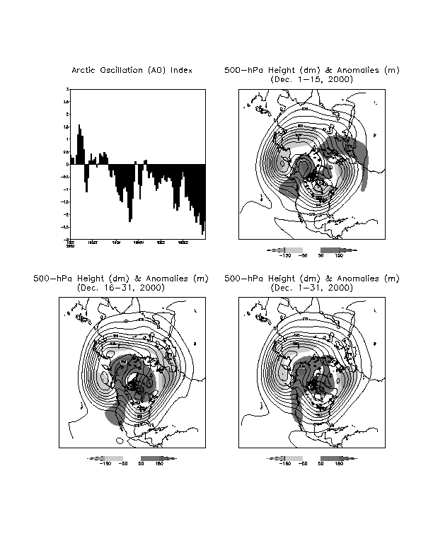
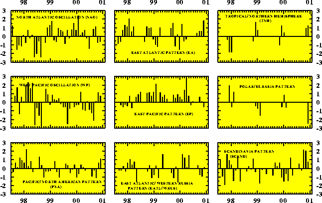
anomalous circulation reflected a strong negative phase of the Arctic Oscillation (Fig. A2.2). It also projected regionally onto the positive
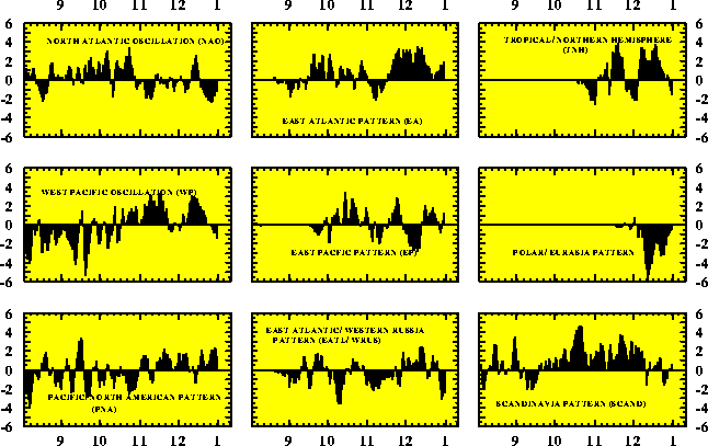
phases of the Pacific/ North American (PNA) and the East Atlantic (EA) teleconnection
patterns (Figs. E6, E7), and onto
the negative phases of both the North Atlantic Oscillation (NAO) and the Polar/ Eurasia
pattern. Over North America, this anomalous circulation contributed to extremely cold
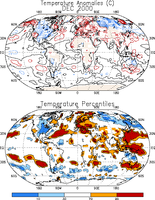
temperatures across the United States and Canada (Fig. E1).
It also contributed to exceptionally warm temperatures throughout Europe, and to
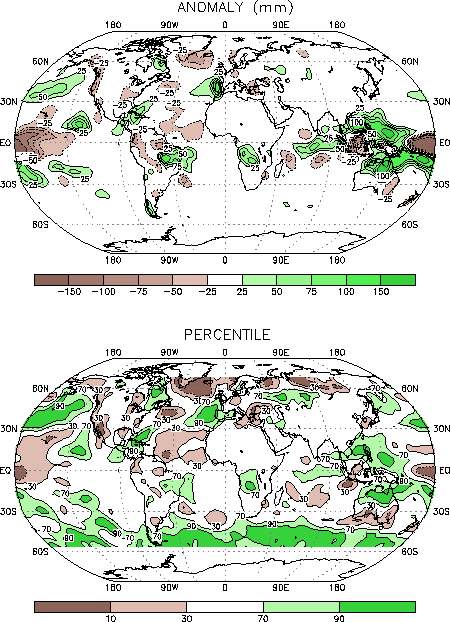
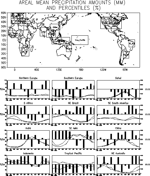
above-average precipitation over southwestern Europe (Fig. E3).
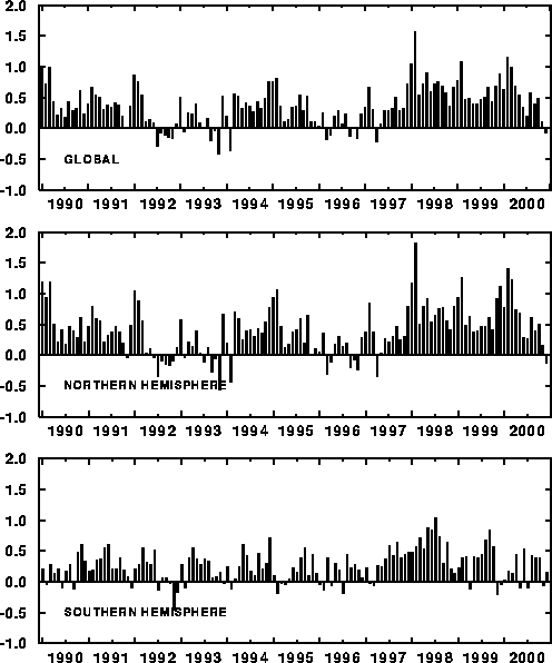
December 2000 also featured a return to slightly below-average global temperatures for
the first time since early 1997 (Fig. E2, top). This
cooling was most noticeable in the Northern Hemisphere, where below-average hemispheric
temperatures were also observed for the first time since early 1997 (Fig. E2, middle).
a. North America
The 500-hPa circulation over North America featured an amplified ridge extending
northward from the extreme western United States to northern Siberia (Fig.
E9). This feature was accompanied by a very strong surface pressure ridge which
extended poleward from the central United States to northern Siberia. (Fig.
E8). The areal extent of this pressure ridge was so expansive that it served as a
duct for driving bitterly cold air from northern Siberia down into Canada and the central
United States. This northerly flow, sometimes referred to as the "Siberian
Express," brought significantly below-average temperatures to the central and eastern
United States and Canada (Fig. E1), with monthly
temperatures averaging below the lowest 10th percentile over the eastern half
of the United States.
b. Europe
Above-average heights covered Greenland and the high latitudes of the North Atlantic
during December, while below-average heights covered both the west-central and
east-central North Atlantic (Fig. E9). This overall anomaly
pattern is consistent with the negative phase of the North Atlantic Oscillation, and was
also evident during November. In both months this circulation pattern was accompanied by a
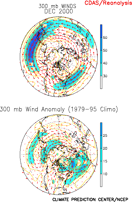
pronounced southward shift of the mean North Atlantic jet stream over much of the Atlantic
basin (Fig. E10, left), with the mean jet core extending
almost due eastward from the mid-Atlantic region of the United States to southern Spain.
During December, this flow pattern contributed to a continuation of above-average
temperatures across Europe and Scandinavia (Fig. E1), and
to above-average rainfall in southwestern Europe (Fig. E3).
2. Southern Hemisphere
The circulation during December featured above-average heights throughout the Antarctic
region, and below-average heights in the southern extratropics (Fig.
E15). This overall pattern is referred to as the negative phase of the
Antarctic Oscillation. It is very similar to the negative phase of the Arctic Oscillation,
which dominated the Northern Hemisphere circulation during the month.
In Australia the northern section of the country experienced significantly cooler (Fig. E3) and wetter (Fig. E3)
than normal conditions during December, while the southern sector experienced
exceptionally warm and dry conditions. The above-average rainfall in the North and
Northeast was consistent with a strengthening of Pacific cold episode (La Niña)
conditions (see Tropical Highlights), while the
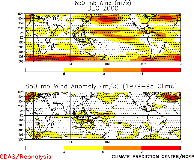
anomalously warm and dry conditions in the South were associated with a shift of the
low-level westerlies to south of the continent (Fig. T20, top).
Elsewhere, near-average rains were observed over southern Africa during December,
following well above-average rainfall in November (Fig. E4).
To date the 2000-2001 southern Africa rainy season, which extends from October - April,
has featured slightly above-average rainfall.


