Tropical
Highlights - December 2001
Tropical conditions during December 2001 reflected
a continuation of strong intraseasonal (Madden-Julian Oscillation-MJO) activity, and a
continued evolution towards a warm episode in the tropical Pacific. Although sea surface
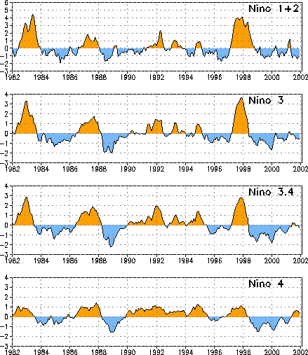
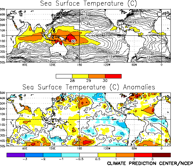
temperature (SST) anomalies were near zero in the Niño 3, Niño 3.4, and Niño 4 regions
(Figs. T5, T18, Table
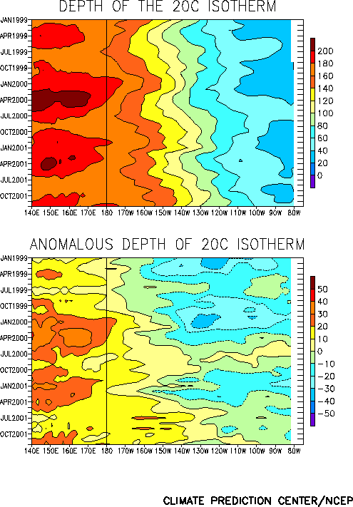
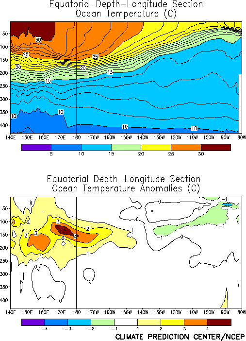
T2), there was a substantial deepening of the thermocline (Fig.
T15) and in increase in subsurface temperature anomalies in the central equatorial
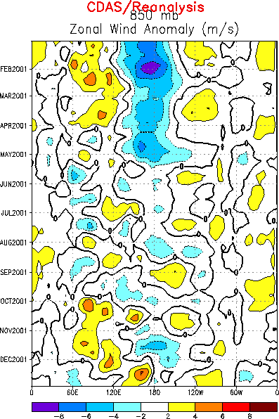
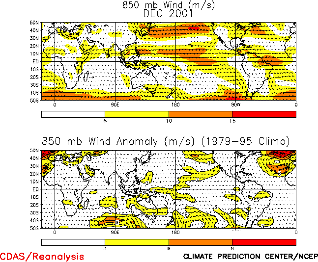
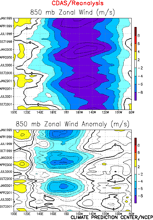
Pacific (Fig. T17). Also, persistent low-level westerly
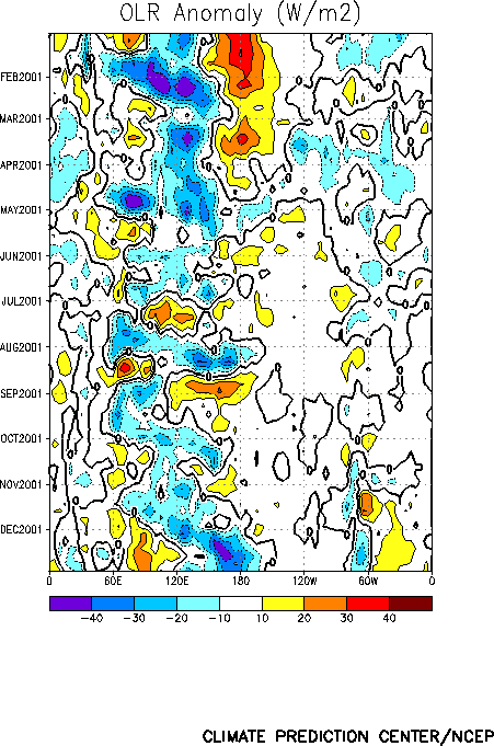
wind anomalies (Fig. T13) and enhanced convection (Fig. T11) have been observed in the western and west-central
equatorial Pacific since late November. These conditions are partly due to strong MJO
activity, but they also represent a significant evolution towards a warm episode.
The changes in the oceanic thermocline (indicated by the 20°C isotherm) were
associated with a strong oceanic Kelvin wave that moved through the western Pacific during
the month. This Kelvin wave was triggered by an MJO-related 850-hPa westerly wind burst
over the western and west-central equatorial Pacific (Figs. T13,
T20). Consistent with these conditions, oceanic temperatures
at thermocline depth increased to 4-5°C above normal throughout the western equatorial
Pacific, and decreased to near- to- slightly below normal values east of 160°W (Fig. T17).
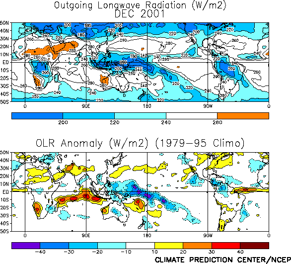
Tropical convection during December was enhanced [indicated by negative anomalies of
Outgoing Longwave Radiation (OLR)] over the western Pacific, in the vicinity of the date
line and along the South Pacific Convergence Zone (Fig. T25).
A time-longitude section of anomalous OLR (Fig. T11) shows
that the enhanced convection originated over the Indian Ocean in mid-November, reached
Indonesia by early December, and then expanded eastward to the date line by the second
week in December. In the vicinity of the date line the enhanced convection during December
resulted in the largest negative OLR index value (-1.5) since October 1997. This
convection was accompanied by anomalous 850-hPa westerly winds over the western and
west-central equatorial Pacific for the first time since October 1997 (Fig.
T7).
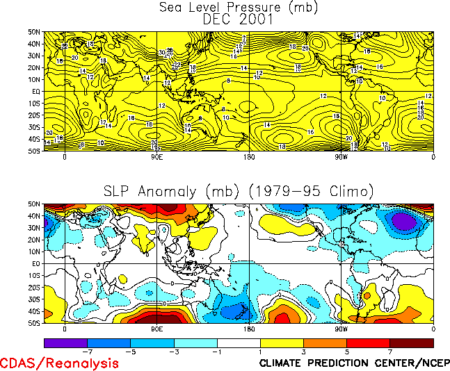
The sea level pressure (SLP) pattern during December featured negative SLP anomalies
throughout the equatorial Pacific and Atlantic Ocean, and positive SLP anomalies across
the Indian Ocean and Indonesia (Fig. T19). This pattern
was associated with negative values of both the Tahiti - Darwin Southern Oscillation Index
(SOI) (-1.2) (Table T1) and the equatorial SOI (-0.8).
This is the first negative value of the equatorial SOI recorded since April 1998 at the
end of the 1997/98 Pacific warm episode (Fig. T2, middle
panel).
|


