|
|
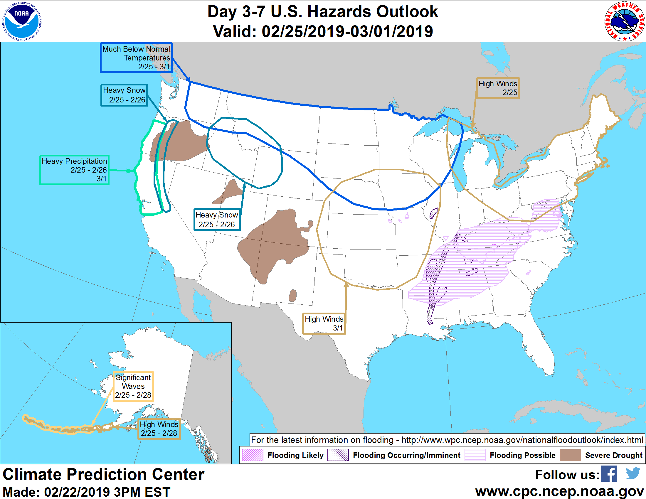
U.S. Hazards Outlook - Made
Jan 01, 1970
|
Composite Images |
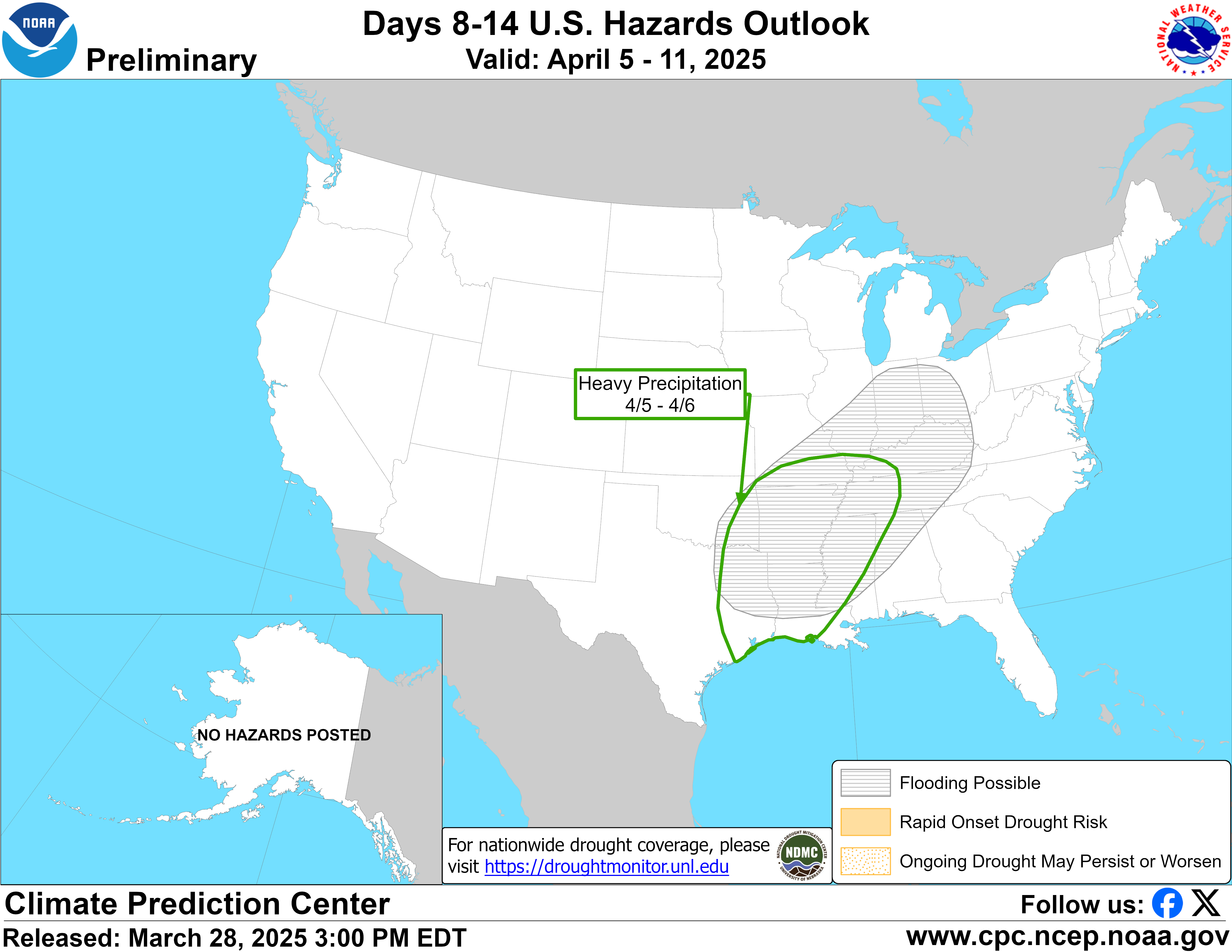
| Day 3-7 Outlook | Day 8-14 Outlook |
 |
 |
|
Valid Thursday, February 28, 2019 to Monday, March 11, 2019
Summary of Forecasts and Hazards
US Hazards Outlook NWS Climate Prediction Center College Park MD 300 PM
EDT June 20 2025 Synopsis: Hazards Detailed SummaryFor Monday June 23 -
Friday June 27: WPC Days 3-7 U.S.
Hazards For Saturday June 28 - Friday
July 04: Forecaster: Rich Tinker $$
Click here to see a display of the GFS Ensemble Forecasts
Please consult local NWS Forecast Offices for short range forecasts and region-specific information.
|
|