|
Synopsis: The chance of El Niño has decreased to about 65% during the Northern Hemisphere fall and early winter.
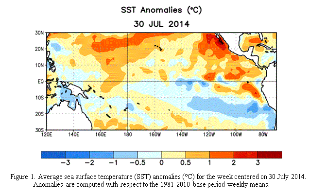
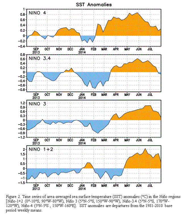
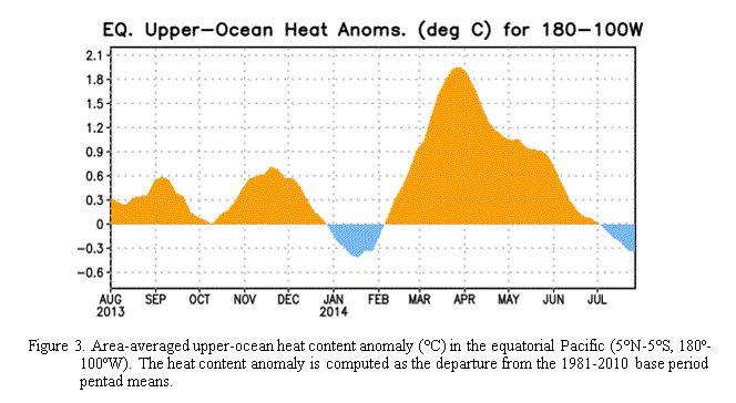
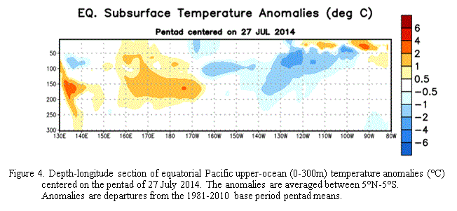
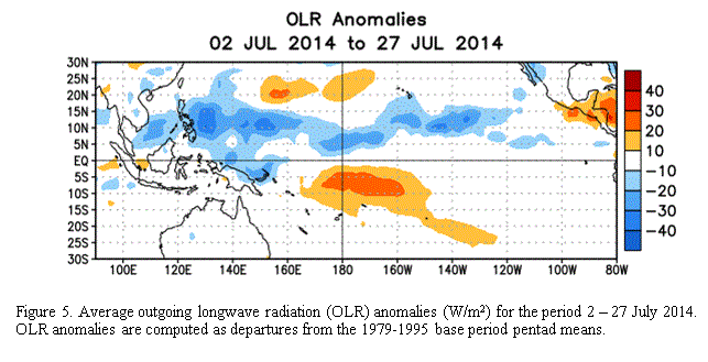
During July 2014, above-average sea surface temperatures (SST) continued in the far eastern equatorial Pacific, but near average SSTs prevailed in the central and east-central equatorial Pacific (Fig. 1). Most of the Niño indices decreased toward the end of the month with values of +0.3oC in Niño-4, -0.1C in Niño-3.4, +0.2°C in Niño-3, and +0.6oC in Niño-1+2 (Fig. 2). Subsurface heat content anomalies (averaged between 180o-100oW) continued to decrease and are slightly below average (Fig. 3). The above-average subsurface temperatures that were observed near the surface during June (down to 100m depth) are now limited to a thin layer in the top 50m, underlain by mainly below-average temperatures (Fig. 4). The low-level winds over the tropical Pacific remained near average during July, but westerly wind anomalies appeared in the central and eastern part of the basin toward the end of the month. Upper-level winds remained generally near average and convection was enhanced mainly just north of the equator in the western Pacific (Fig. 5). The lack of a coherent atmospheric El Niño pattern, and a return to near-average SSTs in the central Pacific, indicate ENSO-neutral.
Over the last month, model forecasts have slightly delayed the El Niño onset, with most models now indicating the onset during July-September, with the event continuing into early 2015 (Fig. 6). A strong El Niño is not favored in any of the ensemble averages, and slightly more models call for a weak event rather than a moderate event. At this time, the consensus of forecasters expects El Niño to emerge during August-October and to peak at weak strength during the late fall and early winter (3-month values of the Niño-3.4 index between 0.5oC and 0.9oC). The chance of El Niño has decreased to about 65% during the Northern Hemisphere fall and early winter (click CPC/IRI consensus forecast for the chance of each outcome).
This discussion is a consolidated effort of the National Oceanic and Atmospheric Administration (NOAA), NOAA’s National
Weather Service, and their funded institutions. Oceanic and atmospheric conditions are updated weekly on the Climate Prediction Center web site
(El Niño/La Niña Current Conditions and Expert Discussions). Forecasts
are also updated monthly in the Forecast Forum of CPC's Climate Diagnostics Bulletin. Additional perspectives and
analysis are also available in an ENSO blog. The next ENSO Diagnostics Discussion is scheduled for 4 September 2014.
To receive an e-mail notification when the monthly ENSO Diagnostic Discussions are released, please send an e-mail message
to: ncep.list.enso-update@noaa.gov.
|


