|
Synopsis: There is an approximately 95% chance that El Niño will continue through Northern Hemisphere winter 2015-16, gradually weakening through spring 2016.
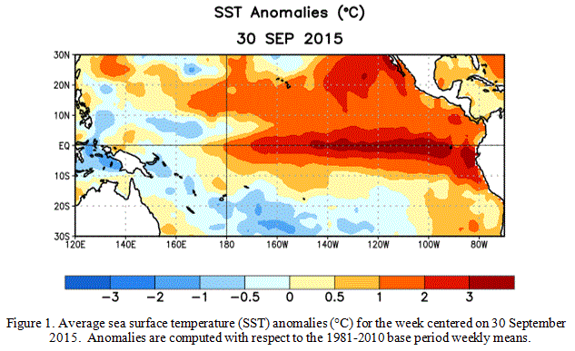
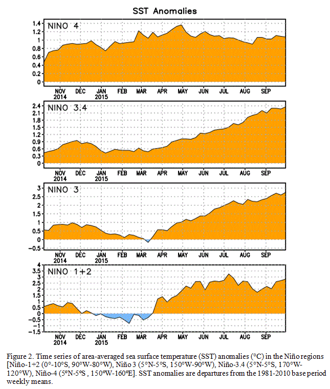
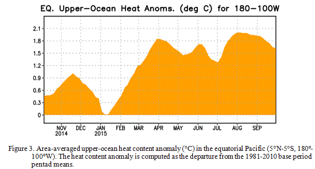
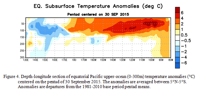
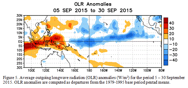
During September, sea surface temperature (SST) anomalies were well above average across the central and eastern Pacific Ocean (Fig. 1). The Niño indices generally increased, although the far western Niño-4 index was nearly unchanged (Fig. 2). Also, relative to last month, the strength of the positive subsurface temperature anomalies decreased slightly in the central and eastern Pacific (Fig. 3), but the largest departures remained above 6oC (Fig. 4). The atmosphere was well coupled with the ocean, with significant low-level westerly wind anomalies and upper-level easterly wind anomalies persisting from the western to the east-central tropical Pacific. Also, the traditional and equatorial Southern Oscillation Index (SOI) values became more negative (stronger), consistent with enhanced convection over the central and eastern equatorial Pacific and suppressed convection over Indonesia (Fig. 5). Collectively, these atmospheric and oceanic anomalies reflect a strong El Niño.
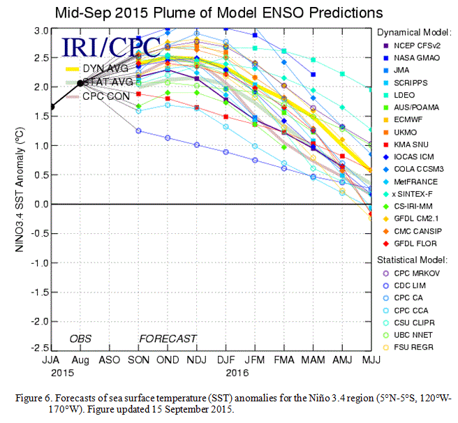
All models surveyed predict El Niño to continue into the Northern Hemisphere spring 2016, and all multi-model averages predict a peak in late fall/early winter (Fig. 6). The forecaster consensus unanimously favors a strong El Niño, with peak 3-month SST departures in the Niño 3.4 region near or exceeding +2.0oC. Overall, there is an approximately 95% chance that El Niño will continue through Northern Hemisphere winter 2015-16, gradually weakening through spring 2016 (click CPC/IRI consensus forecast for the chance of each outcome for each 3-month period).
Across the United States, temperature and precipitation impacts from El Niño are likely to be seen during the upcoming months (the 3-month seasonal outlook will be updated on Thursday October 15th). Outlooks generally favor below-average temperatures and above-median precipitation across the southern tier of the United States, and above-average temperatures and below-median precipitation over the northern tier of the United States.
This discussion is a consolidated effort of the National Oceanic and Atmospheric Administration (NOAA), NOAA's National
Weather Service, and their funded institutions. Oceanic and atmospheric conditions are updated weekly on the Climate Prediction Center web site
(El Niño/La Niña Current Conditions and Expert Discussions). Forecasts
are also updated monthly in the Forecast Forum of CPC's Climate Diagnostics Bulletin. Additional perspectives and
analysis are also available in an ENSO blog. The next ENSO Diagnostics Discussion is scheduled for 12 November 2015.
To receive an e-mail notification when the monthly ENSO Diagnostic Discussions are released, please send an e-mail message
to: ncep.list.enso-update@noaa.gov.
|


