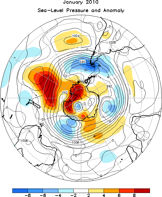
Skip Navigation Links www.nws.noaa.gov 
NOAA logo - Click to go to the NOAA home page National Weather Service   NWS logo - Click to go to the NWS home page
Climate Prediction Center
 

Climate Diagnostics Bulletin
Climate Diagnostics Bulletin - Home Climate Diagnostics Bulletin - Tropics Climate Diagnostics Bulletin - Forecast


  Extratropical Highlights

  Table of Indices  (Table 3)

  Global Surface Temperature  E1

  Temperature Anomalies (Land Only)  E2

  Global Precipitation  E3

  Regional Precip Estimates (a)  E4

  Regional Precip Estimates (b)  E5

  U.S. Precipitation  E6

  Northern Hemisphere

  Southern Hemisphere

  Stratosphere

  Appendix 2: Additional Figures


JANUARY 2010

FIGURE E14.  Southern Hemisphere mean and anomalous sea level pressure (CDAS/Reanalysis). Mean values are denoted by solid contours drawn at an interval of 4 hPa. Anomaly contour interval is indicated by shading. Anomalies are calculated as departures from the 1979-1995 base period monthly means.


NOAA/ National Weather Service
NOAA Center for Weather and Climate Prediction
Climate Prediction Center
5830 University Research Court
College Park, Maryland 20740
Page Author: Climate Prediction Center Internet Team
Page Last Modified: February 2010
Disclaimer
Information Quality
Credits
Glossary
Privacy Policy
Freedom of Information Act (FOIA)
About Us
Career Opportunities