 |
Nino region SST indices
JUNE 2008
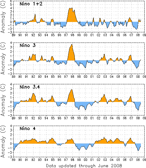
FIGURE T5.
Nino region indices, calculated as the area-averaged sea surface temperature anomalies (C) for the specified region. The Nino 1+2 region (top) covers the extreme eastern equatorial Pacific between 0-10S, 90W-80W. The Nino-3 region (2nd from top) spans the eastern equatorial Pacific between 5N-5S, 150W-90W. The Nino 3.4 region 3rd from top) spans the east-central equatorial Pacific between 5N-5S, 170W-120W. The Nino 4 region (bottom) spans the date line and covers the area 5N-5S, 160E-150W. Anomalies are departures from the 1971-2000 base period monthly means (Smith and Reynolds 1998, J. Climate, 11, 3320-3323). Monthly values of each index are also displayed in Table 2.
|
 |


