|
AUGUST 2013

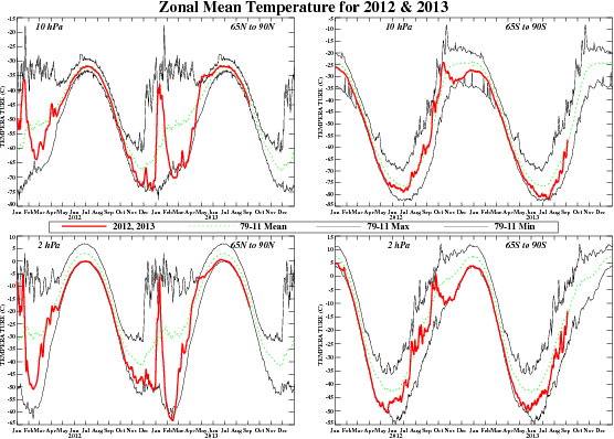
FIGURE S4.
Daily mean temperatures at 10-hPa and 2-hPa (red line) in the region
65N-90N and 65S-90S for the past two years. Dashed green line depicts the 1981-2010
base period daily mean. Thin solid black lines depict the daily
extreme maximum and minimum temperatures.
|


