 |
MAY 2025
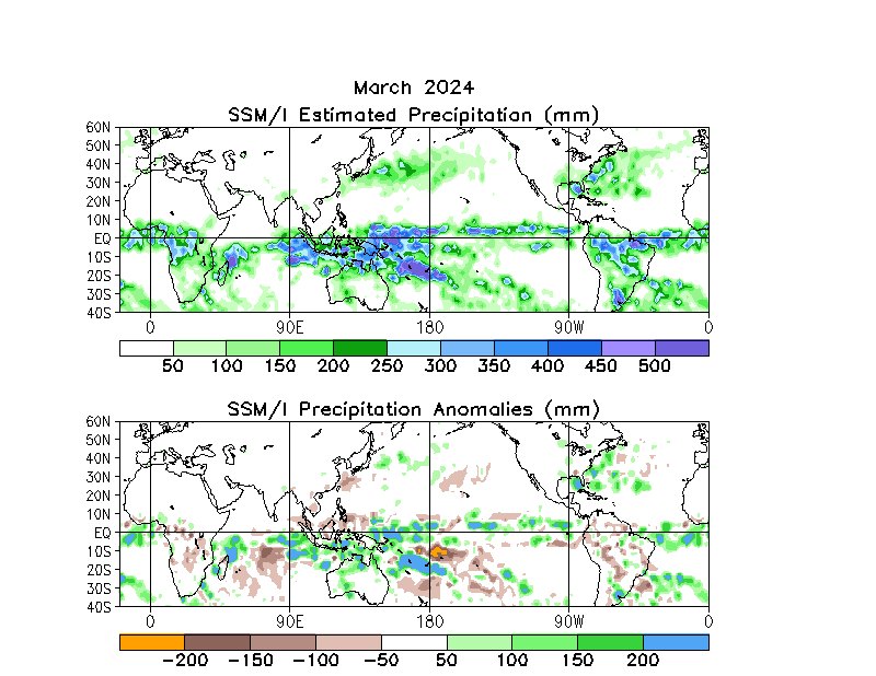
FIGURE T26.
Estimated total (top) and anomalous (bottom) rainfall (mm) based on the Special Sensor Microwave/Imager (SSM/I) precipitation index (Ferraro 1997, J. Geophys. Res., 102, 16715-16735). Anomalies are computed from the 1987-2010 base period monthly means. Anomalies have been smoothed for display purposes.
|
 |


